cptcatz
-
Posts
1,077 -
Joined
-
Last visited
Content Type
Profiles
Blogs
Forums
American Weather
Media Demo
Store
Gallery
Everything posted by cptcatz
-
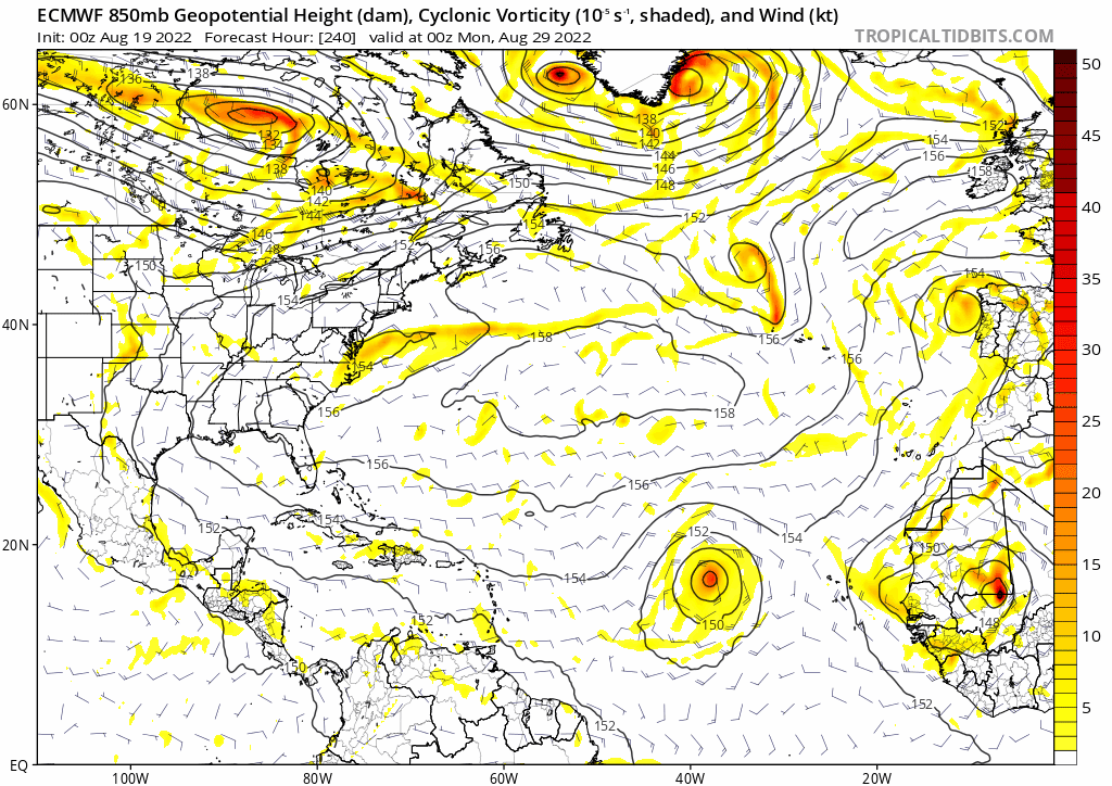
Very interesting last frame of the Euro model... intensifies from 986 to 973 while moving southwest.
-
2022 Atlantic Hurricane season
cptcatz replied to StormchaserChuck!'s topic in Tropical Headquarters
Most models were also showing Irma hooking right while it was in the middle of the Atlantic as well... -
2022 Atlantic Hurricane season
cptcatz replied to StormchaserChuck!'s topic in Tropical Headquarters
It looks like on visible that's it's trying to tighten up a low level spin...
-
2022 Atlantic Hurricane season
cptcatz replied to StormchaserChuck!'s topic in Tropical Headquarters
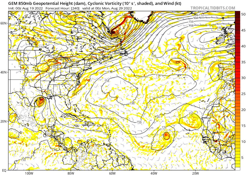
Sure, when it's head to head. But now 12z CMC also is showing the same thing, so the competition is Euro/CMC/Icon vs GFS. Who ya got now? -
2022 Atlantic Hurricane season
cptcatz replied to StormchaserChuck!'s topic in Tropical Headquarters
Impressive band of convection forming in the northeast side which is where the wave is merging. I could see this outperforming the models.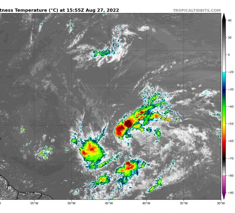
-
2022 Atlantic Hurricane season
cptcatz replied to StormchaserChuck!'s topic in Tropical Headquarters
Yeah, I mean GFS is all alone with the Caribbean system but every single model has been showing the lead Atlantic system developing for a couple days now. I'd be really surprised if NHC doesn't bump it up to at least 50-60% at 8pm. -
2022 Atlantic Hurricane season
cptcatz replied to StormchaserChuck!'s topic in Tropical Headquarters
Euro going all in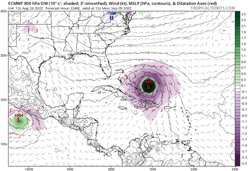
-
2022 Atlantic Hurricane season
cptcatz replied to StormchaserChuck!'s topic in Tropical Headquarters
The EPS model on Tropical Tidbits go out further than 240hr and show South Florida is in play bigtime... -
2022 Atlantic Hurricane season
cptcatz replied to StormchaserChuck!'s topic in Tropical Headquarters
I'm watching this closely from Boca Raton...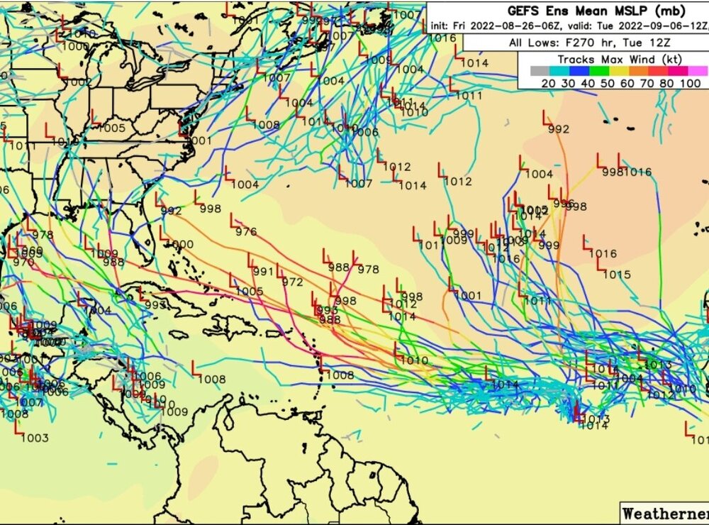
-
2022 Atlantic Hurricane season
cptcatz replied to StormchaserChuck!'s topic in Tropical Headquarters
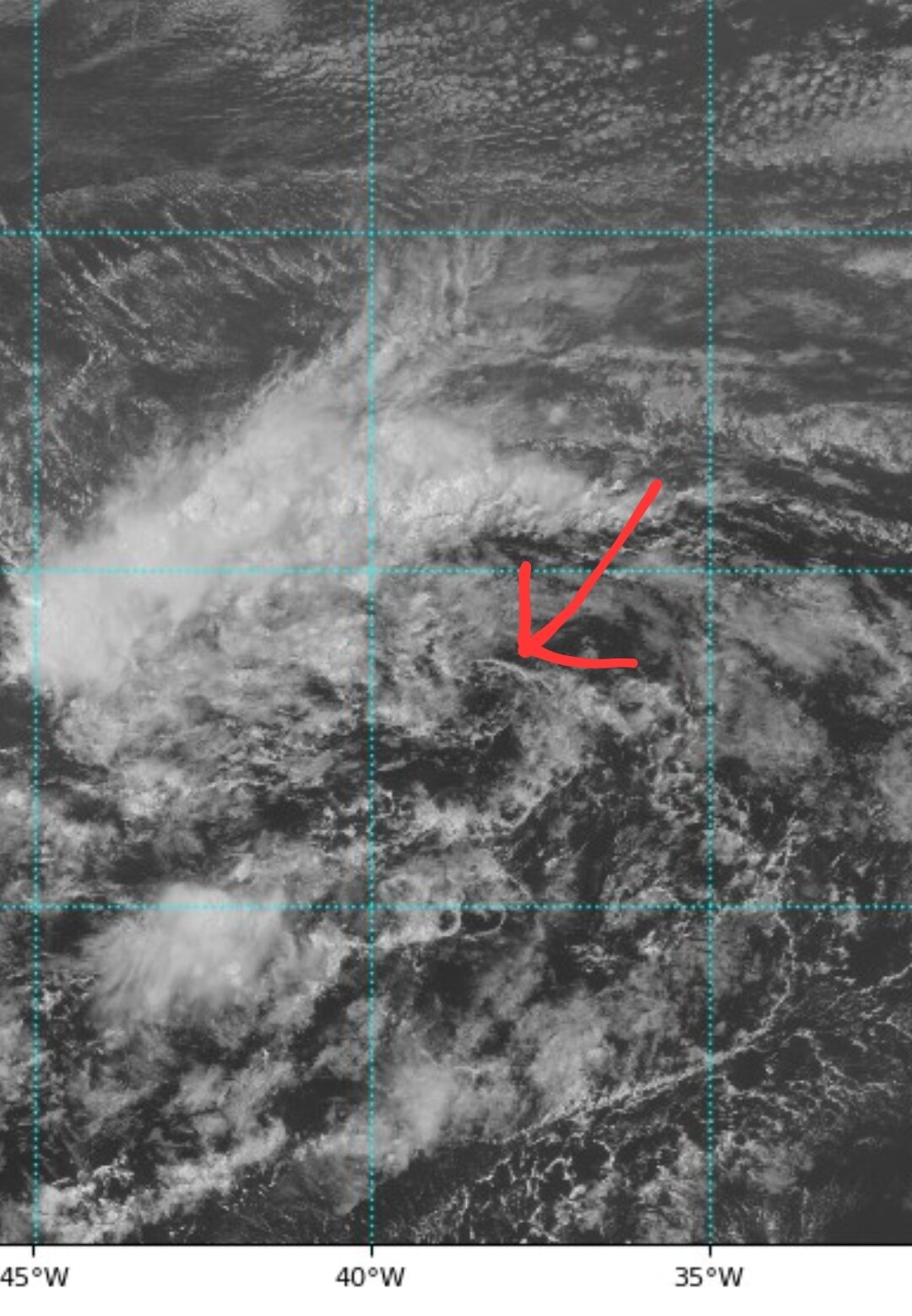
Can anyone explain what this system is at 10N,35W? It's the most impressive area of convection I've seen all season, so why don't models have it developing?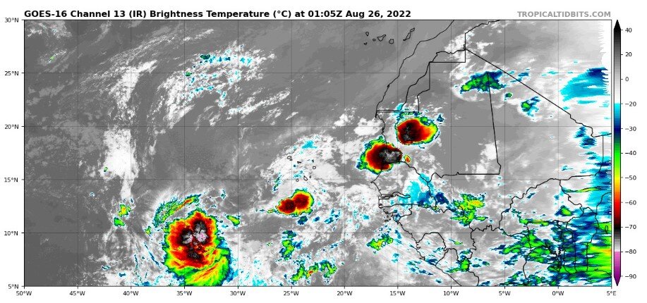
-
2022 Atlantic Hurricane season
cptcatz replied to StormchaserChuck!'s topic in Tropical Headquarters
Yeah this is definitely the most interesting euro run in a while. I still don't trust anything beyond 5 days any more than I can throw them. -
2022 Atlantic Hurricane season
cptcatz replied to StormchaserChuck!'s topic in Tropical Headquarters
I'm no meteorologist, I'm just a guy with logic, but I think a big problem with the seasonal forecasts is it seems that they pretty much only take two things into account: water temp of the Pacific, and water temp of the Atlantic, and spit out numbers based solely on that. And yet what we're seeing is there are so many other environmental factors besides it being La Nina with a warm Atlantic. But I'm ready to throw my towel to ldub. I'm getting tired of watching the models keep dropping the storms at the 5 day mark. What a borefest. -
2022 Atlantic Hurricane season
cptcatz replied to StormchaserChuck!'s topic in Tropical Headquarters
At the 5 day mark, there is zilch happening in the tropics...
-
2022 Atlantic Hurricane season
cptcatz replied to StormchaserChuck!'s topic in Tropical Headquarters
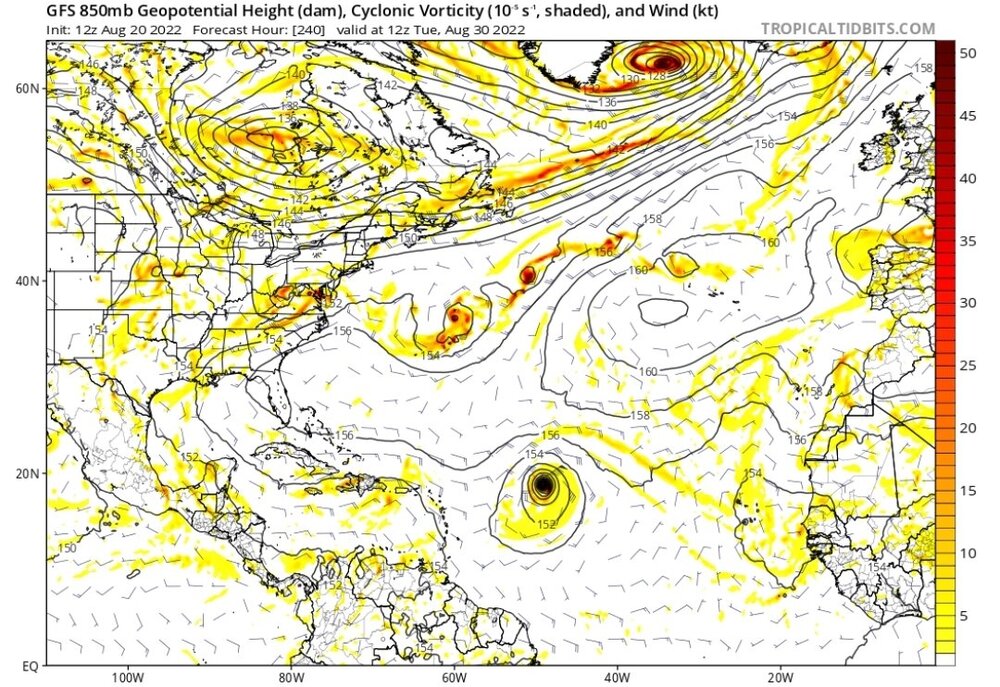
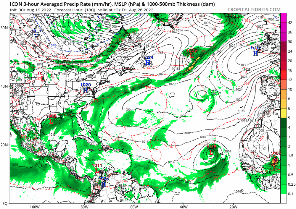
The 0z EPS is pretty bullish with three waves in the next 10 days: it starts to develop the current 20% lemon just north of the Caribbean and ends the run with it on a crash course into Florida. The next wave seems a bit messy in the central Atlantic but the third wave looks to be a vigorous one. Looks like the main story of the models is they have no idea how to handle this monsoon trough.
-
2022 Atlantic Hurricane season
cptcatz replied to StormchaserChuck!'s topic in Tropical Headquarters
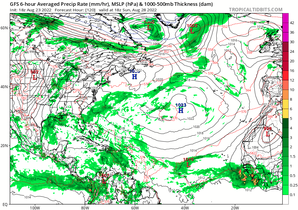
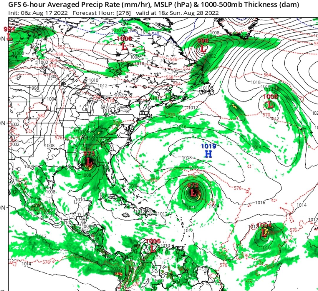
And then every time you declare victory, the GFS comes back to mock you once again, this time with the 06z bringing a major through the Lesser Antilles, direct hit onto Puerto Rico, then bringing the monster into the Gulf...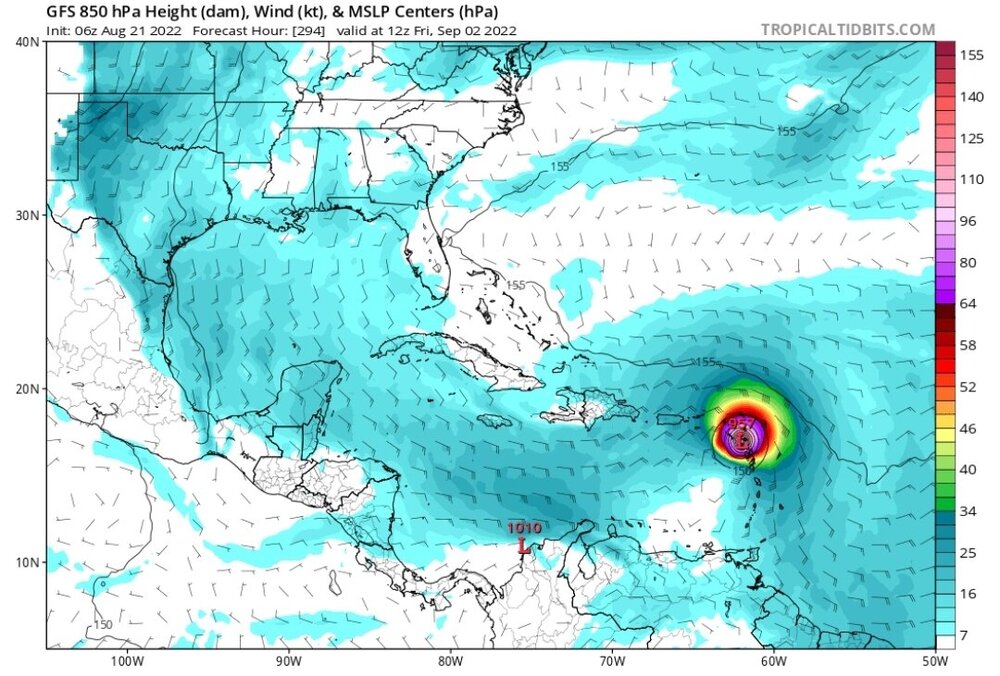
-
2022 Atlantic Hurricane season
cptcatz replied to StormchaserChuck!'s topic in Tropical Headquarters
Lol at the dueling majors. Quiet season who? -
2022 Atlantic Hurricane season
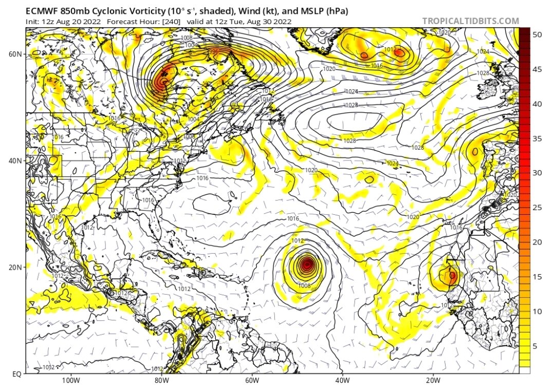
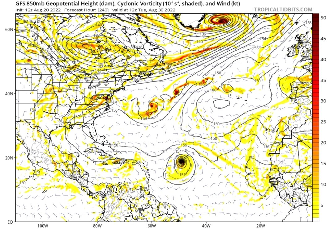
cptcatz replied to StormchaserChuck!'s topic in Tropical Headquarters
Amazing agreement between GFS and Euro on today's 12z runs.
-
2022 Atlantic Hurricane season
cptcatz replied to StormchaserChuck!'s topic in Tropical Headquarters
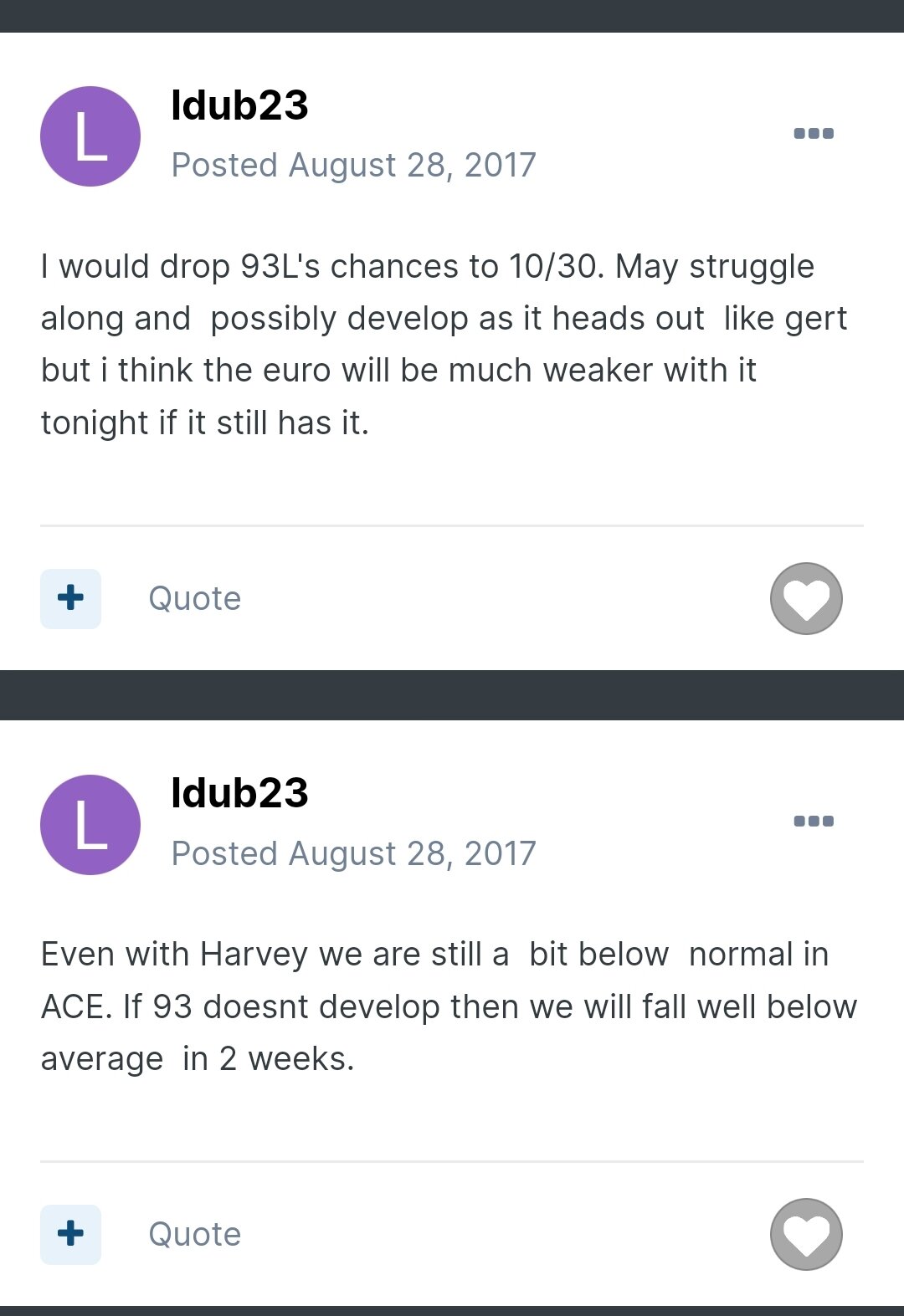
As noted in ldub's posts from late August 2017, the MDR was quite hostile then too until Irma flipped the switch. It's only hostile until it's not, and models are in agreement that that will flip possibly next week. -
2022 Atlantic Hurricane season
cptcatz replied to StormchaserChuck!'s topic in Tropical Headquarters
I'm not saying this storm Euro develops is going to be another Irma, but I'm getting serious vibes from ldub's posts regarding 2017's 93L only two days before it was named Irma: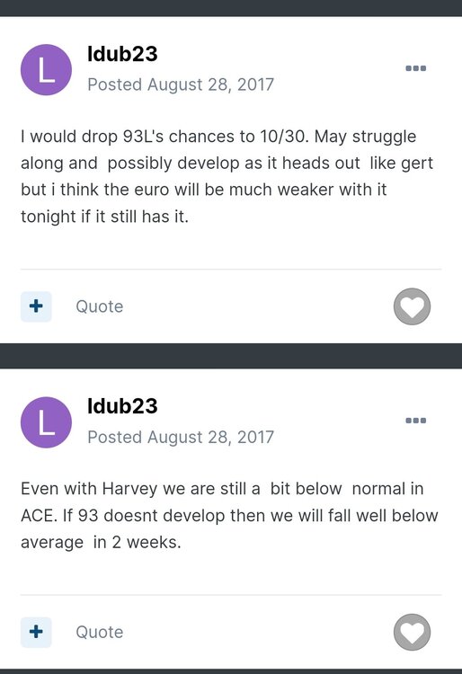
-
2022 Atlantic Hurricane season
cptcatz replied to StormchaserChuck!'s topic in Tropical Headquarters
Euro never had the leading wave doing anything, it has the second wave coming off around 8/24 and the latest euro run 0z is the most bullish with it ending with it at 997 mb. Not sure what you mean by euro dropping it. -
2022 Atlantic Hurricane season
cptcatz replied to StormchaserChuck!'s topic in Tropical Headquarters
Overnight Euro, ICON and CMC are all back with developing the second wave leaving Africa on 8/24. Now the GFS is alone not developing that one...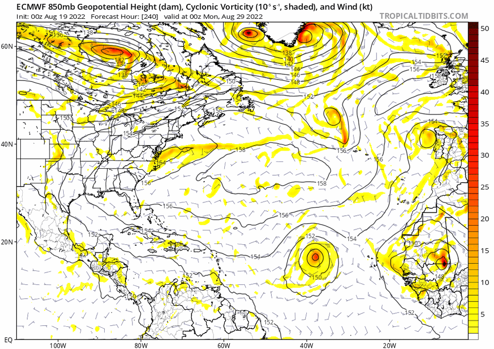
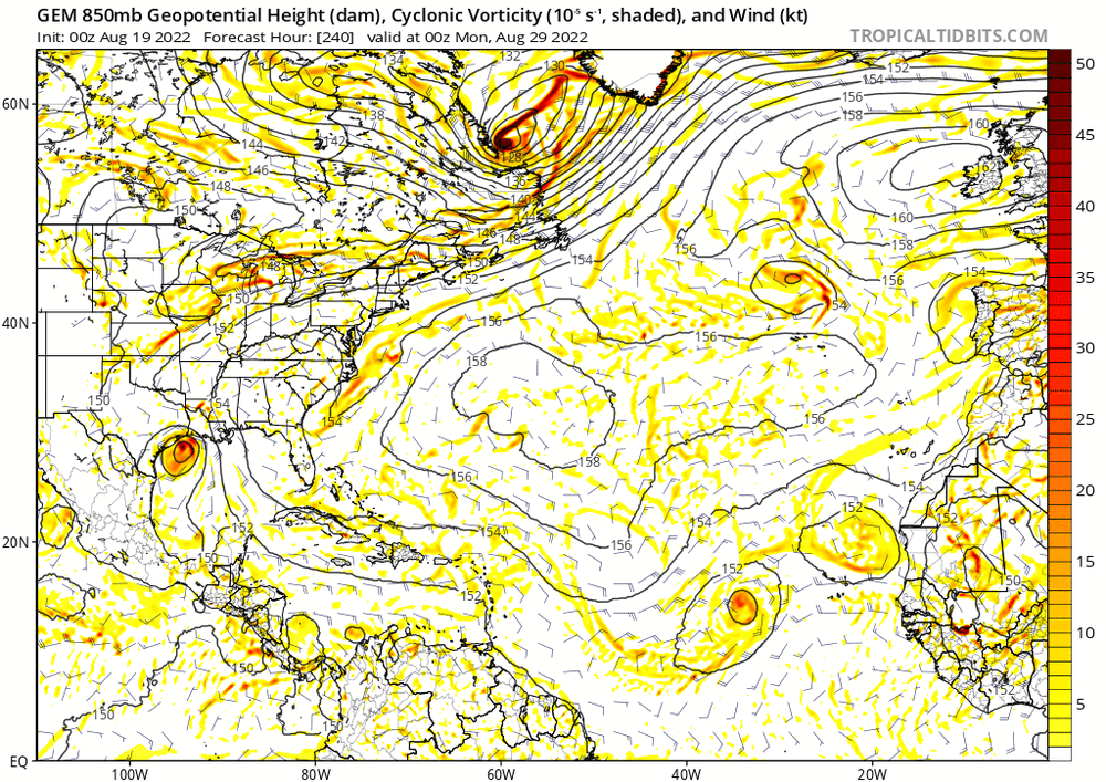
-
2022 Atlantic Hurricane season
cptcatz replied to StormchaserChuck!'s topic in Tropical Headquarters
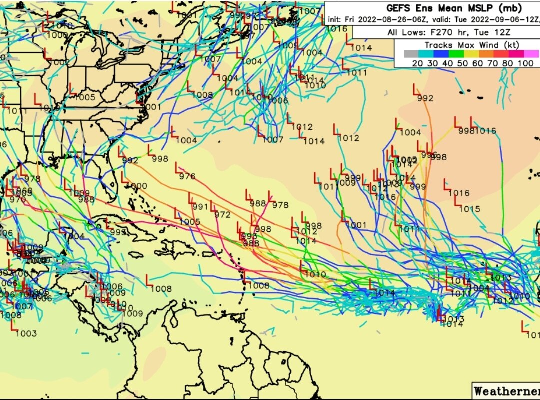
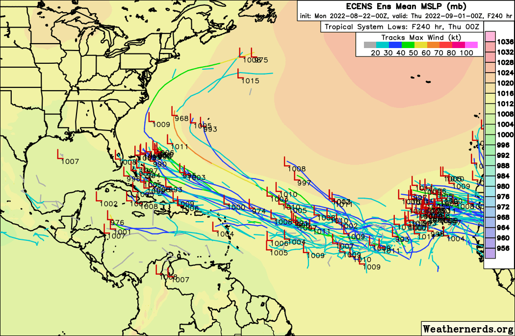
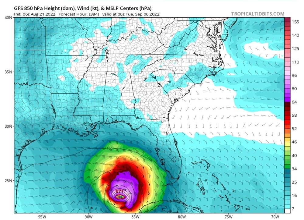
GFS operational may have eased up but the ensembles still rock Florida and the Gulf Coast in this mornings 06z run. -
2022 Atlantic Hurricane season
cptcatz replied to StormchaserChuck!'s topic in Tropical Headquarters
^GEFS goes ham on south Florida. August 25 will mark the 17 year anniversary of Hurricane Katrina making landfall, the last time a hurricane has made landfall on the east coast of Florida... -
2022 Atlantic Hurricane season
cptcatz replied to StormchaserChuck!'s topic in Tropical Headquarters
06z goes just as nuts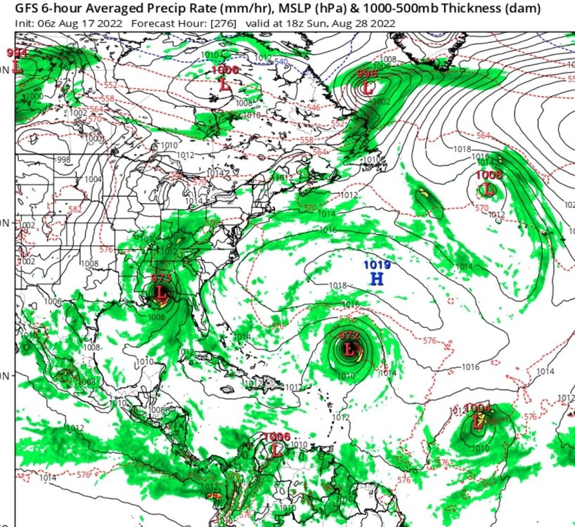
-
2022 Atlantic Hurricane season
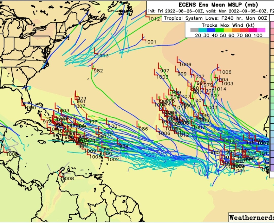
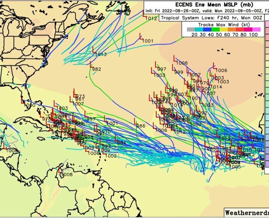
cptcatz replied to StormchaserChuck!'s topic in Tropical Headquarters
The 12Z GFS ensembles are still blasting the east coast...