cptcatz
-
Posts
1,077 -
Joined
-
Last visited
Content Type
Profiles
Blogs
Forums
American Weather
Media Demo
Store
Gallery
Everything posted by cptcatz
-
First launch is scheduled for tomorrow at noon. Hopefully it's a successful launch! https://spaceflightnow.com/2022/06/10/astra-poised-to-begin-three-launch-campaign-with-nasa-hurricane-research-satellites/
-
2022 Atlantic Hurricane season
cptcatz replied to StormchaserChuck!'s topic in Tropical Headquarters
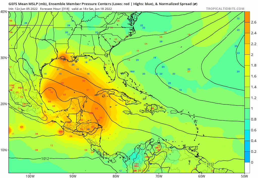
GFS had really been consistent showing a storm moving north out of the Caribbean this time next week. Talking about 7 days from now, it's not really long range fantasy. If this doesn't verify something really needs to be done with the GFS. -
2022 Atlantic Hurricane season
cptcatz replied to StormchaserChuck!'s topic in Tropical Headquarters
Who is DT? -
2022 Atlantic Hurricane season
cptcatz replied to StormchaserChuck!'s topic in Tropical Headquarters
Models are being pretty consistent with another gulf storm in about 1-2 weeks
-
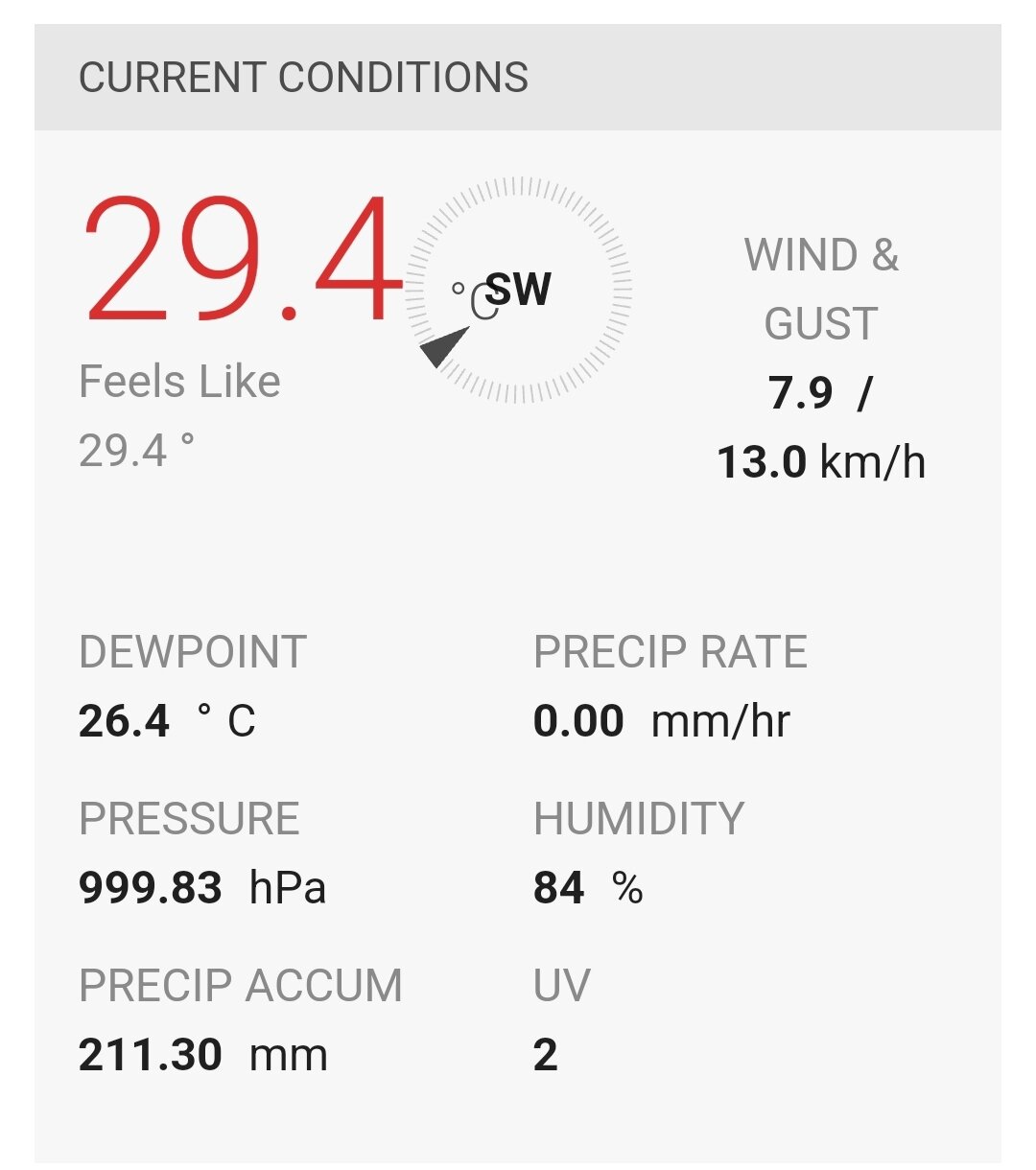
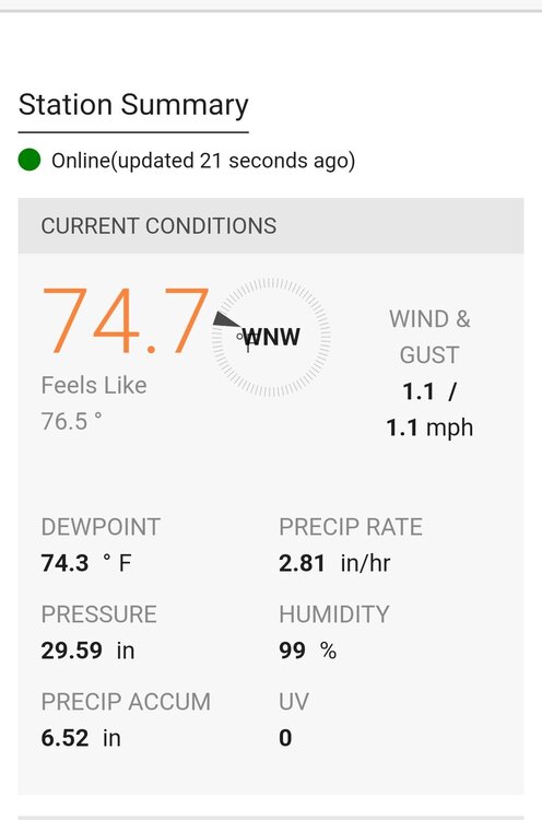
Just picked up my first sub-1,000 pressure reading

-
Rain since midnight now at 8.21 inches. Total for storm is 10.35 inches. Pressure now down to 1,001.32 mb. Highest rain and lowest pressure I've seen here since I moved the week after Irma hit (September 2017).
-
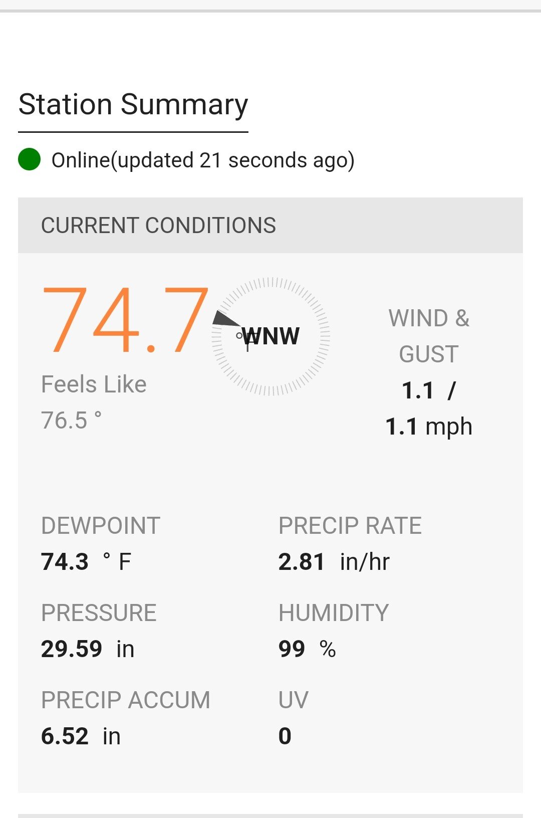
We've been getting really impressive torrential rain for the past hour. Now up to 6.52" for today and continuing to rise fast, which means nearly 2 inches in the last 1.5 hour. Pressure down to 1,001.07 mb.
-
From my backyard Ambient station in Boca Raton: Yesterday: 2.14" As of 8:26am today: 4.71" Current pressure: 1,003.12 hPa Radar looks like there's still another couple inches to come.
-
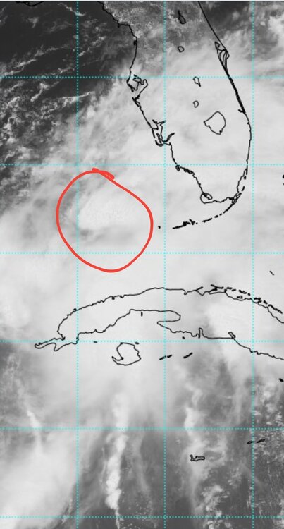
Looks like it's not going to even be designated a cyclone before hitting Florida.
-
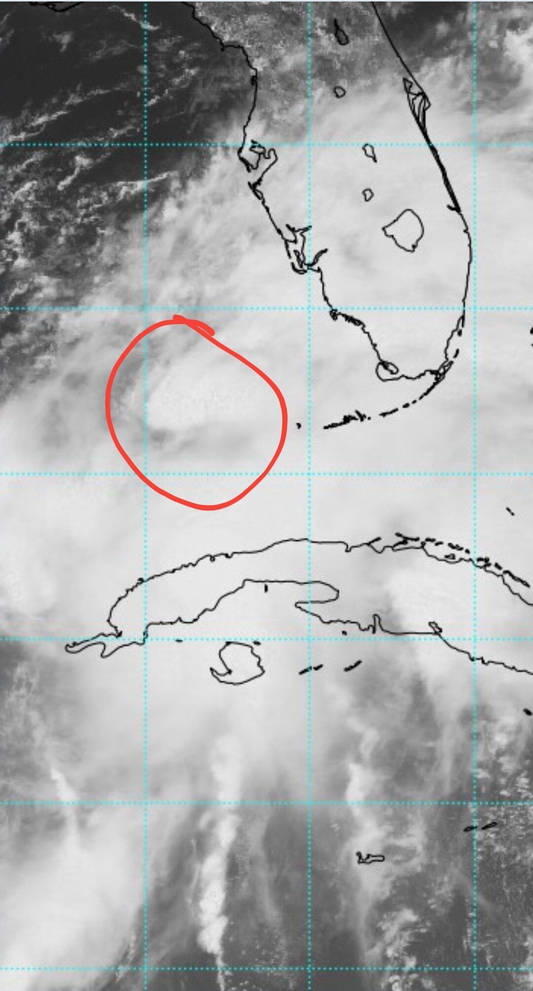
Almost looks like there's a new area of rotation forming due west of Key West
-
I wouldn't let your guard down when some of the squalls closer to the center come through. We could get some nice gusts.
-
And there it is
-
Gotta think we'll get a PTC, TD, or TS at 5pm along with warnings/watches as impacts in South Florida will likely be starting within 24 hours of then.
-
Based on the current trends, I-4 from Tampa to Jacksonville seems to be the cutoff of the impacts. You'd probably miss the bad stuff.
-
2022 Atlantic Hurricane season
cptcatz replied to StormchaserChuck!'s topic in Tropical Headquarters
12z GFS coming in hot with a legit tropical storm hitting Florida and visible satellite is showing some nice spinnage. Maybe time to make a new 91L thread? -
It'll be interesting to see how far east this gets before making landfall and if it can bypass the part of Southern Oaxaca that sticks out. If it gets east of that, it could cross the Isthmus of Tehuantepec which is only 124 miles wide with a max elevation under 1,000 feet. That could be a big factor in how disrupted it gets before moving into the Gulf of Mexico. 12z Icon has it getting pretty close, although it still dissipates it.
-
2022 Atlantic Hurricane season
cptcatz replied to StormchaserChuck!'s topic in Tropical Headquarters
Overnight euro has a strong TS/cat1 heading right to Tampa...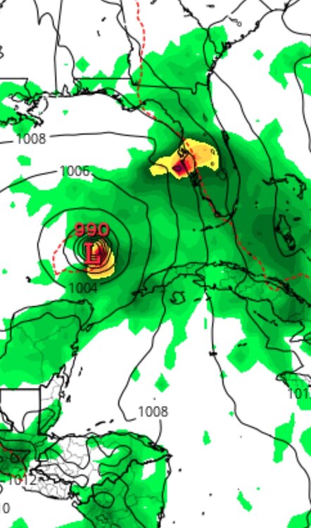
-
2022 Atlantic Hurricane season
cptcatz replied to StormchaserChuck!'s topic in Tropical Headquarters
The big three are all in agreement of a sub-1000 storm passing near/over the Florida peninsula. Probably looking like something like Eta's impacts for us here.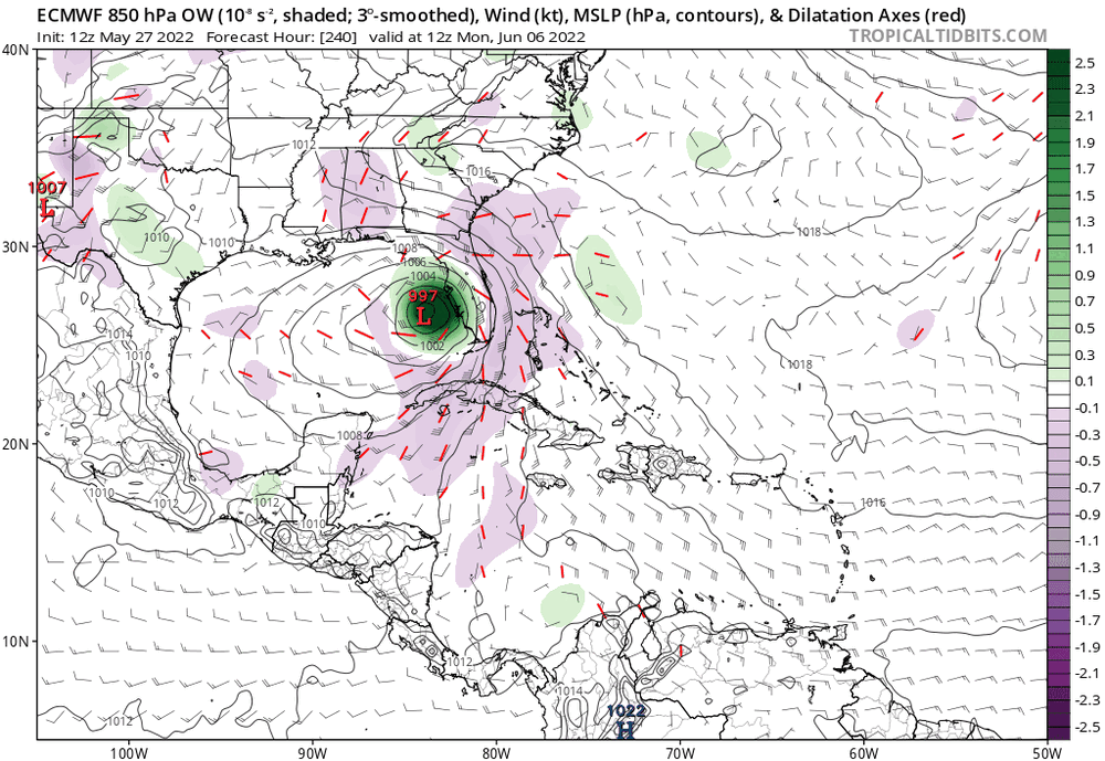


-
24/13/6 got a feeling about this season
-
2022 Atlantic Hurricane season
cptcatz replied to StormchaserChuck!'s topic in Tropical Headquarters
First time this season the bearish Euro has shown a solid TC in the Atlantic. Seems like over the past few years the Euro showing a TC is not something to brush off...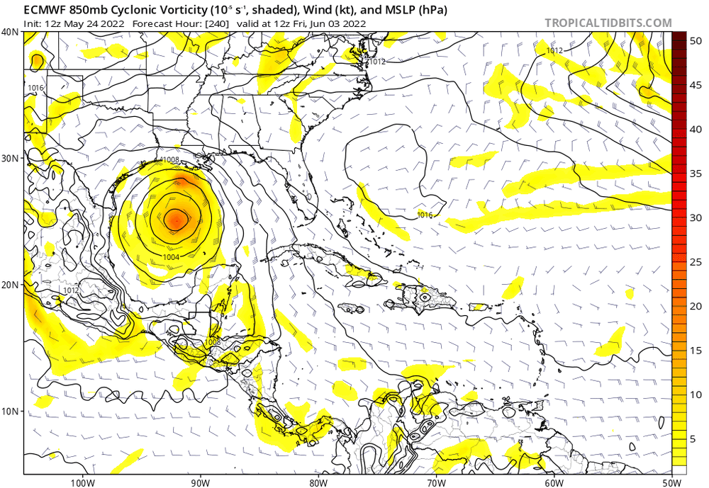
-
2022 Atlantic Hurricane season
cptcatz replied to StormchaserChuck!'s topic in Tropical Headquarters
Next area to watch? GFS thinks this strong MJO is gonna spawn a hurricane
-
2022 Atlantic Hurricane season
cptcatz replied to StormchaserChuck!'s topic in Tropical Headquarters
I have no idea if this is significant but that's an impressive looking area of convection over the southern Caribbean...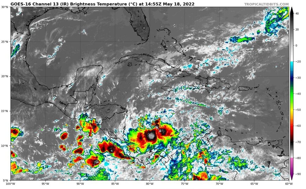
-
2022 Atlantic Hurricane season
cptcatz replied to StormchaserChuck!'s topic in Tropical Headquarters
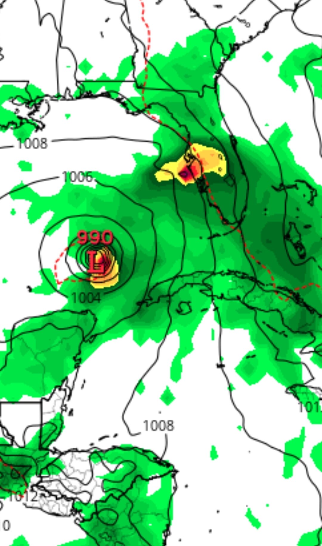
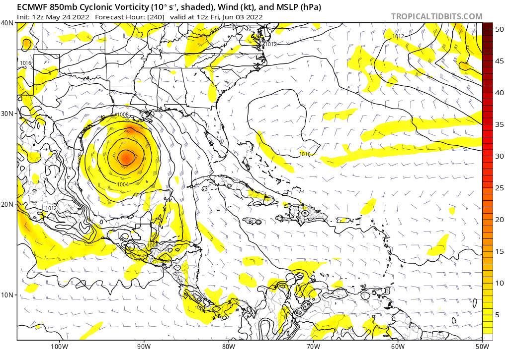
Aaaaaand GFS has thrown in the towel. That was fun while it lasted... -
2022 Atlantic Hurricane season
cptcatz replied to StormchaserChuck!'s topic in Tropical Headquarters
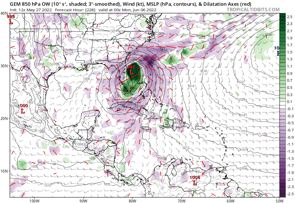
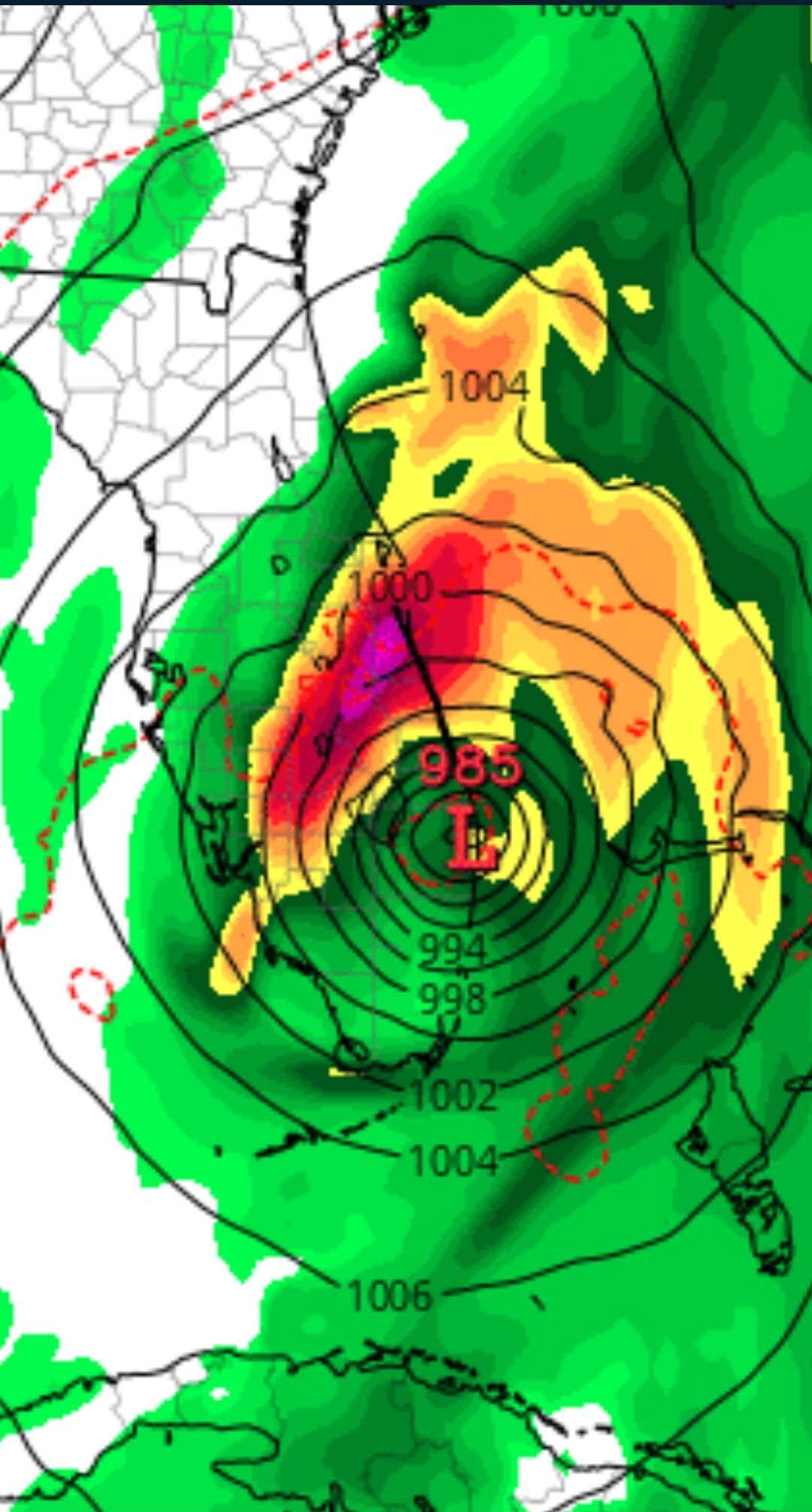
06z GFS is one of the worst model runs I've seen for southeast Florida in a long time. The 985 mb eye dead center over West Palm Beach.
-
2022 Atlantic Hurricane season
cptcatz replied to StormchaserChuck!'s topic in Tropical Headquarters
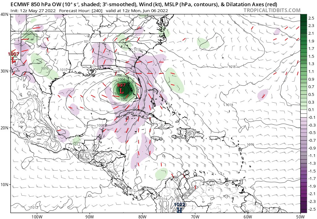
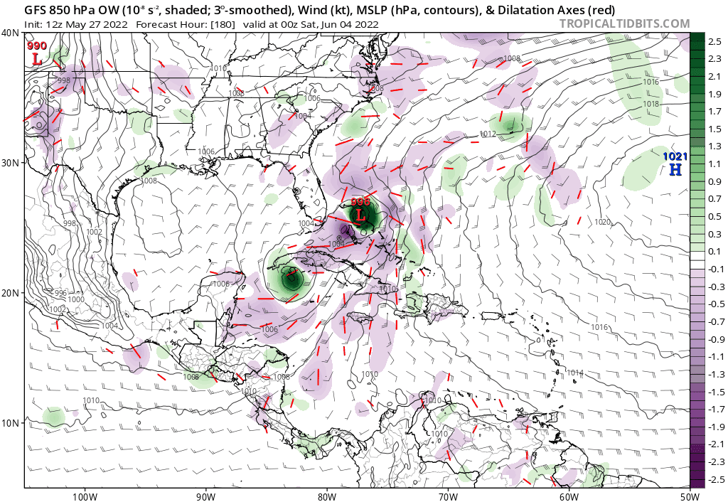
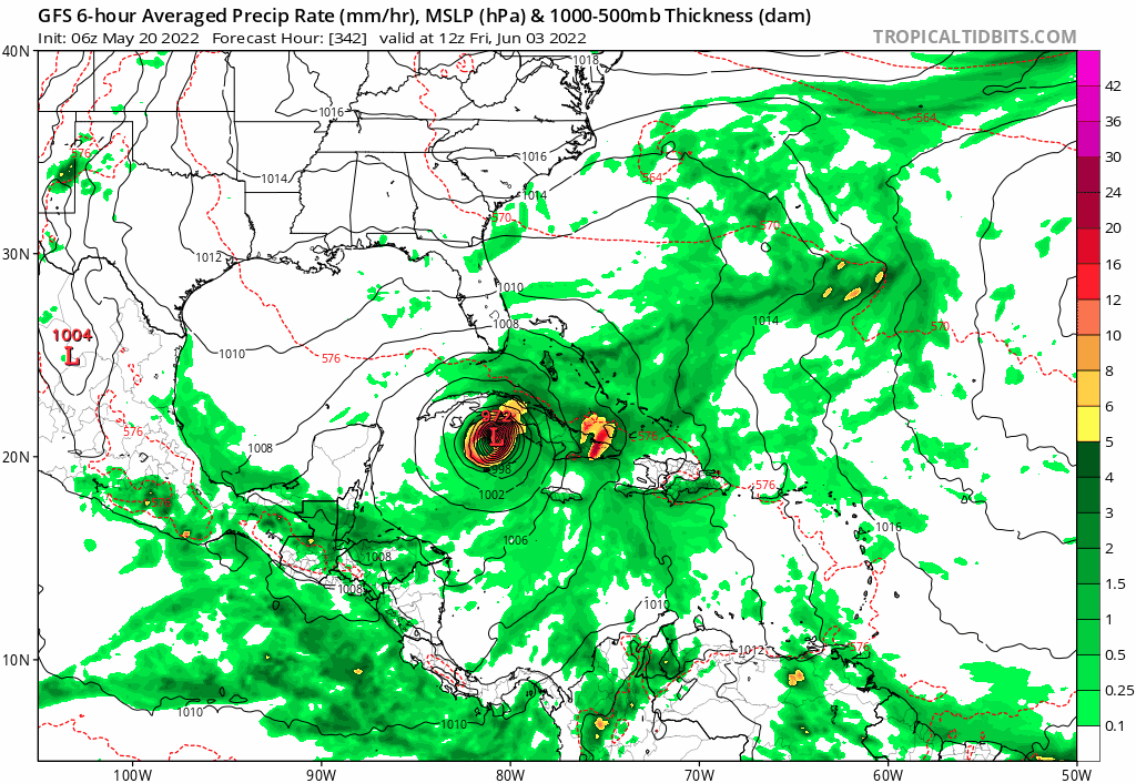
18z GFS is sticking with a strong TS/weak cane near the Yucatan but backed off blowing it up in the Gulf. This what you're looking for in Tampa?