cptcatz
-
Posts
1,077 -
Joined
-
Last visited
Content Type
Profiles
Blogs
Forums
American Weather
Media Demo
Store
Gallery
Everything posted by cptcatz
-
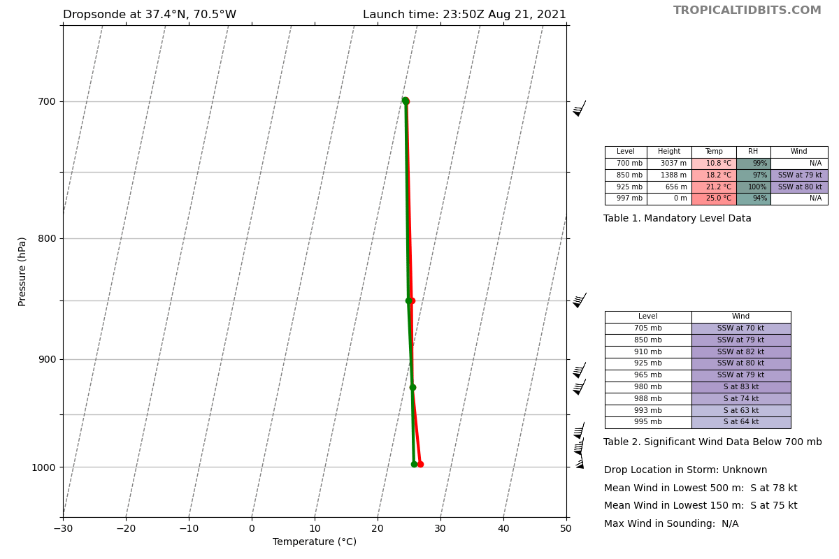
Whatever gets the east side of this storm is gonna get some really nasty winds. 64 knots at the surface is no joke.
-
Henri has started it's slight turn west of due north

-
It's trying to wrap convection around the northeast side of the center. If it can wrap around, it can be in good shape. Only problem is it's running out of warm water.
-
I don't think that's an eye... I think that's the convection eroding and exposing the LLC, which if that's the case is not a good sign for intensification.
-
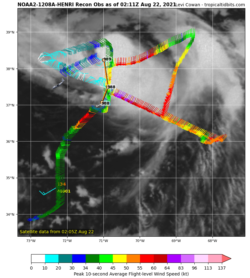
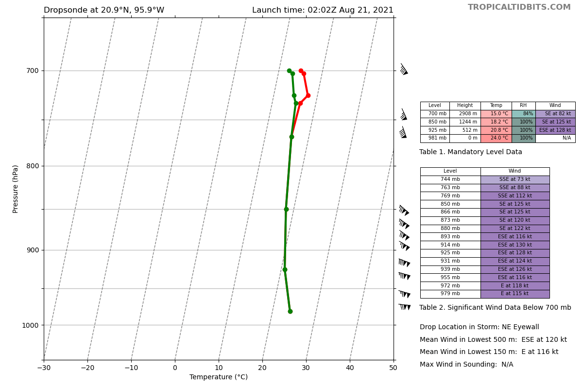
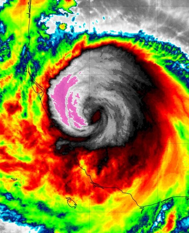
Hot damn, 115 knots at the surface. We got a full fledged cat 4.

-
Recon just recorded 115 kt flight level wind. Does NHC upgrade it to cat 3 at 11pm?
-
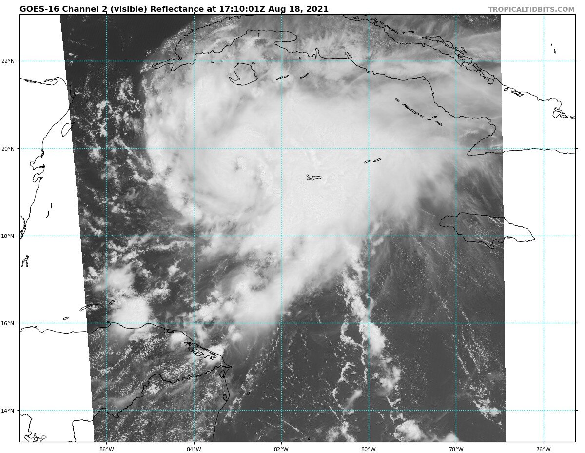
Can't see an eye like that forming in a not-even-hurricane.
-
Finally about to get the first real eye of the Atlantic season
-
Oof that HMON run brings worst case scenario surge into NY harbor...
-
With the rate of inflation and prices of materials, a couple collapsed decks makes for a billion dollar disaster.
-
Lots of 18z euro ensembles now show a NYC metro strike. Now that would be something
-
TropicalTidbits
-
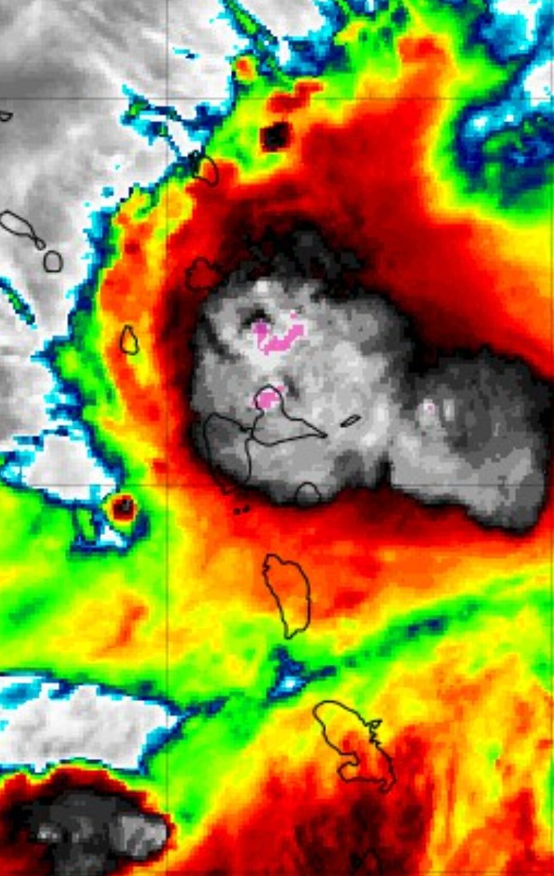
Is that an eye I see right next to the new hot tower popping up?
-
2021 Atlantic Hurricane season
cptcatz replied to StormchaserChuck!'s topic in Tropical Headquarters
Not even a fantasy cane going into September on the GFS? Pretty weak first half of the season. -
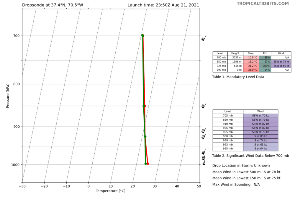
68 knots FL winds, I'm pretty surprised NHC isn't putting out a special statement with at least a hurricane watch. With landfall hours away, seems like it's a good time now to warn the coast of possible hurricane conditions.
-
Have we had a storm this season where the NHC didn't highlight the uncertainty of the forecast?
-
Interesting geography note: if Fred goes due north it would hit the piece of land jutting out. But the models all show it making a slight turn to the northwest bringing it into the bend between Destin and Panama City. This track would give it another good hour or more of intensification.
-
Haiti is very prone to earthquakes and to tropical cyclones. Eventually you'll get them occurring close together. I can't see how one would cause the other to happen.
-
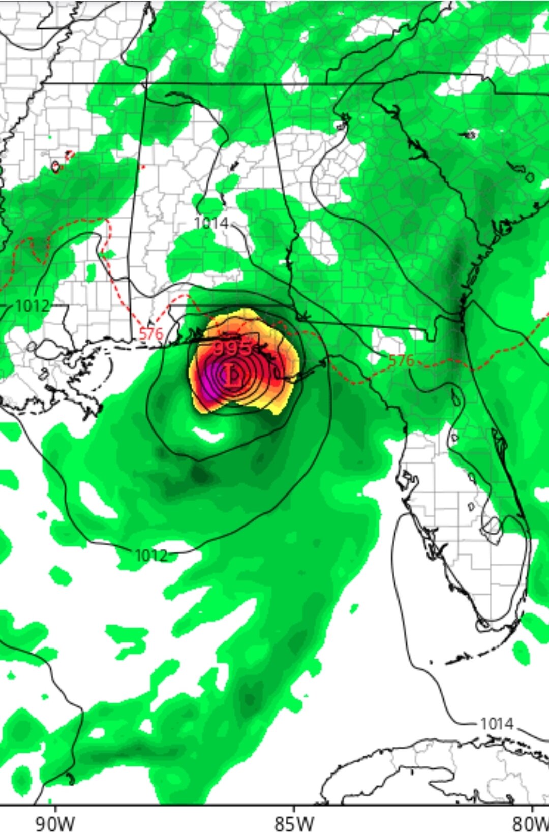
Recon found 52 knot flight winds and GFS is now showing a 995 mb landfall. I think the panhandle is gonna be in for a surprise.

-
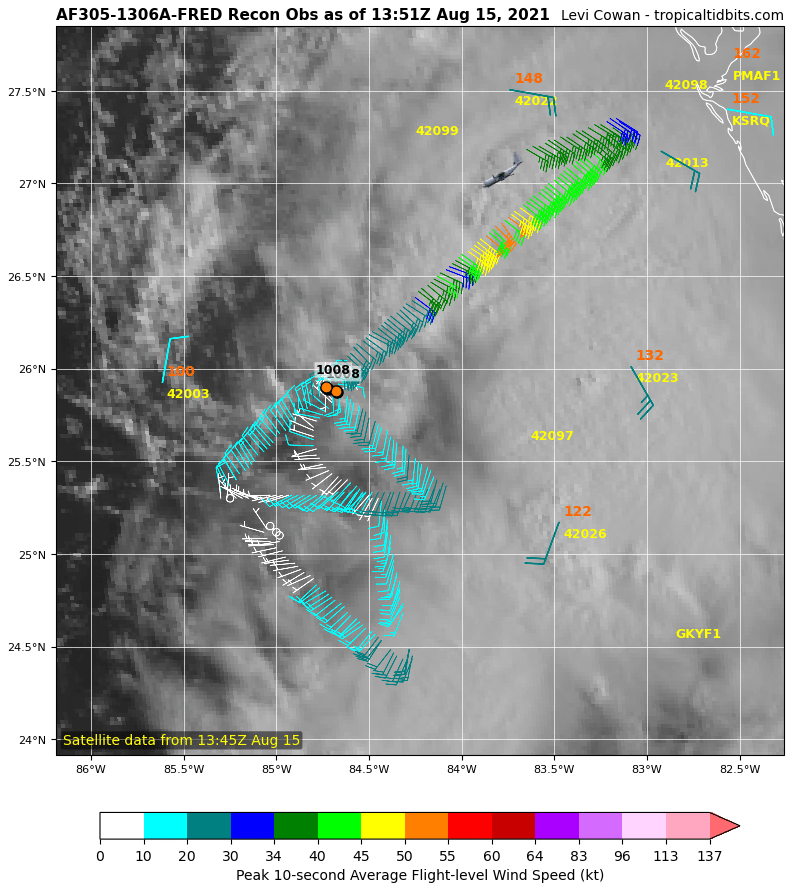
Recon finding some impressive winds NE of the center. Interested to see what they say at 11am. Hurricane watches going up for the panhandle?

-
Grace doesn't seem to be gaining any latitude at all. Don't see how any of those HWRF runs of it getting north of Puerto Rico could verify. Looks like it could just cruise the Caribbean right into the Gulf.
-
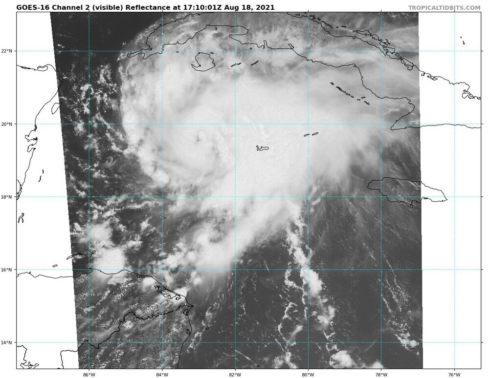
Anyone know what rain totals are like in Cuba? I feel like intense convection has been sitting over Cuba for the past two days...
-
Can anyone explain what's going on with this structure? Will the storm drop one of these convection blobs or maybe will they start wrapping around each other and form an eye in the middle?
-
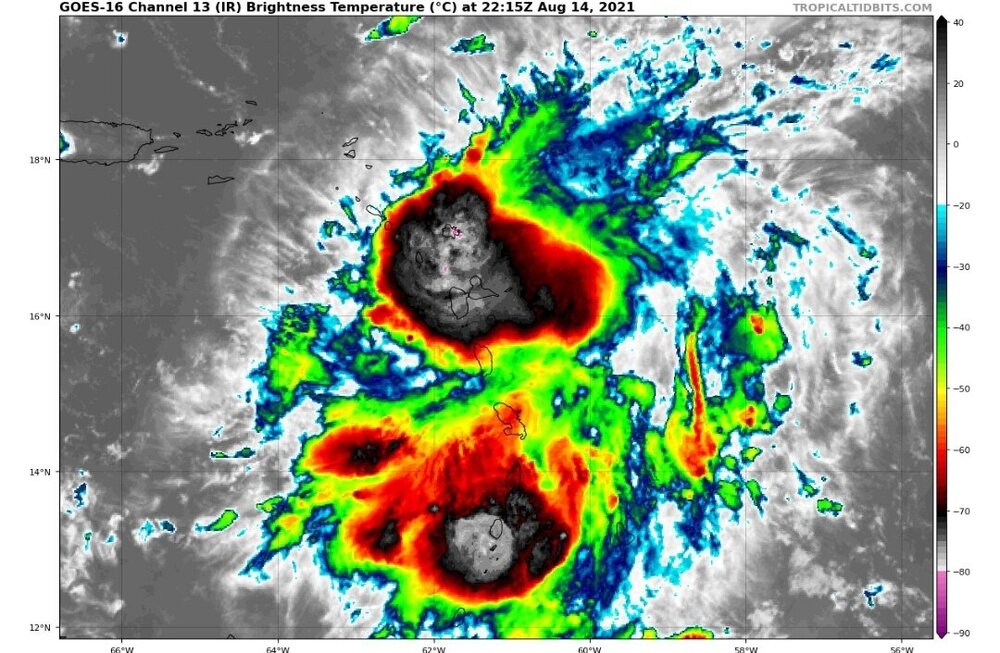
Interested to see what's happening in northern Guadalupe right now.

-
Looks like it's on a crash course for Antigua, should be getting good surface obs soon.