cptcatz
-
Posts
1,109 -
Joined
-
Last visited
Content Type
Profiles
Blogs
Forums
American Weather
Media Demo
Store
Gallery
Everything posted by cptcatz
-
It's an estimate of the highest winds over water as it makes landfall. What part of that can't you comprehend?
-
Yooo this new plane just recorded 136 kt flight level wind...
-
I think the surge will be overblown on this. A fast moving small storm doesn't have time to build up a big surge. Kinda like a Charley situation.
-
Yep, people seem to only remember the ones that intensified upon landfall. But Idalia in 2023 weakened right before landfall, Delta in 2020 did too, and of course Katrina weakened big time before landfall.
-
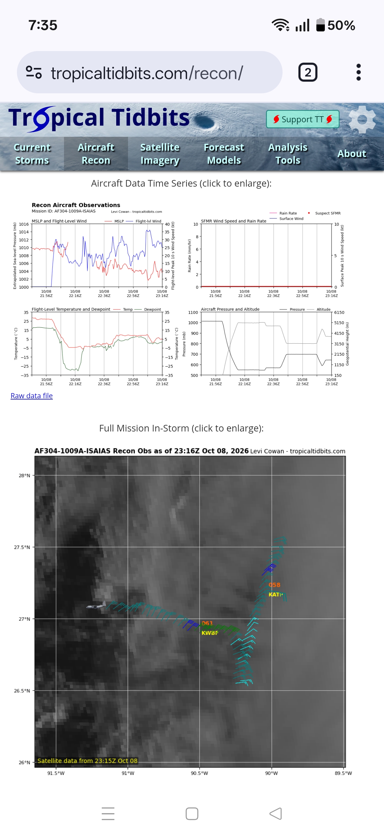
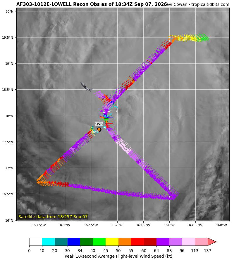
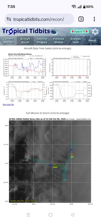
Anyone know what's up with the recon plane? Going in weird directions and altitude is all over the place
-
I mean the noreaster last week looked far better than this does
-
I feel like asking NHC if those 100 mph winds are in the room with them right now...
-
Looks like it's trying to wrap some deep convection around the west side of the eye. If it can hold on and build an eyewall out of this, that's it's shot.
-
Looks like it's struggling. What else do you expect from #2026?
-
2026 Atlantic Hurricane Season
cptcatz replied to Stormchaserchuck1's topic in Tropical Headquarters
What a season! It's September 19 and a new weak tropical depression near the Azores is getting all the hype. -
2026 Atlantic Hurricane Season
cptcatz replied to Stormchaserchuck1's topic in Tropical Headquarters
You've been posting lots of UK runs showing a tropical cyclone lately with nothing coming of it. UK has been just as bad as GFS with its fantasycanes. -
2026 Atlantic Hurricane Season
cptcatz replied to Stormchaserchuck1's topic in Tropical Headquarters
Pretty remarkable, we are now looking at a solid chance of going the rest of September with no tropical cyclone, let alone a hurricane. Now that GFS finally dropped its fantasycane, models show zilch into October. -
2026 Atlantic Hurricane Season
cptcatz replied to Stormchaserchuck1's topic in Tropical Headquarters
I don't think this is accurate. Weather phenomena don't have "functions". They are the outcomes of atmospheric processes and don't actually have purposes. -
2026 Atlantic Hurricane Season
cptcatz replied to Stormchaserchuck1's topic in Tropical Headquarters
Is there any research or data on how hurricanes one year impact the ocean temperatures the next year? I feel like just because there may not be any hurricanes this year, that doesn't impact next year's ocean temps nearly as much as other ocean and atmospheric processes that take place over the winter. -
Moved even further to the northeast than recon even thought! Landfall is definitely a possibility...
-
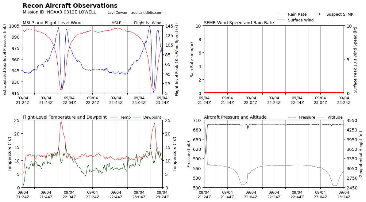
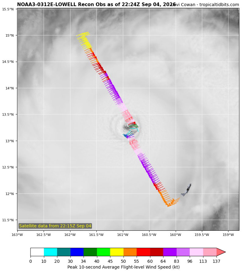
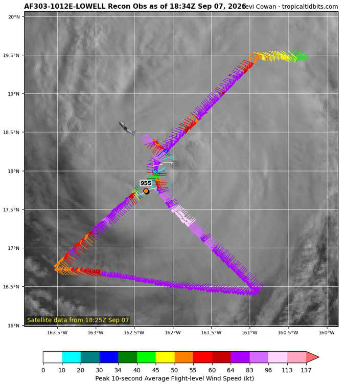
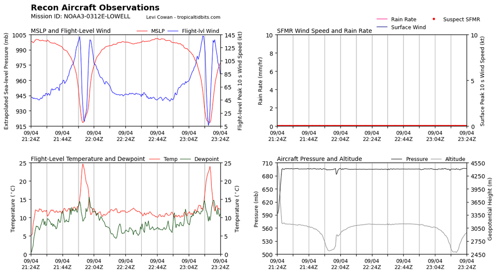
Pass through the eye just recorded 143 kt flight level wind and 918.4 mslp. Impressive
-
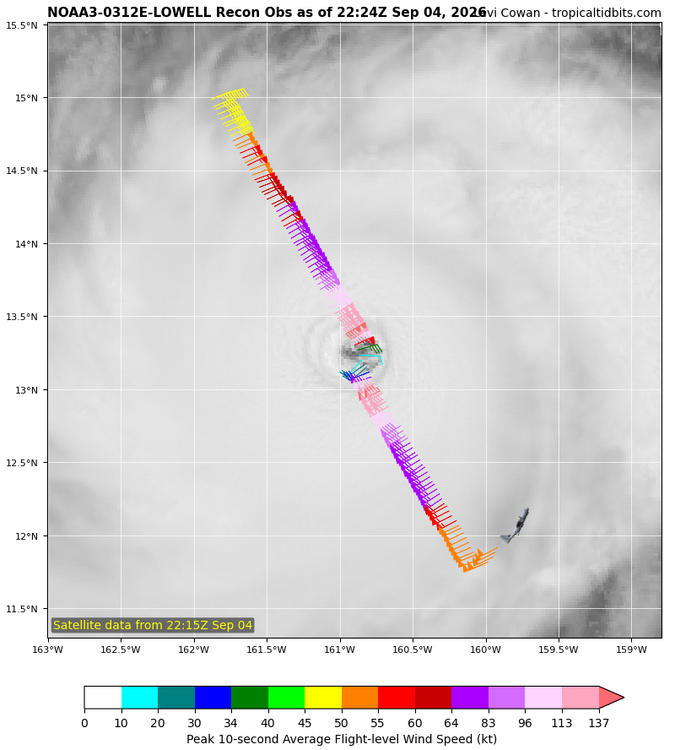
Lowell is putting on a show for recon right now
-
No way this is becoming a hurricane. Still so weak and not enough time until landfall.
-
Looks much more like it's about to go poof rather than boom.
-
2026 Atlantic Hurricane Season
cptcatz replied to Stormchaserchuck1's topic in Tropical Headquarters
Euro and GFS both out to mid September with no tropical development. The question may start getting real soon... Can we go a whole season without a hurricane? -
2026 Atlantic Hurricane Season
cptcatz replied to Stormchaserchuck1's topic in Tropical Headquarters
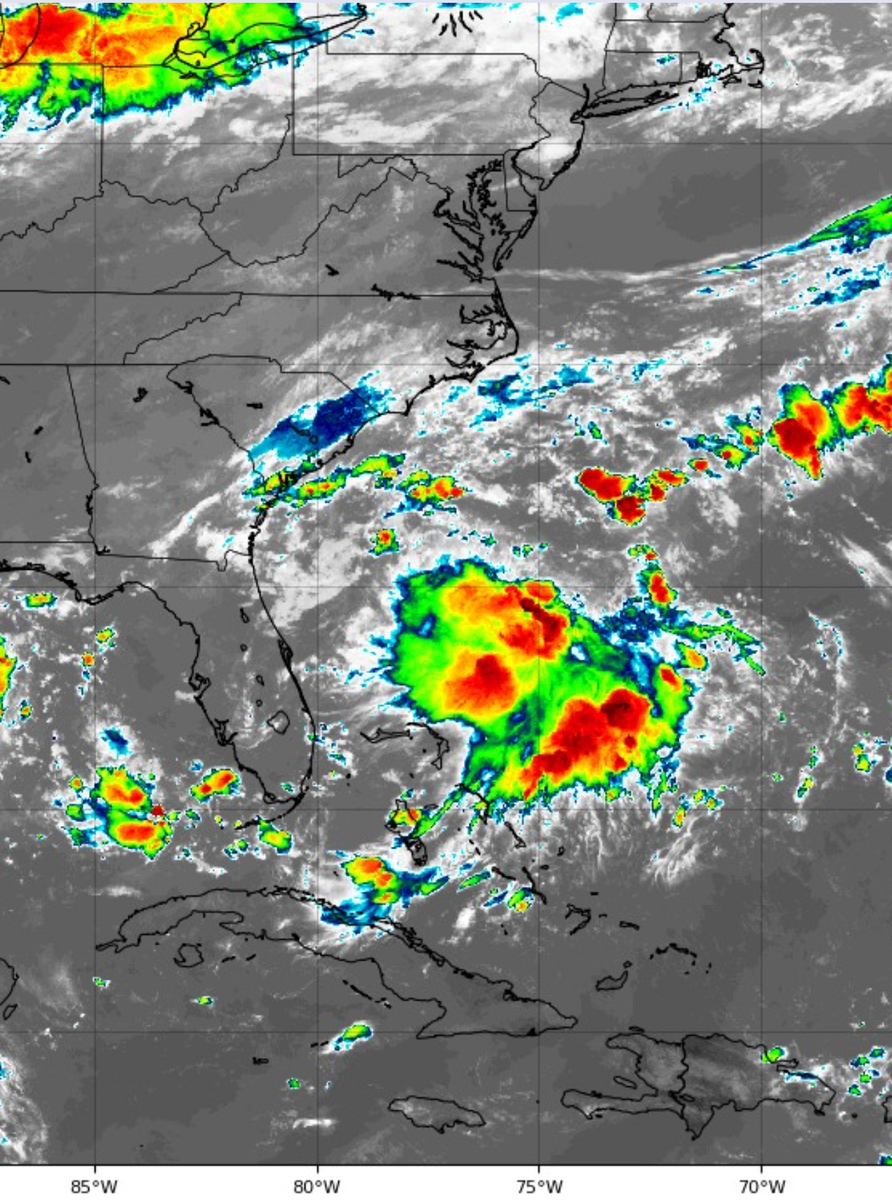
The UK has been hinting at this system forming in front of Dolly along the SE coast. It was kind of a mystery until now but check out this satellite presentation. Looks like it was on to something.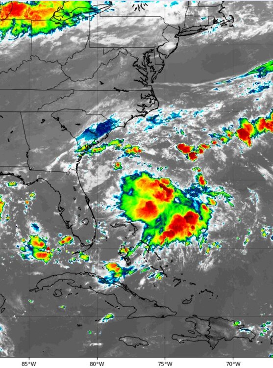
-
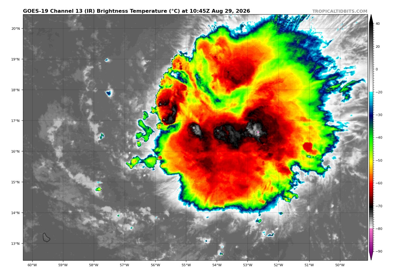
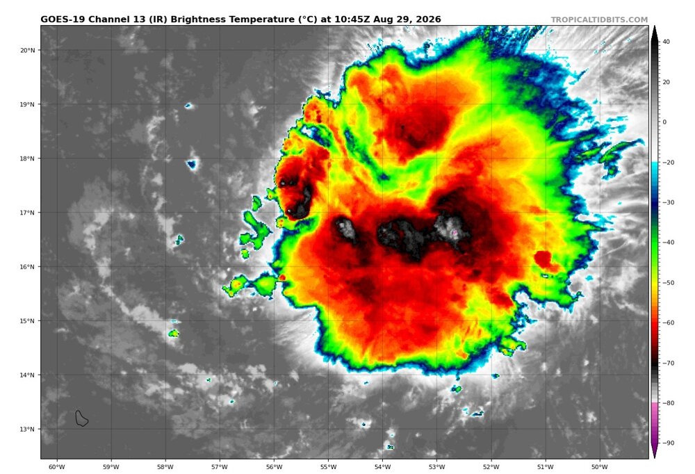
Dolly still looking voluptuous at this ripe age of hers. I feel like models have no idea what's going on. Same with NHC. How can this possibly only have a 0%/10% of becoming a TC?
-
I'm not convinced this is the end of Dolly. There's still a pretty clear center of rotation visible on satellite and it looks like it's gaining in latitude much faster than forecasted. If the circulation goes north of the islands, which it seems that it might, then I think game is on once it makes it closer to the Bahamas. The big factor will be whether the weak LLC stays intact, which it probably wouldn't if it went over the islands, whereas it could if it goes north of them...
-
FWIW, the GFS this morning redevelops Dolly's remnants in the GOM and gives Texas a hurricane. Yeah should be interesting if/when it opens back into a wave, will NHC immediately put an orange/red back onto the TWO.
-
No, a post tropical storm is a system that used to be a tropical storm but is no longer. Post means after, the opposite of pre. So a wave coming off of Africa is not a post tropical storm.