

stadiumwave
-
Posts
1,168 -
Joined
-
Last visited
Content Type
Profiles
Blogs
Forums
American Weather
Media Demo
Store
Gallery
Posts posted by stadiumwave
-
-
1 hour ago, snowman19 said:
You are going to get your push. Our ideas really aren’t that different, I’m just slightly higher with my trimonthly peak ONI estimate at +2.1C - +2.3C. Despite some incredibly bad info on twitter, this Nino event HAS NOT peaked nor is it going to rapidly fall apart. This DWKW and WWB mean businessYou're overkill. Everyone needs to be objective. There's too much subjectivity your way & the other. The middle ground will win the day.
-
 3
3
-
-
28 minutes ago, brooklynwx99 said:
pretty good signal for SPV weakening into Dec

Much better than Mondays update!
And thanks!
-
1
-
-
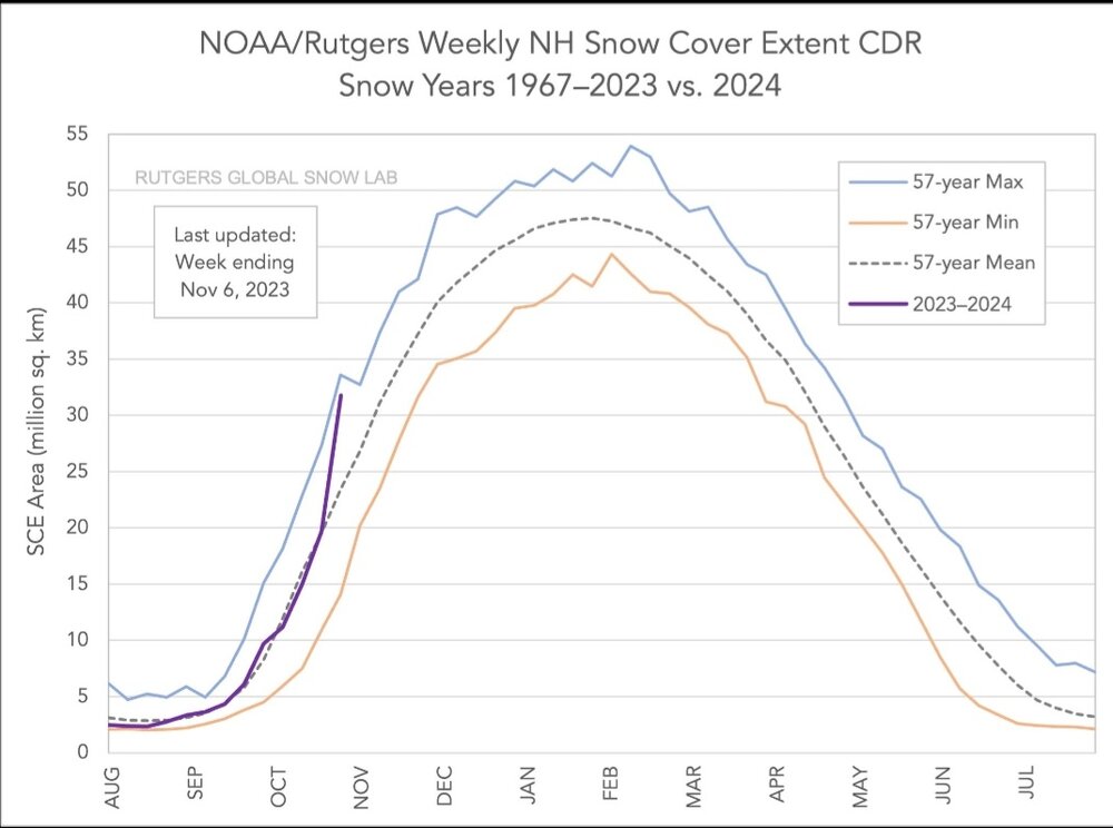
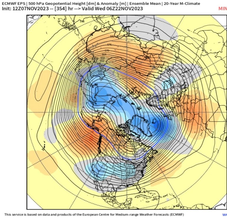
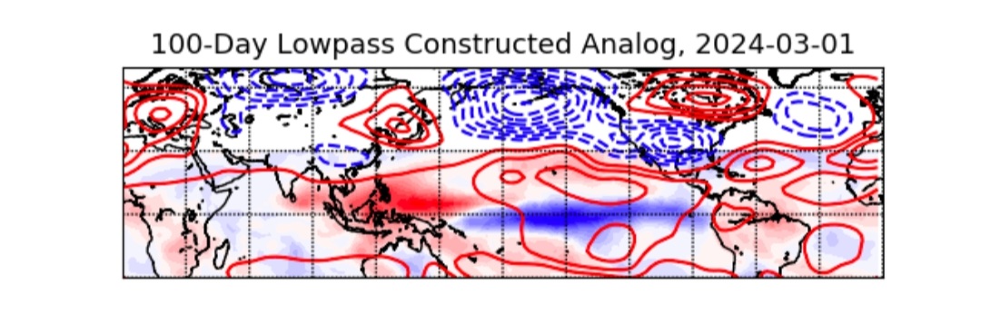
Anyone have the stratosphere forecast graph from today's Euro Weeklies?
-
Hmmm....
-
5
-
-
-
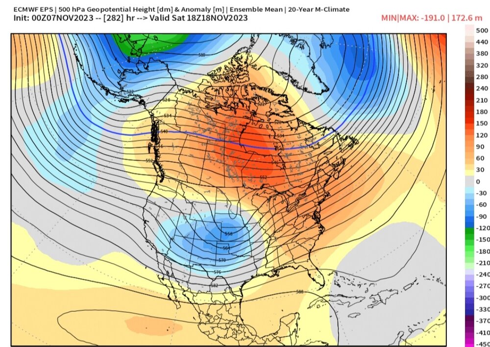
21 minutes ago, griteater said:
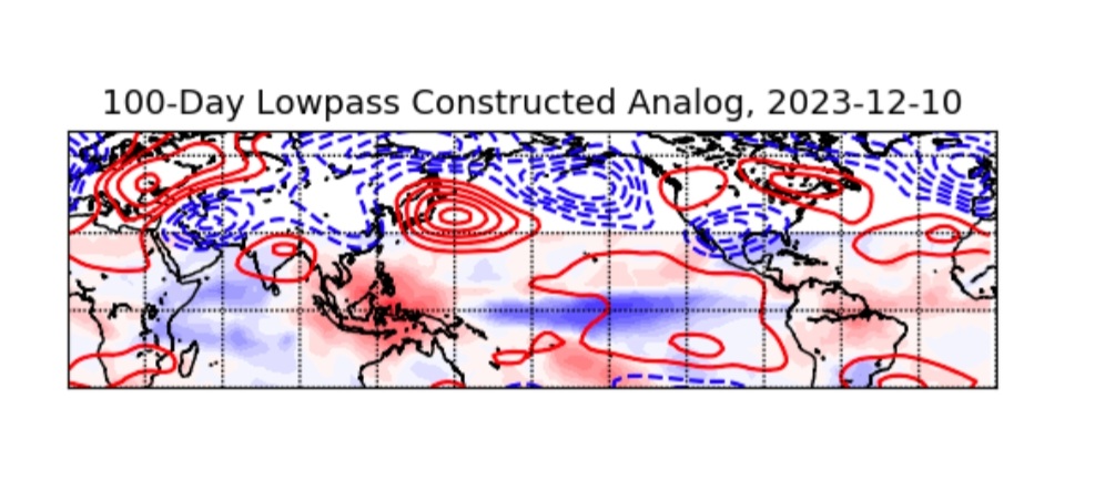
@stadiumwave I want to get on board with Roundy's lowpass tool here...I like the concept...but it's always seemed to end up a bit off the mark when I've looked at it / tried to use it (others may have had more success with it).
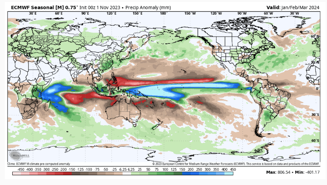
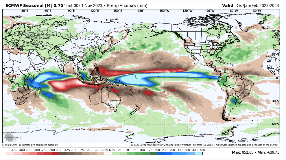
In this particular case, the thing that looks off to me is that the tool is going with a more east-based look with the lowpass / base state convection in blue there centered farther east than what we've seen this summer and fall, and what is forecasted on the Euro Seasonal (2nd image). This is important as the end result in Roundy's tool is showing the big, east-based Aleutian Low look with above normal heights over the Great Lakes and SE Canada like 82-83 / 97-98. I suppose it's still possible for us to go in that direction if we were to have a last gasp major push like Nov/Dec 1991, but I don't think that will materialize.
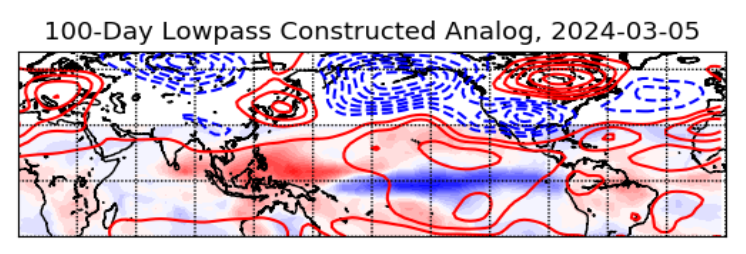
I love Paul, but I've noticed the same with his tools.
And he has been using big adjectives about the Nino with everything that occurs (+IOD, last wind burst...etc.) & its resulted in pretty much nothing each time. I wonder why he's not being a little more cautious with his descriptive terms? He's not usually the "hype" type.
-
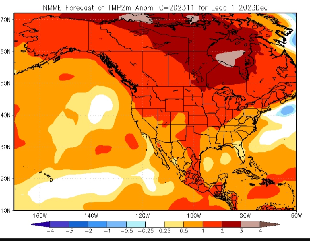
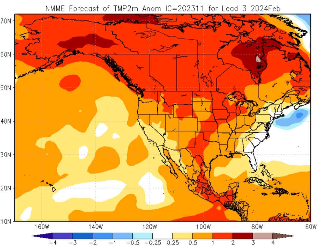
Just now, Itryatgolf70 said:
Are those cold signals for us if he is correct or warm?
Looks good to me. I'd take that DEC anyday verses what a Nino DEC can be.
-
1
-
-
-
2 minutes ago, brooklynwx99 said:
this is conveniently left out for some reason. I was told by someone that the forcing can't be used month to month because of sub-monthly variability lmao there is no convincing anyone of these differences at this point
That's pretty telling.
-
3 minutes ago, GaWx said:
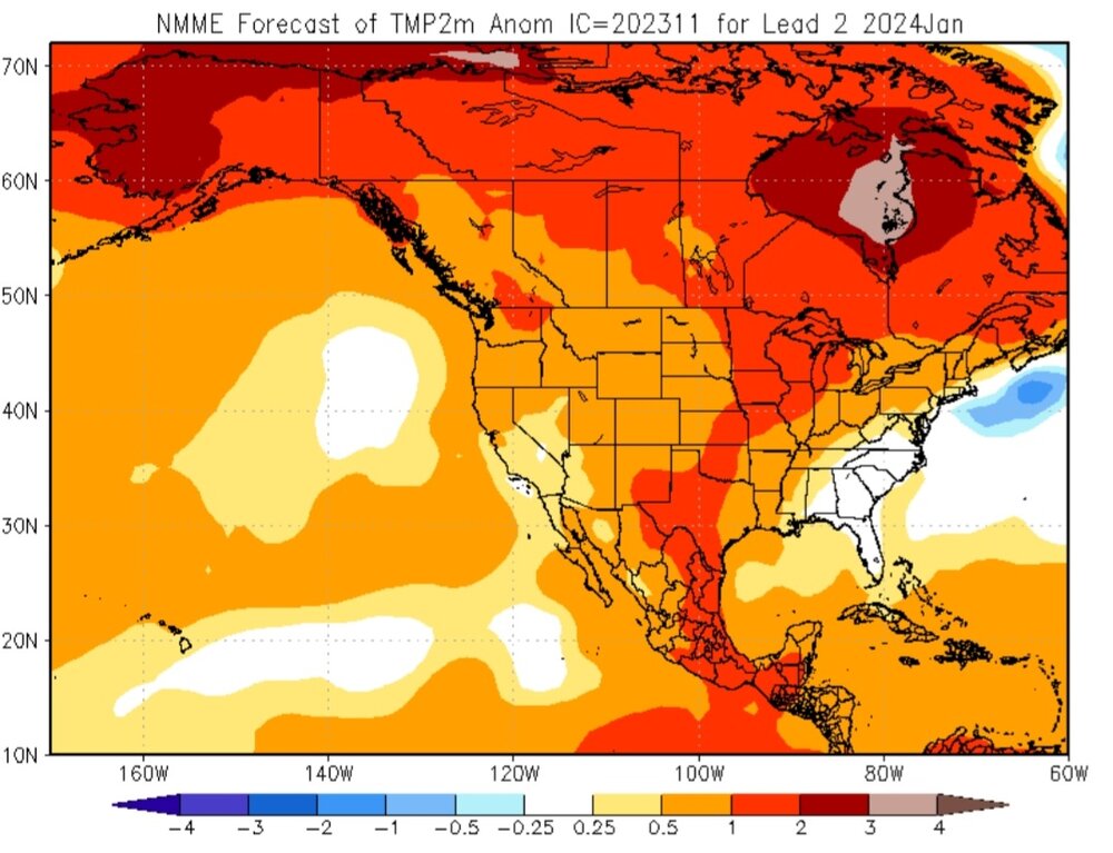
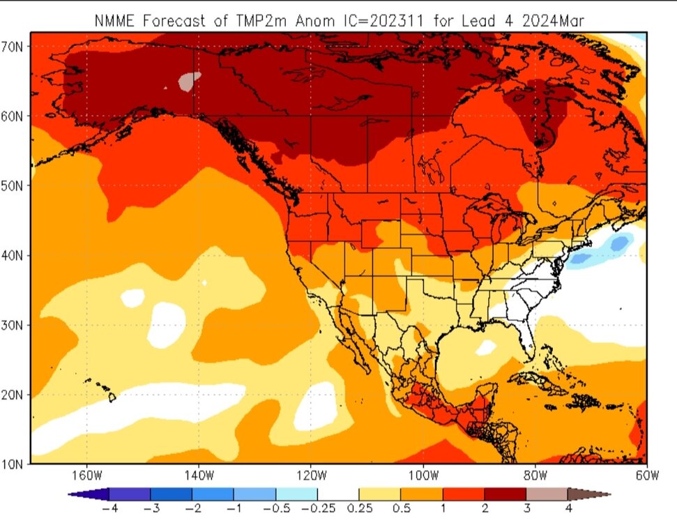
He assumed that based on the much wetter NMME vs last month in the W US. I still haven’t seen 2m temperatures update on TT. Has anyone seen 2m anywhere?
Obviously warmish on 2m temps verses the norm on most seasonal models always anymore.


-
1
-
 1
1
-
-
37 minutes ago, George001 said:
72-73 is a solid analog, yes this nino likely won’t become super like that one did, but most guidance has it peaking as a high end strong event. This isn’t a true east based nino like 97-98, the structure is also a good match (basin wide but east lean). The combination of strong nino and -PDO is another thing that matches 72-73.
It is in ENSO SST anomaly structure, also the -PDO, but the QBO & forcing is different.
As Gritear & Wiz both showed in their forecasts, the forcing is very similar to 2002-03, & 2009-10.
-
12 minutes ago, griteater said:
Griteater’s Winter Outlook (23-24)
Link to PDF: Griteater's Winter Outlook (23-24).pdf - Google Drive
Very well done sir! I like the objective, humble approach in mentioning factors that could take this either way. I also agree on the balance of warm & cold periods & nothing really "locking in" for the long haul.
-
3
-
1
-
-
32 minutes ago, snowman19 said:
What in the world are you talking about?? No one is rewriting anything. That tweet I just posted simply explained why the MEI isn’t measuring up right now. The SOI has actually been impressive for months per @Gawx and I’ve never argued about main forcing. This Nino is going to warm, it hasn’t peaked, the peak most likely happens late December/January and it’s very well coupled as I have explained in the past couple of weeks in hereExactly! It's coupled but I disagree on how well it's coupled. I think Eric exaggerated his point.
And while its coupled, it is its own flavor. To have as strong of an El Nino, based totally on SST's, & the main forcing to be that far west is indeed new territory based on the data we have. So, appealing to 1972-73, 1982-83, 1997-98, & 2015-16 (which all had greatest forcing east of dateline with 97-98 being the furthest east) and then laughing is kind of strange.
My take on this winter is nothing will surprise me. I think there's some reasons those who desire a blowtorch winter should be very concerned & those who love cold/snowy winters to be as well. A humble approach would be the best approach with this.
-
1
-
-
1 hour ago, snowman19 said:
Are you looking at what’s going on right now oceanic wise? They are all about to warm big time. You’ll just ignore it when it happens though. Funny, don’t see you mentioning the RONI anymore lol And besides Eric Webb, the other tweet I just posted gave a very clear explanation of why the MEI is the way it is.
And I’ll admit, you have Mark Margavage, Joe Bastardi, Henry Margusity and Tony Pann on your side, going HUGE cold and snowy winter, MEI to the rescue!!! 4 true all stars with those guys in the weather community. Legends. I’m sure this winter will work out superbly for you when you have them on your bandwagon lol
They will warm but not big time, or or at least based on what I'd consider "big-time".
-
1
-
-
6 hours ago, snowman19 said:
Hmmmmmm, very interesting stuff…..
@CAPE @40/70 Benchmark @bluewave @Daniel Boone @Terpeast @brooklynwx99 @griteater @GaWx @stadiumwave @mitchnickYou're conveniently calling an El Nino "east-based" based on SST's when in fact the main forcing has been west of the dateline the entire time. I'm surprised that Eric who has spent soooooo much time in the past pointing out how much that matters seems to say it means nothing now????
So list of things that "no longer" matter now:
1. SOI
2. MEI
3. Location of main forcing
Wow! We're rewriting all the literature. Thanks
-
3
-
-
Yoda has spoken!
-
4 minutes ago, brooklynwx99 said:
oh man. I'm still expecting the Nino to couple... not really worried there
but the "MEI is bullshit and you're just a weenie if you don't think this is going to act like 1997" stuff is so dated. no way this acts like its full ONI strength
Paging Webb...
-
 3
3
-
-
This winter will not be 2009-10 in my opinion but the progression of that winter should be remembered. Because it seems like when it gets warm in NOV anymore folks seem to want to write winter off which is nonsense.
NOV, 2009 Temp anomalies

500mb

NOV 1-10

NOV 10-20

NOV 20-30

DEC 1-10

DEC 10-20

DEC 20-31

DEC Temp Anomalies

DEC 500mb

DEC 15-31, the 2nd half of Dec was the coldest.

Again, I'm in no way saying this winter will be a repeat of 2009-10. I'm simply saying don't get excited or despair this month. Let it all unfold. Don't jump to conclusions either way.
-
4
-
-
25 minutes ago, brooklynwx99 said:
again, I don't understand the issue of the SW trough for December. most stronger Ninos feature this -PNA/+NAO pattern, so it should not be surprising. it is likely going to be a warm month

As a rule of thumb, we all know most El Ninos have that warm DEC either way but if it's a cold NOV it's a given DEC will warm.
-
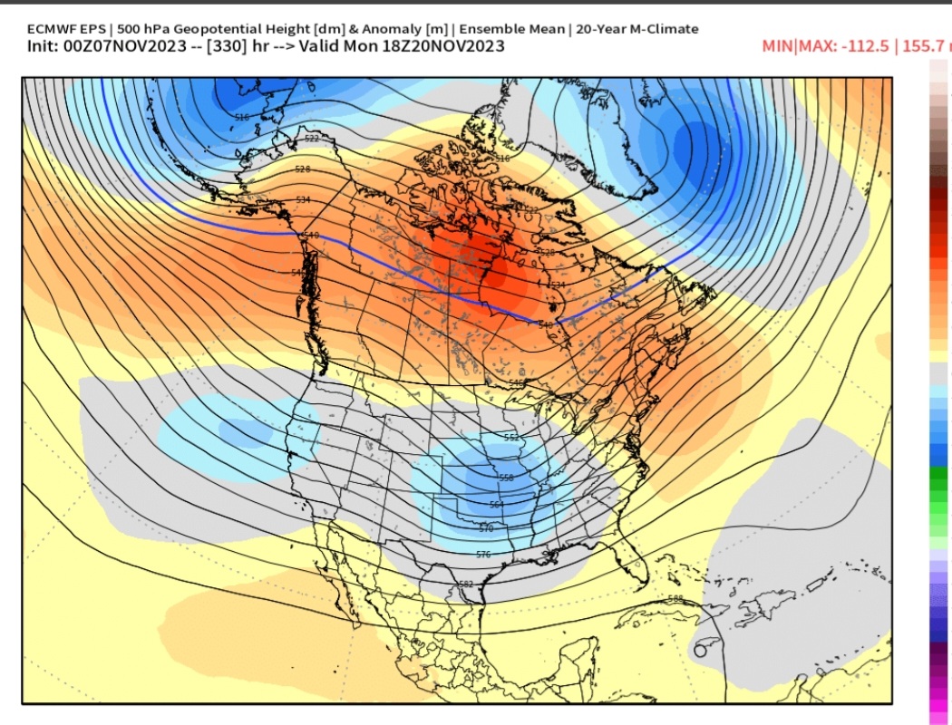
9 minutes ago, bluewave said:
But notice the main trough axis still hangs back near the SW.
It's a process. A repeated pattern like that will keep normal to below normal anomalies in the southern half over a period of time. Wave after wave simply moves across the CONUS. That's not a terrible pattern heading into DEC. I've seen worse for sure.
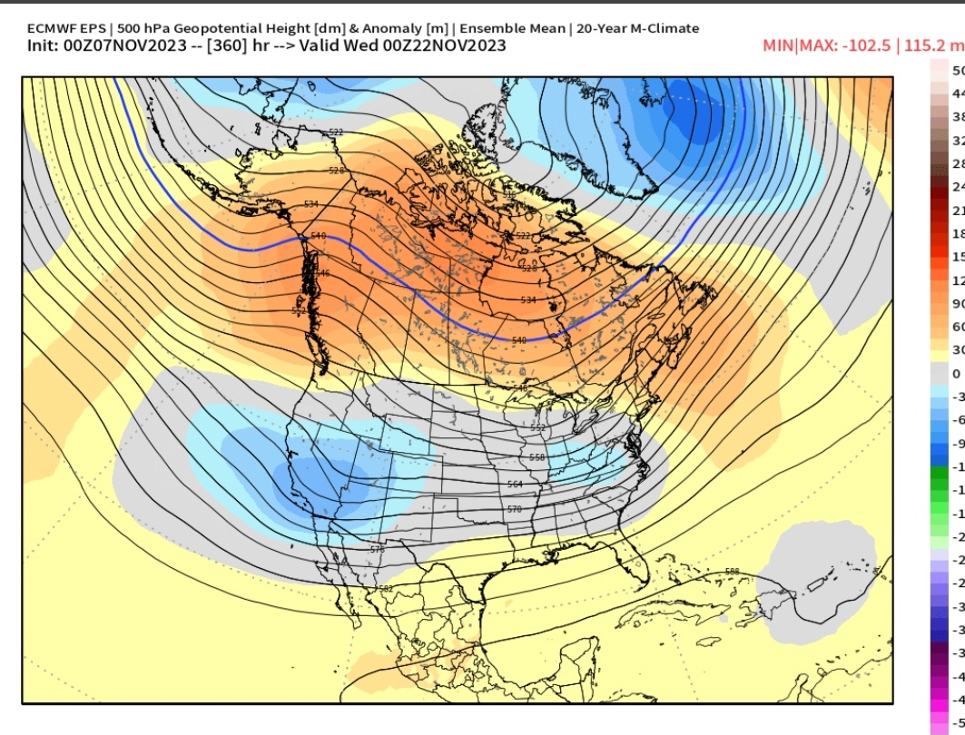
Today's 12z EPS:
-
4
-
-
6 hours ago, bluewave said:
The EPS is starting to show the winter pattern in a few weeks that we get when we have an El Niño +PNA ridge in Canada that gets undercut by the La Niña background or -PDO SW trough.


Jet ends up undercutting ridge in the 10-15 day range. A repeat of that would be welcomed heading into DEC.


-
2
-
-
1 hour ago, CoastalWx said:
Didn't he cancel winter yesterday?
Yea, that's what I was thinking, lol
-
-
57 minutes ago, griteater said:
A few thoughts:
1. Fair point from GA as the lack of big cooling in the W Pac and E Maritime Continent may cause some interference with El Nino at times by enhancing convection in the W Pac...but yeah, whether the MJO RMM plots are showing a legit east tracking MJO wave or not, there is almost always a background weak MJO wave/ripple that traverses the equator around the globe, and as that signal (usually seen well with VP movement) kicks out of the W Pac into the dateline and east and constructively interferes with the background El Nino convection, that will be the time that should offer the most promise for wintry weather in the East.
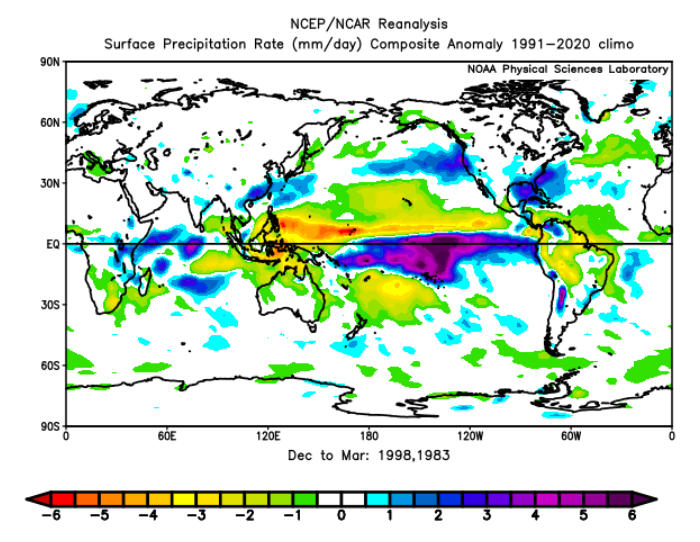
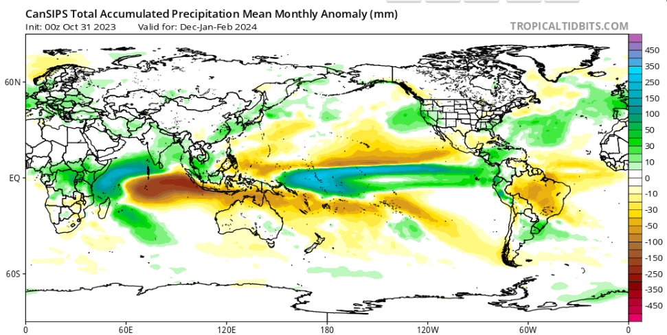
2. Look at how the precip maps from the winters of 09-10 / 02-03 (west-based El Ninos) compare with 97-98 / 82-83 (east-based El Ninos). Euro and Cansips Seasonals match more with the west-based look
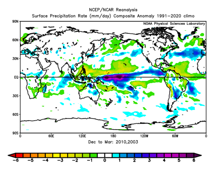
3. Lastly, here is how MJO phases 6-7-8-1-2 look during El Nino in December / Jan / Feb (note: the Dec images don't have a 'Dec' label or El Nino label on them, but you can see that they are grouped under Dec during El Nino when you click on the images here): https://www.americanwx.com/raleighwx/MJO/MJO.html
December:
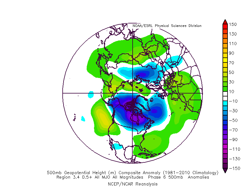
January:
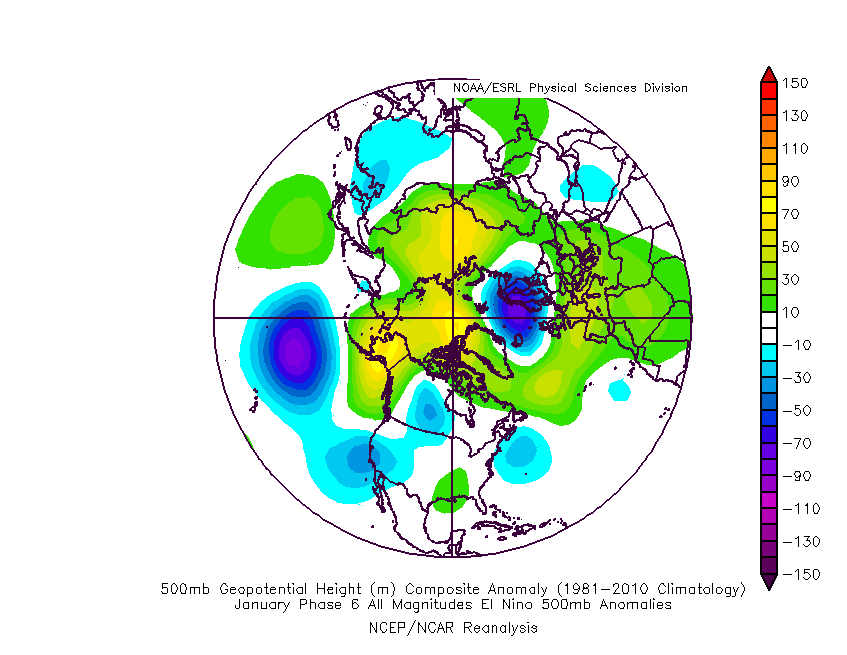
February:
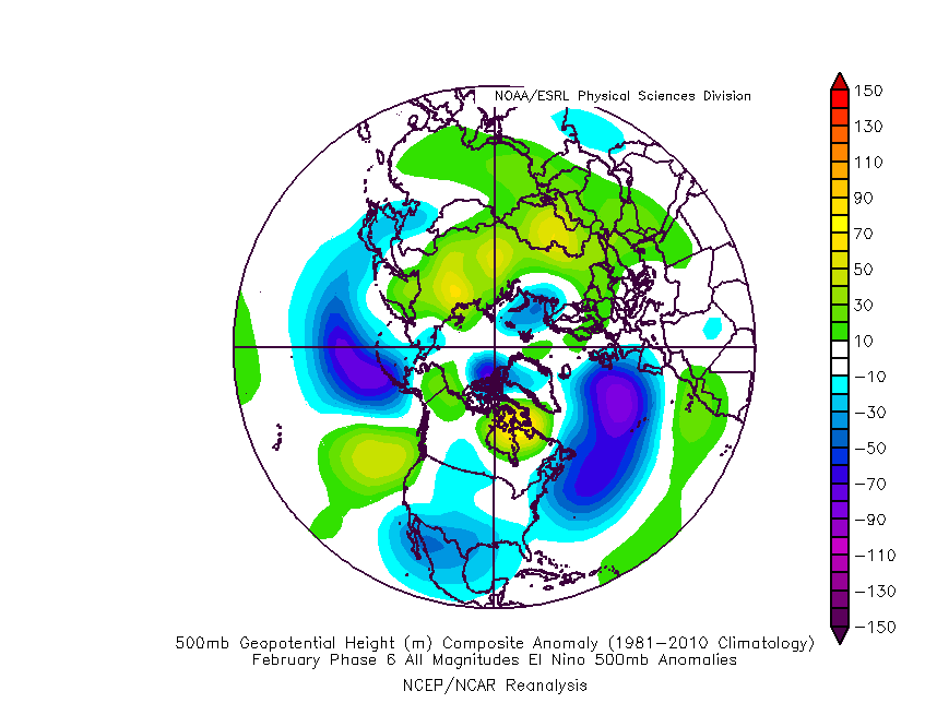
The forcing comparison is just massive! I keep asking myself why some will not mention this? Like it doesn't matter? It matters!!!
Great post on all Grit!
-
2
-
1
-


El Nino 2023-2024
in Weather Forecasting and Discussion
Posted
BINGO!!! I just do not think people are being honest with themselves. Too much desire for many to say "I told you so". The event is a hybrid type & not textbook anything,which is why the indexes are so skewed more with this event.