

stadiumwave
-
Posts
1,168 -
Joined
-
Last visited
Content Type
Profiles
Blogs
Forums
American Weather
Media Demo
Store
Gallery
Posts posted by stadiumwave
-
-
Rock & roll! Happy new year!

-
 6
6
-
 2
2
-
-
1 hour ago, GaWx said:
Neither last night’s extended GEFS (12/14 run) nor today’s Euro Weeklies (12/15 run) was what I wanted to see as they both suggest a sharp decrease vs earlier runs in the chance for a major SSW anytime soon:
1. Extended GEFS: % of members with major SSW
12/11 run: 48
12/12 run: 32
12/13 run: 29
12/14 run: 23
2. Euro Weeklies:After many days showing 45-60%+ of members with a major SSW, today’s suddenly plunged to only ~33%. Yesterday’s was ~50% with a whopping ~17% for 12/28-1/2, alone. Today’s has only 3% for 12/28-1/2! Today’s has 17% for 12/28-1/12 and only 21% through 1/17. The extreme major SSW (sub -15) members stayed ~same with 7% vs 8% yesterday though that was ~17% two runs ago:

Good old "MJO confusion" model run to run variability I think.
-
42 minutes ago, 40/70 Benchmark said:
Is it me, or have they adjusted these? I feel like SO was 0.3 and ON was 0.6, whereas now they are 0.4 and 0.8, respectively.

-
2
-
2
-
-
39 minutes ago, qg_omega said:
PV will get pushed to the other side of the globe yet again
But at that point it's already weak & decoupled from the troposphere and it really doesn't matter. Opens the door for increase HL blocking.
Also that is classic precursor to a full-blown SSW which is defined by a reversing of the winds. Smart money is it's going to occur.
-
1
-
-
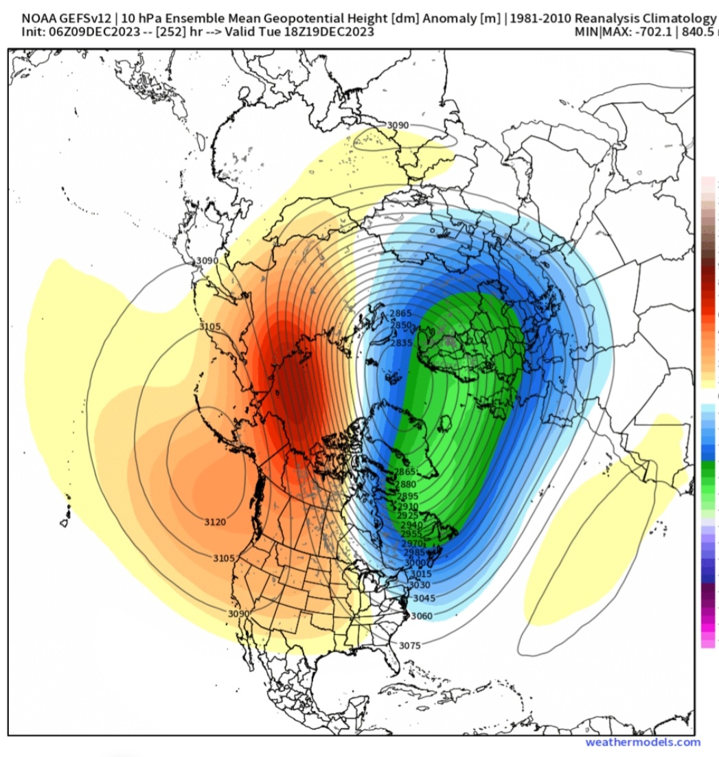
GEFS 10mb Anomaly

GEFS control 10mb anomaly

-
2
-
1
-
-
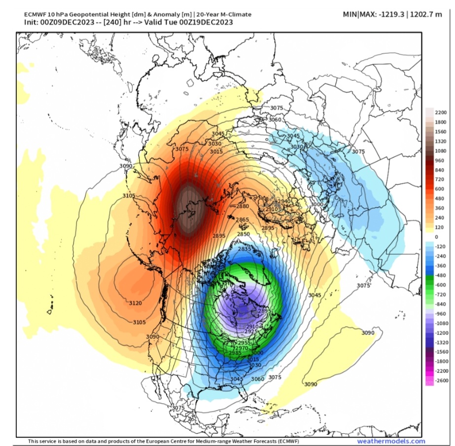
24 minutes ago, GaWx said:
Today’s Euro Weeklies are about as weak as any run yet for the last few days of Dec/early Jan. Total major SSWs are ~~50%. The highest concentration of major SSWs occur Jan 2-9 (~25% of members), which is supported by E QBO climo. (The extreme SSWs throughout Jan increased with ~17% total sub -15, ~15% sub -20, 5% sub -25, and 2% sub -30.):

10 mb temp anoms 1/1-8:
Also, Jan 8-15 cooled back almost to as cold as the run from 3 days ago. But no football spiking from me!
Organic methods still looking good for cold that 2nd week.
-
1
-
-
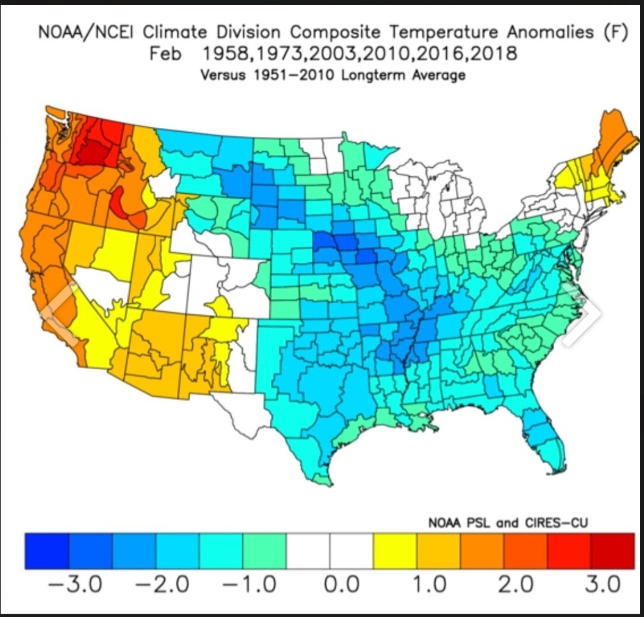
4 hours ago, snowman19 said:
At this point a -PDO winter is all but guaranteed. A historic first (strong -PDO) for a Nino this strongWith a month long +PNA. So, who cares
-
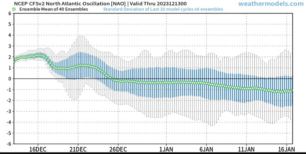
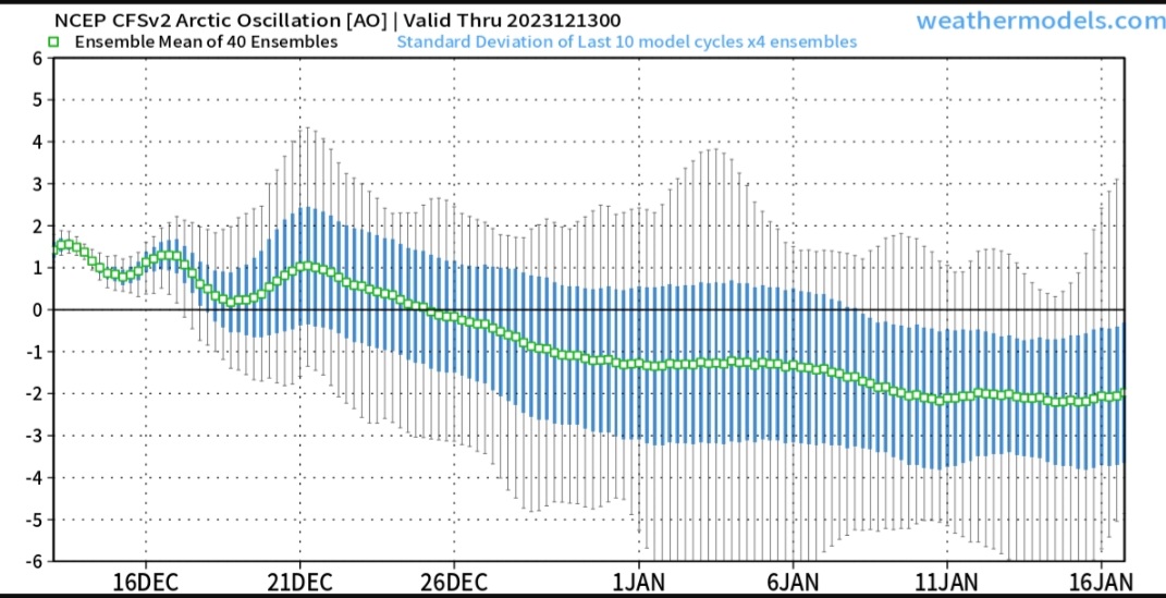
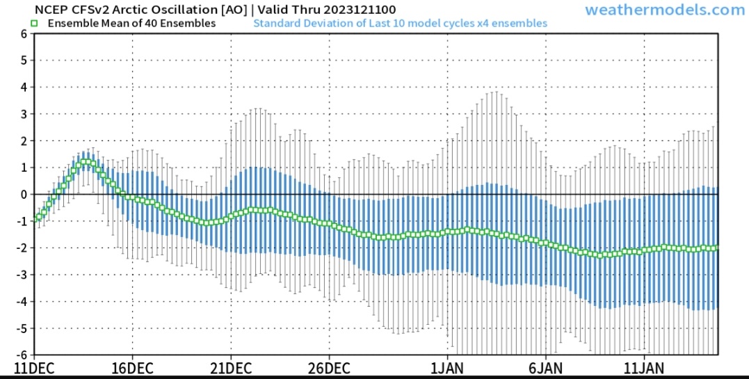
CFS continues to show NAO & AO drop around & after Christmas.

-
3
-
-
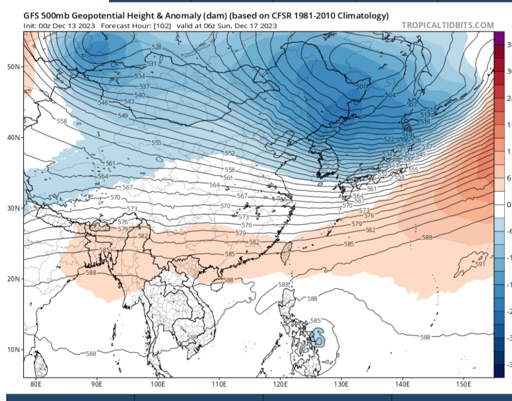
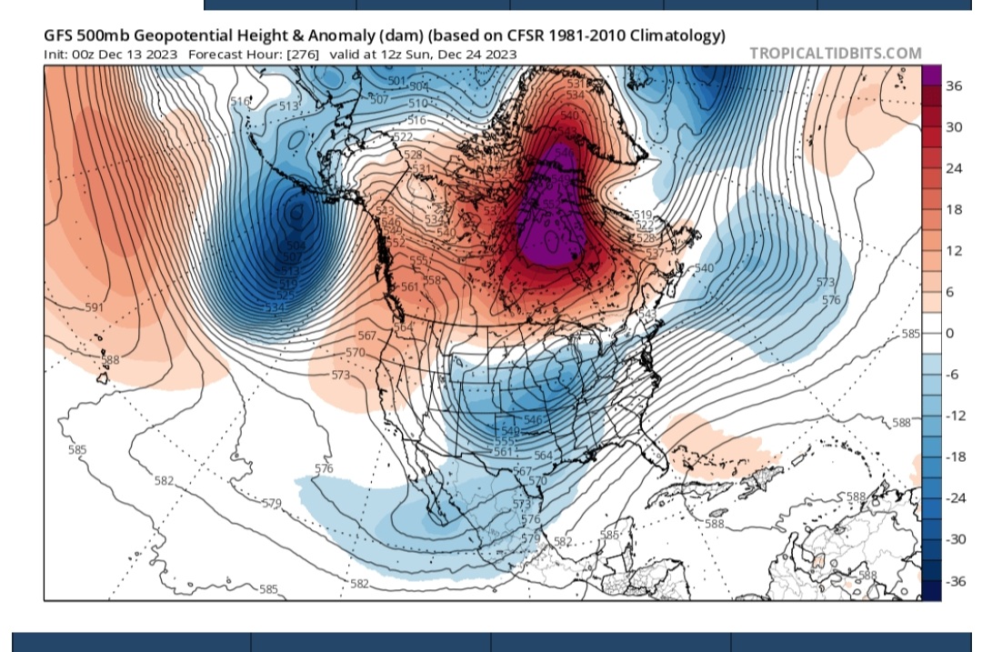
10 hours ago, griteater said:
Mid-late Dec 1994 has been showing up on the CPC analog dates recently
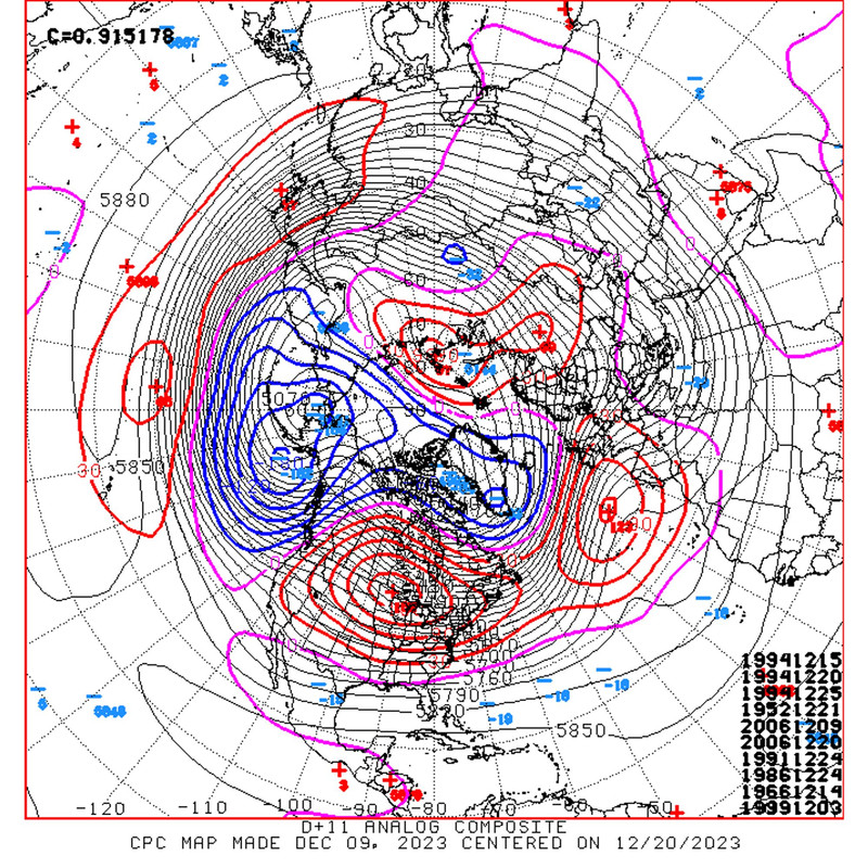

East Asia has a lot of troughiness being modeled Dec 16-29. Per East Asia Rule, correlates to east U.S. 6-10 days later. Somewhere around Christmas through 1st week of new year.

The 0z GFS & GEFS changed drastically for Christmas Eve.
Trend

This does not appear to be a cold outbreak but some seasonal & perhaps tad below normal when systems swing through. Would support some possible snow potential somewhere during that period .
EDIT: I could've swore I saw DEC 24 on the analog map, ha. My point was irrelevant except for the Christmas period.
-
3
-
1
-
-
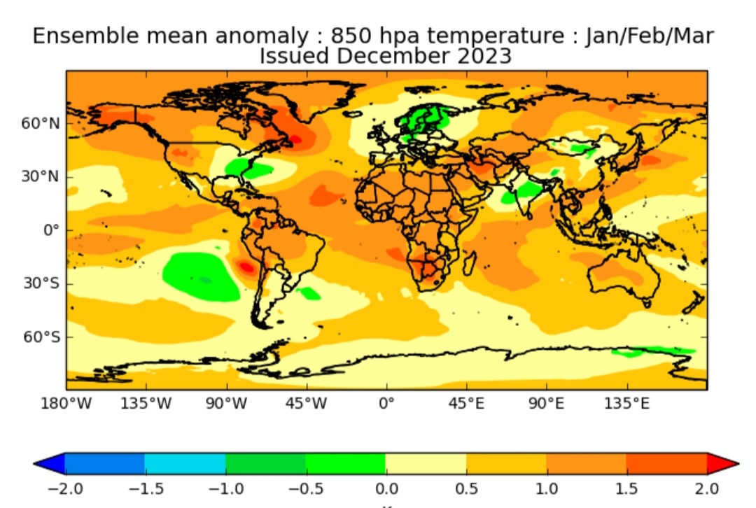
1 hour ago, stadiumwave said:
UKMET updated...great looking JFM
500mb
2m Temps
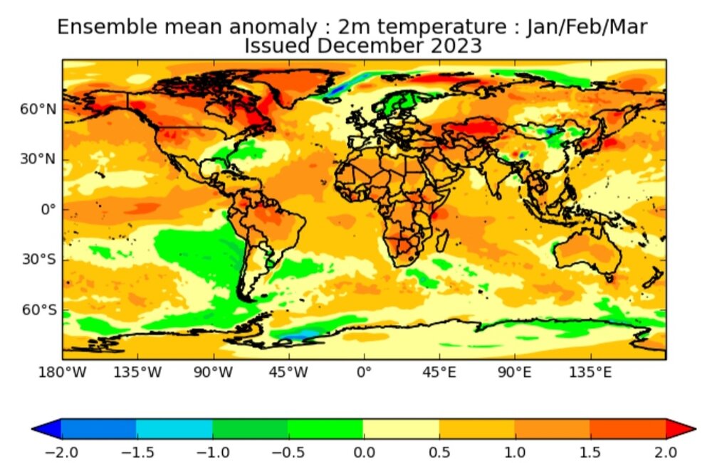
850mb Temps
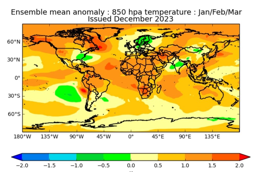
Precip
SST's

JMA updated...great JAN & FEB
JAN
FEB
-
3
-
-
UKMET updated...great looking JFM
500mb
2m Temps
850mb Temps
Precip
SST's
-
3
-
3
-
-
1 minute ago, Terpeast said:
Yeah it would be nice to shake things up for the back half of the winter.
But as last night's storm proved, we don't really need a SSW. The mid-atlantic forum pulled a rabbit out of a hat with some getting up to 4" under the best banding (many got 1-2" which is more than what was forecasted). This happened in a lousy pattern... and it just snuck up on us inside 3 days.
And it's only Dec 11.
We will have our chances despite a less than ideal pattern, and even more chances when the pattern improves.
Continued warming Strat warming episodes, weakening the SPV is probably fine as long as MJO cooperates. If not...need SSW & reset.
-
1
-
-
CFS Weeklies really swinging to colder look 2nd week of JAN as we've been discussing:
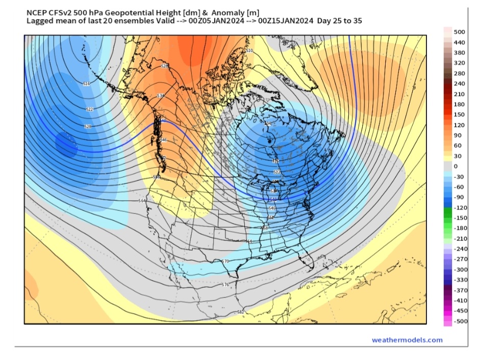
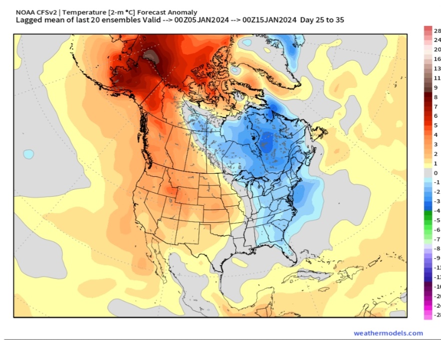
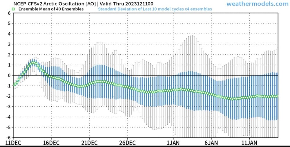
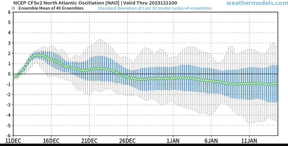
That AO & NAO drop that far out is pretty significant. If models are correct on that period, and I think they're catching on, then expect that signal to intensify.
-
8
-
-
I've been up in the air about whether a full blown SSW is needed. I've about decided....yes. Either full-blown reversal or a significant weakening event to shake things up.
-
6 hours ago, GaWx said:
All of the sudden, today’s Euro Weekly for 1/8-15 came in much colder than yesterday and is the coldest for that week since it started being covered on Nov 30th:


Also, today’s 12/25-1/1 isn’t quite as warm as yesterday’s.
I mentioned a couple of days ago there are signs of the 2nd week of Jan...8-15...being colder per organic methods. I'm pretty certain of a trough, but anomalies are always in question.
Fingers crossed for those colder anomaly solutions if today's update.
-
1
-
-
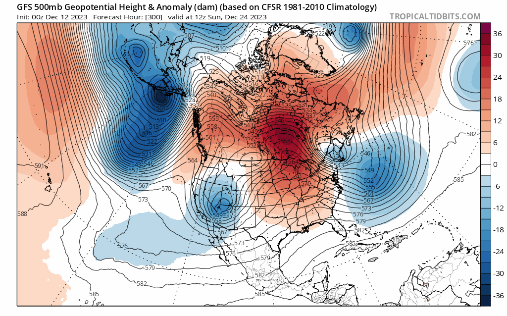
32 minutes ago, 40/70 Benchmark said:
Looks like the GFS suite is just more of a PV elongation, whereas the European decimates it.
12z EURO caved more to the GFS idea.
-
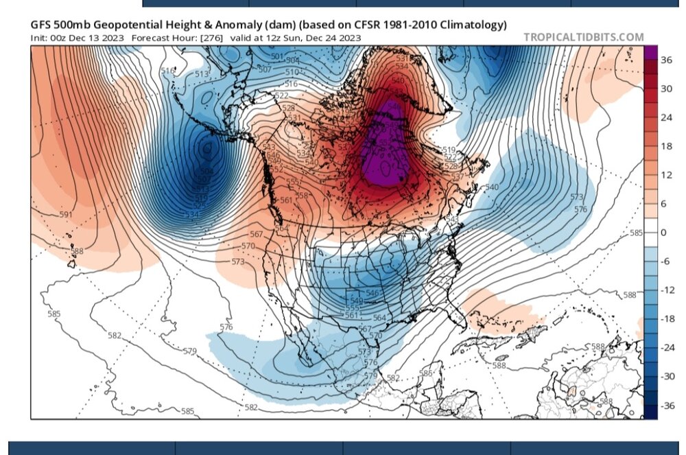
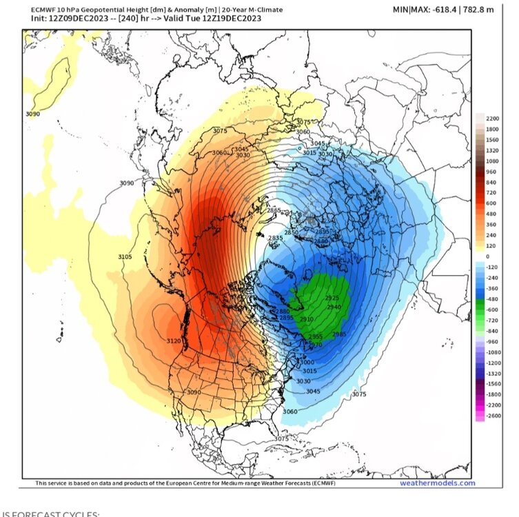
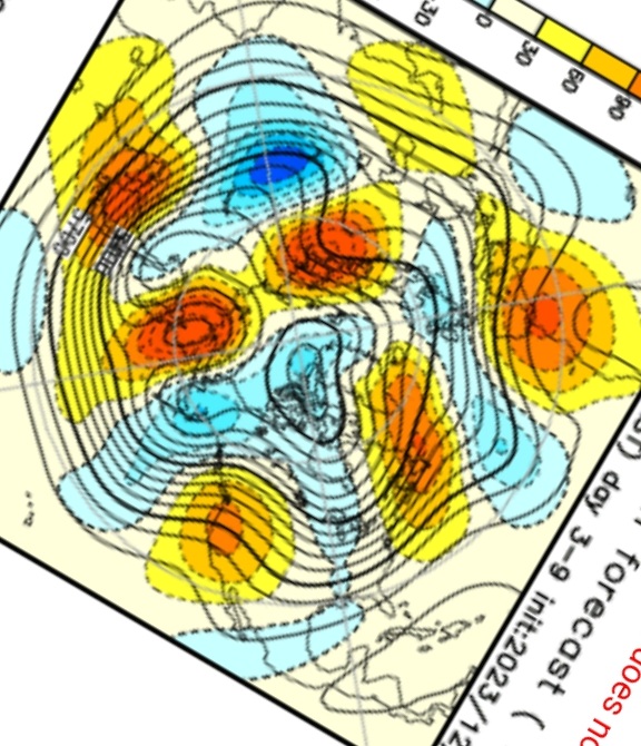
This may not look like much to some but the stratosphere forecast between Euro & GFS is a big difference:


-
3
-
-
3 minutes ago, Terpeast said:
Recent mjo got can kicked a few days to a week, though. But December was always going to be warm anyway. Still expecting Jan-Feb to be colder (near normal give or take a couple degrees)
It did but inititial model guidance had it moving way to fast which smart money was always on a slower propagation. Models finally corrected.
Everyone needs to keep in mind that models are not stellar at MJO forecast. And during active MJO winters models usually suck pretty bad. If they get MJO wrong then the overall 500mb pattern is more than likely wrong as well. As a rule of thumb I'd be skeptical of model guidance outside of 5 days on specific systems & 7-10 days on overall global patterns.
-
I've read more whining on social media than I can bare. I've seen nothing change for the worse. The thought has always been a typical warmer El Nino DEC that toward the end of the month begins improving & into JAN has good winter potential.
My analog package which consisted of 2 super El Ninos, 3 strong El Ninos, & 2 moderate had the typical Dec warmth.
A nice JAN with colder conditions in SE & with a strong Aleutian low.
Aleutian low weakens & retrograde in FEB & that month has the strongest high latitude blocking.

Winter ends late FEB & transitions to a warmer March.
Headed onto January the 0z long-range GFS looks great.


-
5
-
-
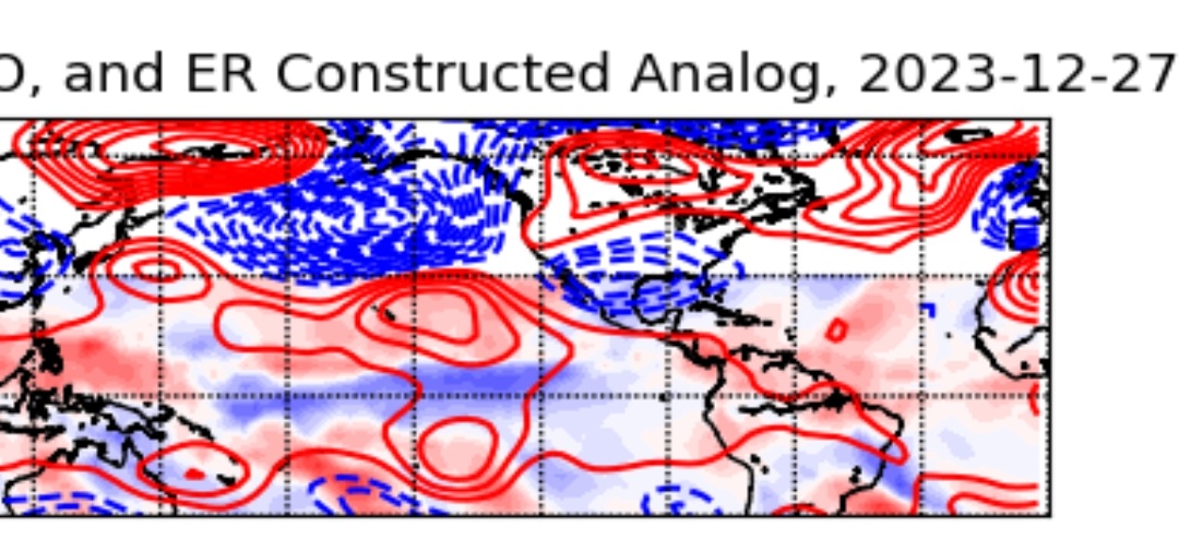
2 hours ago, 40/70 Benchmark said:
Yea, I don't expect a particularly cold month in the mean.
Not for NE.
-
EPS, DEC 23
Paul Roundy's "Low pass MJO, ER Constructed Analog", DEC 27th...looks similar:

-
3
-
-
2 hours ago, Terpeast said:
Phase 7 by 15th (give or take). Still no can-kick
The deeper into Dec we get Phase 7 is not a bad phase per Roundy's MJO guidance
-
1
-
-
A lot of signs emerging that the 2nd week of JAN will be a cold pattern for everyone east of say Kansas.
-
JMA Weeklies just updated.
Week 1
Week 2
Week 3 & 4
-
5
-


El Nino 2023-2024
in Weather Forecasting and Discussion
Posted
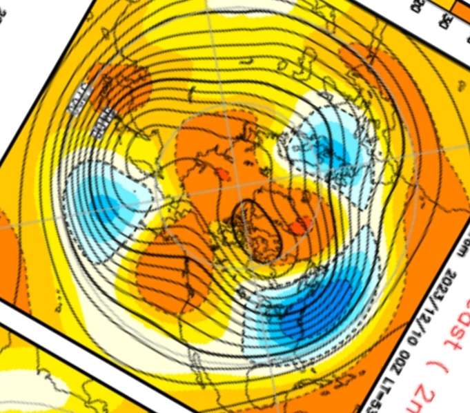
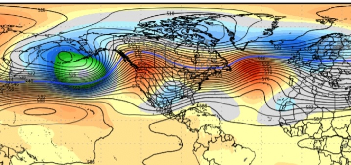
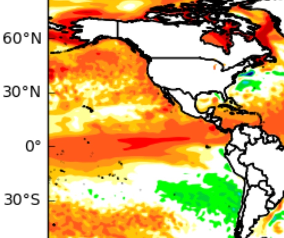
Another look. I'm sharing because this is so cool looking! Watch it eat!