

CAPE
-
Posts
36,860 -
Joined
-
Last visited
Content Type
Profiles
Blogs
Forums
American Weather
Media Demo
Store
Gallery
Everything posted by CAPE
-
That's the problem. He is 35, not 30. In between is a cliff for a WR, outside of a few exceptions like Rice.
-
The Ravens inability to acquire/draft/develop a legit WR is actually some sort of 'master plan'. They think having a bunch of TEs can work, but that is really driven by economics- TEs don't get paid like WRs. Dumb.
-
The Jackson to Jackson connection!
-
DeSean Jackson is a Raven. Cheap, low risk addition, but not the answer to make the passing game legit. Probably cut him inside of 3 weeks. The Ravens have 6 TEs though! Ofc the ultimate solution to an actual NFL level passing attack is a new OC, and there is zero chance that happens.
-
Picked up 0.12" of rain in a brief downpour last evening. Just over a quarter inch total over the last 2 weeks since the multi-day wet period ended. Getting dry here again.
-
Terrible. Need to make a legit move or don't bother. DJ Moore.
-
If DeCosta wants Lamar, and the team, to succeed, pull the trigger on a deal for a number one WR before the deadline. They won't fire Roman, but his mickey mouse offense might function better with a legit threat at receiver. Bateman might be a number 2, if he could stay healthy. The rest of the bunch are third and fourth receivers on any team with a pro-level passing offense.
-
Long way to go, but so frustrating right now. 3 games lost with 10+ point leads, and for various reasons. Today it was numerous killer penalties and over simplistic play design/poor play calling by Roman, as usual. He really needs to go. That sort of move worked out pretty well mid season once.. I bet Lamar would welcome it, although you will never hear him say that.
-
Drake had a great game, but it apparently wasn't by design. Dobbins' knee tightened up. Another issue with this team- so many of their key players are coming off of serious injuries. Precarious.
-
Lamar has not been close to elite the last 3 games. Pretty good at times, but several overthrows and the turnovers have hurt in close games. The most disturbing thing in this game to me were the penalties. Lack of discipline. It's always something though, and that's at least partly coaching. Happy for Wink though. He was run out when it should have been Roman. It has been a long time since that super bowl win, and Harbaugh's in-game coaching decisions have contributed to several losses over the past 2 seasons. If this team doesn't get it together and make the playoffs, it might be time for a change.
-
Mediocre. Undisciplined. Killer penalties. As for paying Lamar huge money, DeCosta's play looks pretty smart right now.
-
Did y'all know this Nina is basin wide? Really a cold one too. Important to keep on top of it. Thankfully we get updated every few hours.
-
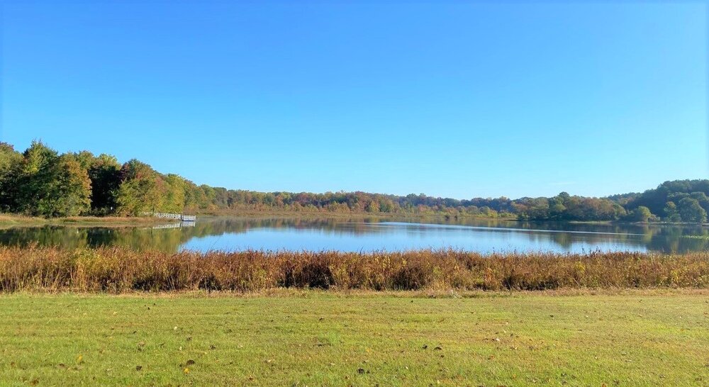
Colors are getting pretty decent over this way. A shot I took at Tuckahoe yesterday morning.
-
Hyperbolic weather dweebs on twitter are a dime a dozen.
-
Verbatim the end of month 'torch' for the east is a few days in the upper 60s the week of the 24th on the GEFS. That would be pretty typical Fall weather for this region.
-
Pretty windy and warmish after a low of 40. 71 now. Leaves are comin down in earnest. First round of actual leaf blowing today.
-
There will be a warm up during that period as the pattern de-amplifies, but it remains to be seen if a shift to a persistent -PNA is upcoming. Most LR guidance suggests any W US trough will be transient through the end of the month and into November.
-
ad nauseam
-
That general look a month later might be productive.
-
Wait- you don't think this thread can become a massive whine-fest if we are torching mid November with no end in sight? I can think of a few posters who will largely inflate the post count if that happens lol.
-
I'll leave it for now as we are squarely in Fall and will be officially until December 1 (or 21 depending on criteria). If the thread gets too big as we head into Dec I am sure someone will create a new one.
-
Latest CFS runs suggest a continuation of a general western US ridge/eastern US trough into the first 10 days of November. Love the idea from a Fall weather perspective, but not sure it bodes well for December.
-
And by Fall I mean from now through December. The winter thread is becoming a bit of a clusterfuck right on schedule. So, it's looking like the much discussed shift in the pattern towards a -PNA late month might be transient to nonexistent per the latest ens means.
-
He might be a useful blocking TE.


