CAPE
-
Posts
36,860 -
Joined
-
Last visited
Content Type
Profiles
Blogs
Forums
American Weather
Media Demo
Store
Gallery
Everything posted by CAPE
-
Spits and drizzle. Impressive tropical event.
-
Weather people be starved for any action other than warm, sunny days.
-
Well, that wasn't the point exactly. Your post was wrt the 18z NAM precip distribution. The reality is as the tropical remnants move NW and interact with a front/encounter the cool/dry HP pushing in from Canada, there will probably be more than one associated disturbance impacting the region. The actual remnant low may result in a precip max to the SW of the DCA-BWI corridor, and then as the flow shunts everything eastward, there looks to be a developing coastal low resulting in heavy rains along the coast later in the weekend/early next week, thus another precip max to the east.
-
Ronnie Stanley may make his debut Sunday. Much needed with the recent injuries on the OL. Can we make it through one damn game without another season ending injury? Michael Pierce elected to have surgery on his torn biceps and is now done for the year. That's number 4!
-
Os aren't finishing strong. Hopefully they can win a couple more and finish above 500. Future looks good.
-
or the east?
-
6z NAM for part 2
-
Yeah, have to see how that part trends today. 0z Euro still looks decent, but latest guidance suggests it would mostly impact coastal areas.
-
Looks like everyone gets in on some rain from the initial surge northward late tomorrow and Saturday. Possible development/redevelopment of low pressure along the MA coast as the remnants shift eastward is the feature to watch for additional rain/wind for late Sunday-Tuesday period.
-
who wouldn't eat this? I rarely eat cake, but I am ok with carrot cake. Not always the best looker. Personally, the only really tempting dessert for me features deep, dark chocolate.
-
EPO/WPO driven, and we threaded the needle many times. It can work, but a pattern like that can just as easily be a cold/dry warm/wet deal too. Many ways to lose here, even with the holy grail of mod/strong Nino with strong stj, and HL blocking- although that's our best bet for above avg snow until proven otherwise.
-
Could be a soaker for the Ravens-Bills game.
-
On the northern fringe of that warned storm. Had a history of quarter sized hail and 60 mph wind. Just a brief downpour and a bit of small hail. No wind. Probably worse a few miles south and down towards Denton.
-
Ravens offense needs health, and the D still needs work. Better effort but still too soft. Lamar, well..$$$
-

2022 Mid-Atlantic Severe Wx Thread (General Discussion Etc)
CAPE replied to Kmlwx's topic in Mid Atlantic
From Mount Holly AFD this morning- The upward trend in strength and coverage of convection forecast for this afternoon has continued in the latest guidance this morning. There will be seasonably strong synoptic forcing for convection along with strong deep layer effective shear of 40 kts or perhaps even higher. The primary limiting factor with this setup remains the instability, which is likely to remain around 500-1,000 J/kg. However, the forcing and kinematic environment should be able to overcome the relatively low CAPE to result in scattered strong to locally severe thunderstorms. Additionally, the aforementioned mid- level cooling should also help overcome the less than impressive instability parameters with forecast mid-level lapse rates possibly exceeding 7 C/km. The primary threat of severe weather with these thunderstorms will be locally damaging winds and large hail, however the low- level hodograph curvature will also support a couple brief/weak tornadoes. Effective SRH values look to be around 100-150 m2/s2 with 0-1 km bulk shear around 10-20 kts. LCLs will be around 1000 meters or higher, so this will limit the tornado potential a good bit. -
2022 Mid-Atlantic Severe Wx Thread (General Discussion Etc)
CAPE replied to Kmlwx's topic in Mid Atlantic
...SUMMARY... Scattered severe storms producing large hail and damaging winds are expected from mid to late afternoon across the northern Appalachians and parts of the Mid Atlantic and southern New England through evening. ...Portions of the Appalachians, Mid Atlantic and southern New England... Within a larger-scale upper trough, a lead wave will move from the OH Valley to the Mid Atlantic during the day, providing cooling aloft and midlevel winds of 60-70 kt, enhancing shear. At the surface, low pressure will slowly deepen from Lake Huron into NY, with a front trailing southwestward across PA, WV, eastern KY and Middle TN by late afternoon. Meanwhile, a warm front will develop over southern New England, resulting in destabilization toward evening. Dewpoints will rise into the lower 60s F there, with upper 50s to lower 60s F southwestward along the front where heating and mixing will be stronger. The warm sector will become uncapped by around 18Z from PA southward across WV, VA, KY and TN, with further destabilization 21-00Z from NJ into southern New England. MLCAPE of 1000 J/kg will be common, with locally higher values. Deep-layer shear will be strong beneath the upper jet, with values around 60 kt common from eastern TN to the DelMarVa. Precipitation may be ongoing from OH into PA and western NY early in the day, north of the midlevel jet where temperatures aloft will be cold, and as warm advection around 850 mb translates east. Given cold temperatures aloft, some of this activity could produce small hail. As the air mass destabilizes beneath the cold air aloft, some of these storms may expand and become severe across PA and NJ during the afternoon, producing hail and wind. Later in the evening, additional storms may interact with the warm front where low-level shear will be stronger, and a brief/weak tornado could occur, depending on whether surface temperatures are warm enough for surface-based parcels. -
The starters have allowed I think 2 runs in 39 innings to the Astros this season. Impressive.
-
The Orioles with back to back shutouts of the best team in the AL.
-
Low of 44.
-
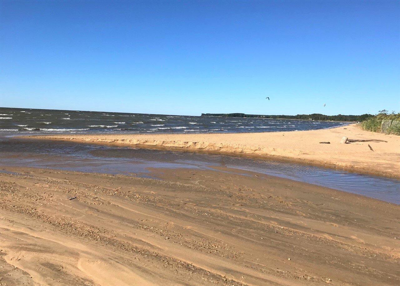
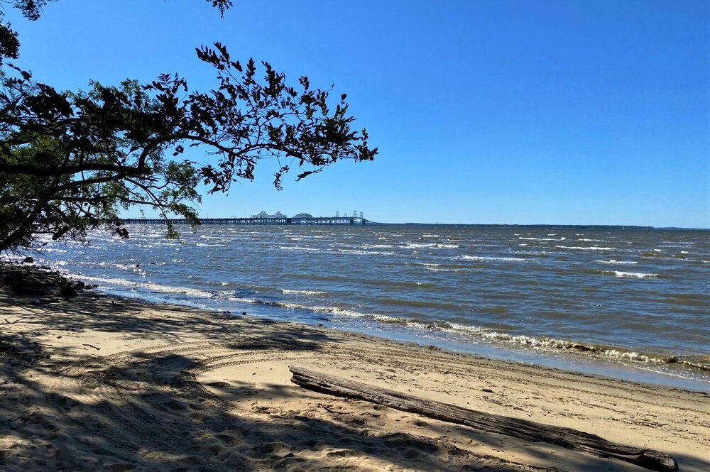
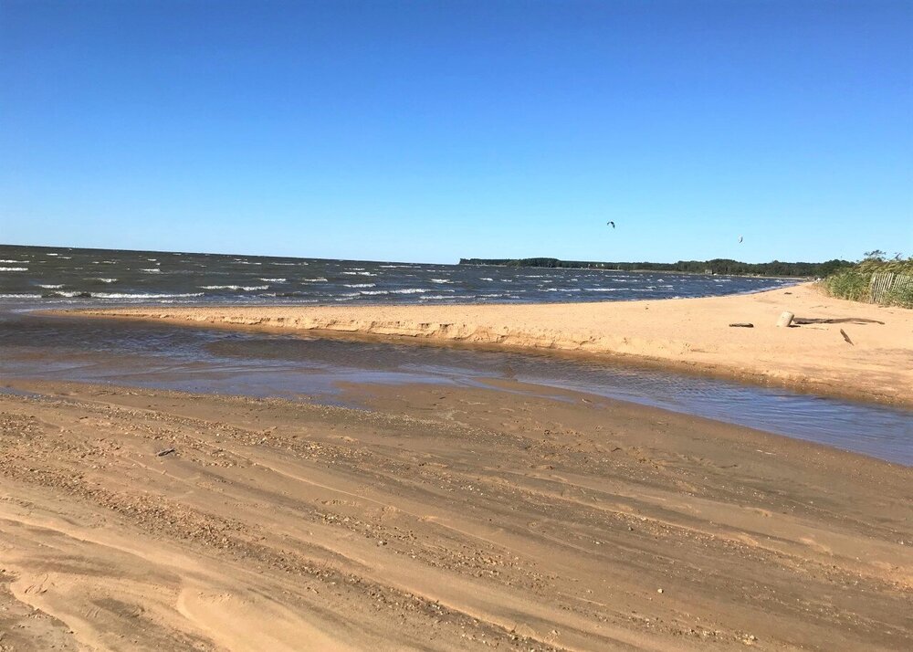
Spectacular day. A couple shots from Terrapin Park just east of the bay bridge.
- 573 replies
-
- 14
-

-
So the Ravens did sign JPP. They sure could use some help in the pass rush dept. Not sure how much he has left in the tank, but maybe he can help some and be an example for the younger players like Oweh. He needs to step it up.
-
Having to look to the right out my kitchen window now to see the sunrise through the trees makes me happy.
-
51 here. Outside day!
-
I am in the woods so I know the struggles. I can get cool season tall fescue established just fine in the early Fall, and it will thrive in the Spring and early summer, but once we get the persistent heat, blazing high sun, and the trees are all active, a significant amount of it just gives up and goes to thatch. Some areas hang on enough and come back. I let the moss do its thing for the most part, and try to keep a nice grass area in the back (over the drain field) around my firepit area. I just have to do a fairly significant reseed every year in late Summer/early Fall.