All Activity
- Past hour
-

Central PA Summer 2026 Discussion/Obs Thread
Itstrainingtime replied to Voyager's topic in Upstate New York/Pennsylvania
I tell her that every single day. I am a truly blessed man. -
From a little earlier this afternoon:
-
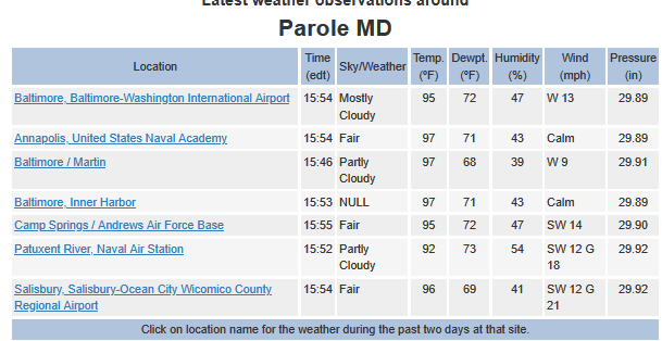
This is a strange heat wave. Both Annapolis and Salisbury running hotter than BWI and AAFB. Opposite of usual. Early July, KNAK never got above 97 while the others were 101/102. I didn't expect to get over 95 here today. (Shows my forecasting skill I guess )
-
99 here 98 New Brnswck 99 EWR
-
Storms aling and between i80
-
 Lost in all the smoke excitement today. Much of the modeling lost the showers/ storms and soaker they had for Saturday . That better not completely vanish Stein
 -
77
-
97 Pretty cool https://x.com/i/status/2077490268874461241
-
 So dark here (with a sepia/orange tint) I would swear I’m about to get nailed by a big thunderstorm. New England Dark Day -2026 edition
 -
Nice line if storms building to my northwest. Looks like it might hold together by me. Fingers crossed.
-
 India Pharm Delivery: online pharmacy india - legitimate online pharmacies india
 -
Manhattan and the Bronx under a severe thunderstorm warning
-
India Pharm Delivery: online pharmacy india - legitimate online pharmacies india
-
India Pharm Delivery: online pharmacy india - legitimate online pharmacies india
-
Hottest day of the summer at jones beach with the wind Nw. We lucked out during the last heatwave with just enough onshore component. .
-
 See, you are already thinking ahead and abstract. How can I use this experience to be a better uber weenie svr wx forecaster going forward?
 -
Exactly what the HRRR fcst Tue eve.
-
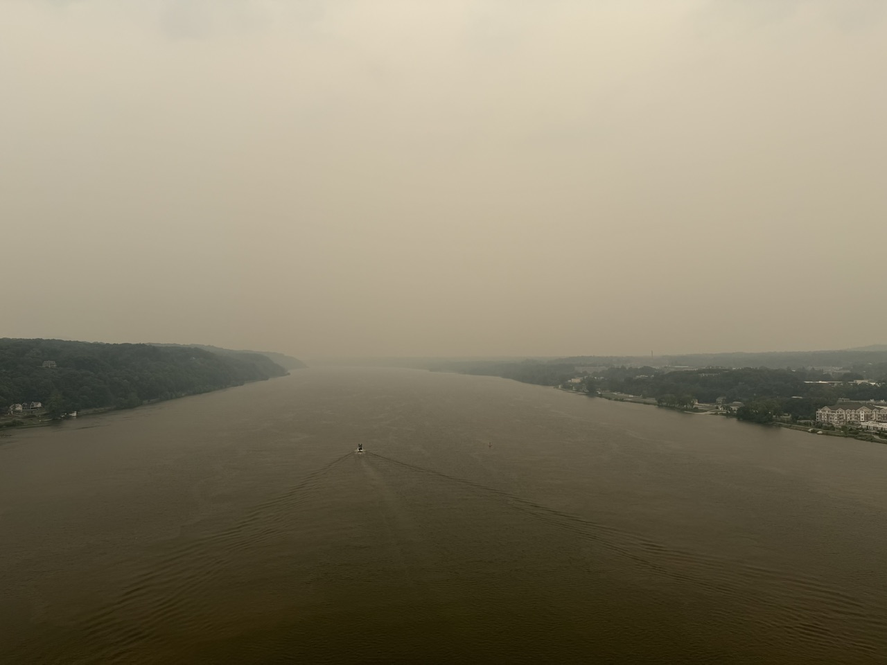
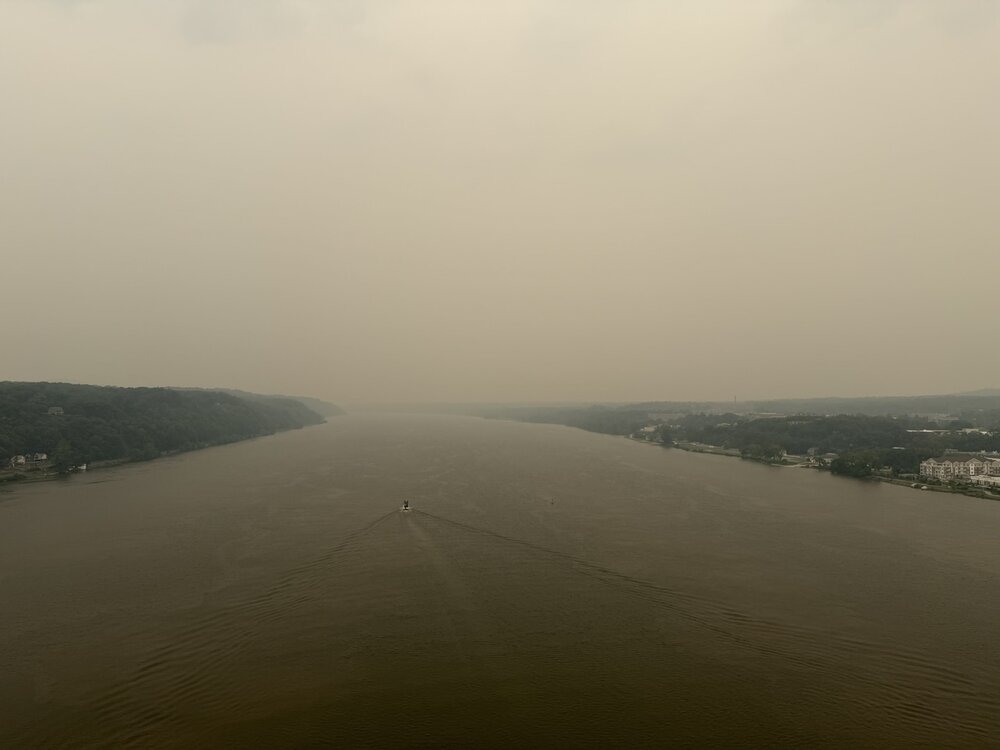
Smoke followed me home. Temps dropping now due to smoke it seems. Picture from the walkway over the Hudson, a little before 1pm.
-
AQI is bad esp NYC and north. Unhealthy category from Lower Manhattan and north from there. Not as bad in SI and increasingly better into NJ S and W of SI
-
Yes, so I do not want to hear this is a complete bust! The daylight hours were and the smoke is the likely cause of the bust here, but again, there is far too much focus on what did *not* go right rather than what did! I can count on one hand how many times in the last 30 years that anywhere in New England has had golf ball sized hail between midnight and noon. Bona fide supercells between midnight-noon in New England are rare. And even thought the models overdid the overnight convection, it all quickly dissipated once near the MA border by 10z, which is exactly what the HRRR showed Tue eve. So is the above just to be discounted? Sometimes events do not work out at fcst, and I can't tell you how many times in the Midwest/Plains/Southeast on paper everything looks awesome for svr wx parameters and a HIGH risk is issued, and under-performs. Things do not change meteorologically just b/c this is the NEUS. Sure, volatile atmospheres like this are uncommon here, esp. a strong EML, but that is irrelevant as to if it works out all as fcst or not. This is an excellent opportunity to learn from our mistakes, model shortcomings, and conditional factors that can crop up at the last minute (e.g. thick smoke). I for one will be investigating/researching the role of wildfire smoke on convection now. It was already mentioned earlier about how it impacts +CG frequency. And just b/c the smoke was a determinant to convection this time, does not necessarily mean it always is. You need to ask, does it matter if it is thin or thick smoke? Does the height and vertical depth of the smoke layer matter? Not all smoke particulates are the same, so that does matter as to things like CCN (CoastalWx should appreciate this b/c he is big on sea salt CCN for OES! ). Turn an experience that was not good or did not work out into something positive. Experience is what you get when you don't get what you want/expect, and thus you are that much better off going forward!
-
my place has 95.5 with heat index 107.2. Toledo airports have heat index 101-102
-
Definitely cut the temps here, currently 83 with the smoke visibility about 3 miles
-
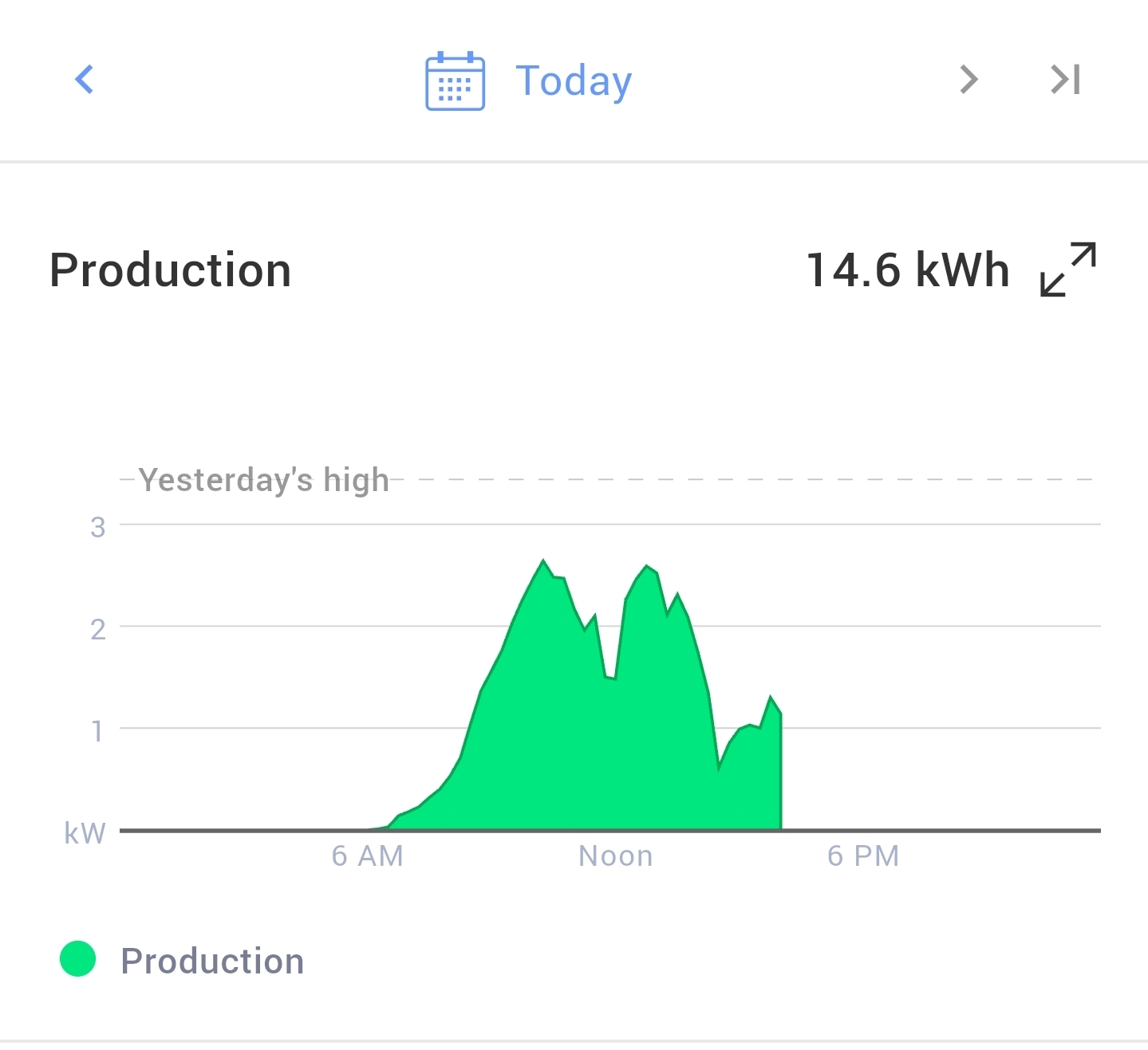
 I lost around 50% production today on my solar panels compared to a clear sunny day. My system is only 5kw and maxed out around 2.75kw today. I usually produce around 30-35 kwh on a sunny day.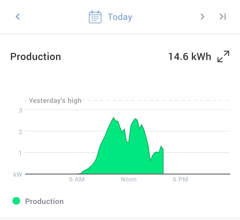
-
High topped showers or storms now forming in NE PA
-
The air here is now officially disgusting.