All Activity
- Past hour
-
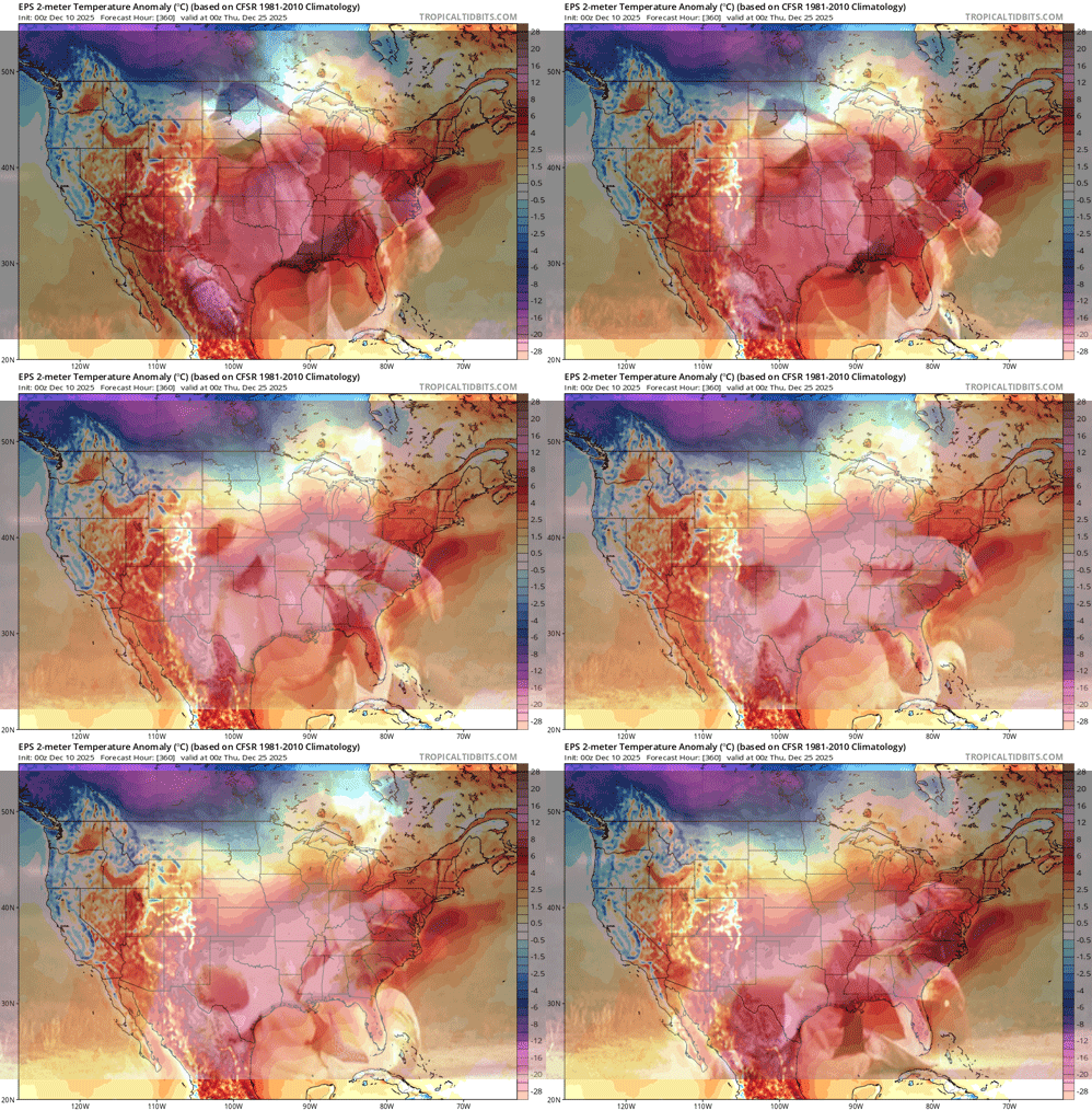
60s for Christmas Eve on the 12z GFS lol
-
Snowstorm potential 12/14/2025
SnowGoose69 replied to WeatherGeek2025's topic in New York City Metro
One thing I will say before the Euro comes out is it has been insanely good the last 3-4 weeks on these MW/Lakes storms. It obviously has been pretty mid on the E Coast. Thats been a tendency now for a few years. For awhile it sucked over amping everything in the 90-120 period. Since the most recent upgrade that bias is gone and its tended more to underamp in the 48-96 period or just do something/ANYTHING that is different from all other models. The good news so far is everything moved towards it the last 2 cycles and this system is a different setup than the one it botched last week so perhaps its onto the idea this time -
I can confirm! .
-

December 2025 regional war/obs/disco thread
Damage In Tolland replied to Torch Tiger's topic in New England
That look is exactly how the monster I storm happened in Montreal and NNE in 98. This time that would be over SNE/CNE -
First flakes starting here. Looks like around 0.5 to 0.6 of QPF, hoping for some denser 10:1 type stuff so we can build our base to withstand the next couple weeks.
-
6z Euro looked a bit north..hopefully we can get it back shortly.
-

Central PA Winter 25/26 Discussion and Obs
Itstrainingtime replied to MAG5035's topic in Upstate New York/Pennsylvania
Well...yuck: @MUweather I'm becoming convinced that this persistently cold pattern ends by the middle of next week. The MJO may just stay in the COD & have very little influence on the pattern over the next few weeks. The SPV will also rapidly strengthen after mid-month & remain strong in Jan. Additionally, ensemble models show a major retraction of the Pacific Jet between ~Dec 17-22. As a result, a massive Bering Sea ridge develops & stays in place for weeks. The Bering Sea ridge often precedes an eastern U.S. warmup & flareup of the Southeast Ridge by 6-10 days. -
Next winter may be telling, its TBD but if we have lets say a 0.6-1.2 El Nino and we continue to see the PDO sit more near -1 to like + 0.5 we really want to see some degree of slowing Pac flow/less -PNA etc...if we still see a heavily Nina type pattern even in that type of regime we may be in trouble or at least waiting 5-10 years til we see the Pac go back to a +PDO ERA
-
as per the norm, areas out in the hills reporting 6 inches, while we get half that here on east side.
-
-
Euro just further north as usual
-
In terms of surface weather it's mostly a miss with snow showers and C-1" with more in SNJ. But I agree aloft it's the closest I've seen in a few days to a bigger solution with the PV dropping into the trof and amplifying it almost to a neutral tilt.
-
0z and 6z euro looked a lot like gfs and ukie?
-
Closer than 0z
-
If you listen closely you can hear children crying as defeated middle-aged men throw wrapped gifts and a flame-engulfed tree out the window. I also heard what sounded like a hooved animal getting choked out, and some muttering about the Mansfield snow depth, maybe? Wasn't expecting that based on the title. Kinda wild, actually.
-
100% correct!!
-

December 2025 Short/Medium Range Forecast Thread
Carvers Gap replied to John1122's topic in Tennessee Valley
The CMC and GFS at 12z are a great example of the conundrum. The CMC has the December 20th cold front. The GFS does as well, but it is more seasonal. If that Canadian Yukon air can find a mechanism southward, those d10+ forecasts could change rapidly. -
.thumb.png.4150b06c63a21f61052e47a612bf1818.png)
December 2025 regional war/obs/disco thread
HIPPYVALLEY replied to Torch Tiger's topic in New England
Yeah, a three legged turtle race. -
Snowstorm potential 12/14/2025
WeatherGeek2025 replied to WeatherGeek2025's topic in New York City Metro
ukmet is a strung out southern miss! never really gets going after digging -
Was a good 2-3 degrees warmer than expected this morning. Wasn’t expecting a ton here, but was hoping for at least a little slushy accumulation which definitely did not occur.
-

December 2025 regional war/obs/disco thread
backedgeapproaching replied to Torch Tiger's topic in New England
I think its the only stretch of road on the East Coast with a chain up requirement for Big Rigs. -

December 2025 regional war/obs/disco thread
weatherwiz replied to Torch Tiger's topic in New England
It's a race between when we get our next region wide crippling ice storm and a cat 3 hurricane -

December 2025 Short/Medium Range Forecast Thread
Carvers Gap replied to John1122's topic in Tennessee Valley
At 195 on the CMC, the air over the Canadian Yukon is -79F. The GFS isn't quite that cold, but it is impressive as well. With that type of cold air sitting upstream, that is why we have to keep our eyes open. -
Pivotalweather.com has it every 6 hours btw... as in 96/102/108.
-
Snowstorm potential 12/14/2025
SnowGoose69 replied to WeatherGeek2025's topic in New York City Metro
Yeah the UKMET did something much bigger just based off the 96 and 120 surface panels but I do not have access to anything else yet, it may have tracked the low too far east from the Delmarva but cannot tell with what I have so far.


