All Activity
- Past hour
-

June 2025 discussion-obs: Summerlike
LongBeachSurfFreak replied to wdrag's topic in New York City Metro
It’s going to a complete shock to the system going from cool drizzle to a potentially historic heatwave. -
4 days with rain in a row.
-
Scattered thunderstorm development will be possible along/ahead of the front from the Carolinas/Mid Atlantic into New England during the afternoon. Wind fields will generally be stronger with northward extent. Depending on the extent of destabilization, supercells and organized clusters will be possible across parts of New England and perhaps the northern Mid Atlantic, which would pose some threat of all severe hazards. Farther south into the southern Mid Atlantic and Carolinas, deep-layer shear will be weaker, but favorable low-level moisture, strong buoyancy, and modest midlevel southwesterlies will support outflow-driven clusters capable of damaging winds and possibly some hail. The organized severe threat will tend to decrease with southwestward extent, due to weaker deep-layer flow. However, favorable low-level moisture and buoyancy could support a few strong to locally severe storms along the trailing cold front into parts of the Southeast during the late afternoon and evening
-
Foggy and misty this morning.
-
On Monday of next week we will be asking for these days back lol
-
61, dreary and.....raining..again
-
Not sure I've ever seen that map. That's pretty cool. Or hot in this case.
-
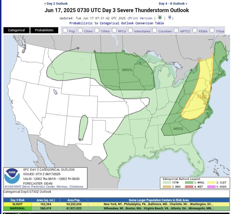
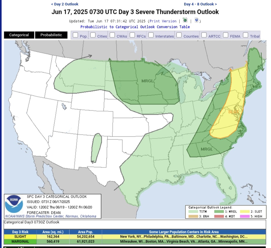
MRGL/MRGL/SLGT the next 3 days. BTW, what do you consider us as? Northern MA or southern MA? Reading the Day 3 morning disco, they were kind of splitting up the areas for best chance of all hazards severe on Thursday. They said Northern Mid-Atlantic had the better chance for all hazards while southern was more a damaging winds threat
-
Times like this I'm glad we left West Springfield and moved to the west side of Westfield. NOT looking forward to this after being spoiled so far this season
-
The rain is great, if it wasn’t surrounded by the persistent mist for the past 2 days. It has not dried out since it started raining on Friday. Flood watch for Fairfax Co and west today.
-
Skin temps. Concrete jungle GW
-
Beautiful
-
Oof
-
You should follow the weather. Warned of it yesterday. You shouldn't have to wake up surprised.
-
The same repeating pattern year after year. Same background state. Different night, same ending
-
Where did this heavy rain come from? Certainly not modeled like this
-
MEX already has 97° for BDL Tue.
-

Central PA Summer 2025
Mount Joy Snowman replied to Voyager's topic in Upstate New York/Pennsylvania
Low of 63 with a hefty .73” of rainfall. -
Love that NBC has the records on the graphic. What a summer about to roll in.
.thumb.png.4035c715ffd0f2f4708b5372744ed6a3.png)
-
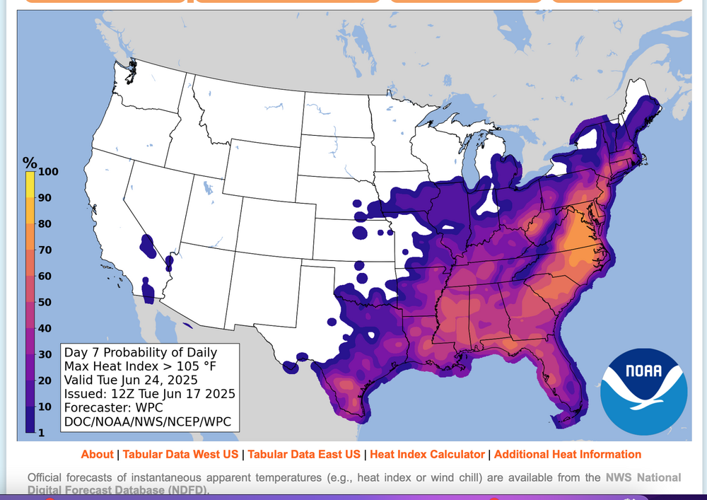
Considering, but not acting upon a possible thread for interior NJ first June 3 or more 100 degree days, occurring next week. Blend of Models is several degrees under 100. I want to see how temps play this Thursday (KEWR 90?), and subsequent modeling. Much can interrupt excessive heat, including sea breezes, thunderstorms, cloud debris. TOO early but for me, worthy of monitoring. 105 "heat index" - think that is our warning criteria up here, has according to WPC statisitcs is around a 60% chance of occurrence Monday and Tuesday. Here is Tuesday's early morning WPC prediction for Tuesday. Click for clarity and use the graph for probability interpretation.
-
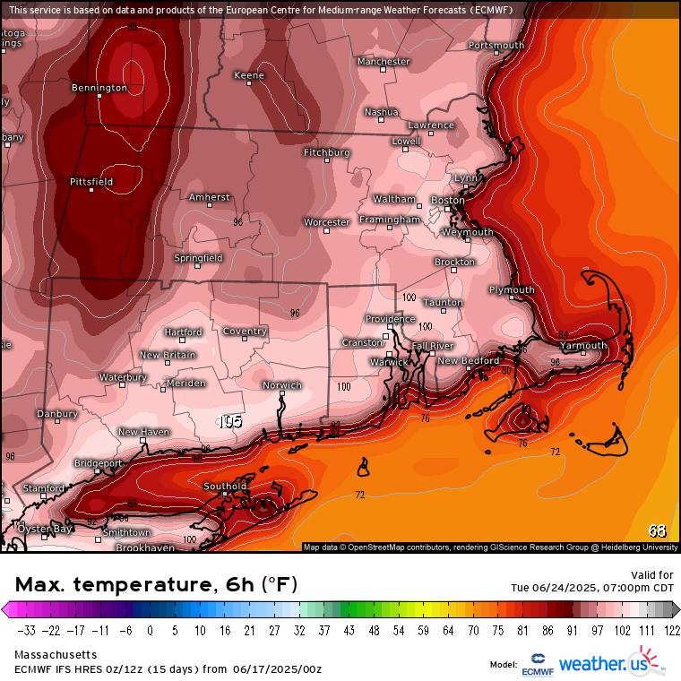
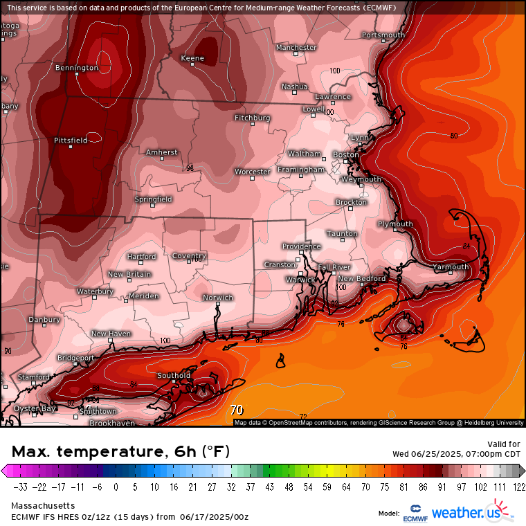
This is not your typical heat wave coming up. Ensembles and model runs are getting more intense every day. This is some historic stuff coming up. 600dm showing up on GFS
- Today
-
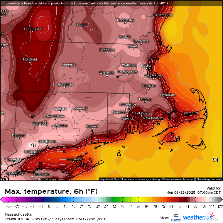
Hottest euro run yet
-
.65" in the last 12 hours, 2.46" for the month.
-
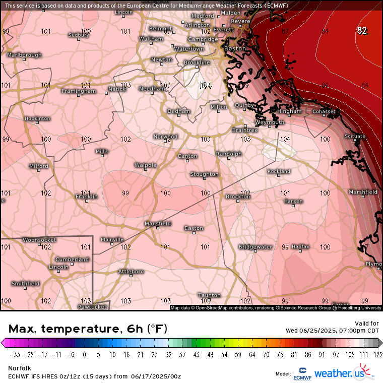
Another. 07 overnight event total 2.84. I'm not sure if anymore is on the way before we bake but I'd bet all of the wet from me on south mutes some of the heat coming up. Instead of 97 it will probably be 95


.thumb.jpg.6a4895b2a43f87359e4e7d04a6fa0d14.jpg)


.png.b2fe3323af9cb29dfcf12b0acdd4c25d.png)


