All Activity
- Past hour
-
Union north?
-
Then we are in agreement
-

2026-2027 Record-breaking El Nino
GaWx replied to Stormchaserchuck1's topic in Weather Forecasting and Discussion
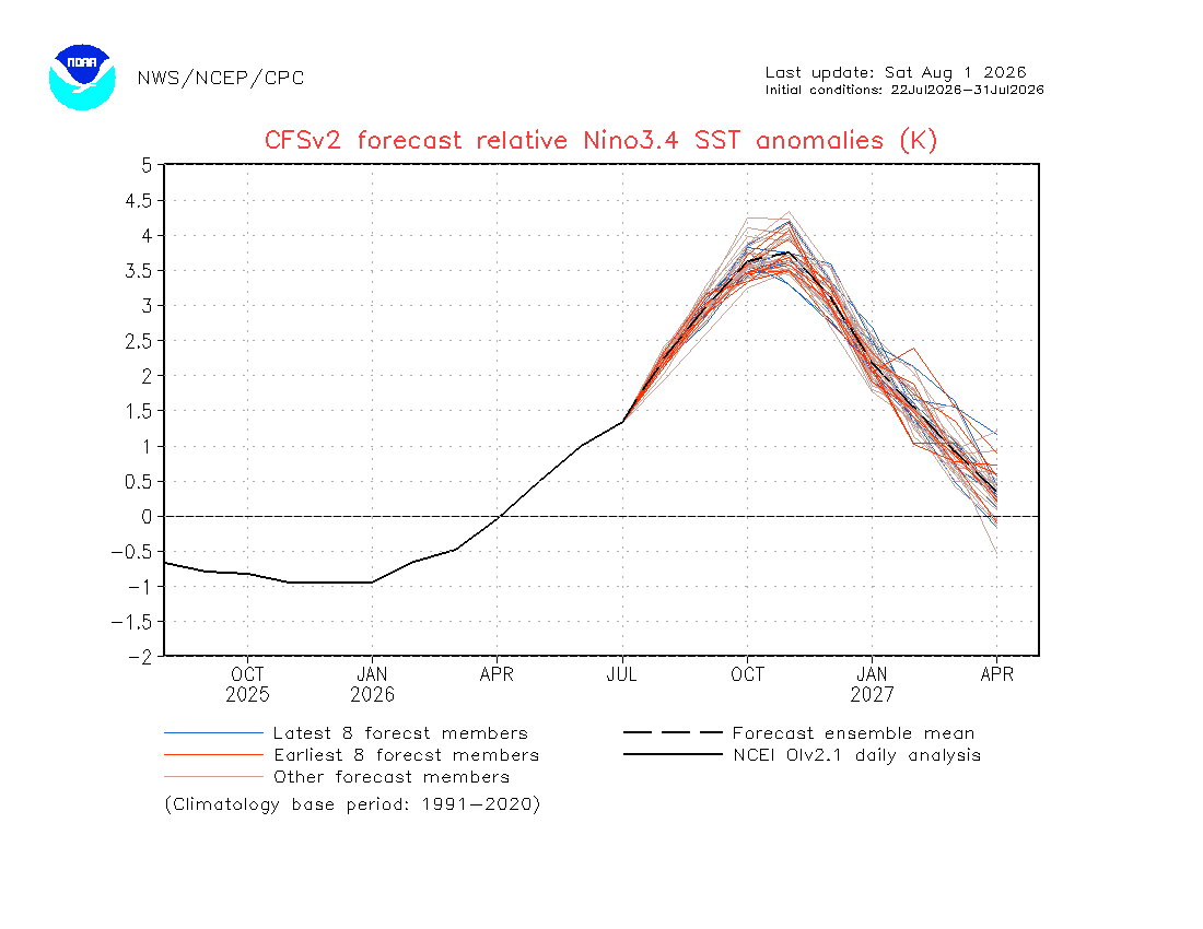
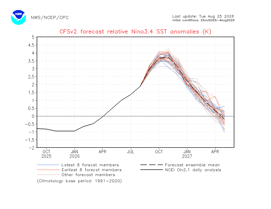
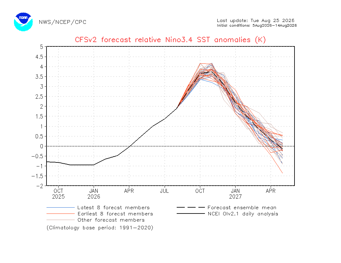
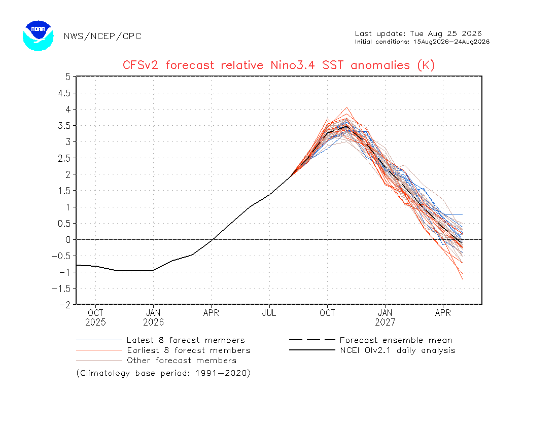
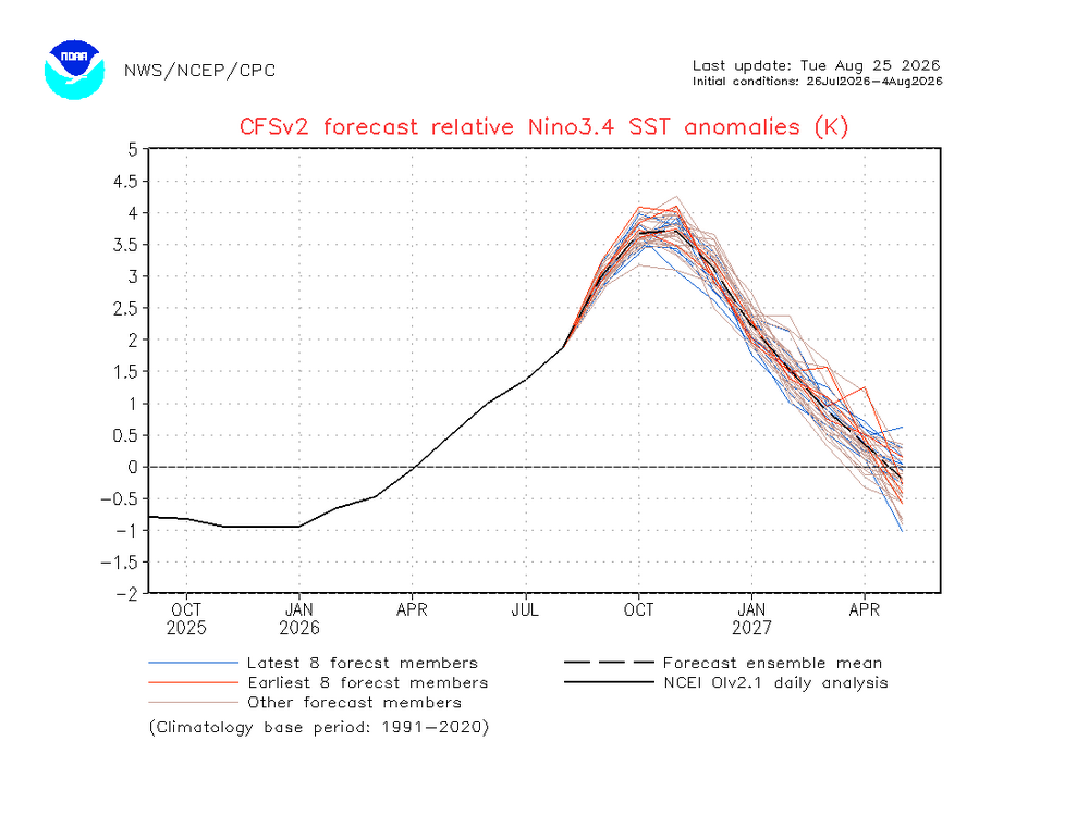
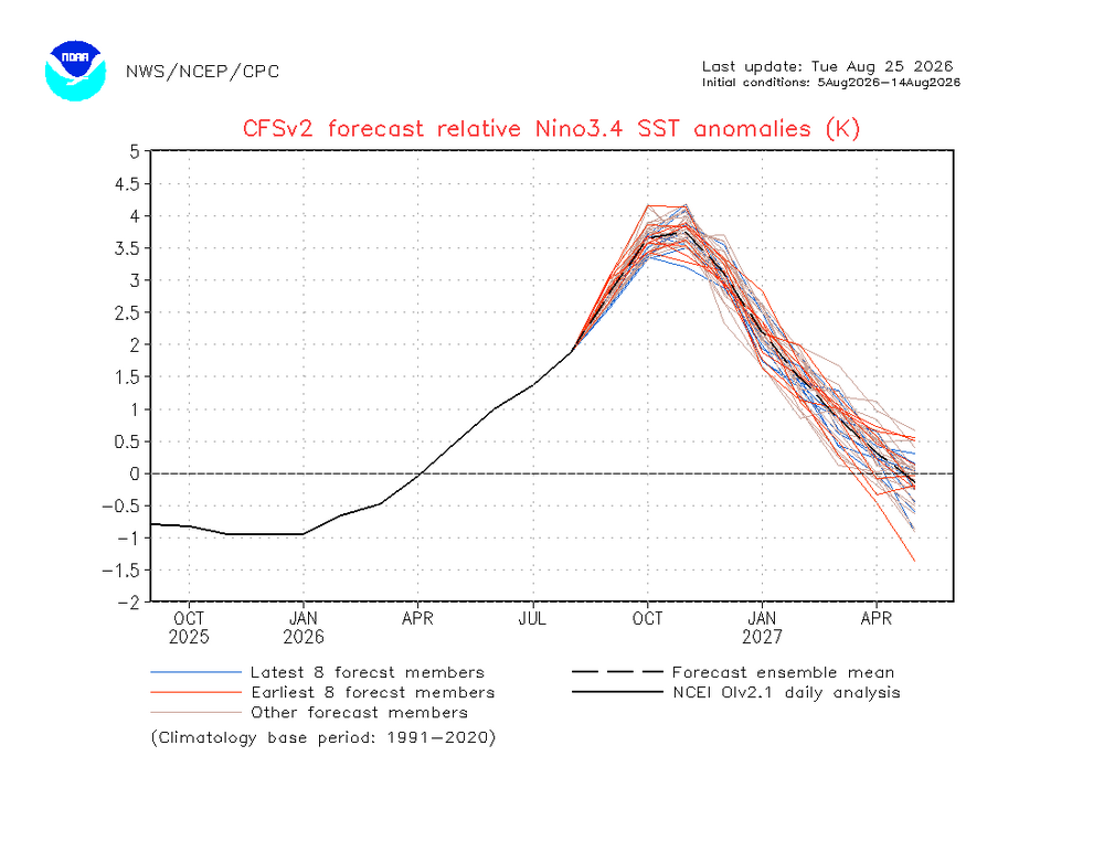
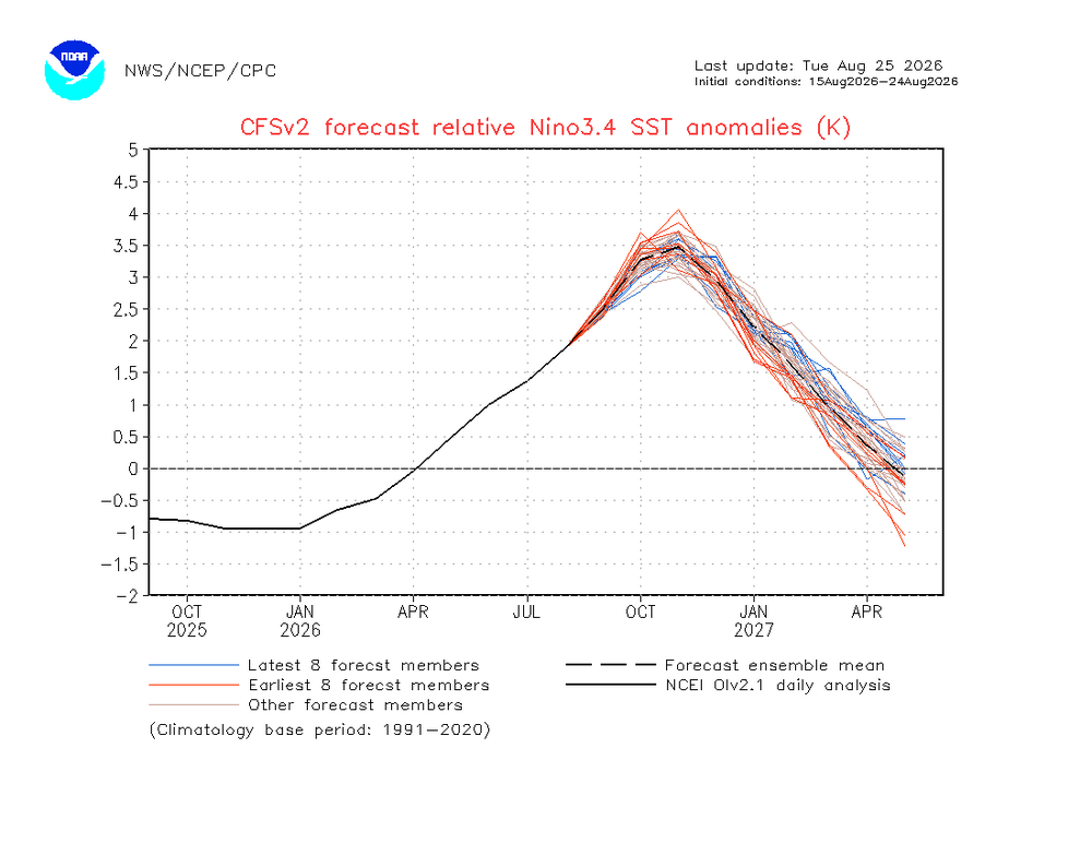
Thanks. Wow, your reduction of RONI peak (tri) to +2.4 to +2.6 is a good bit below my latest RONI prog of ~+2.8 and is only slightly, if any, above the record of +2.4 from 1982-3! That would be way below some still current model progs of +3.3 to +3.5 for tri RONI! They’re likely going to bust way too high as it looks now. Your latest progged ONI tri peak of only +2.7 to +2.9 compares to some ONI tri peaks still near +4.0! Ray and all, check out the following large cooling adjustments on the CFSv2 for RONI monthlies: 7/22-31: Aug was +2.35 7/26-8/4: Aug fell to +1.9; Sep +3.0 8/5-14: Sep fell to +2.85; Oct +3.65; Nov +3.75 8/15-24: Sep fell even more to +2.5; Oct fell to +3.3; Nov fell to +3.5 The trend is clearly down.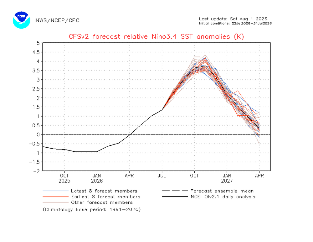
-
Definitely not interior CT.
-
I can see our last 90 occuring during this time frame. I think we easily hit 90 and high dews at the hot spots. Then hopefully kick summer out-good riddance.
-
 NorthTrust Pharm: canadian pharmacy scam - best canadian pharmacy to order from
 -
This totally sounds like a Yogi Berra quote
-

E PA/NJ/DE Summer 2026 Obs/Discussion
Birds~69 replied to PhiEaglesfan712's topic in Philadelphia Region
Phillies/Birds. Summer is over, done, a "has been", kaput, no chance, winter school closings mid-November, fill up the snow blower... 74F/DP 61F -
Don’t see anyway possible of your snowy interior SNE winter
-
Prep this
-
79/57 at 12:40. Amazing
-
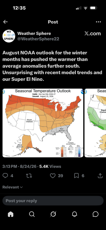
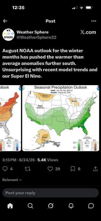
Personally here I am prepping for an all time record low snowfall season
-
yet here we are out to the 25th and we're bouncing around 17
-
*Almost* unanimous model support for *some* development but it is apparent this system has serious hurdles ahead of it. There is likely a window for development/strengthening over next few days, but then it hits a wall of shear, so options at that time are dissipation or weakening. Beyond that, location will be everything. If the system survives into the SW basin, there could possibly be an area of lower shear allowing for development as it likely recurves. If the system goes into Caribbean, it will be heading towards its grave. You're starting to see even the GFS back off on its latest run to a more realistic scenario given the harsh conditions ahead of the system. I am fairly confident this becomes a named storm but I do not think it has much of chance to be a long-tracked hurricane, and it likely won't have much window to intensify at all unless it makes it through the TUTT intact. Probably looking a weak, sheared TS for awhile
-

E PA/NJ/DE Summer 2026 Obs/Discussion
RedSky replied to PhiEaglesfan712's topic in Philadelphia Region
September will have a heat wave -
I’d really like to know what they’re smoking given how 2015 went…
-

Augdewst 2026: Summer's Last Stand
weatherwiz replied to Prismshine Productions's topic in New England
In addition to some locally strong-to-severe weather potential both Thursday and Friday, there should be some risk for flash flooding as well -
https://indiamedok.com/# indian pharmacies safe
-
nah you gotta stand behind your forecast man. 100+" for CON. thanks.
-
Too late
- Today
-
E PA/NJ/DE Summer 2026 Obs/Discussion
Birds~69 replied to PhiEaglesfan712's topic in Philadelphia Region
We may not hit 90F for the rest of the season? Overnight lows in the 50s are super nice... 74F/DP 62F -
https://x.com/JimCantore/status/2092170030330900537 Jim Cantore @JimCantore 7h Baking HOT ridge in the southwest and south central USA will flatten and expand east with its HEAT. This should commence over the weekend finally giving the southwest a break to start the new week. Meanwhile the Central USA, the Mid-South and Southeast bake once again as we start September. Some thunderstorm activity will give some a break.
-
Augdewst 2026: Summer's Last Stand
weatherwiz replied to Prismshine Productions's topic in New England
yup, the 90's seem to be a thing of the past -
Would sign in a heartbeat.
-
Are we going to get less snow from Canada this year because of the tariffs?