All Activity
- Past hour
-

July 2025 Obs/Disco ... possible historic month for heat
Damage In Tolland replied to Typhoon Tip's topic in New England
I just need enough to soak the fert in. Otherwise it’s a loss with the stein pattern next week -
Get ready for the smoke! Can’t even enjoy my low dewpoint days anymore. Ready for fall man.
-
Back home from the beach and about .30” from the first storm a couple of hours ago.
-
MBY got nailed from round 1. Probably over an inch so far today.
-

July 2025 Obs/Disco ... possible historic month for heat
Brian5671 replied to Typhoon Tip's topic in New England
I'd be happy with .25 at this point...settle the dust -

July 2025 Obs/Disco ... possible historic month for heat
Damage In Tolland replied to Typhoon Tip's topic in New England
Doubtful we get a soaking rain -

July 2025 Obs/Disco ... possible historic month for heat
Damage In Tolland replied to Typhoon Tip's topic in New England
He does. Those wild parties all kinds of hell breaks loose. We’ve seen pics -
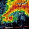
Preliminary Local Storm Report National Weather Service Baltimore MD/Washington DC 148 PM EDT Thu Jul 31 2025 ..TIME... ...EVENT... ...CITY LOCATION... ...LAT.LON... ..DATE... ....MAG.... ..COUNTY LOCATION..ST.. ...SOURCE.... ..REMARKS.. 0139 PM Waterspout 2 ENE Chase 39.38N 76.34W 07/31/2025 ANZ531 MD Trained Spotter Trained spotter reports a waterspout east of Chase, MD over the Bird River moving east. && Event Number LWX2506473
-

July 2025 Discussion-OBS - seasonable summer variability
bluewave replied to wdrag's topic in New York City Metro
Yeah, the 1970s were a wild decade living in Long Beach. First, I got flooded out of my basement apartment for a week in 1972 when TS Agnes came ashore with the very heavy rains. Then the December 1974 Nor’easter which flooded the streets with a tidal surge in front of my elementary school. 1976 featured Hurricane Belle in early August when the ocean met the bay in the West End. My friends lived on Gerogia Ave and the tidal surge pushed the ticket booth for the beach passes down the street. Then the record cold at the end of August with 50 around NYC and 30s to the north and west.That was the coldest winter that I ever experienced. It was so cold that I wasn’t able to get down to the local waterways to see how much ice there was. Then the January 1978 ice storm which was the worst on the South Shore until January 1994. This was followed by the surprise January 1978 15” snowstorm when heavy rains were forecast. Followed by the epic February 1978 blizzard and snow drifts that the LB city bus got stuck in. Next on the memorable events list was our coldest 2 week stretch in February 1979 and the PD 1 snowstorm. The only two major heatwaves in that record cold decade were late August 1973 and mid-July 1977. Outside those two short periods there really wasn’t much need to even turn on the AC much living in Long Beach. Just using a fan was enough most of the time. -
Preliminary Local Storm Report National Weather Service Baltimore MD/Washington DC 148 PM EDT Thu Jul 31 2025 ..TIME... ...EVENT... ...CITY LOCATION... ...LAT.LON... ..DATE... ....MAG.... ..COUNTY LOCATION..ST.. ...SOURCE.... ..REMARKS.. 0139 PM Waterspout 2 ENE Chase 39.38N 76.34W 07/31/2025 ANZ531 MD Trained Spotter Trained spotter reports a waterspout east of Chase, MD over the Bird River moving east. && Event Number LWX2506473
- 1,339 replies
-
- severe
- thunderstorms
-
(and 2 more)
Tagged with:
-

E PA/NJ/DE Summer 2025 Obs/Discussion
BBasile replied to Hurricane Agnes's topic in Philadelphia Region
Under a severe warning now. Let's see if I actually get anything. lol -
Preliminary Local Storm Report...Corrected National Weather Service Baltimore MD/Washington DC 243 PM EDT Thu Jul 31 2025 ..TIME... ...EVENT... ...CITY LOCATION... ...LAT.LON... ..DATE... ....MAG.... ..COUNTY LOCATION..ST.. ...SOURCE.... ..REMARKS.. 0226 PM Flash Flood Gunpowder 39.41N 76.39W 07/31/2025 Baltimore MD 911 Call Center Multiple swift water rescues ongoing along Pulaski Hwy between Allender Rd. and Joppa Farm Rd. && Corrected county/state...location Event Number LWX2506475
-

July 2025 Obs/Disco ... possible historic month for heat
CoastalWx replied to Typhoon Tip's topic in New England
Yep -

July 2025 Obs/Disco ... possible historic month for heat
weatherwiz replied to Typhoon Tip's topic in New England
things will fill in across Connecticut so most should get a decent little drink but the flooding stuff will be south -

July 2025 Obs/Disco ... possible historic month for heat
Modfan2 replied to Typhoon Tip's topic in New England
Do we have a 7/10 split setting up here? Looks like stuff north of the CT border into W Ma and then that band in NYC; does it head over LI? -

July 2025 Obs/Disco ... possible historic month for heat
Brian5671 replied to Typhoon Tip's topic in New England
looks like it was along the south shore of LI-so just a bit too far south-NJ/NYC getting crushed -

July 2025 Obs/Disco ... possible historic month for heat
CoastalWx replied to Typhoon Tip's topic in New England
Look at those cells right near low pressure and warm front near NYC and LI. Ain’t going anywhere. Let’s flood manhattan. -
Yes it was. The report from the spotter was at 139pm per Radarscope and warning issued at 141pm
-
Nothing is up on SPC... but weather might have canceled/delayed it


