All Activity
- Past hour
-

October Comes Early: Late September Multi-Hazard Hybrid Storm
CCHurricane replied to WxWatcher007's topic in New England
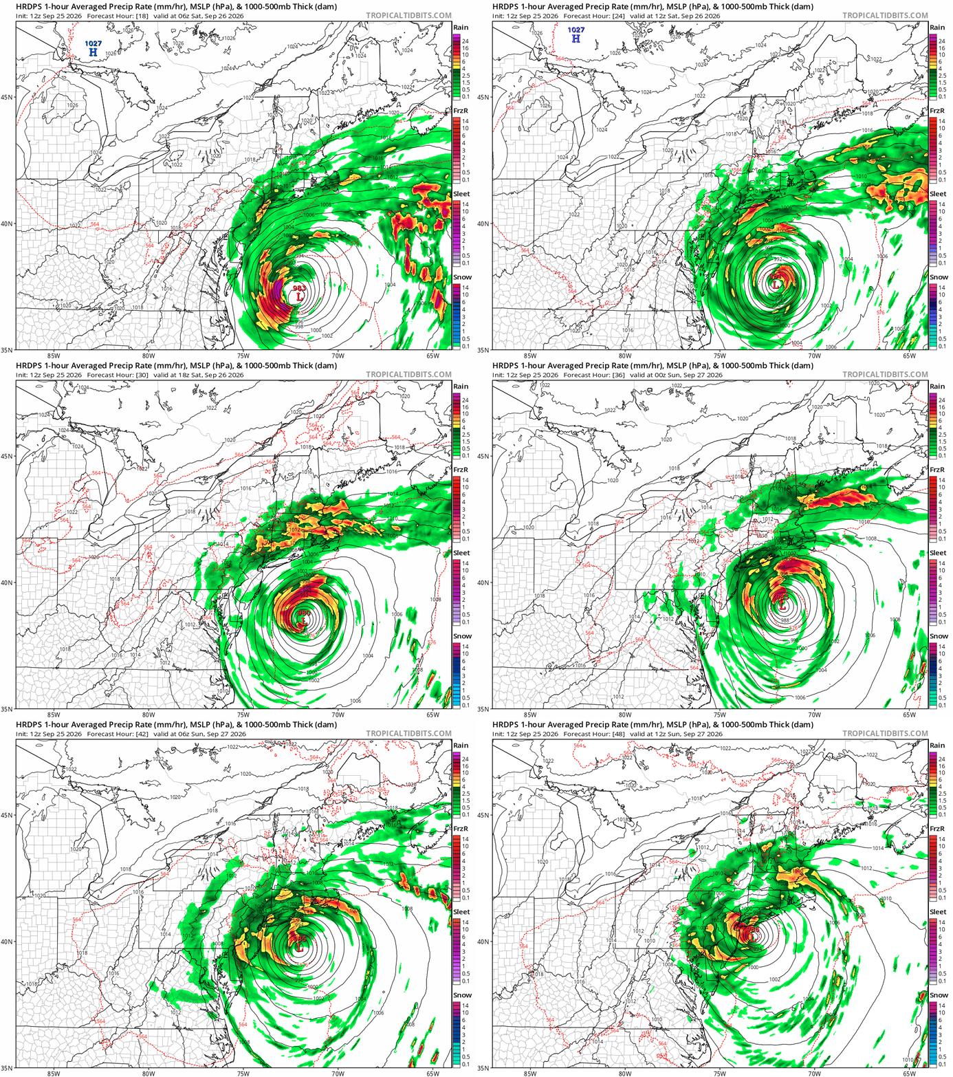
mm/hr -

Strong Nor'Easter/Hybrid Storm Late September 2026
mob1 replied to Rjay's topic in New York City Metro
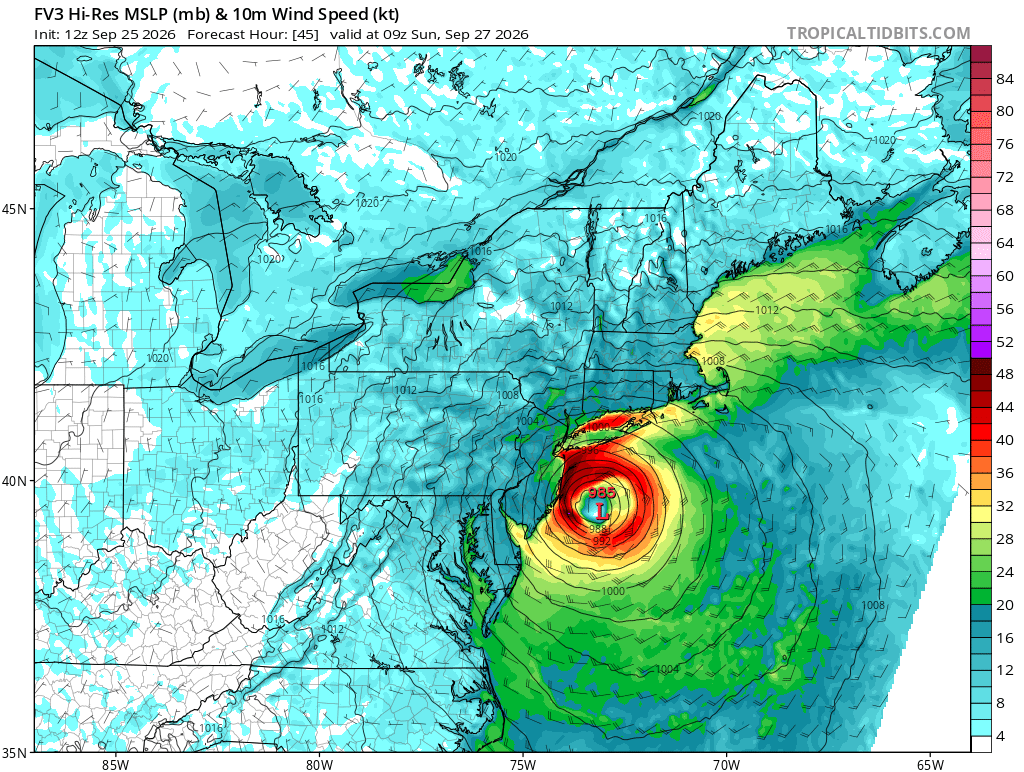
This is the track that'll yield the worst winds and coastal flooding. The models that have it go over the NY harbor or so are less extreme (this is obviously especially true for the central NJ coastline.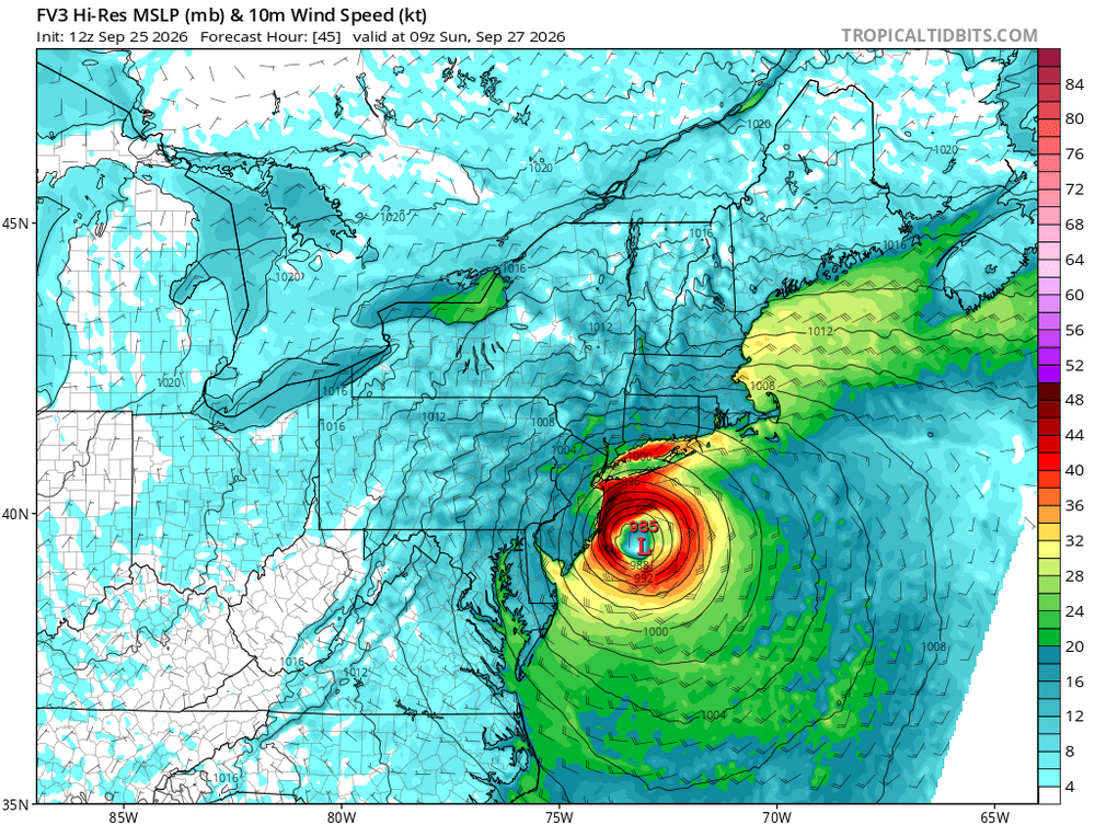
-

Strong Nor'Easter/Hybrid Storm Late September 2026
qg_omega replied to Rjay's topic in New York City Metro
long range meso HRRR and NAMs did -

Strong Nor'Easter/Hybrid Storm Late September 2026
GaWx replied to Rjay's topic in New York City Metro
What about airport service on Sun/Mon at the 3 major NYC area airports? How did past comparable storms affect service? -

October Comes Early: Late September Multi-Hazard Hybrid Storm
WinterWolf replied to WxWatcher007's topic in New England
James? James, is that you? -

October Comes Early: Late September Multi-Hazard Hybrid Storm
WxWatcher007 replied to WxWatcher007's topic in New England
Given how close to the coast it is modeled to get, I think so eventually—whether initially along the NJ coast or when it’s weaker and moving NE over part of New England. -

Strong Nor'Easter/Hybrid Storm Late September 2026
TriPol replied to Rjay's topic in New York City Metro
You mean issuing evacuations? There's not enough time. Absolutely NO model had this slamming into central NJ 48 hours ago. Not even the EURO or EURO AI. -

October Comes Early: Late September Multi-Hazard Hybrid Storm
DirtySnowDen replied to WxWatcher007's topic in New England
The eyewall did not disappear. It’s working on itself, you can see the inner cloud wall developing. -
Strong Nor'Easter/Hybrid Storm Late September 2026
TriPol replied to Rjay's topic in New York City Metro
Well, there won't be much subway service Monday morning if that verifies. -

Strong Nor'Easter/Hybrid Storm Late September 2026
Michael05192016 replied to Rjay's topic in New York City Metro
Sandy lite v.2 - "Sandy's weaker cousin" -

Strong Nor'Easter/Hybrid Storm Late September 2026
Brian5671 replied to Rjay's topic in New York City Metro
Agreed-a few days ago the track suggested north winds now it's NE or even ENE -

2026-2027 Record-breaking El Nino
Typhoon Tip replied to Stormchaserchuck1's topic in Weather Forecasting and Discussion
I did not lol ... 12z GFS looks even warmer... By that, just less obstructed in general. 570+ DM thickness both Thu and Fri, with 582 non-hydrostatic isohypsis situate NW of ALB ... It's actually looking more more WAR-like -
October Comes Early: Late September Multi-Hazard Hybrid Storm
DirtySnowDen replied to WxWatcher007's topic in New England
Will this thing actually make a landfall or meander just south of LI/NJ ? -

Strong Nor'Easter/Hybrid Storm Late September 2026
MANDA replied to Rjay's topic in New York City Metro
I'd also keep an eye on western L.I. Sound. Depending on exact wind trajectories water could be piling into the west end of the sound. Been concerned about that for several days. As of now forecasts are for mid range moderate but room for higher if the winds can go more ENE for a time. Just something to watch. -
Great. Just fn great.
-
Spinning wheel
-
Fya....if its your thing, dewey brewing is releasing their barrel aged pumpkin stout this weekend. Aged 18 months in rum barrels.
-

Strong Nor'Easter/Hybrid Storm Late September 2026
NJwx85 replied to Rjay's topic in New York City Metro
This will come in waves with a steadier rain likely Sunday. -

Strong Nor'Easter/Hybrid Storm Late September 2026
jm1220 replied to Rjay's topic in New York City Metro
Wonder if it’s at the point it’s worth getting out if you’re in a vulnerable area.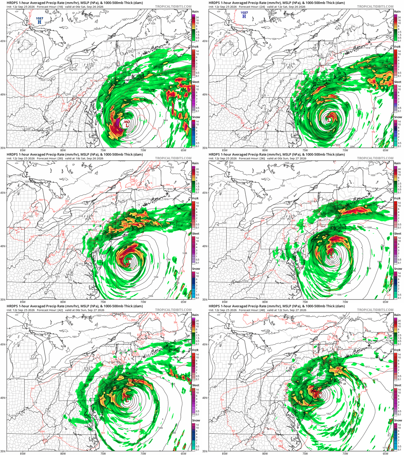
-

Strong Nor'Easter/Hybrid Storm Late September 2026
Rjay replied to Rjay's topic in New York City Metro
Upton now has Freeport in the major category for 3 high tide cycles. -
October Comes Early: Late September Multi-Hazard Hybrid Storm
Typhoon Tip replied to WxWatcher007's topic in New England
under one of those Texas Panhandle stationary super cells -
Idk....probably not thr greatest idea to have a weekends long concert festival on the beach in early fall during peak hurricane season. You had all summer to do that.
-

October Comes Early: Late September Multi-Hazard Hybrid Storm
weatherwiz replied to WxWatcher007's topic in New England
Some convection blossoming too north side of the center. Also, a very nice flux of moisture entraining into this from the Caribbean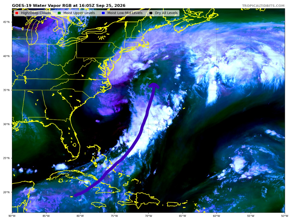
-

October Comes Early: Late September Multi-Hazard Hybrid Storm
CoastalWx replied to WxWatcher007's topic in New England
Yeah, i mean euro had one run give me 4” in 6 hrs, but you’d have to be in that band quite awhile. -
46 here!