All Activity
- Past hour
-
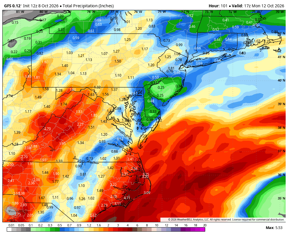
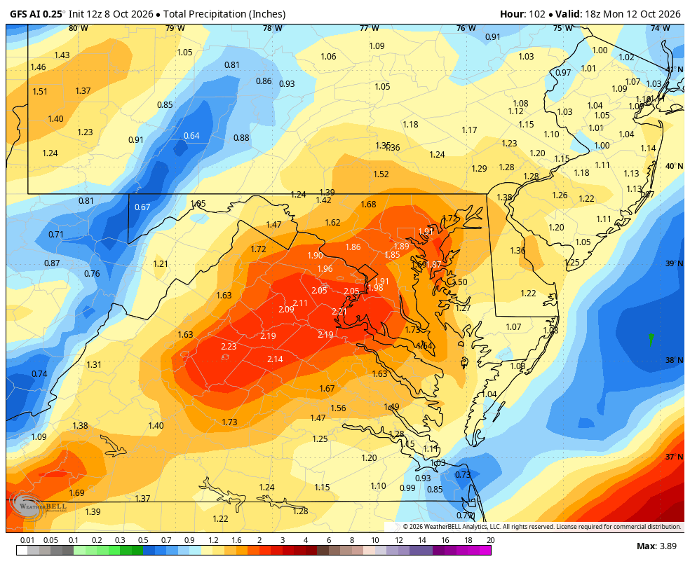
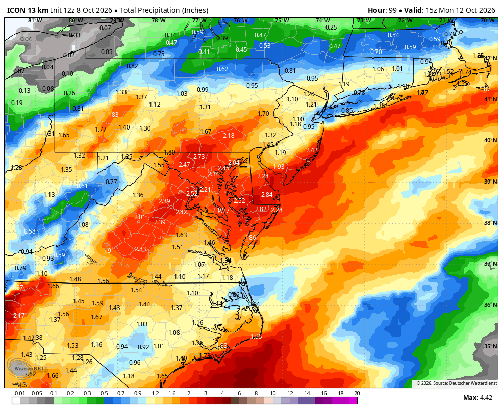
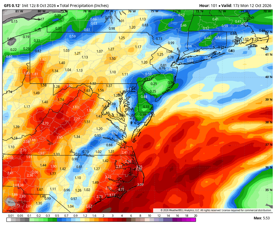
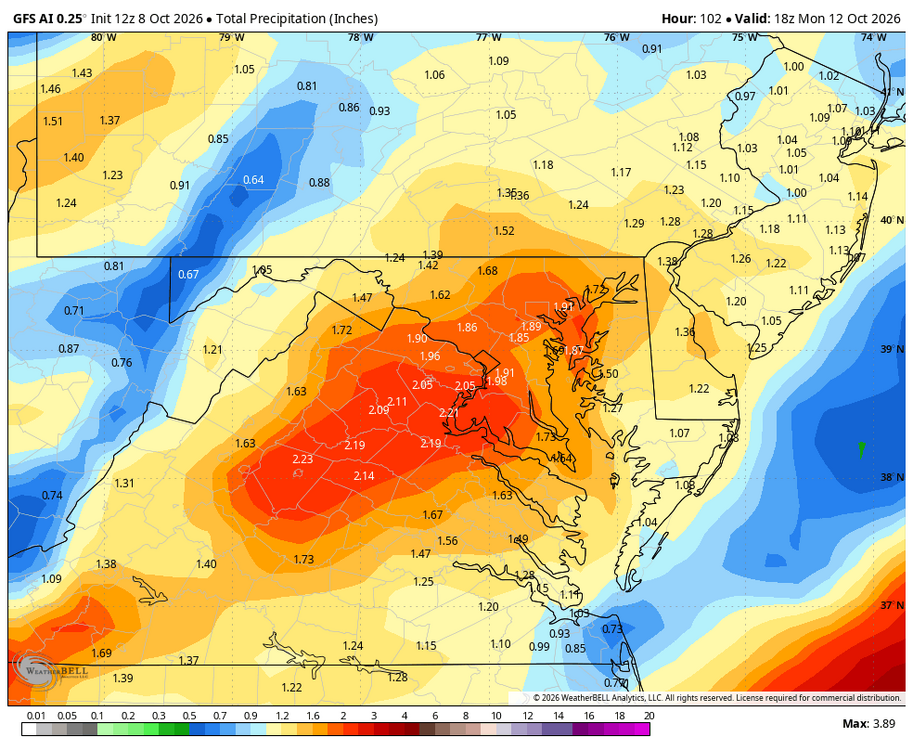
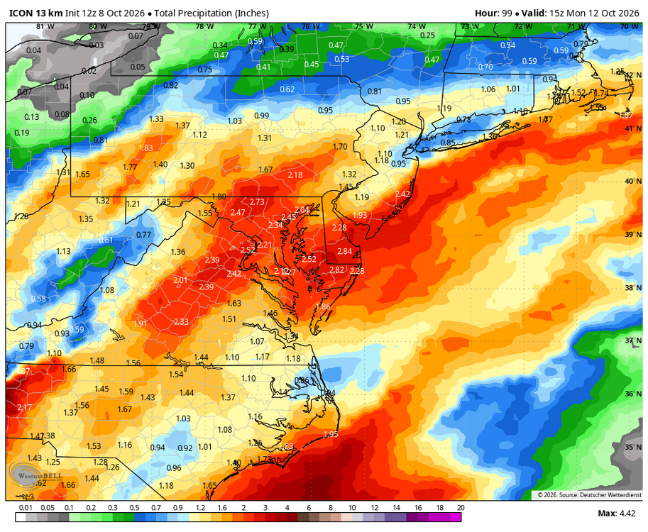
WB 12Z global precipitation totals for Sunday/ Monday.
-
I absolutely think we see some fun winter storms this year. It just wont be the constant white, frozen landscape of last winter.
-

2026-2027 Record-breaking El Nino
michsnowfreak replied to Stormchaserchuck1's topic in Weather Forecasting and Discussion
-
 indian pharmacy store [url=https://indocureglobal.shop/#]IndoCureGlobal[/url] buy medicine online india
 -
Still going strong . Tgiving or bust
-
Hoping for early season snows out west where I'll be in late November/early December and then trip to Montana/Yellowstone in February and Innsbruck/Cortina in March. Assuming that winter gets a late start here. I have an Indy and Ikon pass this year. Would love to get back to Smuggs mid-week this year, the slow lifts and weekend crowds detract from the terrain on my prior visit.
-
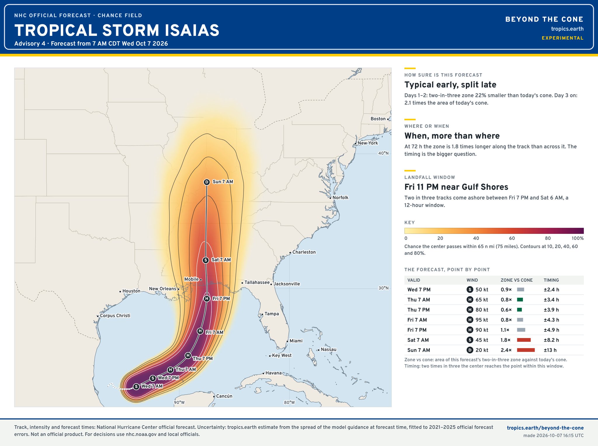
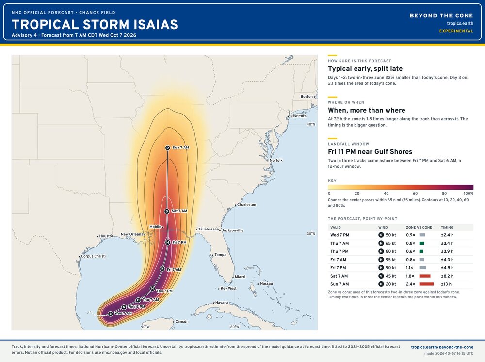
Loving this approach, feel like the NHC should adopt something like this
-
Even 27 is calling for less than .50
-

2026-2027 Fall/Winter Mountain Thread
Maggie Valley Steve replied to BlueRidgeFolklore's topic in Southeastern States
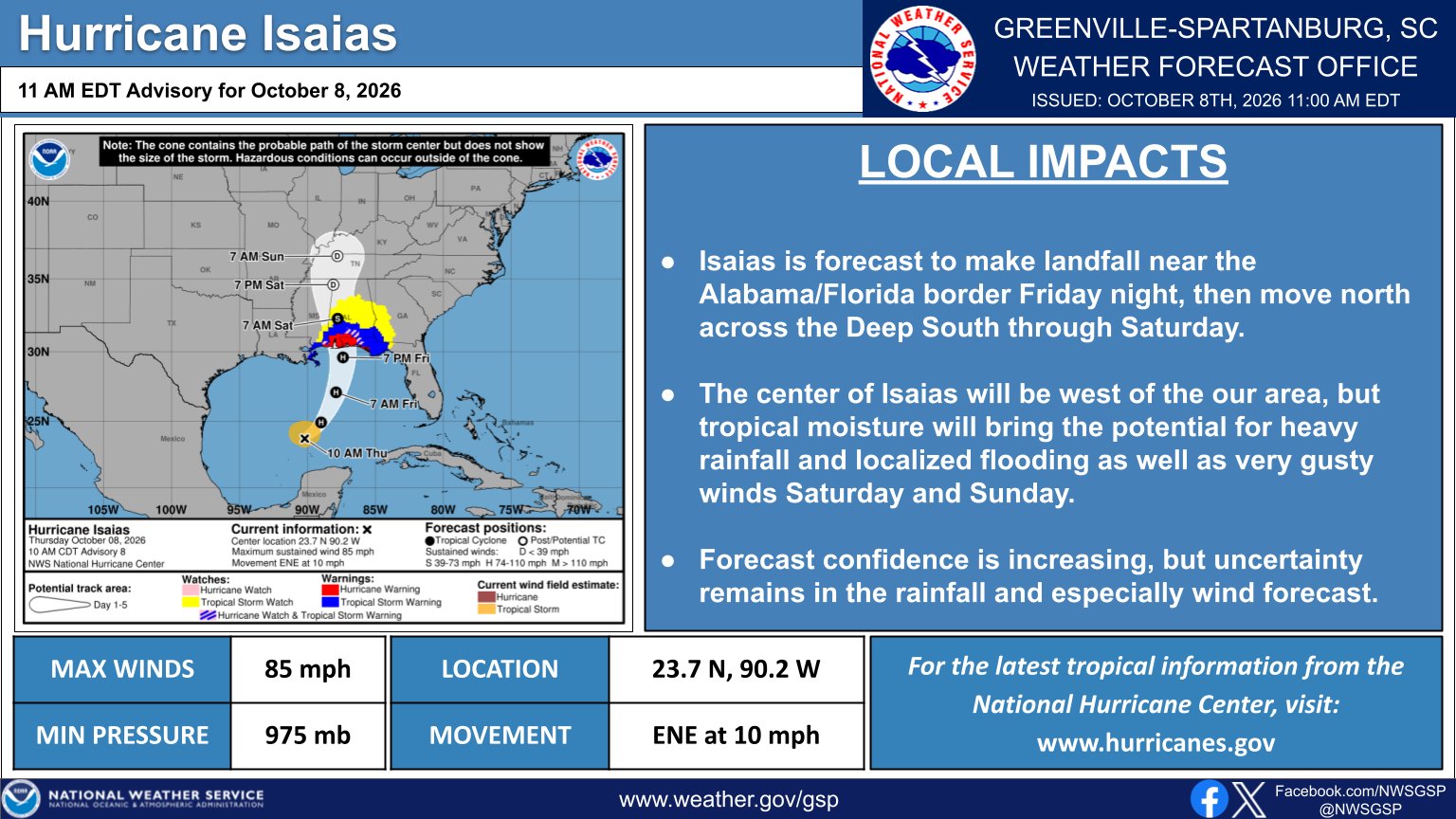
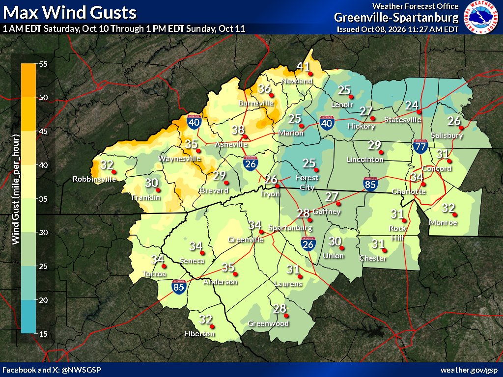
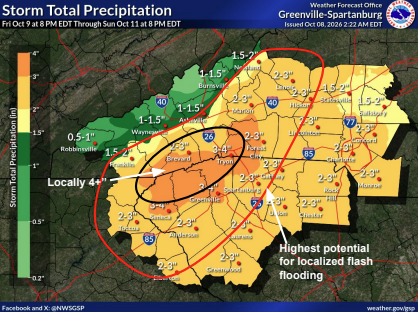
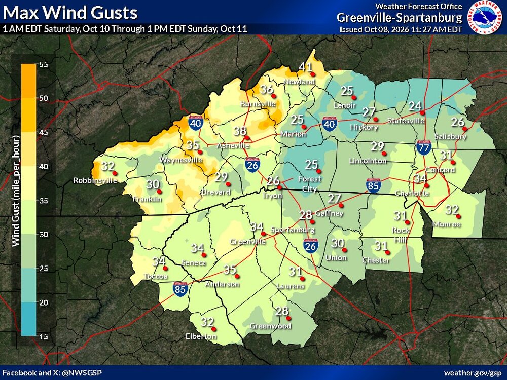
GSP updated information just posted.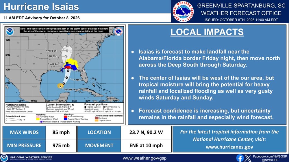
-
Should be a good flex tonight before it gets pummeled early tomorrow.
-
I thought we tied the record of 10/8 from 1851.
-

2026-2027 Record-breaking El Nino
40/70 Benchmark replied to Stormchaserchuck1's topic in Weather Forecasting and Discussion
-
2026-2027 Record-breaking El Nino
40/70 Benchmark replied to Stormchaserchuck1's topic in Weather Forecasting and Discussion
Which is why it probably isn't a good idea to speak in absolutes....the issue that has been plaguing us for the past decade is that we have been mired in a perpetual state of MC forcing...if 2023 was buoyed in phase 6 and this is further east, then I'll take my chances with that. -
2026-2027 Record-breaking El Nino
40/70 Benchmark replied to Stormchaserchuck1's topic in Weather Forecasting and Discussion
In the mean....not necessarily over the shorter-term due to more stochastic pattern flexes; there are also favorable periods within a bad season. -
1905 was a day later (10/7 at 11:30pm vs 10/8) In the satellite era, yes, by far (previous record was 9/11)
-
Yeah although 1905 was about as late:
-
For an “in our backyard” standpoint we cancelled our kids party on 9/26; rescheduled for this Sunday. 35+ adults and kids that need to remain outside… Needless to say, hitting refresh often before I decide to host it or cancel.
-
But this is the latest forming first hurricane of season ever?
-
international drug mart: OmniRxDirect - worldwide pharmacy online
-
https://auroramedsdirect.com/# canadian pharmacies
-

2026-2027 Record-breaking El Nino
Keith Central PA replied to Stormchaserchuck1's topic in Weather Forecasting and Discussion
You said no snow, but you can get a few inches of snow in a bad pattern. Starting off as snow changing to rain..some sort of clipper ect..from late November till late March it can and will snow -
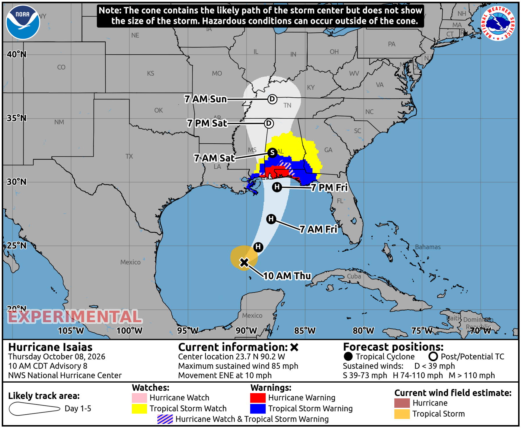
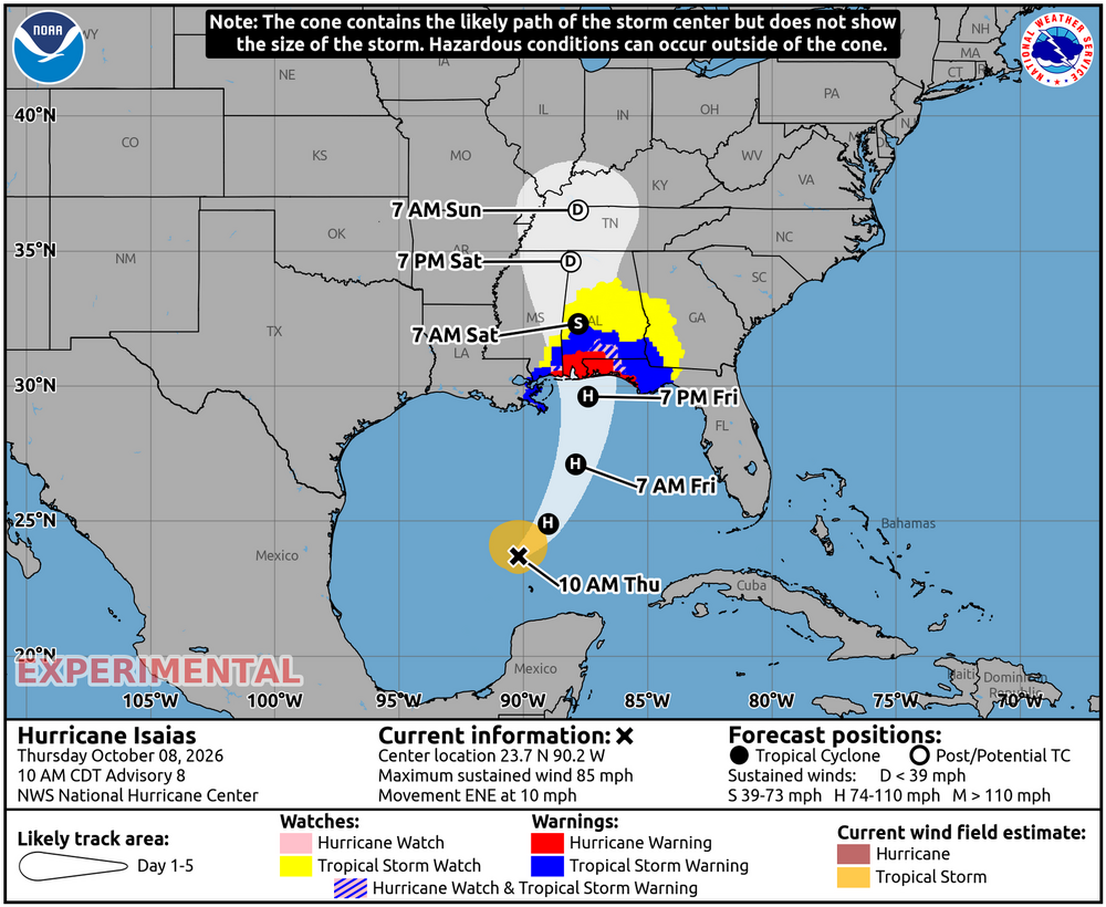
Tropical Storm watches well inland in AL/GA: This is for way up in C AL including Birmingham and Tuscaloosa: **TROPICAL STORM WATCH ISSUED FOR MUCH OF CENTRAL ALABAMA** * STORM INFORMATION: - ABOUT 710 MILES SOUTH-SOUTHWEST OF BIRMINGHAM AL OR ABOUT 640 MILES SOUTH-SOUTHWEST OF MONTGOMERY AL - 23.7N 90.2W - STORM INTENSITY 85 MPH - MOVEMENT EAST-NORTHEAST OR 60 DEGREES AT 10 MPH SITUATION OVERVIEW ------------------ HURRICANE ISAIAS WILL CONTINUE TO MOVE TOWARDS THE NORTHERN GULF COAST, MAKING LANDFALL FRIDAY EVENING. WINDS MAY GUST AS HIGH AS 40 TO 50 MPH LATE FRIDAY NIGHT THROUGH SATURDAY, RESULTING IN THE POTENTIAL FOR NUMEROUS DOWNED TREES AND POWER LINES. RAINFALL AMOUNTS OF 2 TO 4 INCHES WITH LOCALLY HIGHER AMOUNTS UP TO 5 INCHES WILL RESULT IN THE POTENTIAL FOR FLASH FLOODING, ESPECIALLY IN URBAN AND OTHER POOR DRAINAGE AREAS. A THREAT FOR ISOLATED TORNADOES MAY DEVELOP ACROSS PORTIONS OF CENTRAL ALABAMA ALONG AND EAST OF THE TRACK ON SATURDAY, WITH THE HIGHEST POTENTIAL ALONG AND EAST OF INTERSTATE 65. CONFIDENCE IS LOW TO MEDIUM AT THIS TIME.
-
Very impressive structure especially given the shear. If it maintains the current blow up of storms during the convective minimum that could allow significant intensification
-
Seems to be strengthening around the solar minima fighting back shear with convection then levels out as soon as convection starts to die down during the daytime.
-
Another pass with extrapolated 974 mb. Whatever strengthening that is happening isn't happening super quickly.