All Activity
- Past hour
-
.thumb.png.4150b06c63a21f61052e47a612bf1818.png)
Spooky Season (October Disco Thread)
HIPPYVALLEY replied to Prismshine Productions's topic in New England
Maybe you get your first freeze by Thanksgiving? -
Bluesky is for thinking people. Check it out if you value reality.
-

Central PA Fall Discussions and Obs
pasnownut replied to ChescoWx's topic in Upstate New York/Pennsylvania
Yeah...looking at qpf maps currently and I'd say this is a Susquehanna Special. We need it, and welcome it. -

Central PA Fall Discussions and Obs
pawatch replied to ChescoWx's topic in Upstate New York/Pennsylvania
30 for the low this morning ,another frost. Getting ready to get out fishing before the rain. -
If those four torch days didn't happen Central Park would have finished below normal even when going by the 1981-2010 standards. When I calculated the 30 year averages going way back, I found the 1931-1960 and 1941-1970 averages for October warmer than today's FYI.
-

Spooky Season (October Disco Thread)
Damage In Tolland replied to Prismshine Productions's topic in New England
Spinazola? -
Spooky Season (October Disco Thread)
Damage In Tolland replied to Prismshine Productions's topic in New England
Just Foc’ing fantastic. Right in the heart of the start of cold season -

Spooky Season (October Disco Thread)
powderfreak replied to Prismshine Productions's topic in New England
Went below freezing by like 9:30pm last night but held in the upper 20s all night. Low of 26F. -

Spooky Season (October Disco Thread)
AstronomyEnjoyer replied to Prismshine Productions's topic in New England
27.5° for the low this morning. 7th day below freezing this month. -

Spooky Season (October Disco Thread)
Lava Rock replied to Prismshine Productions's topic in New England
Can't take credit, but what a spectacular pic from Mountain View resort in Whitefield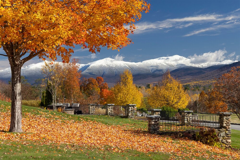
-
Spooky Season (October Disco Thread)
Lava Rock replied to Prismshine Productions's topic in New England
Raymond. We're on a hill at 720' -

Spooky Season (October Disco Thread)
jbenedet replied to Prismshine Productions's topic in New England
Lewiston ME? Isn’t your average low 32 already? -

Central PA Fall Discussions and Obs
mahantango#1 replied to ChescoWx's topic in Upstate New York/Pennsylvania
which one will be right? -
Spooky Season (October Disco Thread)
Lava Rock replied to Prismshine Productions's topic in New England
No sub 32f yet. 35.5 is coldest, but almost never hits <32 until after Halloween. -
Give my regards to Don Pedro.
-
I second! Love me 430 sunsets and darkness early and driving to work in darkness.
-
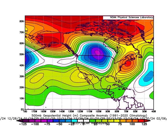
The Greenland block frequently linked up with the Southeast ridge last winter when it actually counted on the days which .20 or greater of precipitation fell. This is why the snowfall totals were so low from Philly to Boston. The average temperature from Philly to NYC was in the low 40s on the 11 days in the composite below. Way too warm of a storm track for decent snows along the I-95 corridor. The winter average was cooler at close to 35° around NYC. But it only arrived following the storms cutting to our west and closely hugging the I-78 to I-84 corridors. 11 day storm composite from Philly to Boston on the 11 days of heaviest precipitation over .20 with strong Greenland block linkage with the Southeast ridge
-
Yes
-
What it is feels like is a bit deceptive since October is one of the fastest warming months of the year. So we have been normalizing how warm it has been getting since it only takes a small + departure to rank in the top 15 warmest Octobers. Sussex NJ is currently ranked 8th warmest October through the 28th. White Plains is 12th warmest and Islip is 7th warmest. It would probably make more sense to use an earlier climate era like 1961-1990 or 1951-2000 as a base period so rankings and departures will actually match up. Instead of updating the normals every 10 years in a rapidly warming climate. This frequent updating leads to the false sense that it isn’t warming as fast as it really is and making the departures less relevant unless they are very high. Time Series Summary for ISLIP-LI MACARTHUR AP, NY - Month of Oct Click column heading to sort ascending, click again to sort descending. 1 2017 61.9 0 2 2021 61.2 0 3 2007 61.1 0 4 1990 60.9 0 5 1971 59.7 0 6 2023 58.8 0 7 2025 58.6 3 8 1995 58.5 0 9 2024 58.4 0 10 1963 58.3 0 11 2019 57.9 0 - 2013 57.9 0 - 2012 57.9 0
-
Garbage pattern starting to take place in order to close off the month. Get ready to be stuck in the 40s all day over the next few days, especially with soaking rains.
-

Spooky Season (October Disco Thread)
CoastalWx replied to Prismshine Productions's topic in New England
I do agree with turn milder after the 9th or so. -
My 5 model blend dropped overnight from 1.96" to 1.44". NBM dropped from 1.75 to 1.20 as would be expected. My sweetspot for significant rainfall seems to be 6 pm to 6 am. I am running a deficit of 7.14" since August 1 !!
-

Central PA Fall Discussions and Obs
canderson replied to ChescoWx's topic in Upstate New York/Pennsylvania
The color has basically sucked so good. -

Spooky Season (October Disco Thread)
Snowcrazed71 replied to Prismshine Productions's topic in New England
You're one strange dude. We've had several mornings now below freezing. And I'm not in an area where you consider me to be remote or up in Northern Vermont. I'm about 12 miles west of Hartford, Connecticut. -
Central PA Fall Discussions and Obs
mahantango#1 replied to ChescoWx's topic in Upstate New York/Pennsylvania
With the projected heavy rain at times and wind gusts projected on some of the models of 40+ we should have a substantial leaf drop till Saturday.