All Activity
- Past hour
-

November 2025 general discussions and probable topic derailings ...
ineedsnow replied to Typhoon Tip's topic in New England
Looks like we get a bit more as that band sinks south in a hour or so? -

First Winter Storm to kickoff 2025-26 Winter season
WxWatcher007 replied to Baroclinic Zone's topic in New England
The thread was posted before the good runs at 12z, so maybe @Baroclinic Zonestill has the juice? -
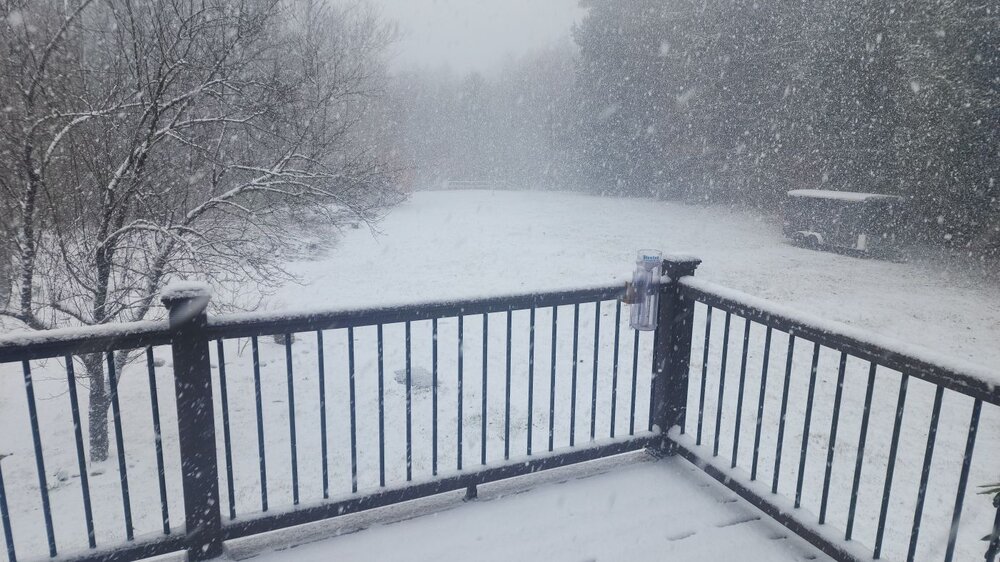
 Same here and now the sun is out. Fun times
 -
Cooking up at WXW2. Temp dropped to 23.5 with -SN/SN. Likely over 20" for November! Returning back up there soon for most of December.
-
December 2025 regional war/obs/disco thread
HoarfrostHubb replied to Torch Tiger's topic in New England
Oh yeah. Forgot it was there. -

First Winter Storm to kickoff 2025-26 Winter season
dryslot replied to Baroclinic Zone's topic in New England
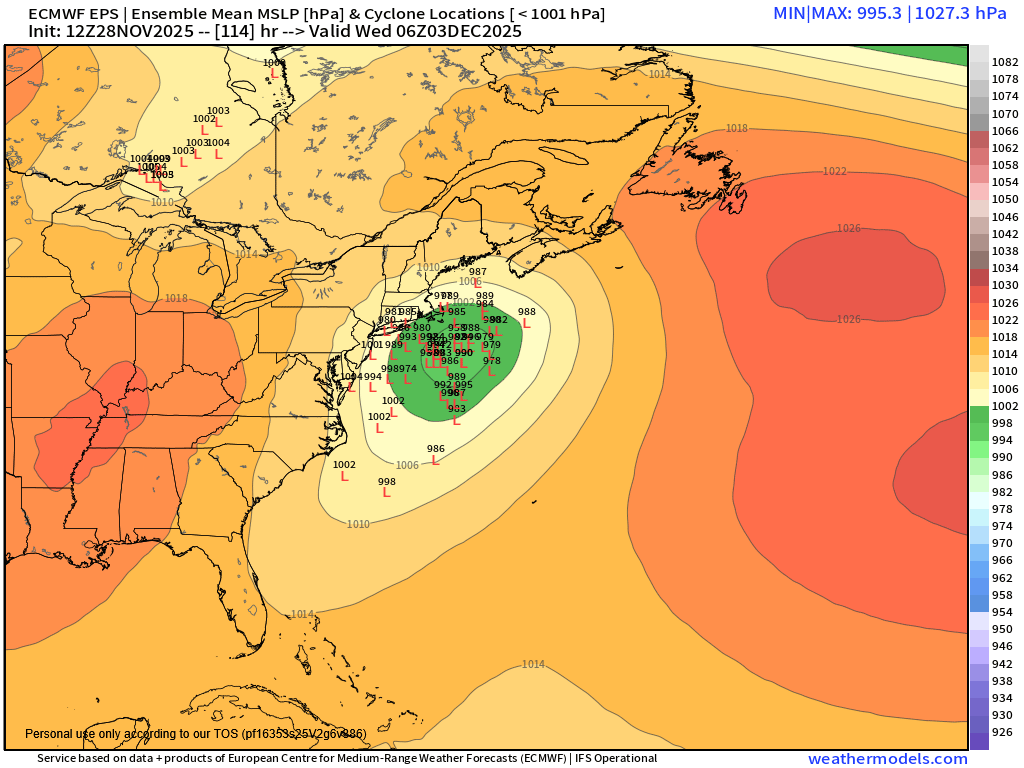
Quite a few more west members at 12z then 06z on the EPS.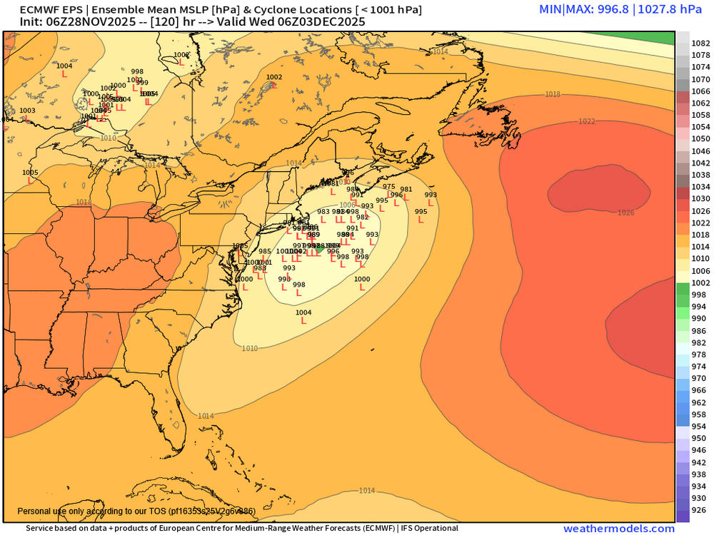
-
I’d forgotten about this. Last year was a wall to wall winter for the state
-

Mid to long range discussion- 2025
WinstonSalemArlington replied to wncsnow's topic in Southeastern States
It was festive and whitened the fro in d. It counts! -

December 2025 Short/Medium Range Forecast Thread
Carvers Gap replied to John1122's topic in Tennessee Valley
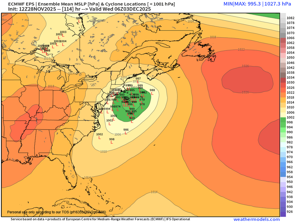
One more thing in a flurry of posts, I am beginning to see evidence that the NAO may begin to fire. It is notoriously hard to predict, but it is significant in both the CMC and Euro 12z runs. It is very evident on the 12z EPS and to some extent the 12z GEPS. That is a BIG difference between the CMC/Euro vs GFS. -
Laying the ground for deep snowpack north of us as we enter prime climo. I’m not mad
-
That eastward "severely misplaced" translating HP as you say, would not be misplaced with a 50/50 LP. For decades the 50/50 low has been a gold standard for a major winter storm because it will lock the cold air in by blocking eastward translation of western New England HP.
-

Nov 28-30th Post Turkey Day Winter Storm
Stebo replied to Chicago Storm's topic in Lakes/Ohio Valley
Yeah, I normally don't disagree with DTX, but with the holiday travel and the face that the western part of their CWA is absolutely going to be warning criteria, I don't get the reluctance. I would do WSW for the entire CWA, it's borderline but the travel would be the tipping point to a warning -

December 2025 regional war/obs/disco thread
Ginx snewx replied to Torch Tiger's topic in New England
November thread? Glad you got it, was my target zone you and Pete MRG -
December 2025 Short/Medium Range Forecast Thread
Carvers Gap replied to John1122's topic in Tennessee Valley
@John1122 is definitely on the money with the 0z GFS not even getting to phase 8. I "think" that GFS plot is hopefully an outlier. But....definitely something to keep an eye on, and as always, a very keen observation from John to spot that. I "think" the 12z GFS began to correct that. I would take the GMON above and shift that stall to the phase 7/8 border. If it was January, I would be far more concerned w/ the faster rotation into 6. But really, I am always concerned it rotates back into 6 - even if it wasn't showing it! I wonder when/if the SSW begins to show at the end of deterministic runs. By the end of next week, we may start to see that influence at the end of those deterministic runs. -
November 2025 general discussions and probable topic derailings ...
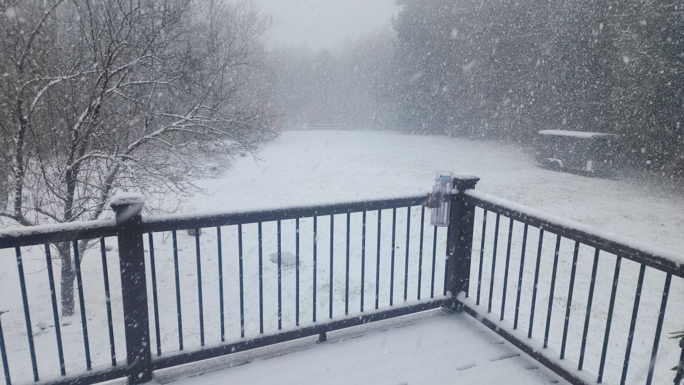
ineedsnow replied to Typhoon Tip's topic in New England
We rip! Ground whitened -
And just to add to this, if (IF) the GEFS is correct that a +EPO/Alaskan vortex pattern takes shape the 2nd week of December, it makes perfect sense that there will still be cold in the CONUS and Canada at that point. It’s not a light switch flip to immediate warmth, that would come later. A +EPO would cut off cross-polar flow and the Pacific floodgates would open. It would take some time for all the cold to get scoured out of Canada and the CONUS but it would happen, again, assuming the GEFS has the right idea @donsutherland1
-
December 2025 regional war/obs/disco thread
HoarfrostHubb replied to Torch Tiger's topic in New England
Some decent blowing snow here now -

Nov 28-30th Post Turkey Day Winter Storm
AWMT30 replied to Chicago Storm's topic in Lakes/Ohio Valley
Gonna be funny with SE Michigan with an advisory and Toledo under a Winter Storm Warning, -
December 2025 Short/Medium Range Forecast Thread
Carvers Gap replied to John1122's topic in Tennessee Valley
I should add that climatology kind of doesn't like snow during early December in the valleys. But during the last 15 years, it has allowed for it. Anyway, this was the GMON from yesterday. 22 days in phase 8! -
December 2025 regional war/obs/disco thread
Ginx snewx replied to Torch Tiger's topic in New England
Oh man have to behave don't want to give Baby Scoots a bad impression -

December 2025 Short/Medium Range Forecast Thread
Matthew70 replied to John1122's topic in Tennessee Valley
Let the snow fall as much as it would like in December! -
December 2025 regional war/obs/disco thread
Ginx snewx replied to Torch Tiger's topic in New England
I have no idea on that Algo but it melts snow as it falls if surface temp is above 32 even if the actual surfaces are well below feezing -
A bird in the hand is worth two in the bush.
-

Nov 28-30th Post Turkey Day Winter Storm
Stevo6899 replied to Chicago Storm's topic in Lakes/Ohio Valley
Nah, advisory. -

December 2025 regional war/obs/disco thread
AstronomyEnjoyer replied to Torch Tiger's topic in New England
Some nice fake snow today. I'm liking the look of some of those clown maps too.