All Activity
- Past hour
-

December 2025 regional war/obs/disco thread
Kitz Craver replied to Torch Tiger's topic in New England
Did AI do well with the last event or fail miserably? I don’t recall -

Winter 2025-26 Short Range Discussion
cyclone77 replied to SchaumburgStormer's topic in Lakes/Ohio Valley
Peoria looking like the better spot to be for the first wave. Northern IL is trending towards a dog turd duster on the globals. -

December 2025 regional war/obs/disco thread
Typhoon Tip replied to Torch Tiger's topic in New England
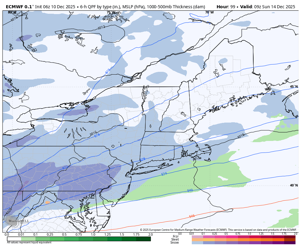
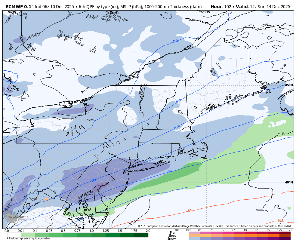
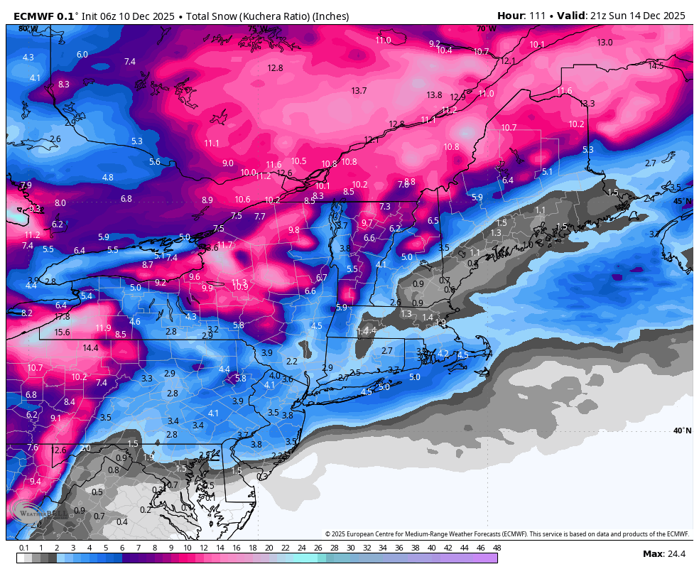
Those solutions look over-produced with QPF. Just a gross linear correlation based upon experience. Flat 1000+surface waves amid a compressed non-hydrostatic field don't have envelopes that extend so far on the northern arc. More typically, that's a narrow band. If this AI is self-learning as it is espoused as being, I suspect that is a less it is about to learn. -
Yeah that’s pretty much the perfect way to describe it. This thing has always had a lower ceiling, but I wouldn’t shut the door on something minor yet.
-

Central PA Winter 25/26 Discussion and Obs
Blizzard of 93 replied to MAG5035's topic in Upstate New York/Pennsylvania
6z Euro is looking good for the late Saturday night into Sunday chance of an Advisory type of potential.
-

December 2025 regional war/obs/disco thread
40/70 Benchmark replied to Torch Tiger's topic in New England
It's not ideal, but correctable with ease at this range, especially given the sensitivity to subtle changes that we are seeing in guidance as a result of the phase on the fly. -

December 2025 regional war/obs/disco thread
Damage In Tolland replied to Torch Tiger's topic in New England
That’s not a bad look at this early stage. I think we see imported on out. -
This snow hole issue we’ve been having over our area the past few years is nothing short of incredulous. Snow to the north of us. Snow to the south of us. Snow to the west of us. The combination between the -PNA and the raging northern jet is just killing us. By no means am I throwing in the towel for winter 2026, but I’m already looking forward to winter 2027 with an El Niño and +PNA.
-
December 2025 regional war/obs/disco thread
40/70 Benchmark replied to Torch Tiger's topic in New England
EURO and EURO AI focus on SE areas, GEFS mostly OTS, and GEPS develops a bit too late, but decent SOP. -
I’ll take a quiet period at Christmas.Though I’d to cash in the last of the clipper train Pattern reload.
-
Yeah the snowpack took a surprisingly big hit. Nice squalls moving in from the north. Ready 2 squall.
-
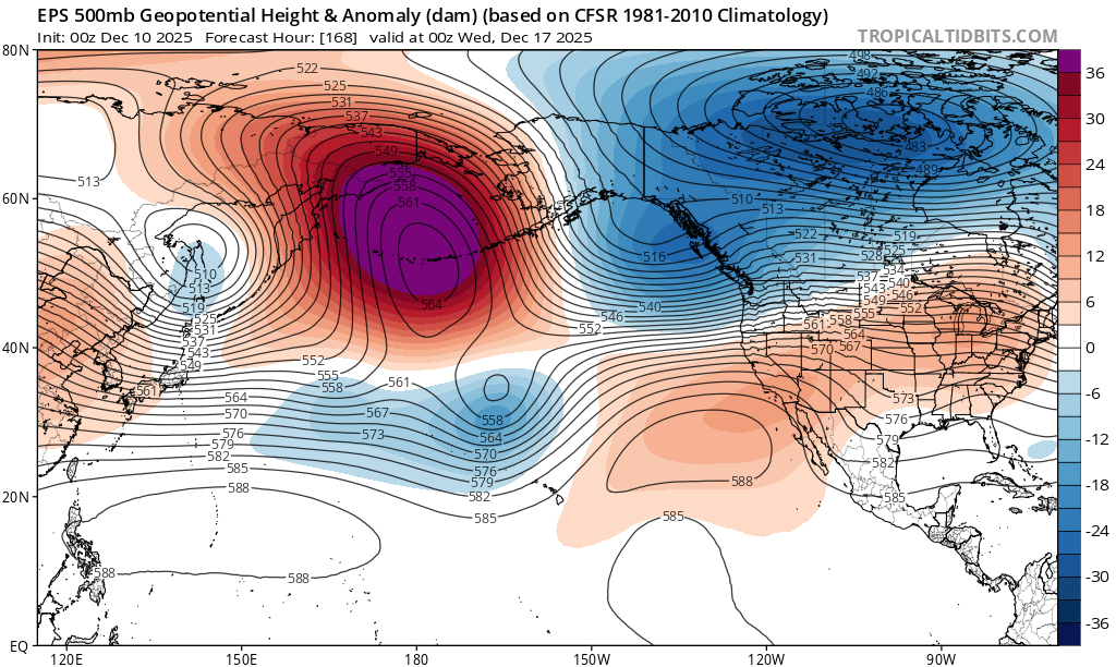
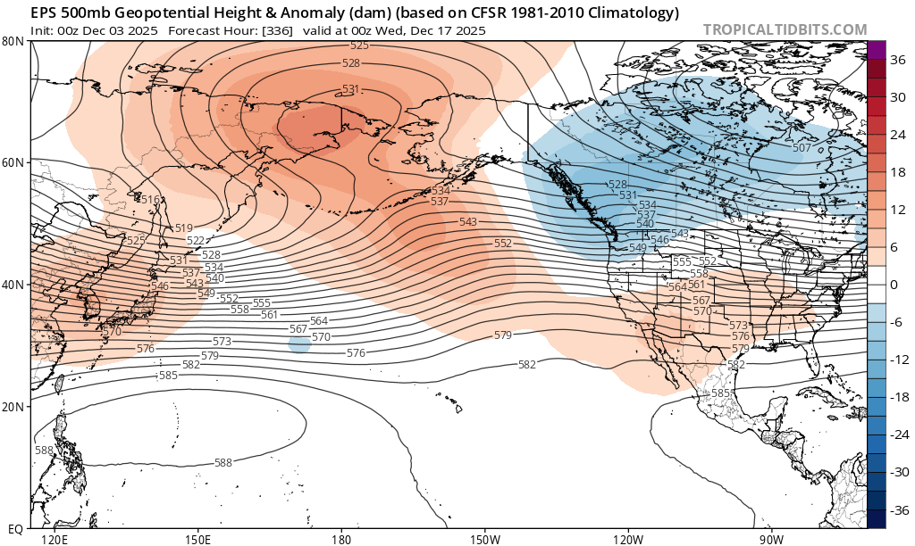
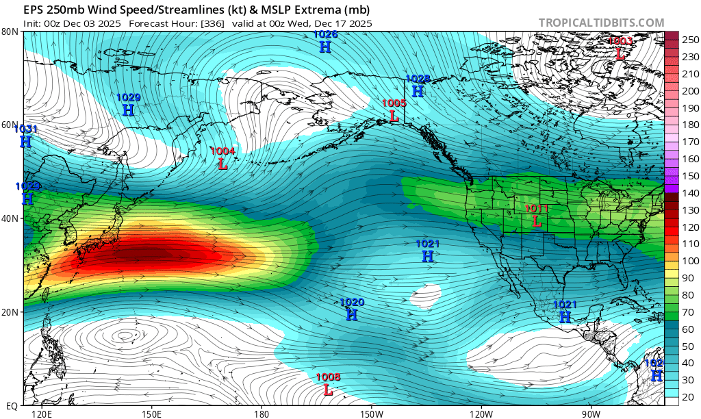
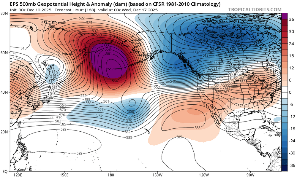
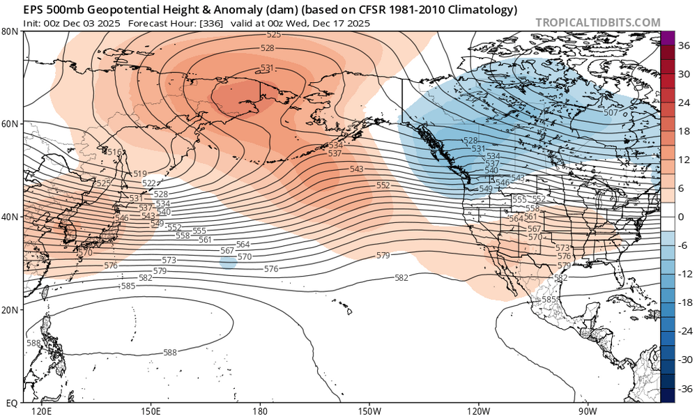
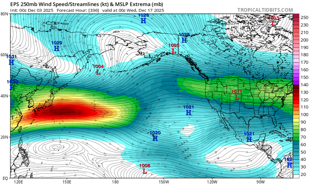
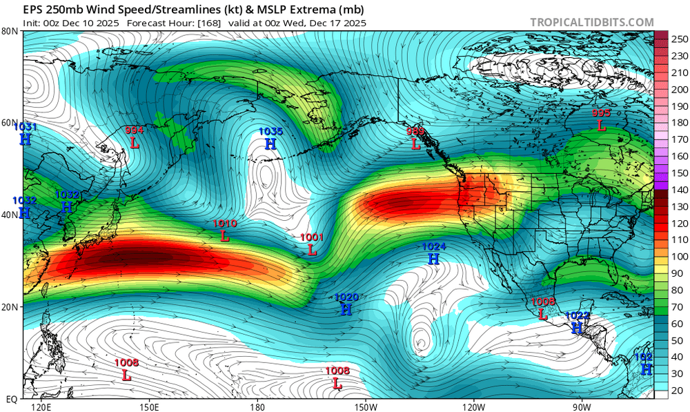
This is similar to what happened last year at this time with the models. Last December started with the extended guidance locking in the -EPO for the whole month. But as we approached the December 10th, the models caught onto how much stronger the Pacific Jet would be and the warmer +EPO pattern. Now the Pacific Jet is forecast to be much stronger mid-December than was indicated last week. Notice how much deeper the +EPO vortex is forecast to be now even with a near record -WPO 500 mb block. In the old days we would usually have the Pacific Jet weaken and we get more of a -WPO -EPO block. So we are on track for our annual warm up from December 17th to 25th. The +EPO is now forecast to becomes more dominant for our sensible weather than the -WPO as the Pacific Jet overpowers the pattern again. New run Old run
-

Central PA Winter 25/26 Discussion and Obs
mahantango#1 replied to MAG5035's topic in Upstate New York/Pennsylvania
Truth, somewhere along the way it all went wrong. -
p rough look gonna end up a seriously two-faced month
-
December 2025 regional war/obs/disco thread
Damage In Tolland replied to Torch Tiger's topic in New England
How did ensembles in all camps look? -

Central PA Winter 25/26 Discussion and Obs
Voyager replied to MAG5035's topic in Upstate New York/Pennsylvania
I wish. Many say we don't do snowstorms and winter like we used to. There is truth to that, but we also don't do heat waves like we used to either. -
Happened a LOT in the 80s. The worst was 1989. Coldest month in my lifetime and the one big storm was mainly rain. Back then cold dry/warm wet was EXPECTED.
-
Unless all the other models start caving, I don’t trust the EURO/EPS anymore. It’s been way too overamped and flip flops wildly. It was really awful just 2 weeks ago with the 12/2 storm where it kept showing a substantial snow for I-95 run after run and then caved to the other guidance. It’s definitely not what it used to be and hasn’t been for a few years now.
-
December 2025 regional war/obs/disco thread
40/70 Benchmark replied to Torch Tiger's topic in New England
Buy. Been touting that for a month. -
December 2025 regional war/obs/disco thread
40/70 Benchmark replied to Torch Tiger's topic in New England
Sunday, but in some cases, both. -
December 2025 regional war/obs/disco thread
40/70 Benchmark replied to Torch Tiger's topic in New England
That would probably be a bit better than implied across my area, over to @HIPPYVALLEY in Greenfield due to some modest mid level banding. -

December 2025 regional war/obs/disco thread
moneypitmike replied to Torch Tiger's topic in New England
Canceling Sunday or the winter? -

December 2025 Short/Medium Range Forecast Thread
Carvers Gap replied to John1122's topic in Tennessee Valley
For kicks and giggles, take a look at the blizzard warning posted for West VA. -
Pattern favors DC to VA area
-
December 2025 regional war/obs/disco thread
40/70 Benchmark replied to Torch Tiger's topic in New England
Jesus, it's brutal in here....give it until 12z tomorrow before cancelling. We have an uber-fast flow with two tiny parcels of energy from the arctic phasing while diving SE at break-neck speeds...won't be resolved until late week.