All Activity
- Past hour
-
hopefully that sustained period of warmth will also be dry and not include any rainfall, Don.
-
Who does weekly shrub pruning? wtf.
-
That’s 12z too… the 18z is even drier.

-
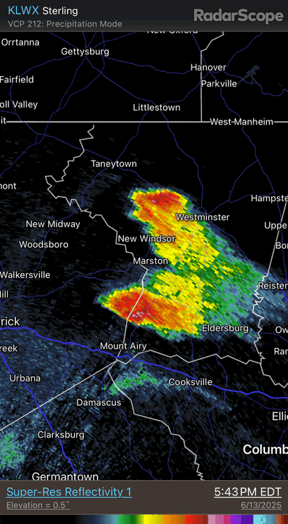
Look at these GIF loops from late this aftn. Classic supercell split mirror pair in n-cntrl MD. The left split accelerates and moves N, and the right split moves ESE and is slow-moving. In a more unidirectional environmental flow w/ wind shear, the supercell splits both have an equal chance of surviving. Most of the time tho when there is directional shear present, it is veering w/ height, so that favors the right mover (cyclonic meso), and the left mover (anticyclonic meso) does not last long. Supercells by default split, but often since the right split is so favored so often from the shear profile, the left split never has a chance and is wiped immediately, so you see nothing on radar! And when overall flow is weak/disorganized over an area, the mesoscale takes over, leading to some odd storm motions and evolutions, as we see today.
- 1,011 replies
-
- 3
-

-
- severe
- thunderstorms
- (and 2 more)
-
He didn't say that...he just said what was exciting about the sounding you posted
-
Texts today say quite different
-
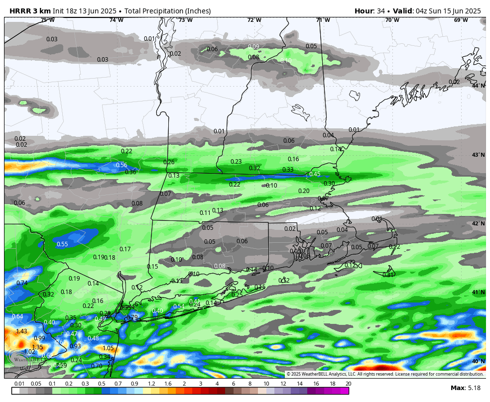
A whole lot of Meh tomorrow morning . Most end up under .25 https://x.com/ericfisher/status/1933533264506917342?s=46&t=dhcbvkjmRcyBVQtDxJ3lRg
-
CT Rain person said no severe, laughed at that assertion days ago
-
Of course GFS with a solid severe setup for Thursday
-
Heat advisories within Alaska.
-
They're generally a couple degrees lower
-
Mapquest? And I was going to Ask Jeeves where Pusey Crossroads was?
-
It will turn noticeably cooler for the weekend with temperatures reaching only the upper 60s in New York City. Showers and periods of rain are also likely during the weekend, especially Saturday afternoon and Sunday. Rainfall amounts will generally be light with most of the region seeing 0.25" or less rainfall. A few of the wetter spots could see around 0.50" of rain. No exceptional heat appears likely through the first three weeks of June. However, a sustained peirod of above normal temperatures could develop starting late next week. The ENSO Region 1+2 anomaly was +0.4°C and the Region 3.4 anomaly was 0.0°C for the week centered around June 4. For the past six weeks, the ENSO Region 1+2 anomaly has averaged +0.23°C and the ENSO Region 3.4 anomaly has averaged -0.07°C. Neutral ENSO conditions will likely continue through at least mid summer. The SOI was -0.77 yesterday. The preliminary Arctic Oscillation (AO) was -0.528 today. Based on sensitivity analysis applied to the latest guidance, there is an implied 56% probability that New York City will have a warmer than normal June (1991-2020 normal). June will likely finish with a mean temperature near 72.9° (0.9° above normal).
-
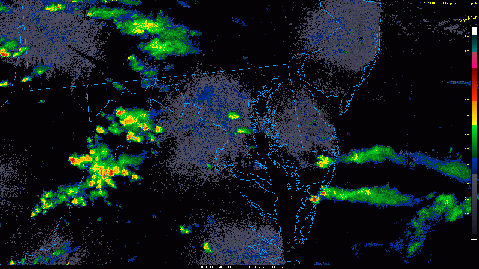
It's maddening; rain swirling everywhere and NOTHING can hit us (besides .01" pity sprinkles). Anything coming in this direct, veers of to the side, splits, or dies just as it gets to us.
-
If you cut yourself off a pint or two earlier, you just might wake up dry.
-
76. 1 for the high with mostly sunny/smoke . A solid day to do the lawn and weekly shrub pruning. Let’s get thru tomorrow and the torch summer awaits us mid week on. Along with severe
-
 Trentwx joined the community
 - Today
-
Warm in the valley, sweating putting up the tarp and deploying the boat today
-
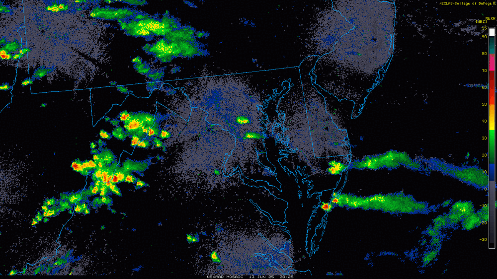
Cool looking outflow on radar as well!
-
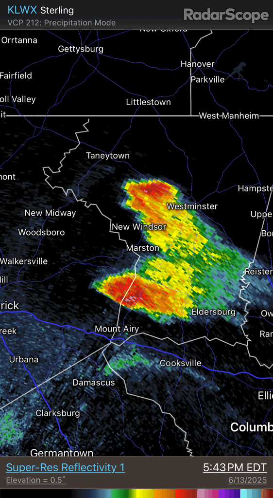
Yeah. That cell definitely has a little bit of a supercell appearance on radar.
-
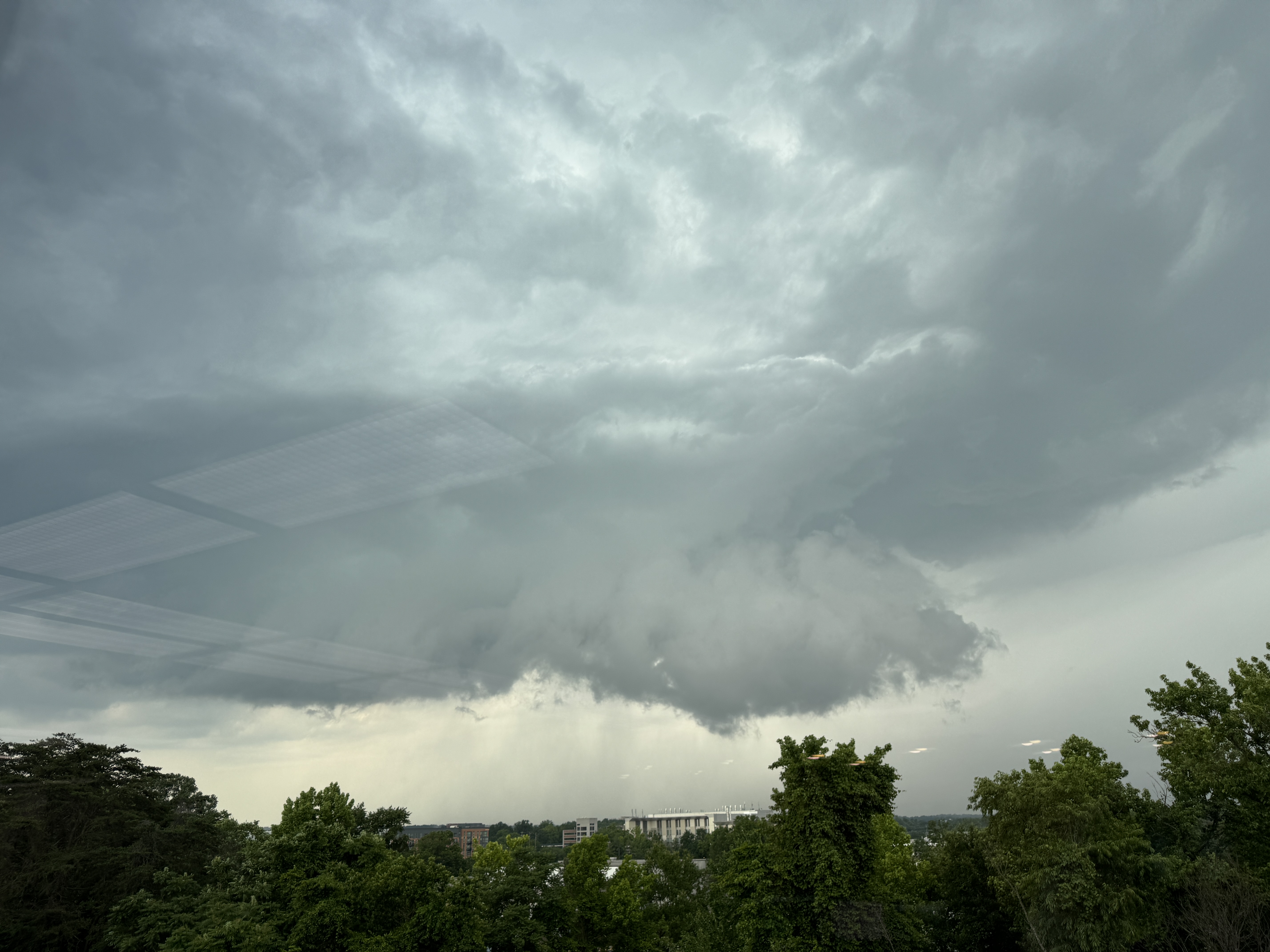
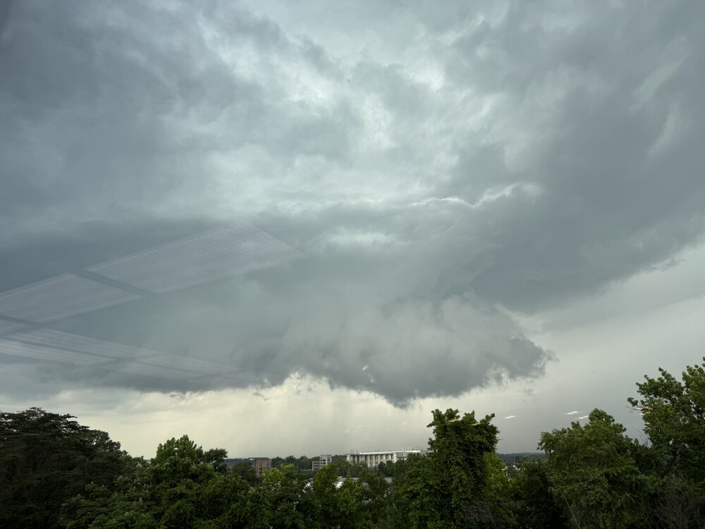
FWIW, this is what it looked like just to the N of College Park at 5pm today. It tried for a brief time. Definite supercell with a long inflow band to the E. I had to take this pix through a window.
- 1,011 replies
-
- 4
-
-

-
- severe
- thunderstorms
- (and 2 more)
-
Thank you.
-
Yeah feels like an early spring day out, minus the high sun angle and full leaf out. Wtf is this bs?
-
https://www.mapquest.com/us/delaware/pusey-crossroads-de-283508779#google_vignette SE of Seaford, DE.
-
High of 62 tomorrow?
-
Um..... Where exactly is that?.