All Activity
- Past hour
-
Final total yesterday was 1.00 with 1.42" for the month
-
-
Hazardous Weather Outlook National Weather Service State College PA 414 AM EDT Mon Jun 9 2025 PAZ057>059-065-066-100815- Dauphin-Schuylkill-Lebanon-York-Lancaster- 414 AM EDT Mon Jun 9 2025 This Hazardous Weather Outlook is for central Pennsylvania. .DAY ONE...Today and tonight. Scattered strong to severe thunderstorms with gusty winds and locally heavy rain are possible this evening into tonight. .DAYS TWO THROUGH SEVEN...Tuesday through Sunday. The probability for widespread hazardous weather is low. .SPOTTER INFORMATION STATEMENT... Spotters are encouraged to report significant hazardous weather.
-
We just can't seem to break this stupid pattern. Looking at the forecast, only two days this week (Wednesday and Thursday) will be nice, then back into the showery weather for Friday through the weekend.
-
50’s and a washout coming Saturday. Ineedsnow has done it again
-
HUGE GLOB of rain just piled up inches and inches of fresh rain tallies over north Texas and east. It is going to miss Austin by mere FEET. More frantic middle of the night water rescues in N TX and points east as multiple rounds of efficient rain producers have been pummeling the same areas over and over and over and over again. This has been a BROKEN RECORD since Jan 1 2025. Many waterboarded communities in N TX are fast approaching 30 inches of rain on the year. While Austin begs for rain on its KNEES, crying out for SCRAPS. Yeah, another one bites the dust. This ought to be Austin's theme song for 2025. Because another one just bit the parched dust AGAIN!
-
62 degrees, .27” of rain yesterday and .06” overnight. Looks like we are under a flood watch the next 2 days, Monday, Tuesday They are saying we could get over 3” of rain in short duration. National Weather Service State College PA 400 AM EDT Mon Jun 9 2025 PAZ006-012-037-041-042-045-046-049>053-092000- /O.NEW.KCTP.FA.A.0011.250609T2100Z-250610T1200Z/ /00000.0.ER.000000T0000Z.000000T0000Z.000000T0000Z.OO/ Potter-Northern Clinton-Tioga-Northern Lycoming-Sullivan-Southern Clinton-Southern Lycoming-Union-Snyder-Montour-Northumberland- Columbia- Including the cities of Trout Run, Lock Haven, Bloomsburg, Coudersport, Mansfield, Shamokin, Laporte, Selinsgrove, Sunbury, Berwick, Williamsport, Renovo, Lewisburg, Wellsboro, and Danville 400 AM EDT Mon Jun 9 2025 ...FLOOD WATCH IN EFFECT FROM THIS AFTERNOON THROUGH TUESDAY MORNING... * WHAT...Flash flooding caused by excessive rainfall is possible. * WHERE...A portion of central Pennsylvania, including the following areas, Columbia, Montour, Northern Clinton, Northern Lycoming, Northumberland, Potter, Snyder, Southern Clinton, Southern Lycoming, Sullivan, Tioga and Union. * WHEN...From this afternoon through Tuesday morning. * IMPACTS...Excessive runoff may result in flooding of rivers, creeks, streams, and other low-lying and flood-prone locations. * ADDITIONAL DETAILS... - Heavy rain rates 1-2 inches per hour are possible with training thunderstorms and could result in localized rainfall amounts in excess of 3 inches over a short duration. - http://www.weather.gov/safety/flood PRECAUTIONARY/PREPAREDNESS ACTIONS... You should monitor later forecasts and be prepared to take action should Flash Flood Warnings be issued. && $$ Steinbugl/JB1
- Today
-
I pulled a small tic off my ankle earlier and man those little ones cling to ya like super glue! It must’ve latched on when I was strolling through a muddy trail yesterday. Wish I took a shot of the sunset earlier too..that damn smoke was thick today. I hope we can clear this crap out for the midweek.
-
Liberty, as stated, this is actually frightening. As always …..
-

June 8 Southern Plains Severe Outbreak
Chinook replied to Powerball's topic in Central/Western States
There aren't many recent storm reports going east of Dallas, as you said. It has finally gotten so late at night it is hitting a stable layer and the downdrafts aren't so bad (maybe.) Well anyway you tend to see the wind reports go away late at night with quite a few situations. Dallas KDAL airport got 1.69" in an hour. Some radar images for Dallas Dallas to Denton may have gotten 2.25" within the last 6 hours. -

June 8 Southern Plains Severe Outbreak
cstrunk replied to Powerball's topic in Central/Western States
Pretty bow echo in ETX has more bark than bite. Warned for 80 mph and the tornado sirens sounded in Longview. Don't think wind even hit 40 mph. -

June 8 Southern Plains Severe Outbreak
Powerball replied to Powerball's topic in Central/Western States
https://x.com/NWSFortWorth/status/1931927067773358147?t=bWXphnTMAVFoFkuKJlcTlA&s=19 -
June 8 Southern Plains Severe Outbreak
Powerball replied to Powerball's topic in Central/Western States
At least in Collin / Denron Counties, there were numerous 60-70 MPH wind gusts, which any other day if not for all the hype would be a solid severe weather event. It is rapidly turning into a Flash Flood situation for DFW now. -

June 8 Southern Plains Severe Outbreak
canderson replied to Powerball's topic in Central/Western States
It does look that way - how is the wind though? -
June 8 Southern Plains Severe Outbreak
Powerball replied to Powerball's topic in Central/Western States
Scenario #2 from FWD's AFD ended up panning out. -
I really hope I'm wrong, but it almost seems we're going into one of "those" summer patterns, in which we get rainy cool weekends with a small burst of heat midweek. This past week was a great example, as is the upcoming one. Gets warm around Wednesday, lasts through Friday, then like clockwork it cools down and/or rains for the weekend.
-
As we’re only a day away from the 72nd anniversary of the great Worcester Tornado, is there a way to get a current picture of this particular area as it looks today vs what this tornado depicts here in ‘53? I’ve tried google maps but with limited success..Any help is greatly appreciated.

-
June 8 Southern Plains Severe Outbreak
Powerball replied to Powerball's topic in Central/Western States
Just got the notification for a Destructive Wind Warning (80 MPH) here. -
Picked up 0.02" from some late afternoon post-frontal light rain. Up to 1.83" for the month now.
-

2025 Lawns & Gardens Thread. Making Lawns Great Again
mreaves replied to Damage In Tolland's topic in New England
Are sure DIT don’t move in next door? -
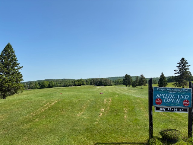
I played 9 at Presque Isle Country Club today. It’s a solid course that was fun. Beautiful day to be outdoors.
-
What has this world come to with our most fervent, Heat hating cold supporter talking like this?
-
High of 89, picked up .23" from some severe warned storms that past to the southeast of us.
-
One more moderate shower rolling through.... 1.25 since Friday.
-
I know 2 couples who have just bought places in The Villages. I can’t think of a worse spot in FL, well maybe in the deep interior panhandle.


