All Activity
- Past hour
-

Central PA Summer 2026 Discussion/Obs Thread
Mount Joy Snowman replied to Voyager's topic in Upstate New York/Pennsylvania
Low of 55. Nice day today before we get a prolonged pattern shift. -
Among the dynamical models the CMC is pretty much alone for now in developing a low close to the coast and giving much of the area significant rain.
-

2026-2027 Record-breaking El Nino
GaWx replied to Stormchaserchuck1's topic in Weather Forecasting and Discussion
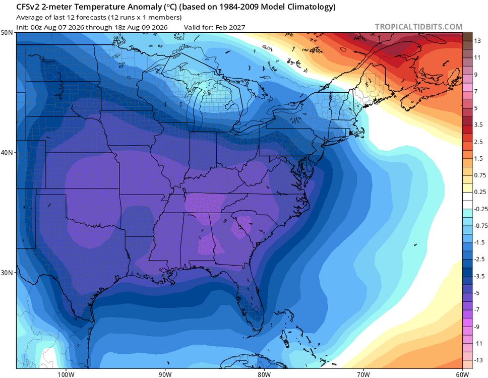
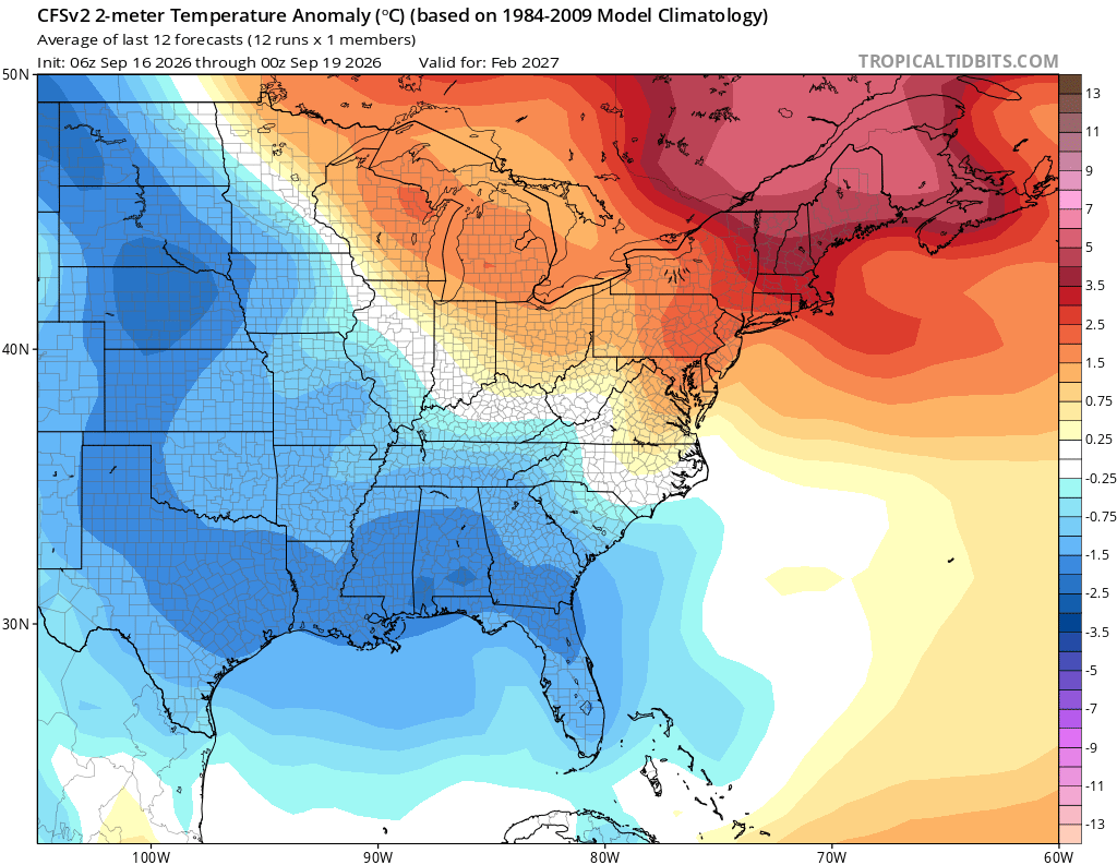
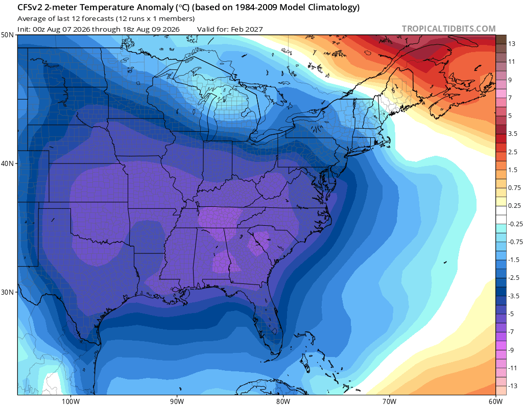
Recent 3 day mean CFS’ have cut way back on the degree of cold in Feb: 9/16-18 Compare that to this from 8/7-9: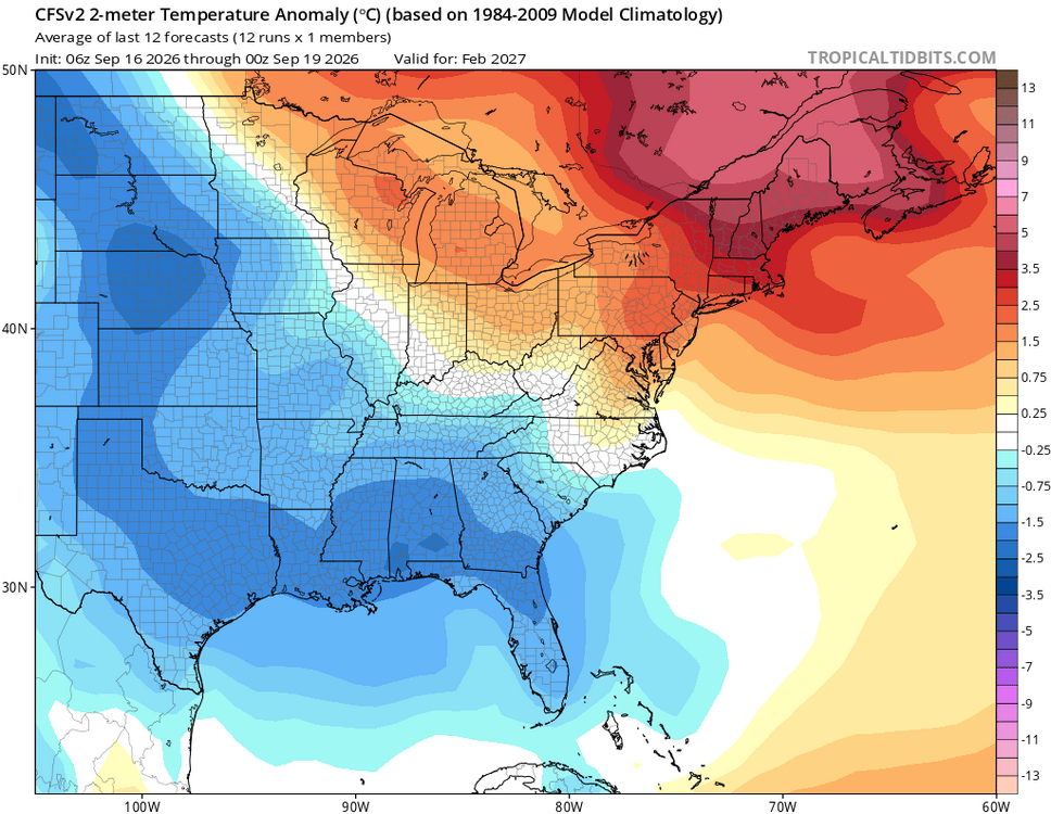
-
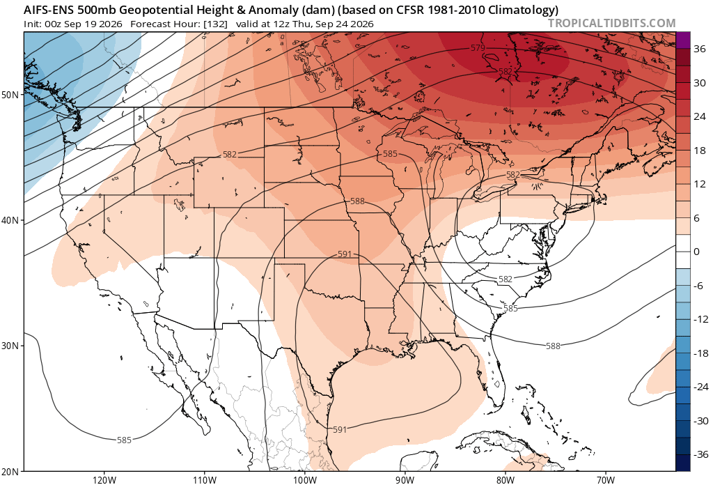
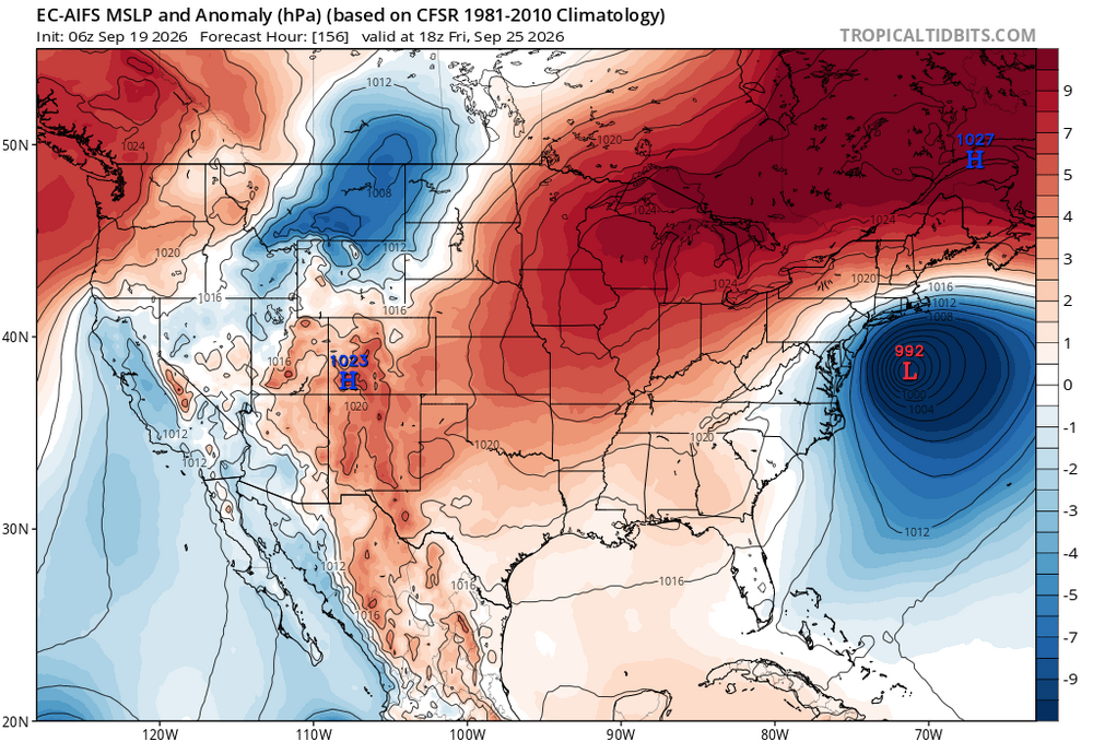
6z AIEPS likes mid week.
-

Septorcher 2026 Discussion - Endless Summer
WxWatcher007 replied to Damage In Tolland's topic in New England
Low of 54 at WXW1 Low of 37 at WXW2–coldest of the season so far. Low of 28° at SLK. -
Why does my forecast from the NWS say Mostly Sunny when its Mostly Cloudy ? Seems like I have to ask this same question over and over again since they are experts at screwing up sky conditions
-
There indeed have been UK runs with false TCs though not false canes. But in this case, all models have a low off the NE coast as opposed to it being just on the UK. But would it be T, ST, or ET and would it stay offshore?
-
Looks like the general trend on guidance is faster movement of the front to our south, and the precip from the initial disturbance stays mostly to the north. Have to see what happens mid to late week with the potential coastal low for significant, more widespread rain for much of the area.
-

Septorcher 2026 Discussion - Endless Summer
mreaves replied to Damage In Tolland's topic in New England
36° here. I’m headed to FL for the week so I haven’t paid much attention to the forecast for here. Doesn’t look too bad though. Cool with some showers? -
6z
.thumb.png.d6bcf9d08ff0b5f8a5db4ba214b2b990.png)
-

2026 Atlantic Hurricane Season
cptcatz replied to Stormchaserchuck1's topic in Tropical Headquarters
You've been posting lots of UK runs showing a tropical cyclone lately with nothing coming of it. UK has been just as bad as GFS with its fantasycanes. -
0.89” of precipitation yesterday. For all the hype of a big rain event it ended up being a run of the mill damp fall day in Minneapolis with a high of 63. 5-7” rainfall totals across the I-90 corridor of southern Minnesota.
-
The 5 model blend for Augusta from Monday - Wednesday has dropped from 2.11" to 1.65" since yesterday.
-
Fall is coming folks.
-
i had to close my window feeling very chilly inside..
-
dt wxrisk is convinced a major northeaster is happening next week..
-
Need to check the UKMET. Now that the CMC has high 500 mb verification scores as well, cant go wrong with that combo!
-

2026 Atlantic Hurricane Season
Windspeed replied to Stormchaserchuck1's topic in Tropical Headquarters
99L's low-level circulation appears to be tightening up under the moderate convective canopy. There is clearly mid-level spin parked over the LLC now. This should end the named storm drought this morning. How strong it can get before environmental conditions deteriorate by Monday-Tuesday remains questionable. Though you can see the shear axis is positioned dangerously close, just south of the system, made evident by the screaming upper cirrus flow on satellite, I could easily see this topping out around 50-60 kts if it can remain just north if it. SSTs are warm enough, combined with a cold pool aloft, to continue supporting convection in the short term. -
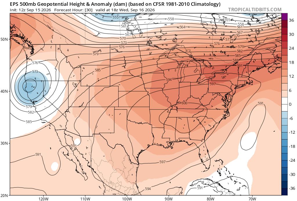
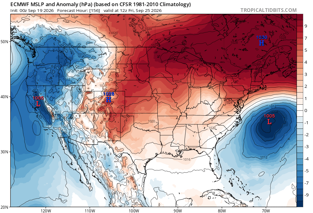
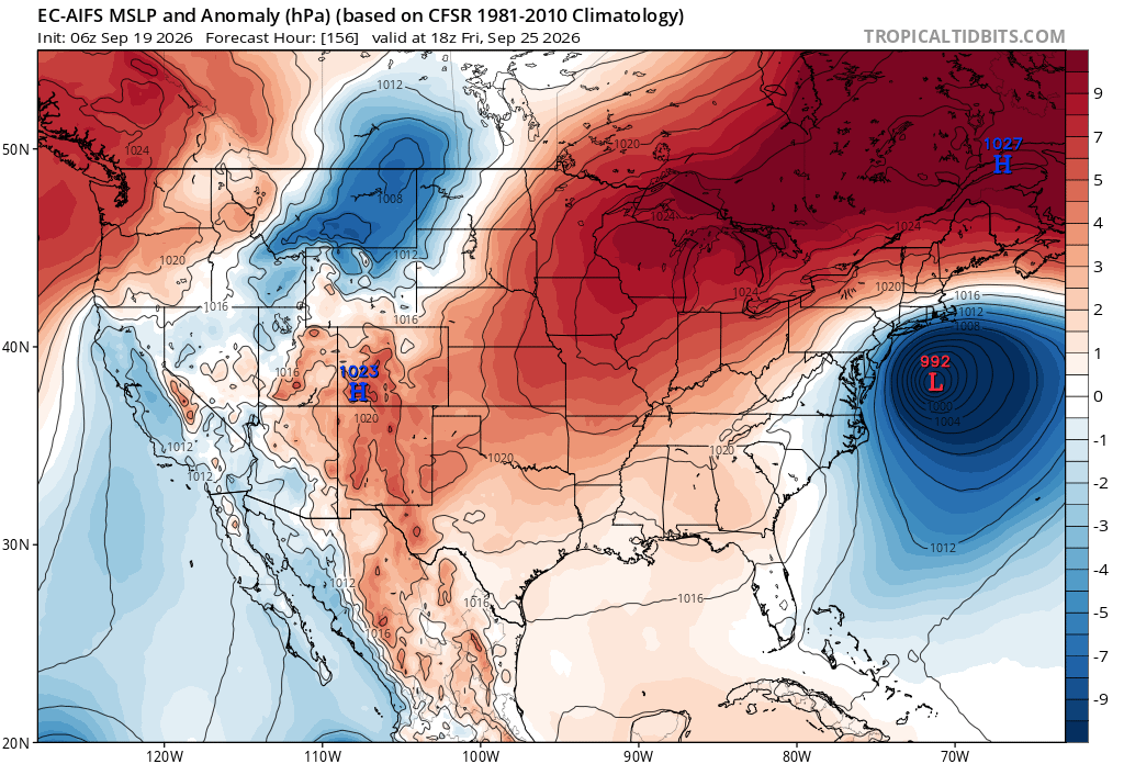
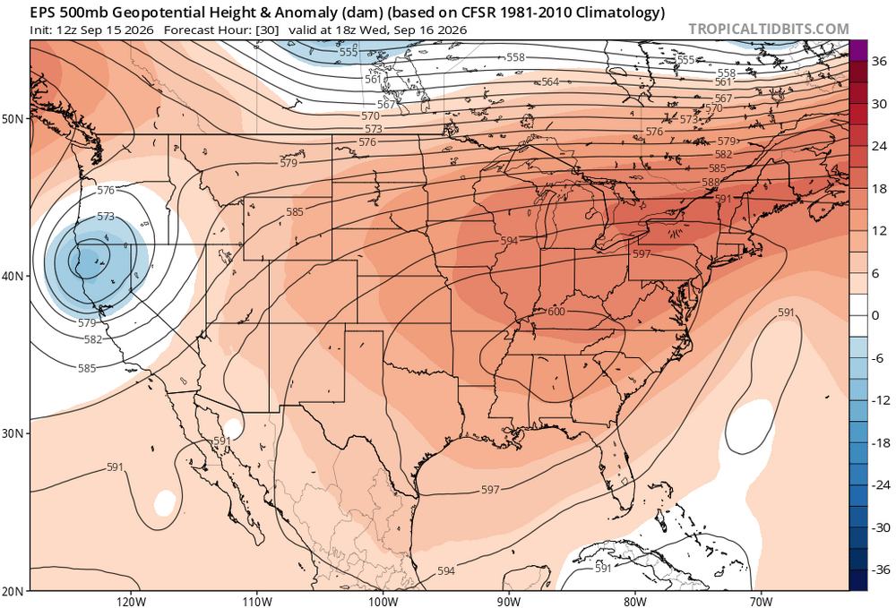
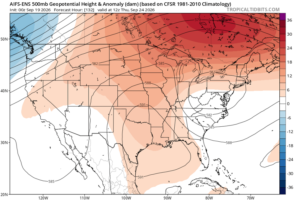
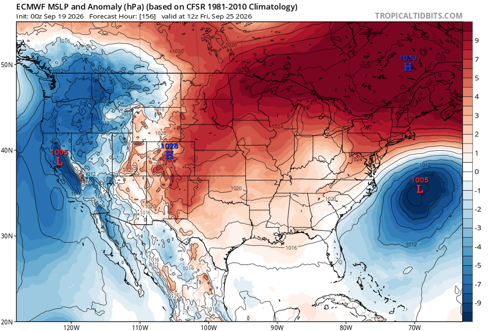
It’s part of the same pattern which produced the record 600 dm pattern this week. The strength of that ridge may be key to how much rain we actually get this week. Some of the stronger high pressure models like the OP Euro keep most of the rain offshore this week. Other models like the AIFS and CMC have more rain especially near the coast with weaker high pressure to the north. But like we saw with the blizzard in February, the AI and other models beat the Euro which was too suppressed with the coastal low. So this will be a good test of how the AI models handle warm season wavelengths with East Coast lows.
-
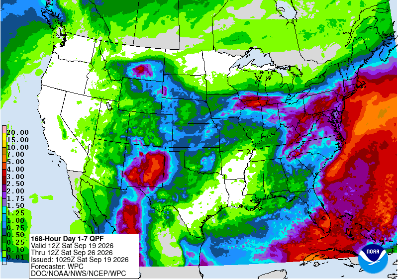
0z euro wants to hang the precip back over the mountains leaving areas to the east mostly dry. 6z gfs is more uniform in the distribution of a 1-2" rain during the week. Canadian really wants to crank the low along the coast resulting in enhanced rainfall over the area. 3 different outcomes on the table. WPC has a healthy amount of rain.
-
Finally a nice morning again. Cool with a breeze and lower humidity.
-
 Generic Tadalafil 20mg price and Generic Tadalafil 20mg price Cialis 20mg price in USA http://mychatik.ru/go.php?url=http://menon36.shop Buy Tadalafil 10mgand http://www.garmoniya.uglich.ru/user/acwhvhgysd/ Generic Cialis price [url=http://cse.google.sr/url?q=http://menon36.shop]Cialis over the counter[/url] Cheap Cialisor [url=http://www.garmoniya.uglich.ru/user/ysbbjsyjpr/]Buy Cialis online[/url] Buy Tadalafil 5mg
 - Today
-

Septorcher 2026 Discussion - Endless Summer
powderfreak replied to Damage In Tolland's topic in New England
34F. -
Cialis without a doctor prescription: MenOn36 - Cialis 20mg price
-
Yes, in terms of the fall equinox, fall begins Tuesday. Meteorological fall, which is used for climate data purposes, began on September 1st.




.png.96eaaf827df1af107e1a9006dc53f3fa.png)