All Activity
- Past hour
-

December 2025 regional war/obs/disco thread
Snowcrazed71 replied to Torch Tiger's topic in New England
Does it look to bring an advisory event to SNE at least? -
I was expecting disaster, it’s not that much different… boo!! Lol
-

December 2025 regional war/obs/disco thread
WinterWolf replied to Torch Tiger's topic in New England
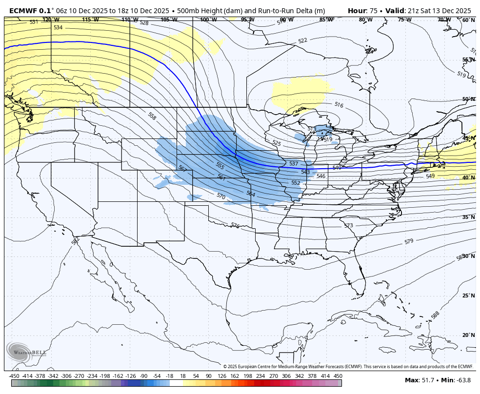
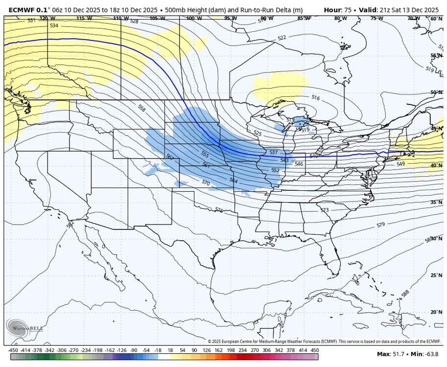
The trend is nice…Euro catching on? Or is GFS right? -
I think if you drop that another 50-100 miles west/southwest then you’re starting to give this enough room to tilt shortwave negative. That’s where you’d get this from a general 3-6/4-8 type event into double digits where a true CCB circulation can start rapidly developing. But at this point, I’m still leery of the whiff east. I don’t like how progressive the flow starts looking behind it so that’s always a worry. But if we can get guidance to trend solidly at 00z, then I’d start thinking a bigger solution isn’t merely a fantasy.
-
(002).thumb.png.6e3d9d46bca5fe41aab7a74871dd8af8.png)
Central PA Winter 25/26 Discussion and Obs
ChescoWx replied to MAG5035's topic in Upstate New York/Pennsylvania
How cold has this year's first 10 days of December been in Chester County PA? Glad you asked - This is the 10th coldest start to December since records began way back in 1893. Of note 5 of the top 11 cold starts to December have all occurred since 2000.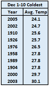
-
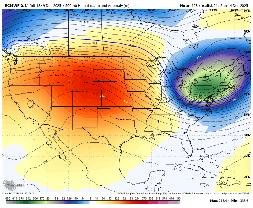
The big thing about that euro run is that it did not throw the TPV piece way east like the GFS did. Not much of a change.
-
I would call it a winter if this happened.
-
E PA/NJ/DE Winter 2025-26 Obs/Discussion
ChescoWx replied to LVblizzard's topic in Philadelphia Region
How cold has this year's first 10 days of December been in Chester County PA? Glad you asked - This is the 10th coldest start to December since records began way back in 1893. Of note 5 of the top 11 cold starts to December have all occurred since 2000.
-
Decent burst of snow this evening. Already a good inch here and still snowing. Roads are not good.
-

December 2025 regional war/obs/disco thread
brooklynwx99 replied to Torch Tiger's topic in New England
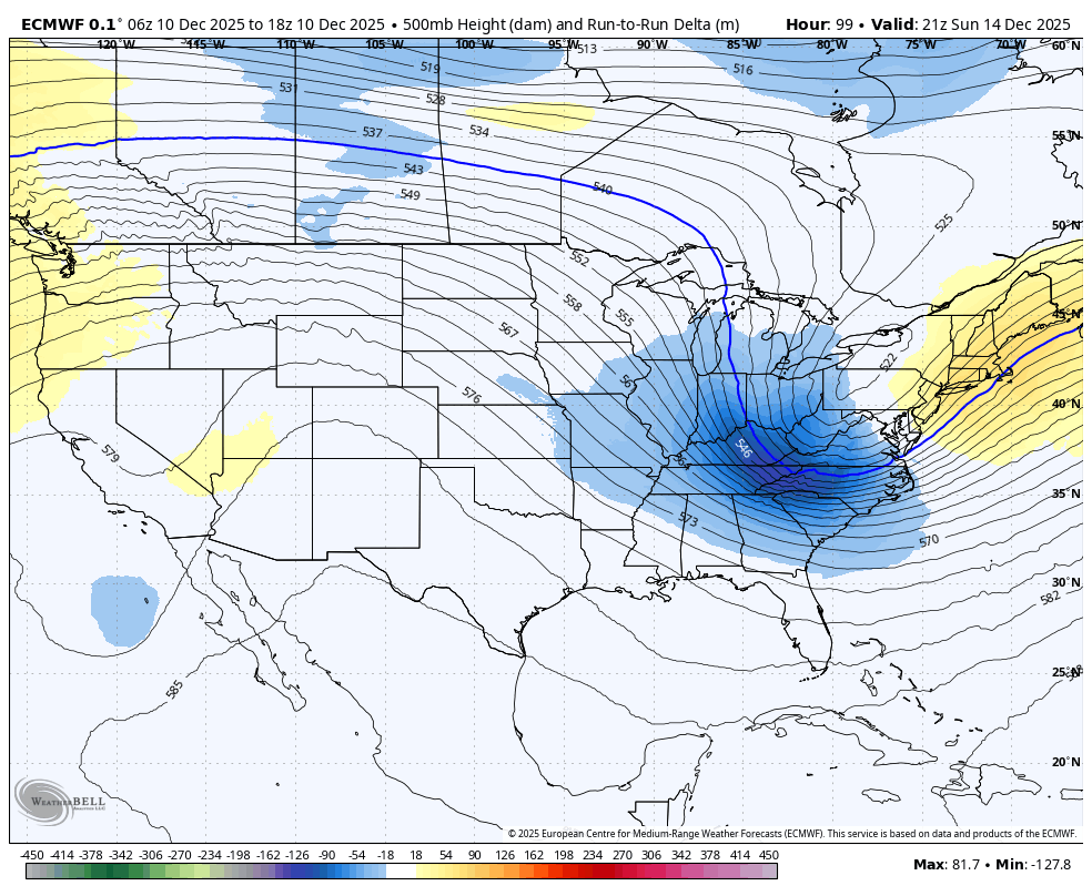
personally i’m wondering if there’s an inflection point where things blow up. 18z euro was teetering, honestly. we’ve been trending that way for a while model cycle now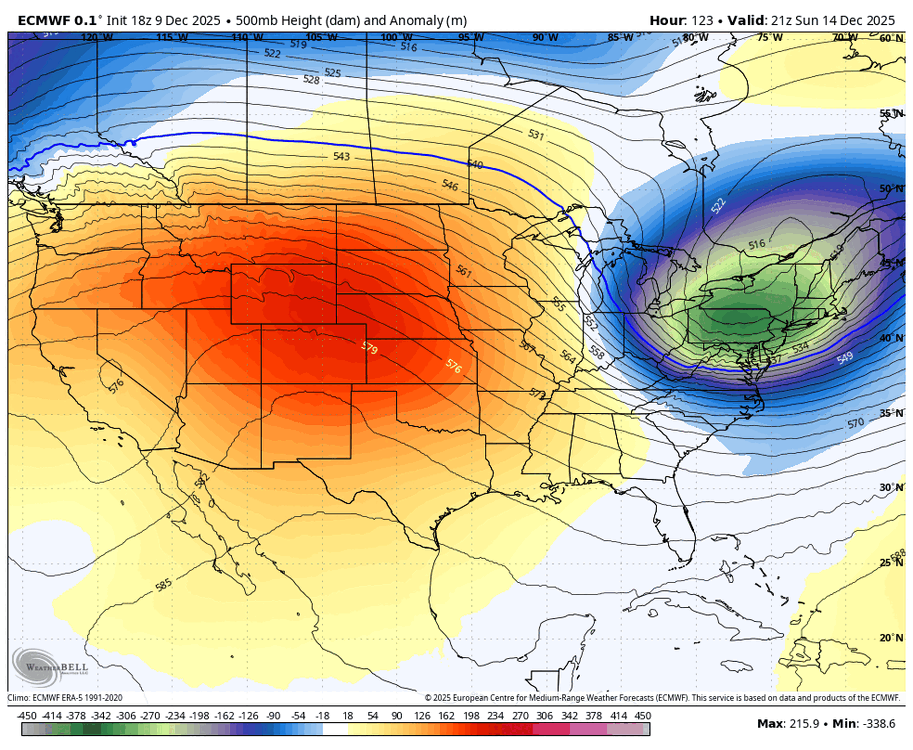
-
Yeah…the low just escapes east before the real fun, but something to watch. Still a lot of good fronto on that run so SE areas would still prob get low end warning snows or close to it on 18z euro.
-
Yeah if you dig those heights on the southwest side, it will help that TPV lobe to drop into the void and pump up downstream heights to get the moisture transport northwest over land.
-
For Sunday?
-
euro is a nice moderate event, comes in more amped with the TPV leaning more southwest
-

E PA/NJ/DE Winter 2025-26 Obs/Discussion
Albedoman replied to LVblizzard's topic in Philadelphia Region
Fantasy Christmas storm shows up again this evening runs with over a foot and half. WE can only dream. White rain all day here but at least it was some precip. Take. -
December 2025 regional war/obs/disco thread
brooklynwx99 replied to Torch Tiger's topic in New England
could tell it was going to be more amped around here. PNA is better and heights are lower farther SW
-
Far SE areas look like they try to catch the developing CCB. That would prob be some violence on the Cape…esp if it can pop quickly as that vort catches up to sfc.
-

December 2025 regional war/obs/disco thread
WxWatcher007 replied to Torch Tiger's topic in New England
-

Minor snow possible sunday 12/14/25
MJO812 replied to WeatherGeek2025's topic in New York City Metro
Euro is better than 12z. -

December 2025 regional war/obs/disco thread
butterfish55 replied to Torch Tiger's topic in New England
"Christmas is cancelled!!" "Christmas Blizzard incoming!!!!!! (If GFS is right)" -
Not enough for you to notice much of a change in Queens sensible temperatures since 1980 had the CO2 levels remained steady instead of rapidly climbing. The recent development last 20 years in Western Brooklyn and Queens is a drop in the bucket compared to the overall UHI footprint of NYC. Add 15-20% to snowfall totals from the late 1800s through the 1980s and the long term downward decline becomes even steeper.
-
Euro about the same as 12z. Just kind of torchy - limits what would have been a better hit.
-
December 2025 regional war/obs/disco thread
brooklynwx99 replied to Torch Tiger's topic in New England
yeah, vort really trying to buckle here
-
18z Euro is worse for most as its drier
-
What was the SWE of that snow? Drier snows melt down faster. More air in the pack with fluffier snows as well.