All Activity
- Past hour
-
The lightning has been pretty wicked the past hour or so back here in the trailing anvil rain. Lots of multiple repeating ultra bright flashes, followed by super long rumbles of thunder occasionally shaking the house.
-
IIRC Birmingham or Huntsville also did that during the evening of 4/3/74. James Spann essentially did that for 4/27/11 when he told his viewers in advance there were going to be so many tornadoes and warnings it would be tough for them to keep up, so to treat any storm that approaches as dangerous and take cover as if it had a tornado (which on that day in Alabama, it probably did).
-
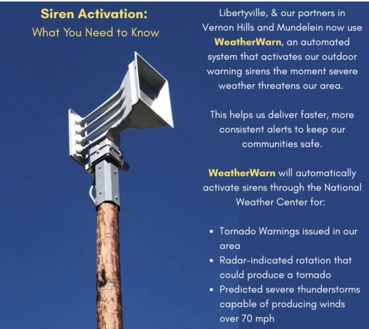
Anyone have thoughts on this? So far I am not a fan. Mundelein had their sirens go off on Tuesday for a severe thunderstorm warning that didn’t really amount to anything. Today Libertyville had their sirens go off an hour before a warning was ever even issued, then went off 2 more times during and then again after the threat had already passed. Not sure having sirens go off for severe thunderstorm warnings is a great idea. People are just going to start ignoring them more than they already are. I understand the desire to automate them but I’m not sure it’s working all that well right now. We all know the story about crying wolf.

-
Probably about an hour to hour and a half until arrival here. Shall see if it still can throw some punches.
-
Jonas…. Son of a bitch.
-
Reminds me of the story of the 1965 outbreak and Northern Indiana issued a blanket tornado warning for every county because it couldn’t keep up. Completely different set up and reasoning but still gives me a chuckle
-
That is a huge tornado warning polygon south of Kankakee.
-
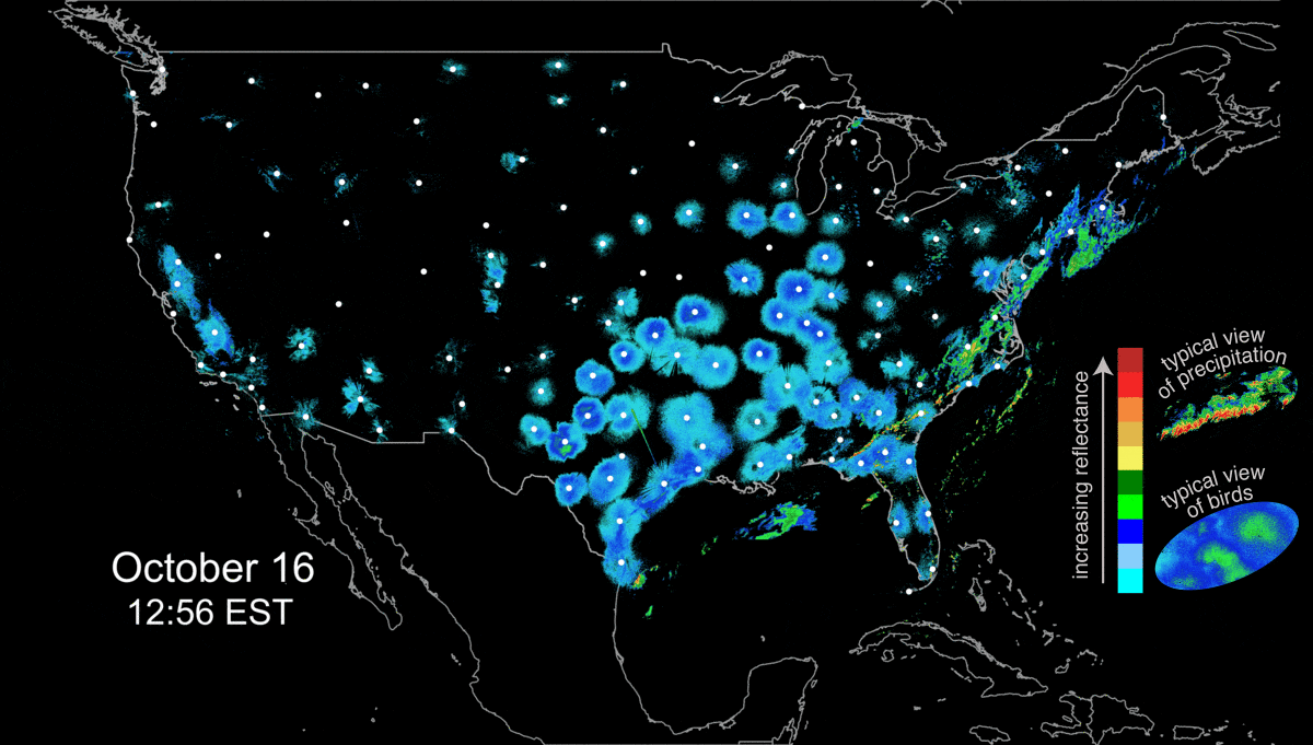
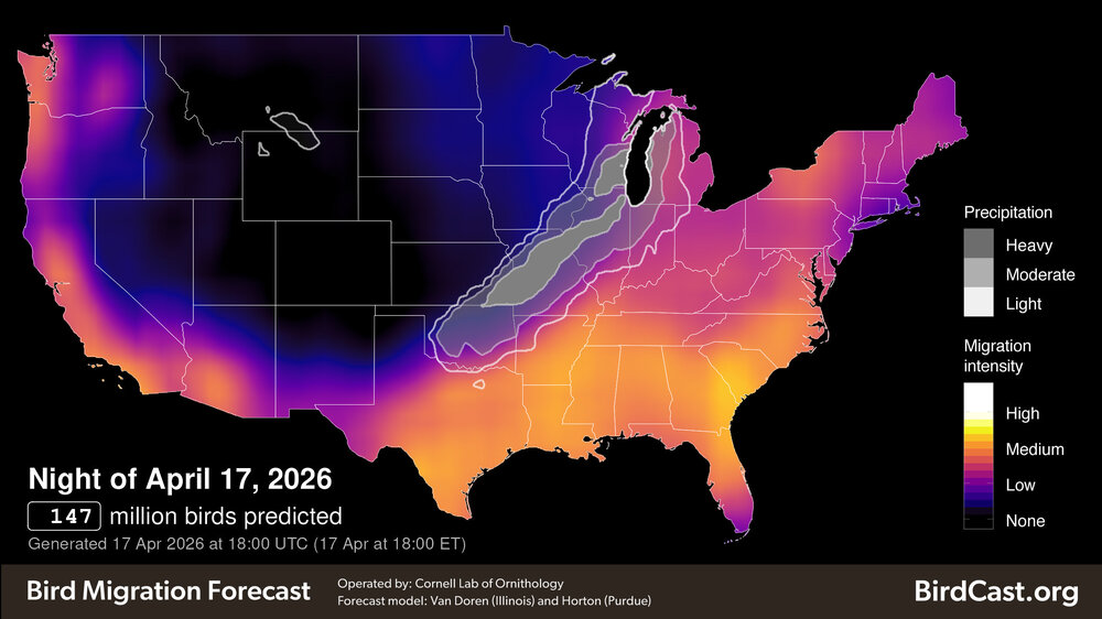
@radarman I see this bird migration stuff from CornellLab a lot and I see UMass-Amherst as one of the contributors. Are they honestly using ground clutter from radiation inversions for this? That’s the impression I get from their daily tracking loops and examples. I thought maybe you would know more. https://birdcast.org/a-primer-for-using-weather-surveillance-radar-to-study-bird-migration/

- Today
-
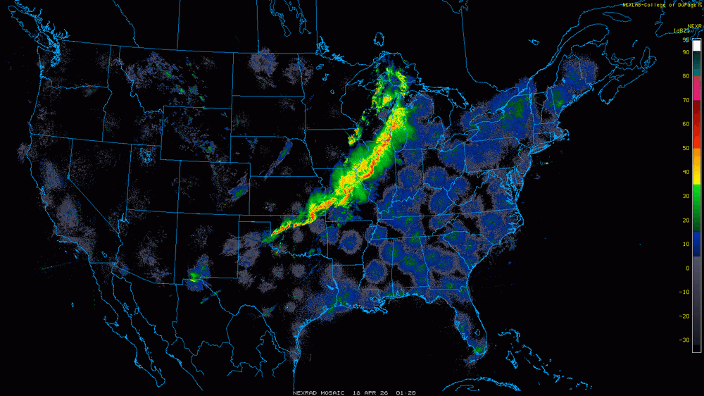
I think this qualifies as the most ridiculous squall line in the history of squall lines.
-
Yeah, folks think he's bad now, he's actually mellowed. Well, let's just say he's aged like Ripple missing the bottle cap. Way back when there were no cameras around he was the WORST! I swung on him in a hotel parking lot after happy hour and missed 30 years ago lol
-

Central PA Spring 2026 Discussion/Obs Thread
canderson replied to Voyager's topic in Upstate New York/Pennsylvania
That’s a lot of tornado warnings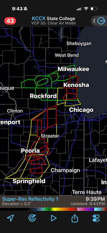
-
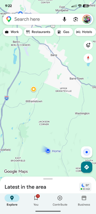
The blue dot is where my friend lives and I live in Upper Graniteville. The track was through the area labeled Jackson Corners.
-
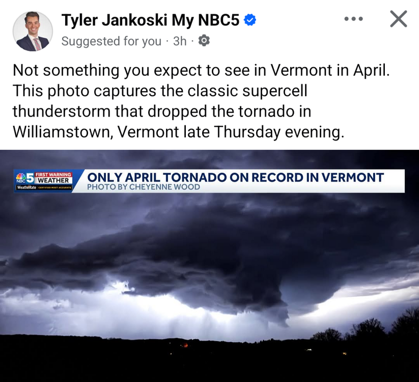
Great Picture!
-
Pretty good picture.
-

2026 Spring/Summer Mountain Thread
Tyler Penland replied to Buckethead's topic in Southeastern States
I managed a grand total of 0.01" overnight last night. Just enough to make the truck look even worse dirty. -
Narrator voice - “looks like it”
-
I agree with the 3 wild card spots if you can be around .500 around the trade deadline you have a chance. Disagree on the defense Ward and O'Neil are not going to be different players than they've been for several seasons Beavers has not been good either. Cowser is better suited in left. Not sure how you fix the D this year. Basillo is not good behind the plate. There bottom 5 in most defensive metrics
-
Waiting to see if this bowing segment near mendota makes it up here
-
Hmm, well, I may be wishcasting again. From the current MCD: Eastward expansion of WW 131 will likely be needed in the coming hours across portions of eastern IL. Drier low-level conditions downstream across IN casts some uncertainty on how intense the line will be beyond roughly the 05-06 UTC time frame into IN, but convective trends will be monitored for the need for downstream watch issuance.
-
Is that the dry slot we had during the snow storm showing up here with the more extreme part going through the triangle?
-
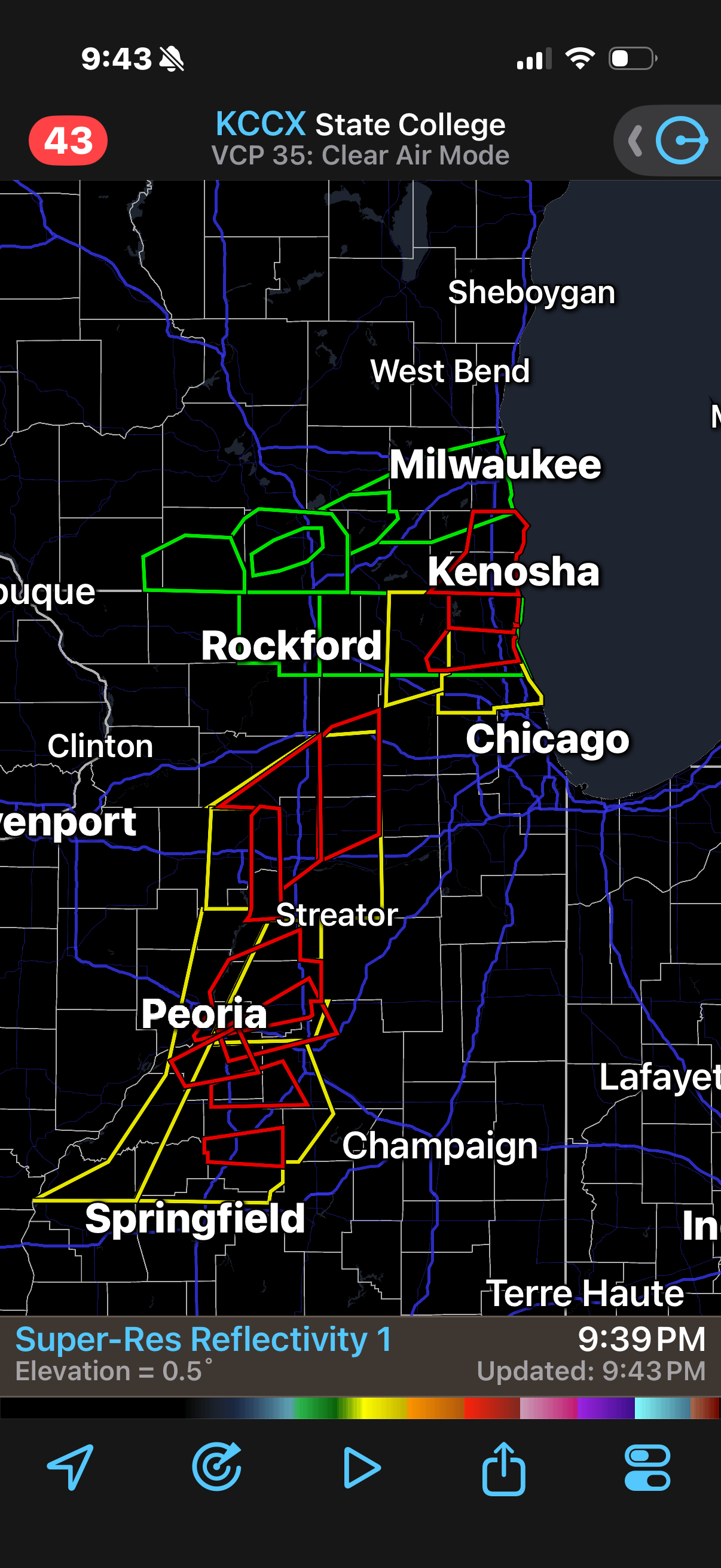
I count 16 Tornado Warnings from Oklahoma to Wisconsin right now. QLCS madness.
-
That lines still looking Shrimpy
-
Yeah, we should be able to squeeze a decent late night storm. Despite being outside of the main action area(s) these past few days, has been nice to grab consistent chance at thunder.
-
Meanwhile, in the UP... rapid melt ongoing. The persistent fog this month has returned and is ushering in much colder weather for the next couple days that will slow the melt before temps warm again next week.
-
What a run. Congrats! I feel like this line is going to hold it together enough to get us a real strong gust front tonight.