All Activity
- Past hour
-
12z/17 cycle in: No thread for the ECMWF first minor barely measurable snow NYC CP 09z/19 and the enthusiastic 11/30 I95 event which should soon be model abandoned- but offers some sort of hope? EC Ensembles are not enthusiastic for measurable snow NYC CP this month but the 12z cycle continues with a potentially wind advisory day sometime between 11/29-12/2. Right now ensembles are saying MAX G around 35 MPH then but for a 300+ hour ensemble, that is noticeably on the high side.
-
All I can say is this...if you don't see me commenting about the LR pattern, there is a reason for that. LOL. The trend has not been our friend over the weekend. But it is the LR, and things can(and likely will) change again. I still think we go cold, but I don't have a lot of model support nor a lot of confidence in that. Cosgrove has to be feeling good about now - he made a good forecast. No idea if it is right, but it is well supported, and he made that when modeling said otherwise. If forced to make a call for December(and this could change), I would say: Week 1: AN to normal Week 2: transition to normal or cold Week 3: BN Week 4: choose your own adventure book
-
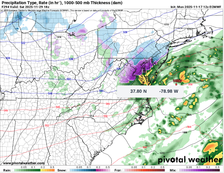
From 6am… Mike Hayes credit.

-
I hate going down the rabbit hole. I do believe they get more on average, but it’s clear there is zero controllable measurements going on and the report is a “vibe” check. I generally take the lower end of the range as logically acceptable. The upper end could be found drifted in the Face Chutes, but you aren’t finding it at a controlled sheltered measurement plot. And honestly, every single event isn’t a 12” range. Like today, we have 10” at base and 10” at top plots. Their ranges get massive really quickly by adding up to 50% for the summit. I won’t lie, that’s how we used to do it 15 years ago and I know exactly how it works. You know what you have at the bottom, and you just add inches for the top regardless. You find 10”, call it 10-14”. You measure 6”? Call it 6-10”. Just add inches and say that’s what’s at the summit. And it escalates totals REAL fast. That’s the old school Eastern snow report way. Stowe went from like a 333” average to 275-ish average when I started measuring and not basing it on vibe or adding inches “for the summit”… The other thing… it’s fukking snowy out there. If you aren’t measuring or paying attention to time frames, it all blends together. You don’t know what’s new and what’s not. What fell two days ago vs last night. Etc.

-
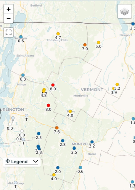
And I guess that 28” snowpack depth is for yesterday, which would be prior to most of this new snow, so it will be interesting to see what today’s depth is going to be.
-
In town I’m at like 8” on the season after 4” last night… JSpin’s gotta be double that. Outside my office is a different story, right there at Alex’s elevation.
-

November 2025 general discussions and probable topic derailings ...
tamarack replied to Typhoon Tip's topic in New England
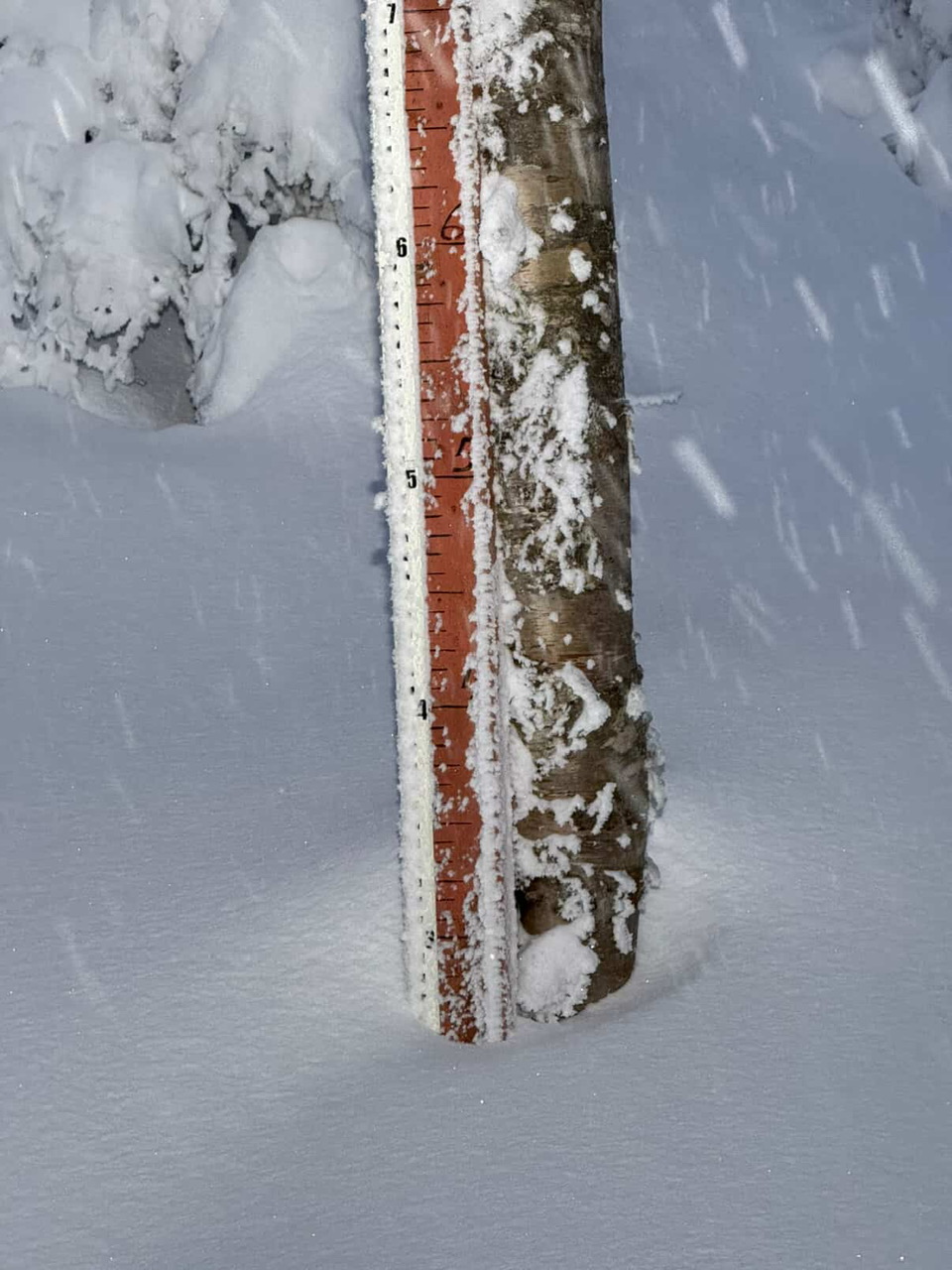
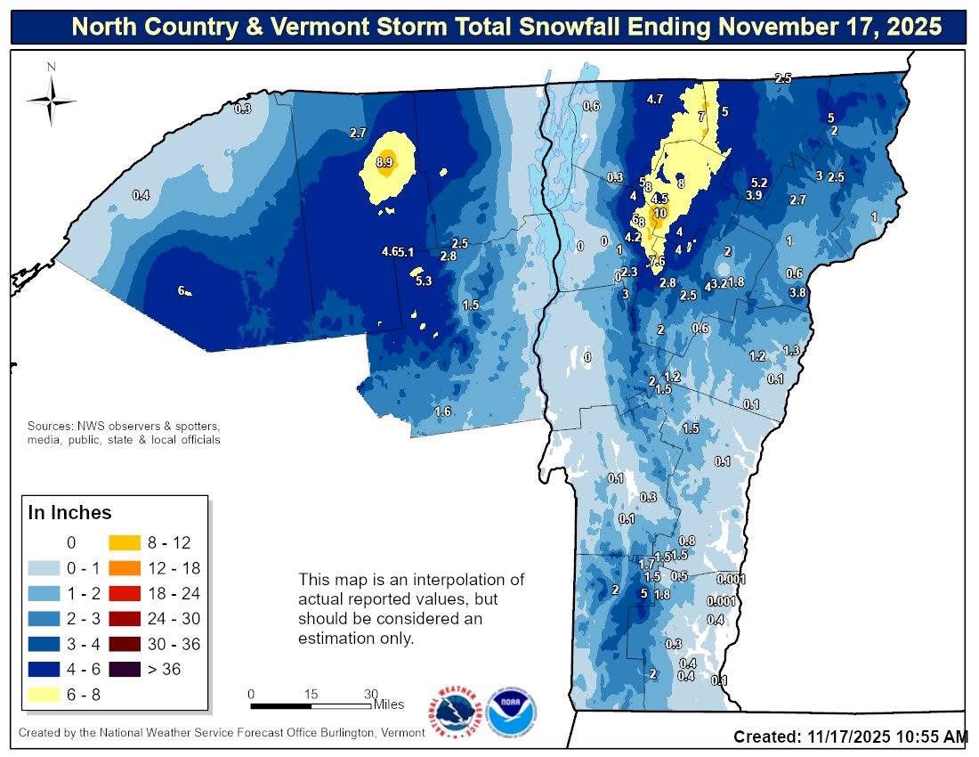
Tops I saw on cocorahs was 8.9", between Ashland and PQI. The Fort Kent pic looks more like 6-7. -
I wish the ridge flex at the end of the GFS was strong enough to get the rain to move north of us but alas, no! #FantasyRangeMusings .
-

November 2025 general discussions and probable topic derailings ...
CoastalWx replied to Typhoon Tip's topic in New England
The good stuff doesn’t happen until well after Thanksgiving. Thanksgiving week is your classic preload with the cold dump into the west and Plains and pumps up the ridge out east. No one saying 75 to 80, but it’s not gonna be cold or anything like that at all. Will average above normal. -
November 2025 general discussions and probable topic derailings ...
CoastalWx replied to Typhoon Tip's topic in New England
Dismiss this -
November 2025 general discussions and probable topic derailings ...
CoastalWx replied to Typhoon Tip's topic in New England
Way different -

E PA/NJ/DE Autumn 2025 Obs/Discussion
RedSky replied to PhiEaglesfan712's topic in Philadelphia Region
Forecast from PA Weather Action Slightly above normal from these fellers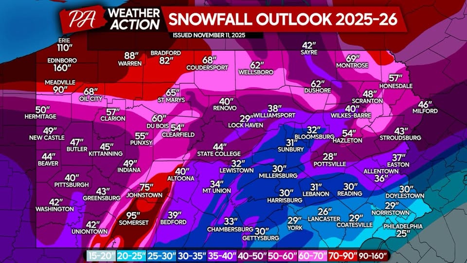
-

November 2025 general discussions and probable topic derailings ...
WinterWolf replied to Typhoon Tip's topic in New England
He likes to be neggy alot. Only has to hold for another 250 hrs…we can do it. -
Updated my records in the other thread. Leader in the clubhouse until @alex and @powderfreak add in their numbers which are probably 3x mine already!
-
GFS-AI? where can I access that?
-

November 2025 general discussions and probable topic derailings ...
MJO812 replied to Typhoon Tip's topic in New England
And once again you are dismissing the projected pattern . -
November 2025 general discussions and probable topic derailings ...
CoastalWx replied to Typhoon Tip's topic in New England
Just need to hold for 300hours. We can do it. -
That doesnt mean this winter will not be good. Its only November 17. Jeez people are already jumping off ledges.
-
You dont need a positive PNA to snow to the coast if you have other teleconnections in your favor ( im talking about further north you go ) You seem really down on this winter
-
Both the 12z Euro-AI and GFS-AI try to dump a decent shot of polar air on the CONUS during Thanksgiving weekend.
-
Early Dec looks bad for the coast, no +PNA in sight so things will cut. Remains to see what mid-late will bring.
-
A link to all the "credible" model RMM forecasts are at this link fwiw: https://www.stormsurf.com/page2/links/mjo_phase.html
-

November 2025 general discussions and probable topic derailings ...
mreaves replied to Typhoon Tip's topic in New England
My friend in PI said they got 8". -
12z Euro was nice. Temps are around 32-35 so rain/snow mix.
-
November 2025 general discussions and probable topic derailings ...
MJO812 replied to Typhoon Tip's topic in New England
Check again Euro pops a small coastal on the 30th and brings some light snow to NYC lol