All Activity
- Past hour
-

First Legit Storm Potential of the Season Upon Us
moneypitmike replied to 40/70 Benchmark's topic in New England
How much do you think we lose because of rain? -
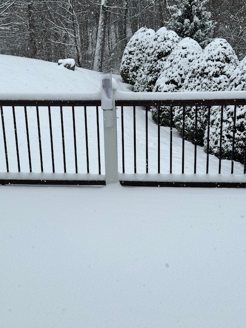
Heaviest snow is over for my location per radar. Still light to some moderate snow for next hour or so. Just measured 3.2”.
-

E PA/NJ/DE Winter 2025-26 Obs/Discussion
Hurricane Agnes replied to LVblizzard's topic in Philadelphia Region
Well this has over-achieved. Coming up on an inch here, streets and treated walks have caved. Temps are still marginal but ground has chilled. Currently 33 with dp 32. -

January 2026 regional war/obs/disco thread
Damage In Tolland replied to Baroclinic Zone's topic in New England
Maybe Moonshine? -

First Legit Storm Potential of the Season Upon Us
CoastalWx replied to 40/70 Benchmark's topic in New England
We take that. Let’s keep ticking -

Storm potential January 17th-18th
the_other_guy replied to WeatherGeek2025's topic in New York City Metro
It’s not the cold you need to storm to move further west for tomorrow. -
Nah
-
Another Coating of Snow Saturday - "It's all we Got"
Damage In Tolland replied to Sey-Mour Snow's topic in New England
Yeah it’s piling -

First Legit Storm Potential of the Season Upon Us
ORH_wxman replied to 40/70 Benchmark's topic in New England
12z euro just for tomorrows storm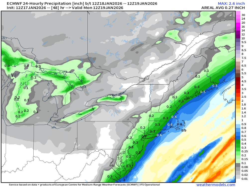
-

January 2026 regional war/obs/disco thread
Snowcrazed71 replied to Baroclinic Zone's topic in New England
Yeah our buddy Cleetus was mentionig a cutter. Hence my response. -

Storm potential January 17th-18th
BoulderWX replied to WeatherGeek2025's topic in New York City Metro
Just measure 3” in Morristown - slowing down a bit but still moderately snowing. -

Storm potential January 17th-18th
Winterweatherlover replied to WeatherGeek2025's topic in New York City Metro
ECM almost doubled totals from the 0Z run to 12Z for today and tomorrow lol -
Euro has 3-6 tomorrow for the NYC area
-

First Legit Storm Potential of the Season Upon Us
Great Snow 1717 replied to 40/70 Benchmark's topic in New England
Gotta love the .1 over Rainthuen lol -

E PA/NJ/DE Winter 2025-26 Obs/Discussion
BBasile replied to LVblizzard's topic in Philadelphia Region
No more graupel. Huge flakes now. Temp down to 36F. -

Storm potential January 17th-18th
SnoSki14 replied to WeatherGeek2025's topic in New York City Metro
This will definitely help with colder thermals for tomorrow. Dynamics are my biggest concern -

First Legit Storm Potential of the Season Upon Us
weatherwiz replied to 40/70 Benchmark's topic in New England
Looks like the heavier banding would even get back to the CT River? -
First Legit Storm Potential of the Season Upon Us
ORH_wxman replied to 40/70 Benchmark's topic in New England
That’s a big hit for SE Ma on euro. Even up into BOS. -

Storm potential January 17th-18th
Superstorm replied to WeatherGeek2025's topic in New York City Metro
I would guess graupel, maybe some sleet . -
Snowing pretty heavily right now in Whitestone. Ground whitened. Including streets.
-

Another Coating of Snow Saturday - "It's all we Got"
Baroclinic Zone replied to Sey-Mour Snow's topic in New England
Was gonna say. Radar looks damn good for CT right now. -
First Legit Storm Potential of the Season Upon Us
CoastalWx replied to 40/70 Benchmark's topic in New England
Yeah euro too -
Thanks coach. True being out past 5 days means changes are going to happen. Plus Arctic air is hard to know how far it makes it. Hopefully we get our share of some frozen precip.
-

E PA/NJ/DE Winter 2025-26 Obs/Discussion
John18 replied to LVblizzard's topic in Philadelphia Region
Haven't seen it snow this hard in a while. What a surprise in Lower Montco Sent from my SM-S938U using Tapatalk -

Storm potential January 17th-18th
WeatherGeek2025 replied to WeatherGeek2025's topic in New York City Metro
1.2


