All Activity
- Past hour
-

11/8-11/10 First Snow and Lake Effect Event
RCNYILWX replied to Geoboy645's topic in Lakes/Ohio Valley
Based on how much discussion there was on social media of the NWS snowfall maps with the huge ranges, was that a topic on here and did anyone attempt to address what those ranges represent? I'd be happy to, just don't want to rehash if it's already been covered. Sent from my SM-S936U using Tapatalk -
I can 100% see us getting 5 minutes of flurries, being "first", then not seeing anything else for the winter!
-
11/8-11/10 First Snow and Lake Effect Event
RCNYILWX replied to Geoboy645's topic in Lakes/Ohio Valley
Also if you're a Chicagoan who likes snow, getting in on any heavy LES prior to the halfway point of November is a big win and extremely rare (I don't recall any events in my time here). I believe there may have been one back in 2000. -

11/8-11/10 First Snow and Lake Effect Event
mimillman replied to Geoboy645's topic in Lakes/Ohio Valley
Not our climo. I’ll sacrifice it though for lake enhancement during the big dogs -
Snow in VA Tech and it's accumulating. Photo was taken at 9AM.
-
 Yeah nice 850mb fronto over Capital District and moving north
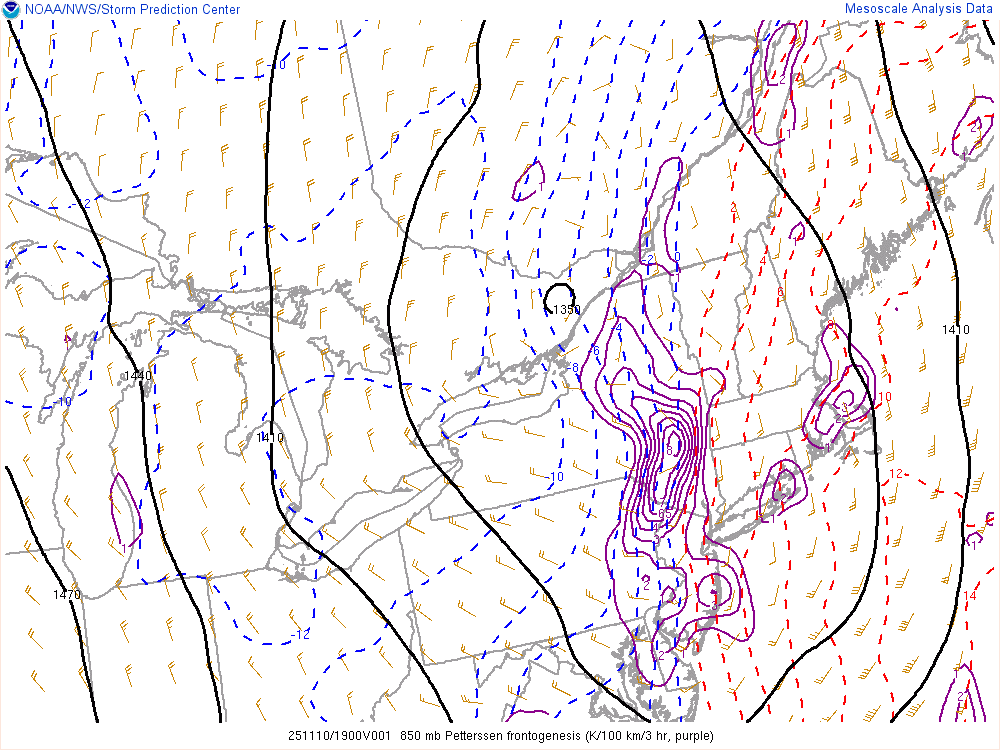
-
Getting absolutely smoked for the past 45 mins. 1.25 inch new and maybe 50-100 yards of visibility if I’m being generous. Temp fell to 19.
-

E PA/NJ/DE Autumn 2025 Obs/Discussion
RedSky replied to PhiEaglesfan712's topic in Philadelphia Region
Man that winter outlook is grim. A cold March with below normal snow lol -

November 2025 general discussions and probable topic derailings ...
powderfreak replied to Typhoon Tip's topic in New England
I think it's blocked and the trajectory of the precip moving almost due north. Probably helps to have a strong thermal gradient in there too as the cold can come into the Champlain Valley and west slopes unmitigated (it's already cooling down near freezing in the Champlain Valley). It takes a bit more for that low level cold to cross the barrier, so likely more mixed or non-snow precip to start. ECMWF and ICON are definitely a bit further east with the precipitation, but I think synoptically it would make sense for the western slopes or even Champlain Valley to wring out the moisture better. A lot of low level fog and mist around right now, feels like the low levels are juiced. Seeder feeder with mid-level lift and then low level orographic juice too. I will say it is inverted at the ski area right now. 36F at 3,600ft 38F at 2,600ft 32F at 1,500ft -

November 2025 general discussions and probable topic derailings ...
CoastalWx replied to Typhoon Tip's topic in New England
Mid levels adding a boost to this. Albany radar lighting up. -
KMRX is just an absurd radar loop right now. @Bucketheadis going to get a foot+.
-
It's definitely a day where if this was truly cold ground or if the snow came over for an hour instead of 20 minute bursts over 3 hours, we'd probably get 3 or 4 inches.
-
Is blocked flow keeping spine QPF lower than the valley? Hoping more of this can creep over and onto the immediate leeward slopes
-
11/8-11/10 First Snow and Lake Effect Event
RCNYILWX replied to Geoboy645's topic in Lakes/Ohio Valley
This. As this case shows, it's tough to get things just right for a certain location with lake effect on the south end of the lake even when there is stationary banding. The jackpot zones are almost always going to be narrow. It's what makes events like Feb 14-16, 2021 rare for the city. -
So far just virga on the radar but looks to be trying to drop down over here.
-
November 2025 general discussions and probable topic derailings ...
powderfreak replied to Typhoon Tip's topic in New England
Yeah, I'm skeptical of those QPF amounts but we'll see. If it verifies, thunder would fit. It's hard to rip out that much QPF in like 4 hours of fast moving lift in a colder air mass. It's like 4-8pm or 5-9pm and done. -
Same here. Some of the most intense snow in years, immediately followed by bright sunshine. Then repeat.
-
November 2025 general discussions and probable topic derailings ...
powderfreak replied to Typhoon Tip's topic in New England
Snowy week for the mountains. Pretty much high POPs every day.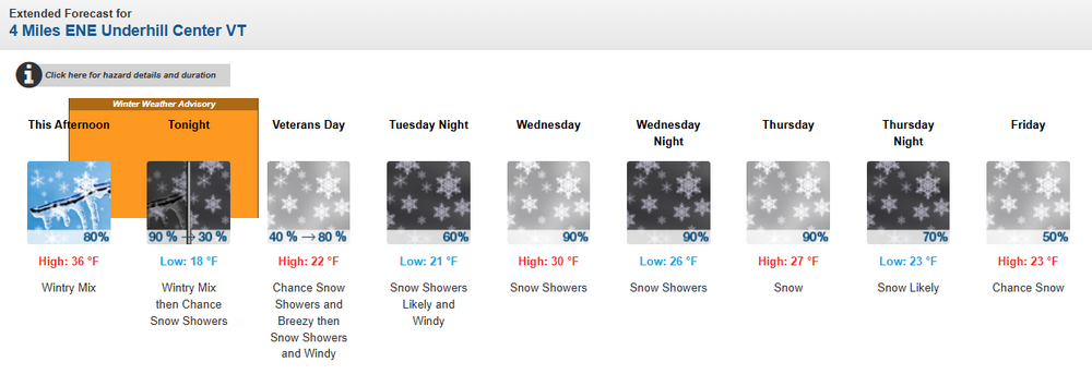
-
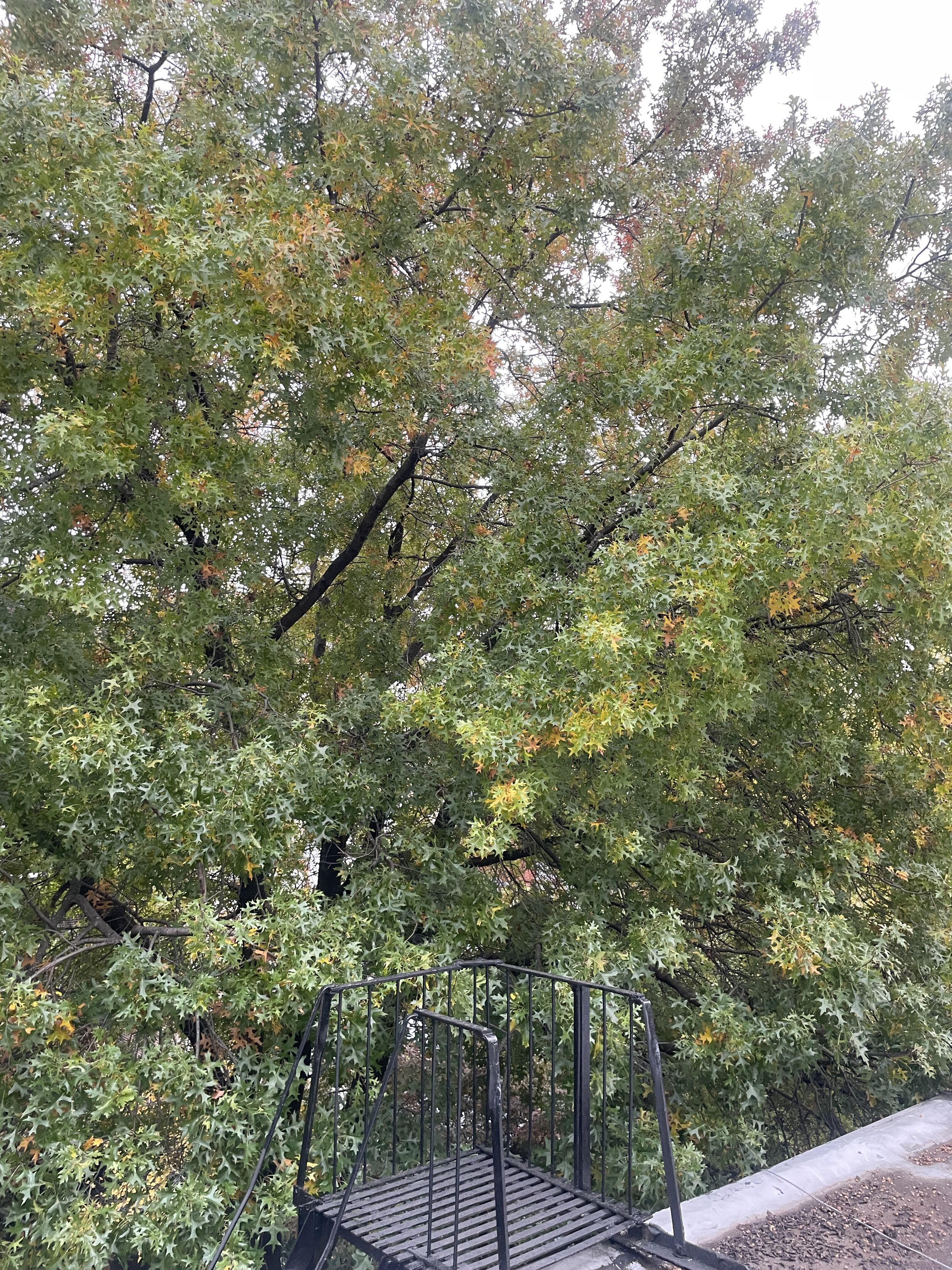
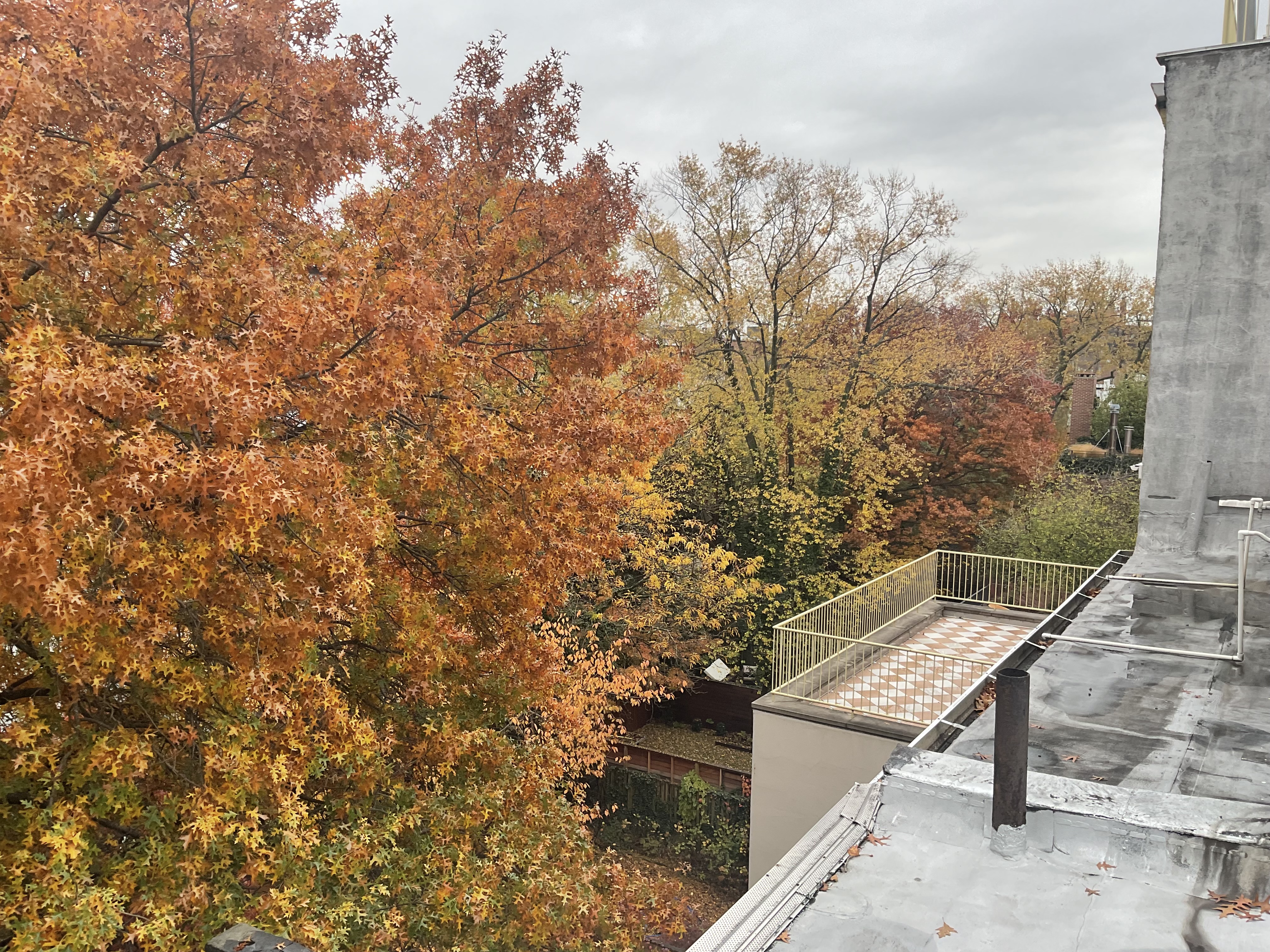
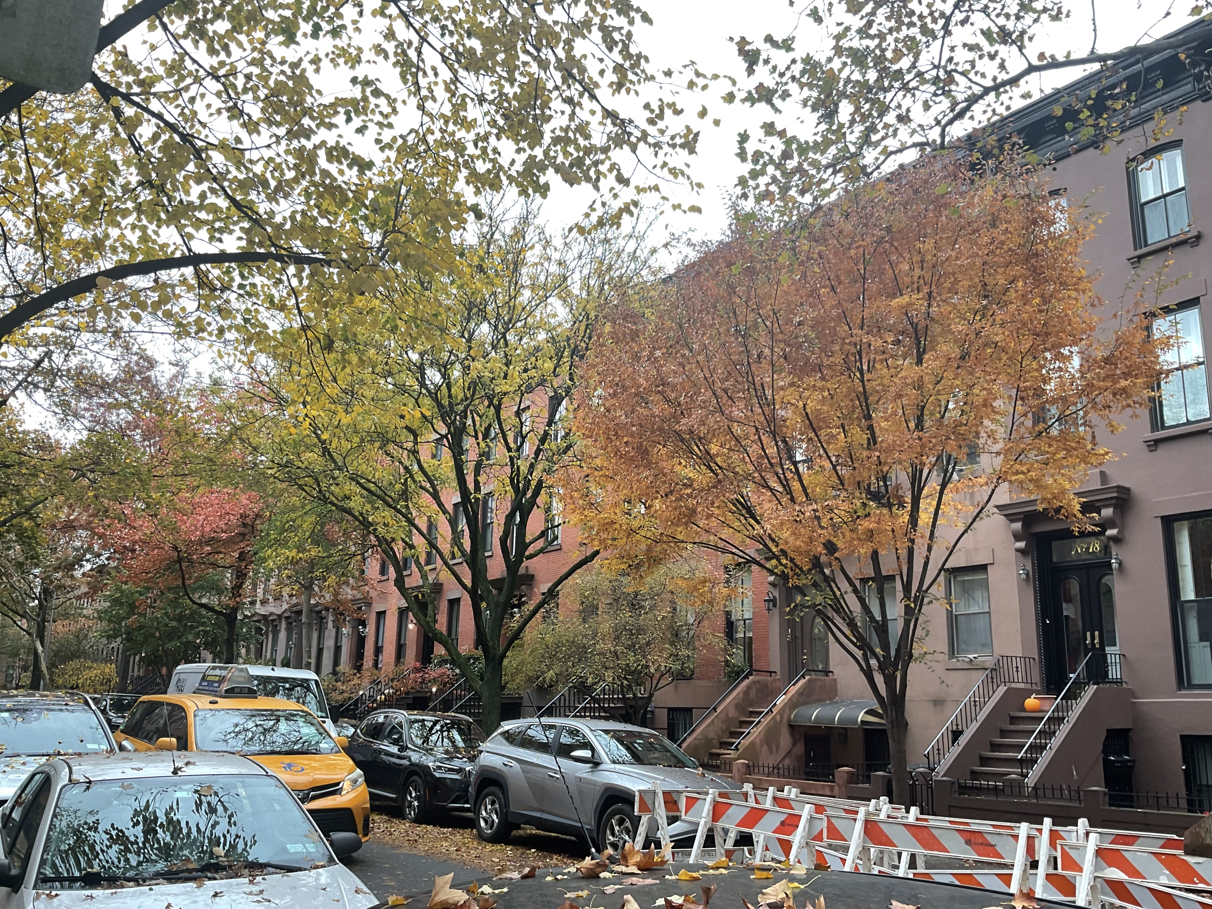
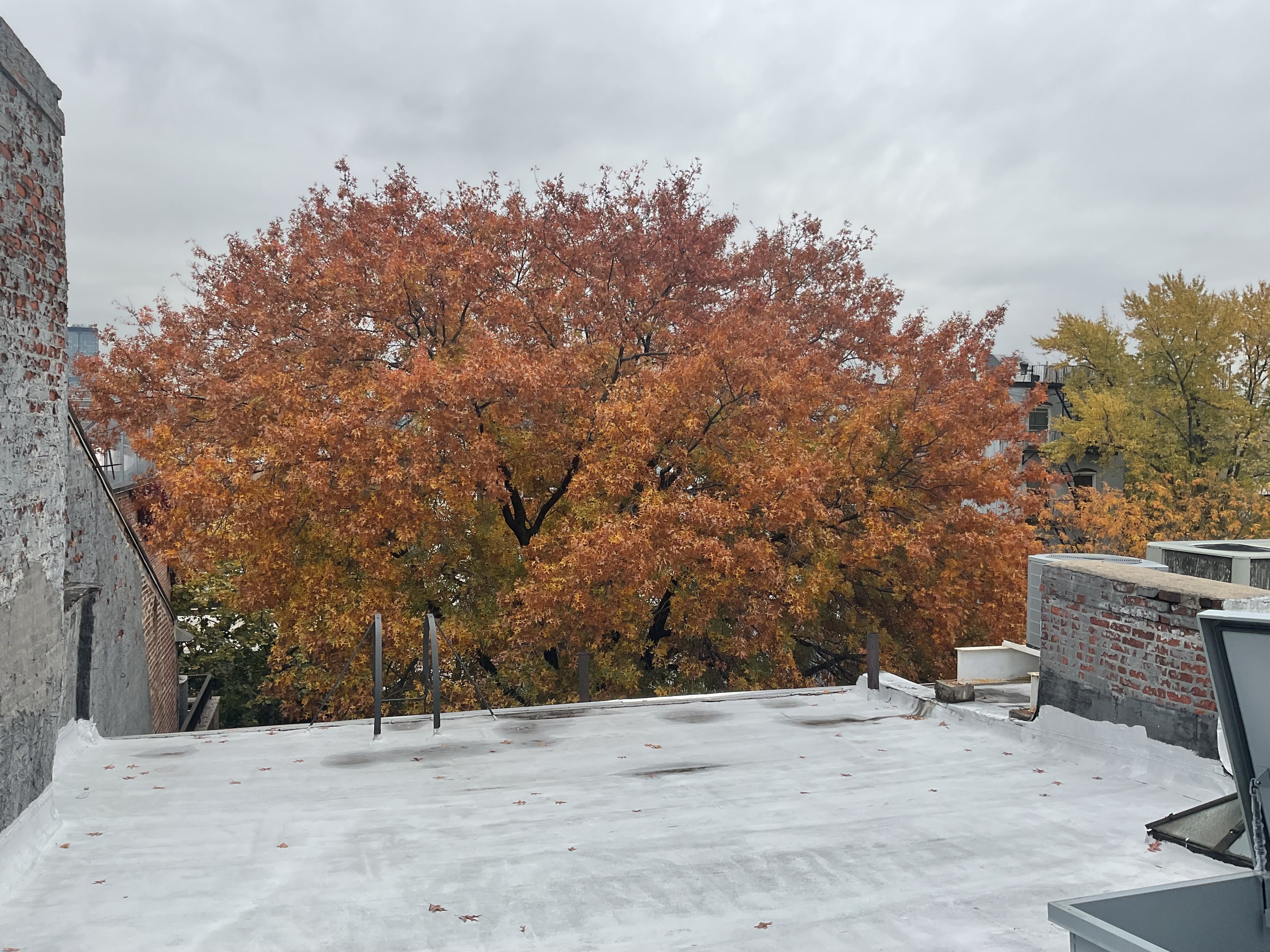
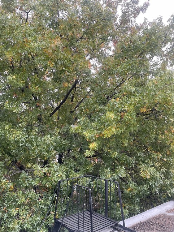
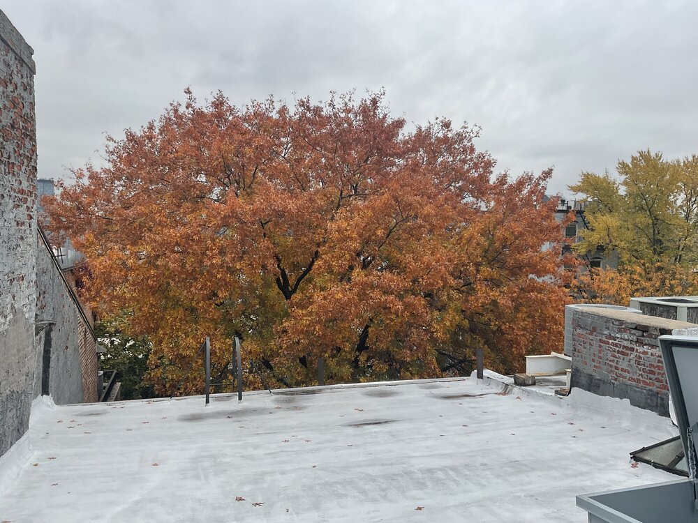
The first photo was taken Oct 29th the second today, 12 days later. The second, third and fourth photos show how a small piece of inner city Brooklyn accelerated to peak. Looking at the street side or from the backyard roof the transformation gives me a sense of peace …… because, I, like the season, am in the Autumn of my years. Stay well everyone. As always ……


-

2025-2026 Fall/Winter Mountain Thread
Maggie Valley Steve replied to Buckethead's topic in Southeastern States
Visible imagery suggests gravity waves are developing just ahead of the potent vort max. I'm starting to see some rising cumulus suggesting the possibility of thundersnow just E of the Knoxville Region. -
Yes, I wasn't expecting much activity until 3pm and beyond. MRX had to move the WWA up by a couple hours.
-
-
Heck yeah! Im working that intersection today.
-
Nice! Yeah it's been snowing here non-stop all day. Starting to lay now.
-
November 2025 general discussions and probable topic derailings ...
CoastalWx replied to Typhoon Tip's topic in New England
I wouldn’t be surprised at a few rumbles of thunder in that.