All Activity
- Past hour
-
Wouldn't mind getting rid of these leaves so my 43 solar panels get more sun. Cutting some of these down within the next 12 months, but that's here nor there.
-
or camping toay
-
Way too early but I can’t resist. Models are showing the first snowfall for the front range mid month.
-

September 2025 OBS-Discussion centered NYC subforum
psv88 replied to wdrag's topic in New York City Metro
Lots of northeast winds this month. Makes sense -
Those days are gone. Used to be Donner pass meant thigh bones and skulls .Now it's hot dogs and hamburgers...
-
My daughter's report from around Campton New Hampshire. Foliage pretty much sucks. Lots of dried and dead leaves. Beautiful day for a hike though.
-

September 2025 OBS-Discussion centered NYC subforum
Sundog replied to wdrag's topic in New York City Metro
The spread between LGA and Newark is pretty significant for a monthly anomaly no? -
September 2025 OBS-Discussion centered NYC subforum
SACRUS replied to wdrag's topic in New York City Metro
Sep Dep's ISP: +2.6 EWR: +2.4 TTN: +1.6 NYC: +1.3 JFK: +1.0 LGA: +0.6 -

September 2025 OBS-Discussion centered NYC subforum
Sundog replied to wdrag's topic in New York City Metro
The 18z GFS has tons of below normal temps for much of the run. I choose to believe it for no other reason than I simply like what it shows. -
September 2025 OBS-Discussion centered NYC subforum
SACRUS replied to wdrag's topic in New York City Metro
Highs EWR: 83 PHL: 83 New Brnswck: 82 ISP: 82 TEB: 81 JFK: 81 TTN: 81 NYC: 81 LGA: 80 ACY: 79 BLM: 77 - Today
-
My month end stats: Highest temp: 94 Lowest temp: 60 Highest dew point: 80 Lowest dew point: 58 Rainfall: 5.27" most if this coming in the last 8 days.
- Yesterday
-
Check this out. It turns out that Humberto and Imelda are the two closest Atlantic hurricanes on record (at 467 miles) other than a highly unreliable two unnamed hurricanes in 1853 (428 miles apart). Next closest of reliable years was Easy and Fox in 1950 (497 miles)!
-
Northeast flow from the two hurricanes triggering flood advisories. Along the coast.
-
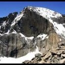
Looking over the mountains somewhere around the Spanish Peaks/Walsenburg with aspen trees
-
let it snow!
-
Guidance hinting that late next week could be first legit cold front
-

September 2025 OBS-Discussion centered NYC subforum
Roger Smith replied to wdrag's topic in New York City Metro
In Sept 1882 as indicated the massive rainfalls 22nd-23rd were in advance of landfalling TS4, and the 2.57" on the 11th plus 0.66" on 12th was due to passage of Hurricane Two (by then only a TS) across the Delmarva Peninsula after a landfall near Mobile (Navarre FL) on the night of 10th-11th. Between those, TS3 of 1882 was a weaker event that moved into TX around the 16th. -
Front going through? Clouds trying to clear and a little breeze out of the NE.
-
September 2025 OBS-Discussion centered NYC subforum
SACRUS replied to wdrag's topic in New York City Metro
Thanks September 1882 New York City Weather Day High (°F) Low (°F) Precip. (inches) Snow (inches) September 1 81 69 0.07 0.0 September 2 85 70 0.00 0.0 September 3 80 72 0.00 0.0 September 4 82 72 0.64 0.0 September 5 79 68 0.00 0.0 September 6 76 65 0.00 0.0 September 7 79 63 0.00 0.0 September 8 82 66 0.00 0.0 September 9 73 63 0.16 0.0 September 10 68 62 0.00 0.0 September 11 67 59 2.57 0.0 September 12 70 57 0.66 0.0 September 13 69 53 0.00 0.0 September 14 77 64 0.09 0.0 September 15 73 63 0.00 0.0 September 16 76 58 0.00 0.0 September 17 74 60 0.00 0.0 September 18 80 65 0.00 0.0 September 19 87 69 0.00 0.0 September 20 84 72 0.29 0.0 September 21 72 62 1.21 0.0 September 22 72 62 2.34 0.0 September 23 66 55 8.28 0.0 September 24 69 55 0.02 0.0 September 25 62 55 0.04 0.0 September 26 63 56 0.05 0.0 September 27 62 51 0.00 0.0 September 28 55 48 0.16 0.0 September 29 60 48 0.27 0.0 September 30 68 50 0.00 0.0 -
Before August was a different story.
-
My standard reminder to NYC participants in forecast contest, tick tock ... deadline is tonight (more or less).
-

September 2025 OBS-Discussion centered NYC subforum
Roger Smith replied to wdrag's topic in New York City Metro
The 88 _ 90 _ 94 of Oct 4 to 6 1941 was the latest not quite a heatwave by official definitions, and mid-October 1954 had three in a row over 84 F. The wet September is a typo, it was actually 1882. And what caused it was mainly a slow-moving tropical storm (TS 4 of 1892) moving up the east coast 22nd to 24th. About three quarters of the month's massive total occurred in that time frame. The TS crossed Long Island with a landfall at Mastic Beach. -
The September 2025 temperature at DCA was a tad below normal at 72.3 degrees, vs 72.4 during 1991-2020. Similarly, precipitation there was 3.72 inches vs 3.93 during 1991-2020. The January-September 2025 temperature averaged 63.0 degrees at DCA, compared with 64.7 last year and the record warm 65.1 during January-August 2012.
-

September 2025 OBS-Discussion centered NYC subforum
donsutherland1 replied to wdrag's topic in New York City Metro
I thought I had included the 1895 but typed too fast. The 1914 heatwave tied the 1895 one for the latest on record at Central Park.


.jpg.951fc00ae5aaf18d2dba7215aa827c78.jpg)
.jpg.4bd848133b12ebfd84557bed97077b0a.jpg)


