All Activity
- Past hour
-
All snow now but about an hour later than modeled . Novelty
-

December 2025 Short/Medium Range Forecast Thread
*Flash* replied to John1122's topic in Tennessee Valley
Man, that pink is hot. -
look at the bright side, we are a cool spot!
-
Sitting in my car at cel phone lot at jfk. Blowing so hard the car is shaking
-
Weeklies corrected big time. It finally pops a positive PNA.
-

Central PA Winter 25/26 Discussion and Obs
Superstorm replied to MAG5035's topic in Upstate New York/Pennsylvania
Snow flurries . -
From 60 to mixed bag in the lower valley.....kind of cool
-
Wet snow! Mixed with rain and cat paws.....32 down from 37 20 minutes ago
-

December 2025 Short/Medium Range Forecast Thread
Daniel Boone replied to John1122's topic in Tennessee Valley
Depends on strength of each really. Location of NAO as well. -

Central PA Winter 25/26 Discussion and Obs
canderson replied to MAG5035's topic in Upstate New York/Pennsylvania
Snow is all gone here so would be nice to get a little cover Christmas week. -
Do you need model guidance for that? Look at any common weather app on your phone…it has been there for days. December is done
-

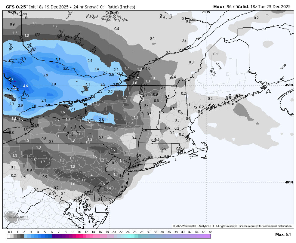
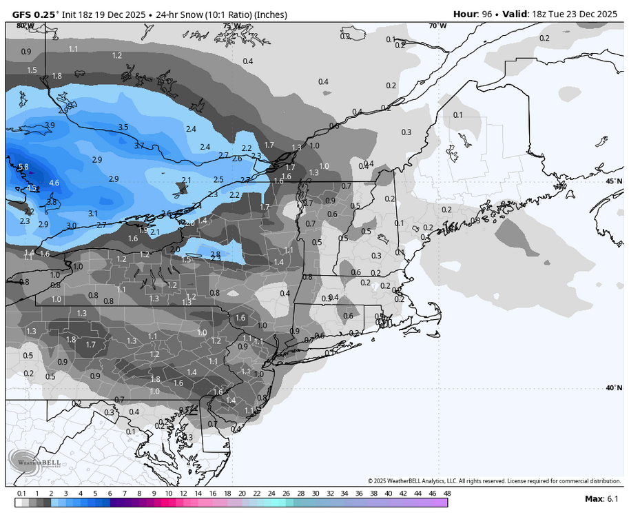
Central PA Winter 25/26 Discussion and Obs
Blizzard of 93 replied to MAG5035's topic in Upstate New York/Pennsylvania
The 18z GFS got more interesting for the Tuesday am weak wave chance. This run gets 1 to 2 inches of snow into the LSV.
-

Winter 2025-26 Medium/Long Range Discussion
A-L-E-K replied to michsnowfreak's topic in Lakes/Ohio Valley
Tone sincere: not necessarily But despite the hot start, this season still has dud stank -
Not a big deal. Some big gusts for 5 minutes or so.
-
Quite windy in Denville. Roaring outside
- Yesterday
-
January 2021 also sucked until the final day
-
Some more very high winds of 60-110 mph in Boulder
-
Blowing close to if not over 50 mphs now sounds furious
-
Ok.
-

December 2025 regional war/obs/disco thread
40/70 Benchmark replied to Torch Tiger's topic in New England
Shocking it would favor that corridor. -
Cooler air is now pouring into the region. The weekend will turn somewhat cooler. No exceptionally cold or warm weather appears likely for the first week of astronomical winter. In terms of precipitation, some rain or snow showers are possible on Tuesday. The closing week of December could experience periodic warmer and cooler days. It now appears that the cooler anomalies will persist mainly in central and northern New England. The probability that December 2025 will have a maximum monthly temperature below 60° has continued to increase. The last time that happened was in 2019 when the monthly high was 58°. If 2025 has a monthly high below 60°, that would be only the fifth such occurrence since 2000 (2003, 2004, 2005, and 2019 are the cases since 2000). The ENSO Region 1+2 anomaly was -0.3°C and the Region 3.4 anomaly was -0.7°C for the week centered around December 10. For the past six weeks, the ENSO Region 1+2 anomaly has averaged -0.33°C and the ENSO Region 3.4 anomaly has averaged -0.67°C. La Niña conditions will likely continue through at least mid-winter. The SOI was -1.19 today. The preliminary Arctic Oscillation (AO) was +2.327 today. Based on sensitivity analysis applied to the latest guidance, there is an implied near 98% probability that New York City will have a cooler than normal December (1991-2020 normal). December will likely finish with a mean temperature near 34.3° (4.8° below normal). Supplemental Information: The projected mean would be 3.1° below the 1981-2010 normal monthly value.
-
Nice late December mcs rolling thru
-

December 2025 regional war/obs/disco thread
Damage In Tolland replied to Torch Tiger's topic in New England
Slowly correcting colder -
Mehthuen
-
Some flakes mixing in but this will be too little too late for anymore