All Activity
- Past hour
-

September 2025 OBS-Discussion centered NYC subforum
winterwx21 replied to wdrag's topic in New York City Metro
Remember all the fires we had last fall. It was horrible. I don't know why anyone would want to see a severe drought. Obviously you don't garden lol. -
I would’ve named yesterday before this one and that Mid-Atlantic low wasn’t even tropical lol. I guess they had to go with continuity once they declared it a depression.
-
-

September 2025 OBS-Discussion centered NYC subforum
LibertyBell replied to wdrag's topic in New York City Metro
October of last year lol. We might repeat that next month except without that annoying phantom *.01* to end the month. I am a perfectionist and I want to see 0 one of these months.... -
September 2025 OBS-Discussion centered NYC subforum
LibertyBell replied to wdrag's topic in New York City Metro
Highs:EWR: 95 (1991)NYC: 93 (1991)LGA: 95 (1991)JFK: 90 (1991) a straight sweep for 1991! In our truly great summers, like 1983, 1991, 1993, 2002 and 2010 we had temperatures in the 90s well into September (mid September or later.) -

September 2025 OBS-Discussion centered NYC subforum
MANDA replied to wdrag's topic in New York City Metro
It is a good thing that event earlier in the month over performed. Think of where we would be without that for this month! -

September 2025 OBS-Discussion centered NYC subforum
SACRUS replied to wdrag's topic in New York City Metro
Highs: EWR: 95 (1991) NYC: 93 (1991) LGA: 95 (1991) JFK: 90 (1991) Lows: EWR: 44 (1950) NYC: 45 (1986) LGA: 48 (1986) JFK: 48 (1958) Historical: 1911: Pipestone, MN is hit with baseball-sized hail that smashes numerous windows at the Calumet Hotel and high school. The local observer measured hail three inches deep. People got their photos taken in automobiles surrounded by the icy white ground. (Ref. AccWeather Weather History) 1932 - Concord NH was drenched with 5.97 inches of rain in 24 hours to establish a record for that location (16th- 17th). (The Weather Channel) 1947: A Hurricane moved in from the Atlantic over Palm Beach and Broward Counties in Florida. Hurricane force winds were experienced along the Florida East Coast from Cape Canaveral to Carysfort Reef Light, south of Miami, while winds of over 100 mph were felt from the northern portion of Miami to north of Palm Beach, or about 70 miles. A 1-minute maximum wind speed of 155 mph was recorded at the Pompano Beach light station. Dozens of people were killed in this storm. It went on to hit the New Orleans, LA area. (Ref. Wilson Wx. History) 1957: Tropical Storm Ester hits the Louisiana Coast. (Ref. Daily News Record Newspaper - Harrisonburg, Virginia) 1960: 23 inches of snow at Rawlins, WY and over 20 inches at Lander set new early season snowfall records for both locations. (Ref. AccWeather Weather History) 1961: A powerful thunderstorm struck Las Vegas, NV with high winds and huge hailstones that racked up the community from one end to the other. The Strip was especially hit hard by the sudden fury of the storm, which blasted down virtually all of the big signs in the resort area and tore part of the roof off the Dunes Hotel. Dozens of homes and businesses had roofs ripped off and/or windows broken by the winds which had gusts to an estimated 80 mph and golf ball sized hail. (Ref. Wilson Wx. History) 1963 - Nearly two and a half inches of rain fell at Yuma AZ in 24 hours. It was the most intense rain for Yuma during the period between 19S09 and 1977. (The Weather Channel) 1965 - A storm produced a band of heavy snow across parts of Wyoming. Totals of 23 inches at Rawlins and 20.7 inches at Lander easily surpassed previous snowfall record totals for so early in the season. (15th-17th) (The Weather Channel) 1971: Boulder, CO was buried under 21 inches of snow and Denver recorded 15.6 inches. Damage to trees and power lines was extensive due to the snow being wet and heavy. Record breaking cold followed the early season snowstorm. Further north, 8 inches of snow fell at Red Lodge, MT beginning the day before ending on this date. Other totals included: Mystic Lake, MT: 5 inches, Livingston, MT: 1 inch and a trace reported at Billings, MT. (Ref. AccWeather Weather History) 1987 - Thunderstorms produced large hail, damaging winds, and heavy rain in the northeastern U.S. Heavy rain in southwestern Pennsylvania forced evacuation of twenty homes along Four Mile Run Creek, near Darlington. Harrisburg PA established a record for the date with 2.11 inches of rain. A cold front in the central U.S. brought freezing temperatures to parts of Montana and Wyoming. (The National Weather Summary) (Storm Data) 1988 - Early in the morning a tornado hit Kelly Air Force Base in San Antonio, TX, injuring three persons and causing twenty-eight million dollars damage. A second tornado on the northwest side of San Antonio caused six million dollars damage, and a third tornado in Bexar County killed one person and injured another. Thunderstorms associated with Hurricane Gilbert spawned a total of forty-seven tornadoes in a two day period, with forty of those tornadoes in central and south central Texas. (Storm Data) (The National Weather Summary) 1989 - Hurricane Hugo hit the Virgin Islands, producing wind gusts to 97 mph at Saint Croix. Hurricane Hugo passed directly over the island of Saint Croix causing complete devastation and essentially cutting off the island from communications. A storm surge of five to seven feet occurred at Saint Croix. The only rain gauge left operating, at Caneel Bay, indicated 9.40 inches in 24 hours. Hurricane Hugo claimed the lives of three persons at Saint Croix, and caused more than 500 million dollars damage. A ship, Nightcap, in the harbor of Culebra, measured wind gusts as high as 170 mph. A cold front brought high winds to the Great Basin and the Rocky Mountain Region, and thunderstorms along the cold front produced wind gusts to 66 mph at Yellowstone Park WY. (Storm Data) (The National Weather Summary) 2000: For the second straight day, the record high of 95° at Denver, Co set three records: 1.) New record high for the date. 2.) The warmest reading for this late in the year. 3.) It marked the 61st day during the year the temperature reached 90° or above, beating the record set the previous day and first set on 9/29/1994. Cheyenne reached a high of 91°, which is the latest day in history that Cheyenne reached at least 90°. Other daily record highs included: Rapid City, SD: 101°, Scottsbluff, NE: 99°, Bishop, CA: 97°-Tied, Pueblo, CO: 96°, Winslow, AZ: 96°-Tied, Clayton, NM: 95 °F. (Ref. Wilson Wx. History) 2004 - The remnants of Hurricane Ivan submerged Pittsburgh in 5.95 inches of rain in one day. That is the most rainfall Pittsburgh has seen in a 24-hour period since records began in 1876. -

September 2025 OBS-Discussion centered NYC subforum
jm1220 replied to wdrag's topic in New York City Metro
Or zero. Maybe one or two what I would call showers and that’s it. -
I have .91 so far just southeast of Fallston.
-

September 2025 OBS-Discussion centered NYC subforum
anthonymm replied to wdrag's topic in New York City Metro
80s type snowfall pattern too, but even less. -
September 2025 OBS-Discussion centered NYC subforum
LibertyBell replied to wdrag's topic in New York City Metro
we had way too much rain for way too long Chris -
September 2025 OBS-Discussion centered NYC subforum
LibertyBell replied to wdrag's topic in New York City Metro
almost like 1966 -
September 2025 OBS-Discussion centered NYC subforum
LibertyBell replied to wdrag's topic in New York City Metro
the cycle has switched to an 80s type pattern -
September 2025 OBS-Discussion centered NYC subforum
LibertyBell replied to wdrag's topic in New York City Metro
Remember this in the winter too -
September 2025 OBS-Discussion centered NYC subforum
LibertyBell replied to wdrag's topic in New York City Metro
Sunshine and warmth is way better than this crap. -
Reupped my EPIC northeast value pass. Only 50 mins to Mount Snow with having occasional midweek flexibly makes it a no brainer. I was weighing my options and came to the conclusion that if you're not skiing Saturday it's a not a bad place to be. It's not very steep but it's not completely flat either. It has some decent natural snow trails and the on and off map woods can be fun. The bonus of Stowe is nice plus the northern NH epic hills are a blast especially Wildcat. I actually had a killer day at Okemo of all places last January, skied only woods and natural snow trails the entire day, pretty fun times really. Maybe being 44 I'm not as inclined to seek the gnar so I'm just enjoying skiing more no matter where it is.
-
Franklin county is getting the goods today Sent from my SM-G970U1 using Tapatalk
-
Looking at radar things seem to be winding down. With what I got last night and then today I am sitting at about 1.50”. Honestly I am surprised. I really felt that this would stay South. But it was so needed.
-
September 2025 OBS-Discussion centered NYC subforum
winterwx21 replied to wdrag's topic in New York City Metro
I know it wasn't looking impressive, but I was hoping for at least a quarter inch today to give things a watering. Terrible that we're going to see almost nothing. That inch and a half that we got a week and a half ago helped, but now it's back to having to water the vegetable garden almost every day. That rain helped hold off the developing drought a little bit too, but now we'll be going into at least a moderate drought here with no rain in sight. Frustrating, but unfortunately we're getting used to the extremes. We either get way too much rain or not nearly enough. I miss the days of getting normal rainfall. It makes it tough for vegetable gardeners. -
Wxfella ratter season. Hope winter follows with a dud, seems to happen frequently after statistically boring ATL seasons
-
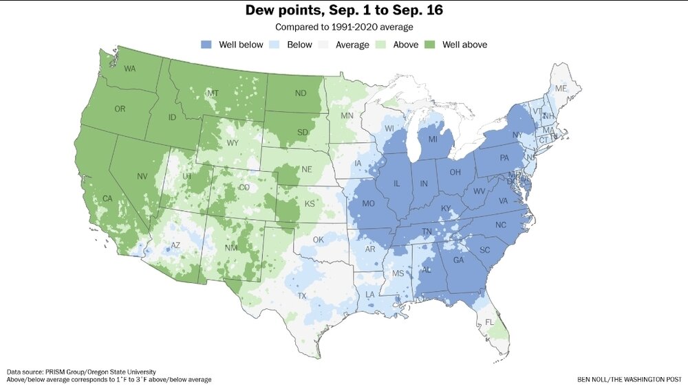
"Dews right through November!" Lolz
-
I have a thing or two to say! First thing- this might take the cake as the most questionably named TS ever! Second thing- I still don’t see a defined center and they even mentioned it is marginally organized at best. I guess the assumption is it keeps organizing through the day but man that’s a questionable call with multiple circulations within a broad wave axis
-
I bet Bastardi will have a thing or two to say about this upgrade lol.
-
Closing in on 0.50” which is more than most models had for here.
-

2025-2026 ENSO
40/70 Benchmark replied to 40/70 Benchmark's topic in Weather Forecasting and Discussion
I think this season can still safely be lumped into the solar max bin.


