All Activity
- Past hour
-
Our daughter was in S VT doing her Field Work on the side of a mountain all day. Got caught in an hours long soaker. Fun times
-
 June DCA _ NYC _ BOS _ ORD _ ATL _ IAH _ DEN _ PHX _ SEA 1.7 1.3 1.1 2.1 1.0 0.3 2.2 2.0 2.2
 -
Looks like the end of the week into the weekend. Week after light her up.
-
Looks like some more rain coming in this evening.
-
Incoming for Scott?
-
This happens a lot in the Plains w/ LP supercells as the hail is thrown downwind of the storm. It also happens at times in the Desert SW when the tstm is all virga but the hail makes it to the ground!
-
1/2” hail reported in N Conway
-
Keep that up north. Thanks. I hand pollinated my pawpaws a week ago and I have fruit set for the first time.
- Today
-
Rain started here ~45 minutes ago and it has gotten heavy at times as boundaries collide over this area per radar. This is a really nice rain that I’m thinking will approach or just exceed 1” and could go a good ways up from there if this continues awhile. There’s been no thunder/lightning associated with this. Update at 7:30PM: rain is still falling (going on 1.5 hours) and there have been additional heavy periods. As a result, I’m very likely near 2” at a minimum and counting! That makes this the best rain in months! My street drains are handling this well. In the past with a rain of this magnitude, it would typically flood. Thus I think the city digging the nearby ditches deeper is helping the flow into the drains!
-
Looks like CWG spun off from the WAPO and is now just “Capital Weather” with a website/app. https://www.capitalweather.com
-
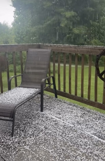
Decent pea-sized hailer around these parts.
-
Such an amazing day! Enjoying dinner on our patio.
-
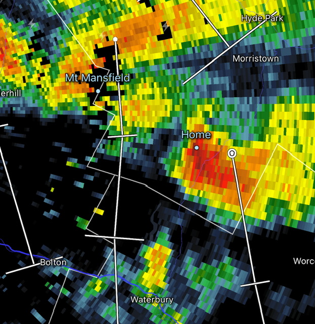
Heavy hail now.
-
Looks like the high will be 74.8 degrees here, currently 74.1/55.6 with just a few high cirrus and altostratus clouds. Today ends the 'freezing season' as the last/latest 32 or lower is today from 1984.
-
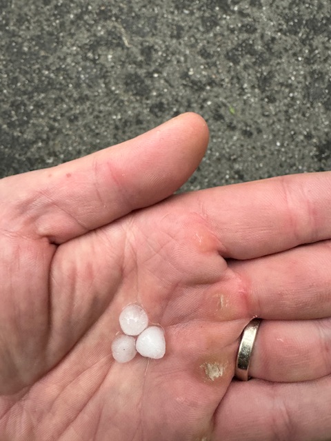
Not sure I’ve ever seen a shower start off with hail. Ground not even wet, just started as ice (peas).
-
 El Nino isn't coupling with PNA or the North Pacific High so far. -PDO hit some lowest monthly numbers in 150 years, over the last few years. Interesting battle this Summer.
- 75 replies
-
- 1
-

-
- let the flood gates open
- oh thats where the moisture is
- (and 1 more)
-
High: 96 on 5/19 Low: 40 on 5/2 2.62" for the month.
-
 Warmest weather relative to seasonal averages in June and early July, then we trend down in later July and August. Wishful thinking, or possible outcome with the El Nino coupling faster than expected.
 -
The day started off with near record low temperatures and even some record lows in parts of the region. Lows included: Allentown: 41° Atlantic City: 43° Bridgeport: 45° Danbury: 37° Islip: 43° New Haven: 43° New York City-Central Park: 50° New York City-JFK Airport: 48° (tied record set in 1966 and tied in 1977 and 2023) New York City-LaGuardia Airport: 54° Newark: 46° Philadelphia: 52° Poughkeepsie: 37° Westhampton: 31° (old record: 34°, 2008) White Plains: 42° Overall, New York City finished May with a monthly mean temperature of 63.2°, which is the normal 1991-2020 value. That was 0.8° warmer than the earlier 1981-2010 baseline. The first week of June will likely see temperatures average somewhat below normal to near normal. However much warmer weather could arrive on Friday and then continue through the first weekend of June. The ENSO Region 1+2 anomaly was +2.1°C and the Region 3.4 anomaly was +1.0°C for the week centered around May 20. For the past six weeks, the ENSO Region 1+2 anomaly has averaged +1.72°C and the ENSO Region 3.4 anomaly has averaged +0.83°C. The ongoing El Niño will continue to strengthen through the summer. The SOI was -14.84 today. The preliminary Arctic Oscillation (AO) was +0.251 today.
-
 DCA: +0.3 100 NYC: +1.1 100 BOS: +1.7 101 ORD: +2.2 101 ATL: +0.4 99 IAH: +0.8 105 DEN: +1.9 104 PHX: +2.3 118 SEA: +2.4 97
 -

Anomalous Late Spring storm May 30 2026
Damage In Tolland replied to HoarfrostHubb's topic in New England
Where can we send you ? AZ? -
The crazy part is, even sometimes SW CT can have vastly different conditions than NYC METRO during an event. Then forget about central CT..it can be night and day differences on multiple ends of the spectrum.
-
It's in the mid 70s as near by as Pennsylvania. Looping the satellite and looking at various obs give the allusion to sawing off summer with this NW deep layer band saw. Watching the sat loop you can just hear the whir of blade. anyway... looking at MEX 12z surprisingly warm this week around the KBDL-KFIT-KASH arc, within which I'm located... 78 Tues, then 80s or around 80 into next weekend... Maybe there's an end to this coldest area relative to climo on the planet bullshit.
-
We dry. We’ve managed to dodge appreciable rains pretty much all month
-
2026-2027 Strong/Super El Nino
Stormchaserchuck1 replied to Stormchaserchuck1's topic in Weather Forecasting and Discussion
12z EPS really warmed up over the Great Lakes/Northeast in the medium/long term. Anti-El Nino.