All Activity
- Past hour
-
88 has been the high in the warmest spots
-
But I feel Barry’s got a good point about this making it pretty easy to claim getting it “right”. NOAA predicted a range of 13-19 NS 6-10 HU 3-5 MH Since 1995 (active era). there have been 21 non-Nino seasons. Of those 21 seasons: 1. NS: 17 (81%) were within 13-19 2. H: 15 (71%) were within 6-10 3. MH: 13 (62%) were within 3-5 If there’s going to be a range, I’d prefer it be smaller..maybe half the size.
-

2025 Atlantic Hurricane Season
BarryStantonGBP replied to BarryStantonGBP's topic in Tropical Headquarters
They just predicted the whole 2016-24 arc compressed into one average -
temp dropping quick under this down to 40.2
-
temp down to 44 off a high of 47. not quite the way DIT and TKitty drew up their ideal summer day
-
hard to tell but maybe some flakes mixing in on this webcam https://franklinpierce.edu/webcam_monadnock/index.html
-
Didn't the usual warm spots already hit 90? I thought we did a few weeks ago when it was hot for a few days.
-
I don't have a wife and never will (thanks autism) so maybe I'll have to make a trip
-
I think we have to wait until later if we even get anything
-
If there is a chance for catpaws, it's under that. Fat drops mean that.
-

Central PA Spring 2025
Mount Joy Snowman replied to canderson's topic in Upstate New York/Pennsylvania
After some imposters tried to steal the crown in recent weeks, the rightful kings have returned to their throne, with the national high and low of 109 and 17 occurring at Death Valley and Peter Sinks, respectively. -
Radar looks much healthier than I expected. I looked like it was raining again here in Columbia after a pretty decent lunchtime walk.
-
90 DP 79, really struggling to get convection going... meanwhile you guys get cold rain, bummer Sent from my Pixel 9 using Tapatalk
-

2025 Spring/Summer Mountain Thread
Maggie Valley Steve replied to Maggie Valley Steve's topic in Southeastern States
It's been an incredibly windy day in the Valley with wind gusts exceeding 40 mph at times. Travels up and down Soco Rd required both hands on the steering wheel! -
dumping under it.. massive drops
-

Central PA Spring 2025
Itstrainingtime replied to canderson's topic in Upstate New York/Pennsylvania
You're learning... -
Central PA Spring 2025
Itstrainingtime replied to canderson's topic in Upstate New York/Pennsylvania
I find this disturbing. -
My brother in law told me there was wet snow in Lackawaxen Pennsylvania earlier.
-
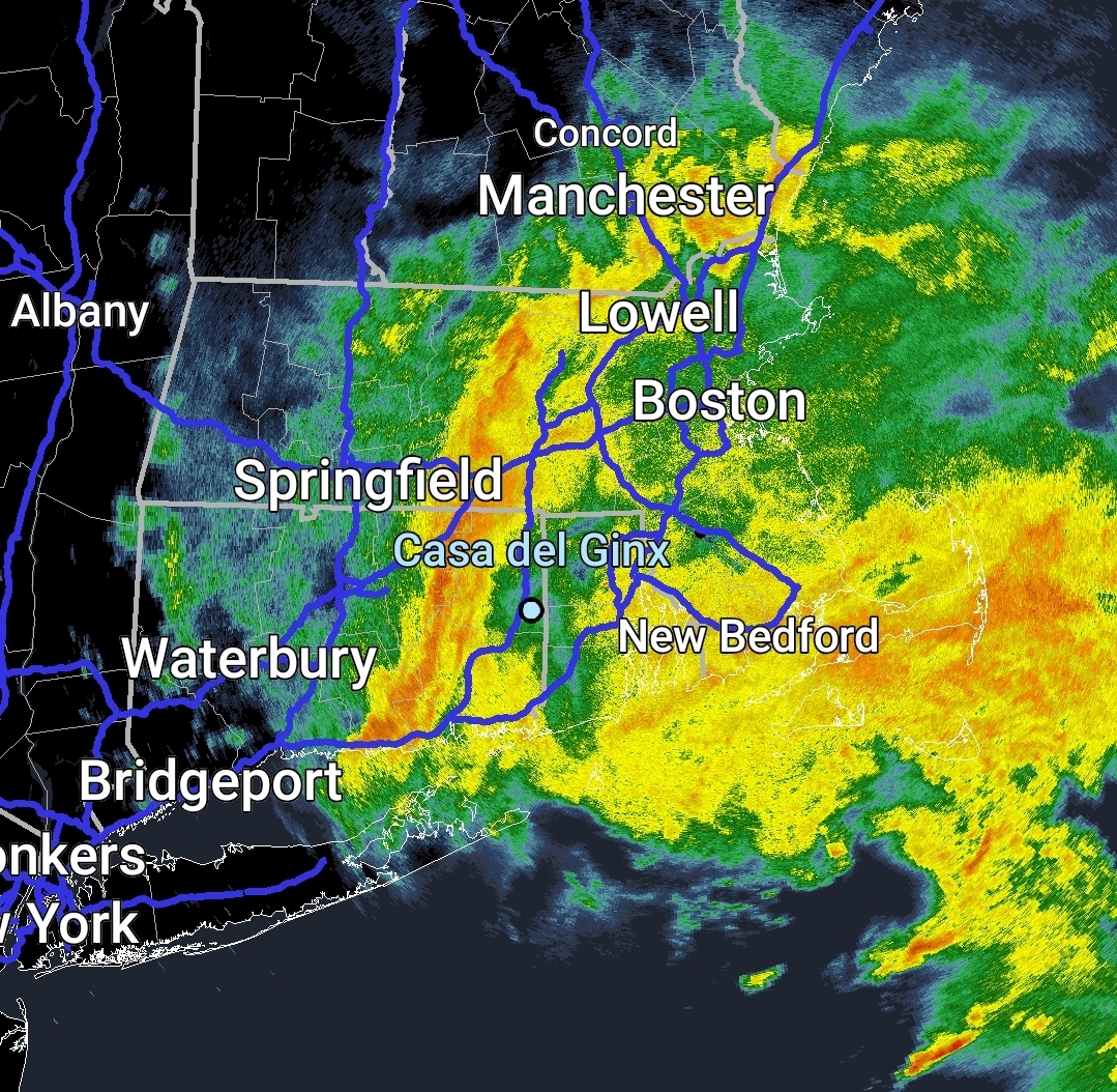
coastal low spin somewhat visible
-
Similar here at 1.26 but still some lingering light showers and drizzle.
-
Nice Death band
-
1.28 two day storm total imby
-
41.7 so close yet so far
-
The entire Northeast finished at 21st coldest for January 2022. It was the last time we had KU snowstorms from ACY into New England. December 26th through January 8th, 2018 was our last top 10 coldest 2 week period in NYC. It also coincided with the record 950mb benchmark blizzard. But the pattern flipped warm pretty fast in January. So the 2nd coldest December 26 to January 8 period on record couldn’t last long enough for January 2018 to finish in the top 10 for cold.