All Activity
- Past hour
-

Central PA Fall Discussions and Obs
canderson replied to ChescoWx's topic in Upstate New York/Pennsylvania
My back still hurts from that 2016 event ha -
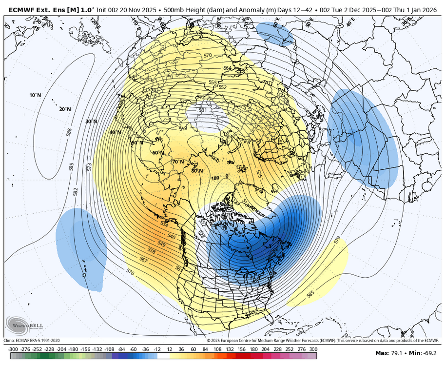
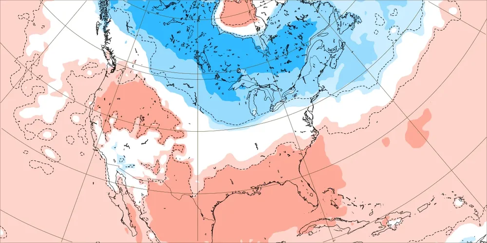
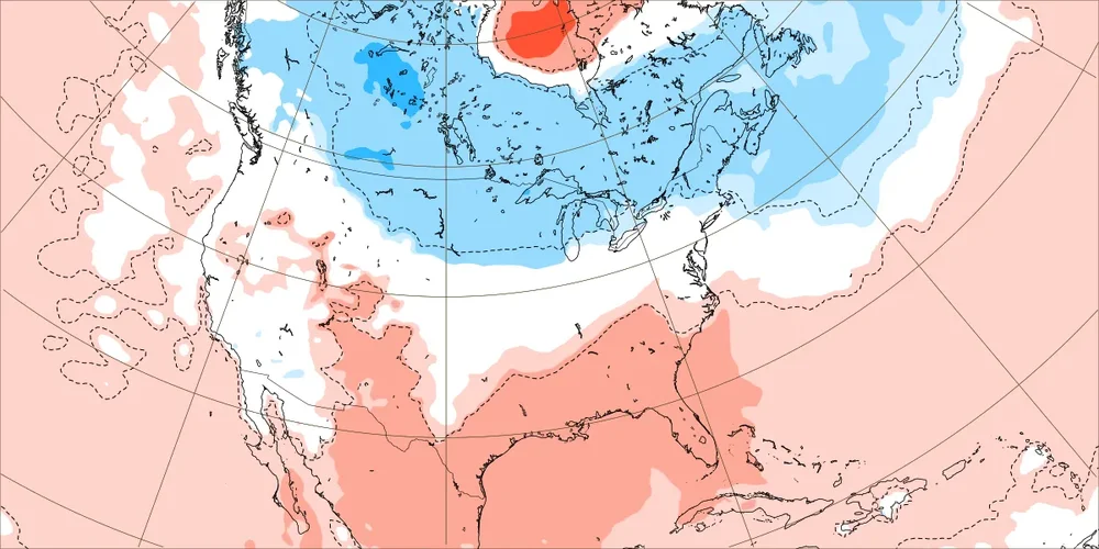
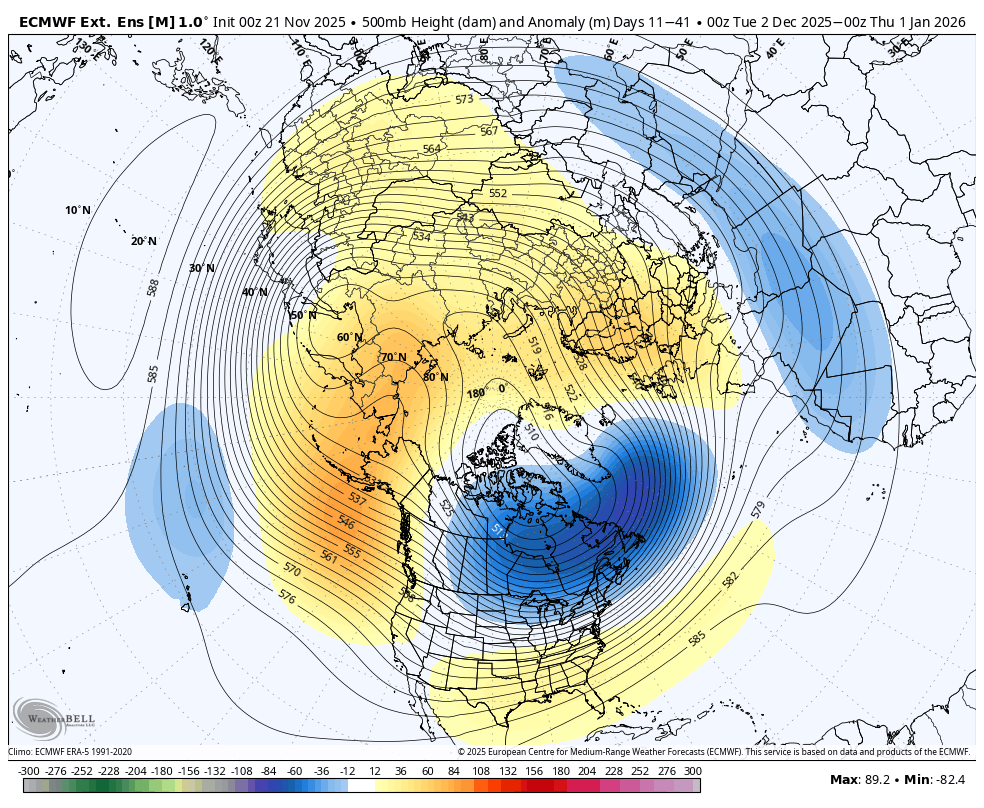
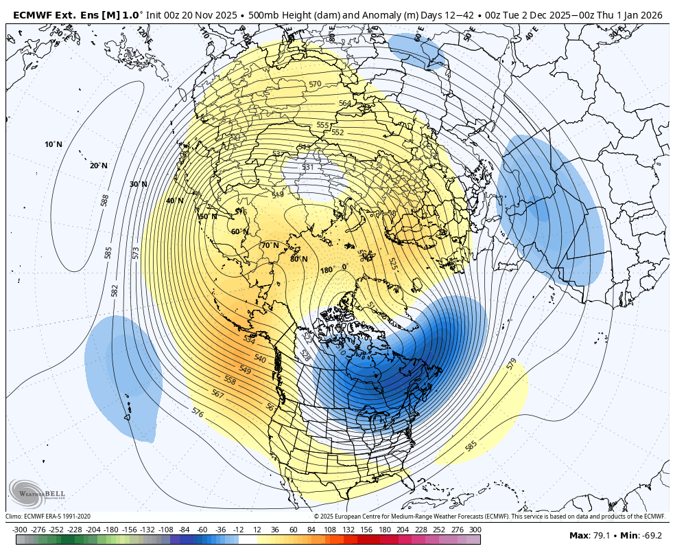
SER asserts itself in the latest WB weeklies. (Today versus yesterday's run.) Whether a blip or the start of a trend away from a December to remember TBD.

-

November 2025 general discussions and probable topic derailings ...
WinterWolf replied to Typhoon Tip's topic in New England
Day 10+ progs don’t usually hold up though. -
I mean, this highlights a problem you bring up all the time about people like snowman spreading their agenda, because here you do a similar thing. Whenever the weeklies show something good you're like "it'll be cold" but whenever the weeklies trend bad you cover it up as shown above.
-
getting some low grade mammies from these elevated waa showers
-
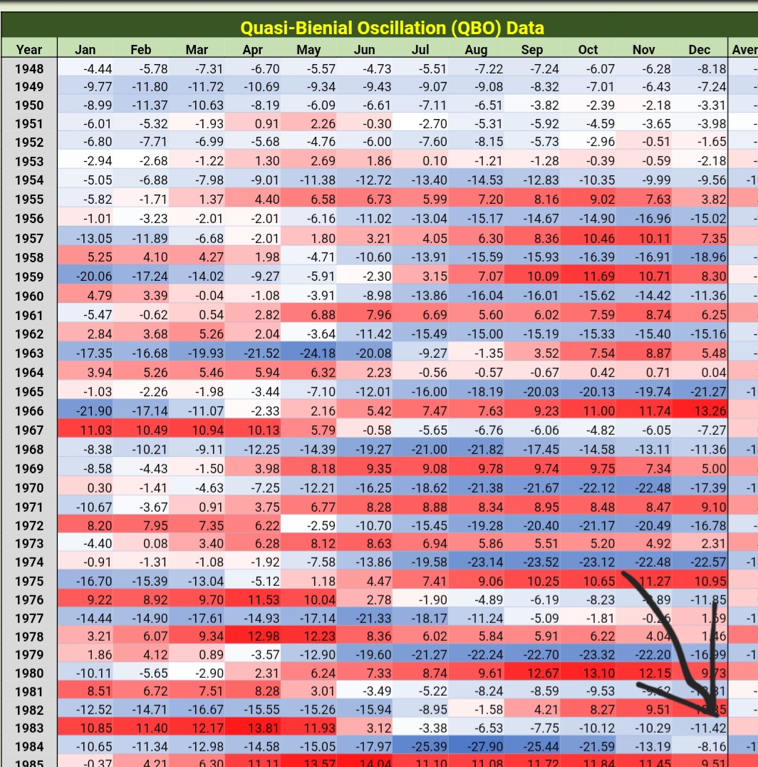
Unless this data is wrong, then you are incorrect. 1983-84 winter was a -QBO winter.

-
You don’t see any warmth, Anthony?
-
Why? I’m not going crazy. We look at long range guidance ITT every day. This is mainly a long range thread. You just posted weeks 3-4, for example. I’d rather have the most up to date.
-
You will go crazy if you take every run verbatim . I wish the weeklies went back to weekly.
-
Where is the warmth ?
-
As per @GaWx research, 1983 did not have any stratospheric warmings in November or December. Furthermore, 1983 was a volcanic winter with a volcanic stratosphere; courtesy of a VEI-5 tropical eruption the year before in 1982. It was also a +QBO winter and a had a strongly +PDO
-
Yes, that's the thing many are a bit upset about, Models have expanded it's reach and extended a bit more over time Larry. Of course, that's the nature of these things as we know.
-

November 2025 general discussions and probable topic derailings ...
eduggs replied to Typhoon Tip's topic in New England
The individuals show extreme variability: torched or frigid. The means are blending the extremes and timing differences. I see hallmarks of the dreaded warm/wet (cutter) to dry/cold repetitive scenario: persistent ridge in southeast, hints of a trof out west, low heights across the Canadian Maritimes. I think it's a red flag that negative height anomalies never progress east into the Deep South. Your comment about a possible SWFE is a good one I think. I could see a few of them in succession if the day 10+ progs hold up... would seem to favor the north country. -
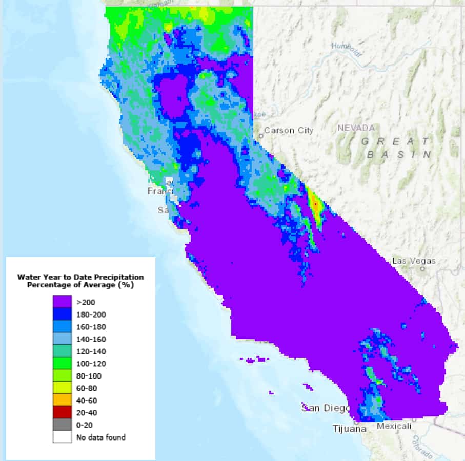
yeah, was looking at that a couple days ago, actually. Thankfully, California is running way above normal for precip on the year.

-

November 2025 general discussions and probable topic derailings ...
CoastalWx replied to Typhoon Tip's topic in New England
The euro stuff he had. I think some gfs stuff is out there. -
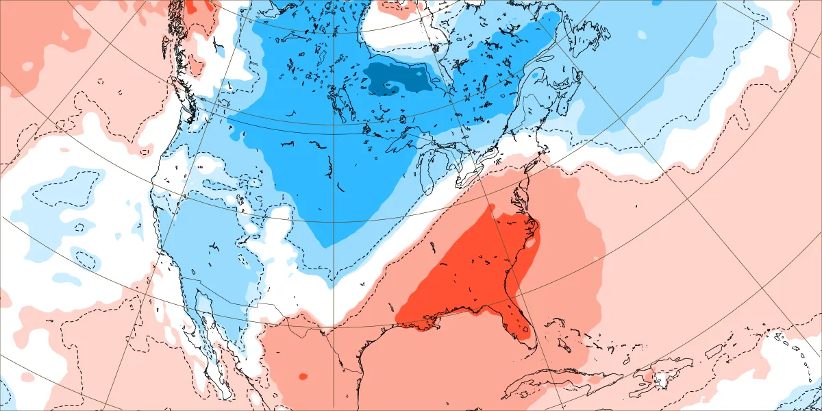
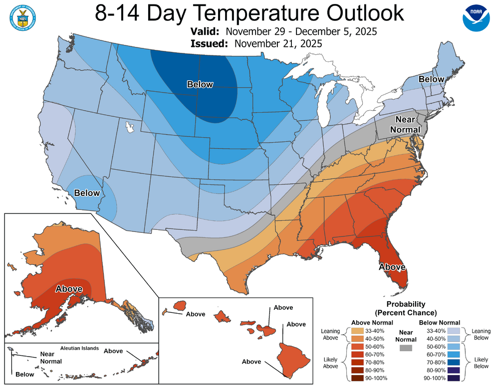
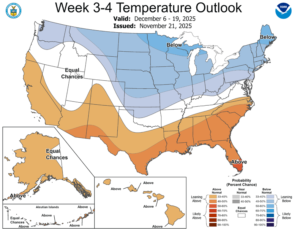
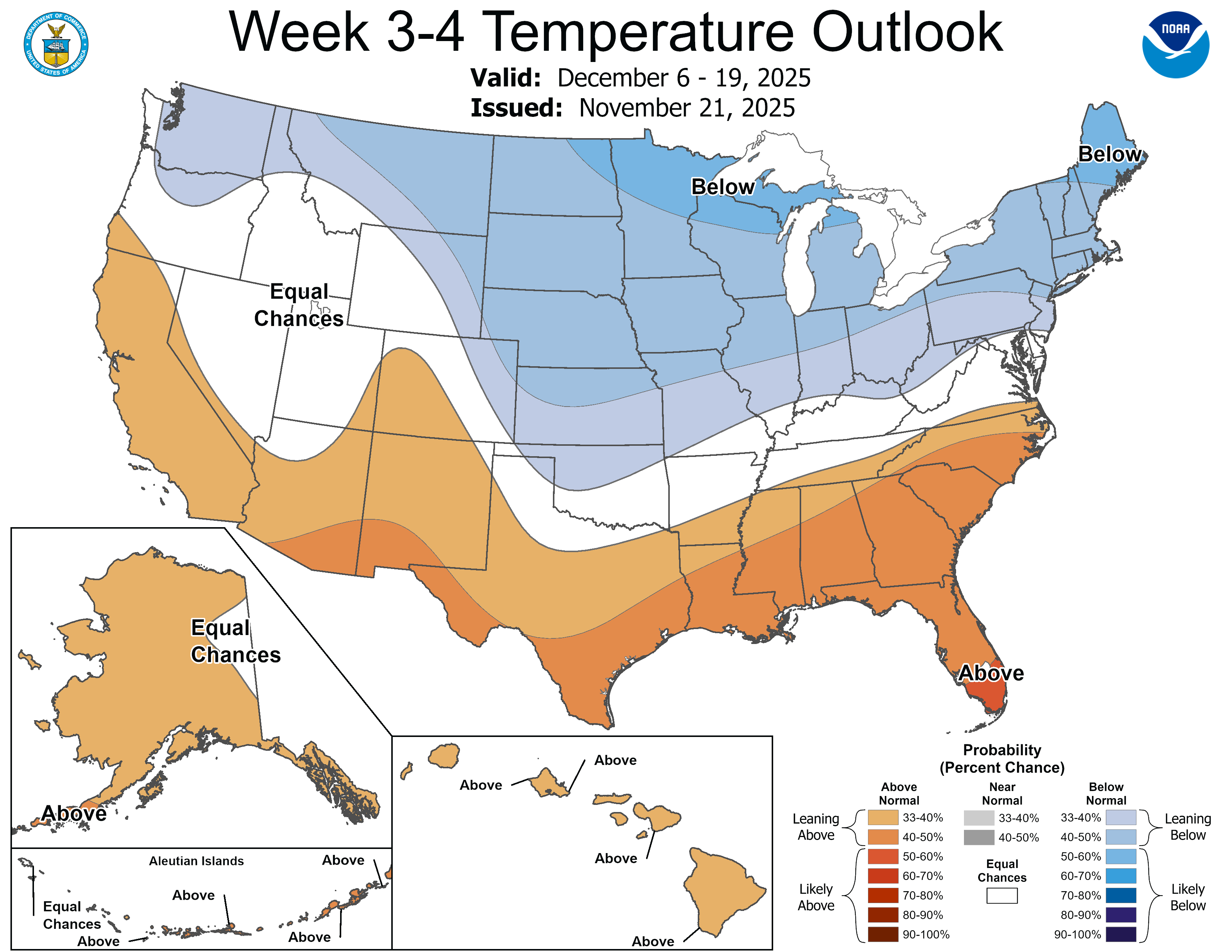
Today’s Euro Weeklies 2m temp changes vs yesterday aren’t good for the E US overall if you prefer cold: Dec 1-7: warmer SE to Mid-Atlantic due to even stronger SE ridge: Dec 8-14: ~unchanged Dec 15-21: warmer SE/very slightly warmer NE Dec 22-28: slightly warmer Mid-Atlantic/very slightly warmer SE: Dec 29-Jan 4: warmer NE


-
I don't think the pattern will continue into the end of December. There's a colder signal for then. There's not much to worry about right now, especially for the NE folks.
-
Warm will rule
-
Winter ? Its November 21. Dude stop posting please.
-

November 2025 general discussions and probable topic derailings ...
dendrite replied to Typhoon Tip's topic in New England
The 200mb VP anomalies? -
For what it’s worth, the Euro AI has performed really well of late, including sniffing out the brief Thanksgiving cold shot followed by warmth, and it has below average temps up and down the EC by around the 5th. Goes to show it’s not all bad on the models but I still think sustained cold isn’t coming until we work into the mid month (maybe the 10th if we’re fortunate) timeframe. The teleconnections just aren’t there but phase 8 should be coming in to play by that juncture.
-
November 2025 general discussions and probable topic derailings ...
dendrite replied to Typhoon Tip's topic in New England
We were out in Gilford all afternoon and I said the same thing. Def a pre-snow event vibe to the clouds. -
The winter is actively showing it's hand with that torch being forecasted first week of December. As many have posted about here, if you're on the east coast, warm Decembers in a nina are about the worst signal possible.
-

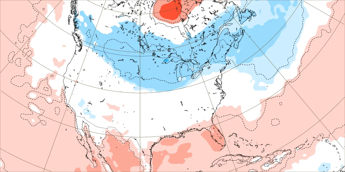
2025-2026 ENSO
michsnowfreak replied to 40/70 Benchmark's topic in Weather Forecasting and Discussion
This map is a great one to show why snowlovers in the Great Lakes always prefer nina over nina.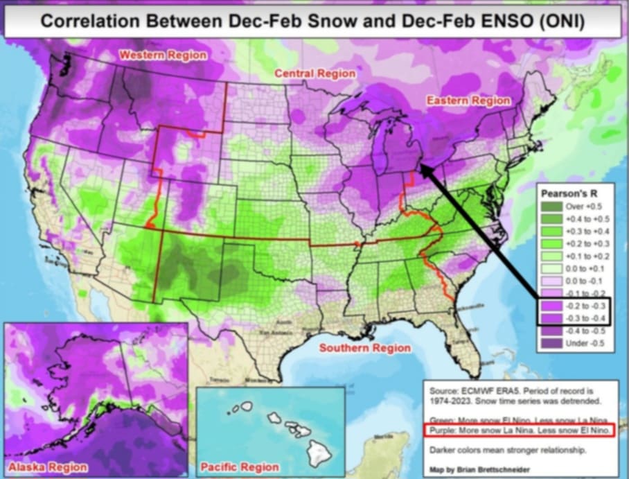
-

MO/KS/AR/OK 2025-2026 Winter Discussion
NWAflizzard replied to stormdragonwx's topic in Central/Western States
12z euro really brings the cold later in this run . Dropping it out west and slowly moving it into our area along with some snow. Still battling that ridge in the east.


.thumb.jpg.ad3a2e31d30aff035044689b311a0540.jpg)