All Activity
- Past hour
-
81/70
-
Got down to a relatively frosty 75 here.
-

June 2025 discussion-obs: Summerlike
WeatherGeek2025 replied to wdrag's topic in New York City Metro
Were we supposed to have rain today? I don't get it! -
Thank goodness this will move the cocktail hour for the wedding I am headed to on Long Island inside.
-
Thundering here.
-
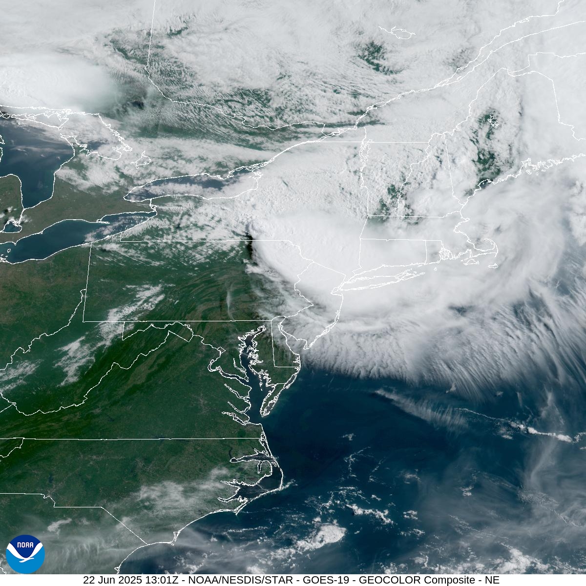
Pretty cool cloud animation from the MSC up North presently, the fanning out of the high clouds in the southern portion of the complex reminds me of the exhaust cirrus from an deeply intensifying hurricane. https://www.star.nesdis.noaa.gov/GOES/sector_band.php?sat=G19§or=ne&band=GEOCOLOR&length=24

-
Picked up 0.54” of rain this morning to keep the swamps happy.
-
Just had the loudest boom here in a long time shook the entire house.
-
Crazy thunder up here in Mahwah right now
-
The cloudiness from the MCS was somewhat modeled for today, but they dropped the ball on the rain completely. Latest GFS actually has more showers tonight.
-
I can only laugh this morning, otherwise I'll go crazy...why is it raining? Can we literally not get a weekend without rain, is there a new rule I missed? Might as well not even open the pool if this is the trend.
-
Next
-
I had to explain to the lady at home on why the ac would stay on even if set higher. It was really toasty last night
-
Wow, that's crazy. That would be very near the State record high minimum for the month of June if legit. Won't count though since it looks like an AWOS site. Looks like the highest is 87F at Canby from 6/29/1931. The 87F from St. Peter on June 30, 1921 is clearly wrong. The next closest low in the State that day was 75F in downtown Minneapolis (see below); however, the 87F from the 1931 heat wave looks reasonably legit. Below are ALL observations of a minimum of 83F or higher in the month of June. The 86s from 1890, 1942 & 1996 all look incorrect as well. While data from 1890 is limited, the second hottest was 73F at Saint Paul downtown, and it shows a ridiculous 4F diurnal range way out of line of the other observations. June 30, 1921 - just showing the hottest sites here: June 27, 1890 - all data:
-
Same theme as we have seen for a while. The best beach weather and heat occurs on the week days. While it always finds a way to rain on the weekends.
-
Yes please, would keep temps down a bit which would be welcomed.
-
It's not a nuisance for literally tens of thousands of pent up beach goers who made plans to
-
This is the most extreme weather video that I have ever seen come out of Queens. Harsh language advisory. But it’s very understandable when you see 125 mph winds.
-
This week’s weather does not look as hot or prolonged as we originally thought. Looking like upper 70s low 80s for me by Thursday. Mid 90s Monday and Tuesday. That is if the models that didn’t get today right are right. Also looks like a quite cloudy week ahead. It does look humid though all week.
-
-
The low of 78 at Detroit breaks the daily record and is the warmest low since July 5, 2018. The all-time warmest min for Detroit, set 5 times, is 80.
-
Looks like NJ will get its remnants
-
As it rolled off the 'Daks it put a hurt on Rome and that region early this morning.
-
Ridge into the east to open JUl
-
About 300 hours away. Both the GFS and EURO in relatively tight agreement. Highs mid / upper 80s - and dry. Leading in its humid/warm with storms 2-3 , beyond 5-6 GFS maintaines warm/humis storm potential and euro builds in next wave of heat.