All Activity
- Past hour
-

December 2025 Short/Medium Range Forecast Thread
Carvers Gap replied to John1122's topic in Tennessee Valley
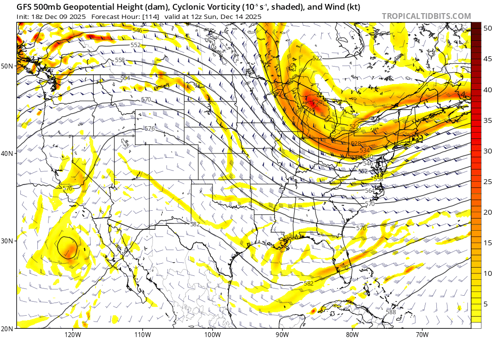
I am watching the 12z GFS roll in right now. Through 174, it is much colder across the NA continent. Let's see if that trend continues to hold for the rest of the run. This fits the trend of modifying warmer air masses. Looks like it has the post Dec 20 cold front rolling down the Canadia Prairies. Let's see if it can push all the way SE - I am still 50/50 on whether it can make it. Nice push SE on this run. -
For future runs, watch the sharpness and how far west the SW can trend. Good signs the last couple of runs.

-
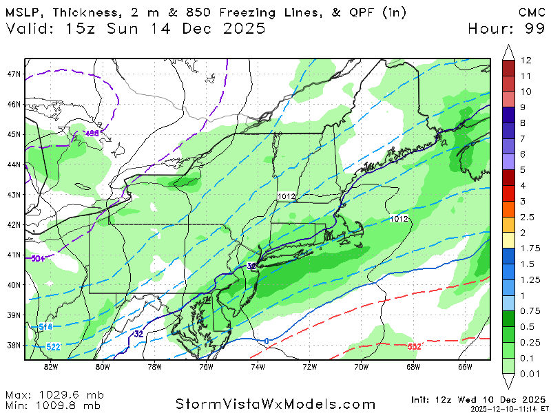
CMC is a miss north for basically PA/MD line south but did jump significantly south from 0z
-

December 2025 regional war/obs/disco thread
weatherwiz replied to Torch Tiger's topic in New England
definitely possible...the BL may be a bit torched down that way. -

December 2025 regional war/obs/disco thread
TauntonBlizzard2013 replied to Torch Tiger's topic in New England
Canadian doesn’t look bad. It’s kind of close to getting eastern areas when it really gets going just offshore -

December 2025 regional war/obs/disco thread
brooklynwx99 replied to Torch Tiger's topic in New England
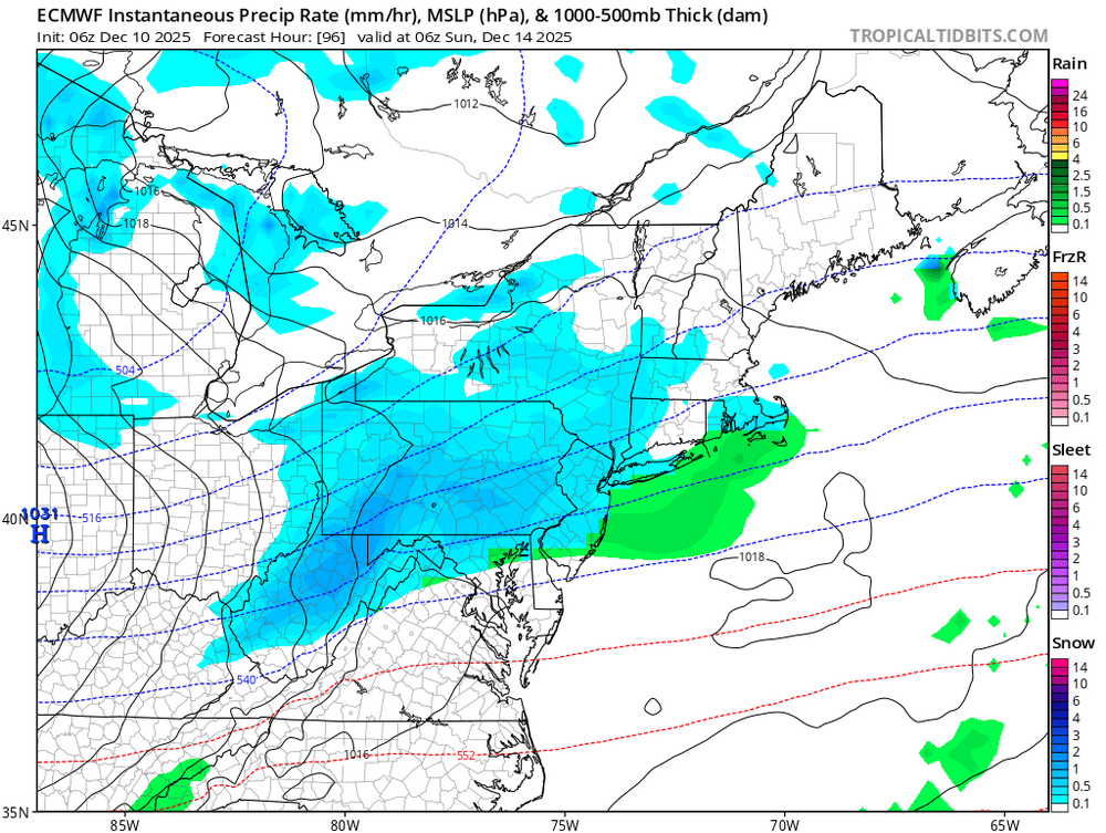
CMC making the same shifts as the GFS. TPV is more favorably oriented.thumb.gif.edbc71506ec1c024e6d840e28d852f61.gif)
-
Cmc
-
Good luck with your first winter storm thread
-

December 2025 regional war/obs/disco thread
SnowGoose69 replied to Torch Tiger's topic in New England
That said there is a risk of a rainer, at least down where I am and the SE parts of the MA forum. I think Forky was maybe hinting at that in one of his posts and I have seen some of the Mets on X indicate that as well, the look over the GL region at 500 is indicative of that but I think the fast flow and overall positive tilt to that trof makes it a remote possibility. In the days of slower Pac flow this one to me would have much higher rain risks at this stage. -

Winter 2025-26 Short Range Discussion
ILSNOW replied to SchaumburgStormer's topic in Lakes/Ohio Valley
It is quite obvious to me that the 15z RAP is the only current model with a hand on this clipper (kidding good luck to those further south of Chicago) -

12/12: The little Friday clipper that could? Or won't.
dailylurker replied to dailylurker's topic in Mid Atlantic
I did it for the team lol -

December 2025 regional war/obs/disco thread
Damage In Tolland replied to Torch Tiger's topic in New England
Atta boy ! -
DDH often has bare ground while four miles away as the crow flies up Route 9 Mitch has feet. Especially when there are lake streamers which lose their juice but then slam into the wall of the Greens. Route 9 between Bennington and Woodford can be ugly!
-
Its another 7 days before we have any idea where early January is going. I currently still side towards this warmup is brief from the Lakes to the NE and NRN MA. May be longer for the TN Valley/SE but still their warmup will be nothing compared to 2015 or 2021, I would bet even places like TN/GA/SC struggle to get much above upper 60s as that is a sneaky setup where highs will keep semi wedging down in there.
-
December 2025 regional war/obs/disco thread
weatherwiz replied to Torch Tiger's topic in New England
Agreed. They are closer to the llv baroclinic zone and also more in line with the RR of the jet -
I’m not buying anything for Sunday until the CRAS comes on board.
-
Hopefully I am good luck, I made a thread for the upcoming potential.
-
There is no chance it's going to happen like that. You could miss, sure...but there's not going to be a 25 mile wide jack from DC to Baltimore. I'd be nothing or a smoothed out solution with us all getting like an inch or two.
-
Really frustrating - I wish it was more expansive. The only good thing is it looks pretty potent. Whoever gets lucky might see 3-5”.
-
Hello everybody, I think it's time to think positive and see where this snow potential for this coming Sunday takes us. It has been a miss, flurries, to a decent size potential. The ceiling looks to be a 3-6 we really need it hope we get it. Discuss
-
December 2025 regional war/obs/disco thread
SnowGoose69 replied to Torch Tiger's topic in New England
Yeah I still lean towards a miss being more likely out of all the possibilities. Once again I almost would rather be in the northern MA right now if you forced me to take a stand one way or another. There is a chance this could get its act together in time that C-SNJ or the PHL area could get a few inches and NYC to BOS could miss out. -
Don't let them bully you. Speak your mind.
-
December 2025 regional war/obs/disco thread
TauntonBlizzard2013 replied to Torch Tiger's topic in New England
Since I’m trying to be more glass half full, that gfs run was better than 6z and close to giving some folks some snow -
December 2025 regional war/obs/disco thread
weatherwiz replied to Torch Tiger's topic in New England
ehhh its too much of a big if. I mean there has to be some sort of reasoning or some clue to provide evidence that would be possible. I think this one is done. Even with a better interaction of the closed low and trough, the profile just scream cyclogenesis and the low-level baroclinic zone is way too far south. By the time diffluence starts developing aloft...its way too late and sfc low doesn't get going until well east. Our best shot IMO is getting that baroclinic zone farther north and working with llvl magic. I don't think that ridge in the west is going to have much influence on anything versus just getting a better interaction with the two energies...but that alone isn't or won't be enough. All of this would start to have to occur several hundred miles west. -
these totals tend to get juicier as we approach the event.....could be 3-4 hours of heavy snow for someone Sunday morning.


.gif.0e0d156d3c29454b7c001ac8f238b02e.gif)


