All Activity
- Past hour
-

The Return of the 12/5 Snowstorm
SomeguyfromTakomaPark replied to SnowenOutThere's topic in Mid Atlantic
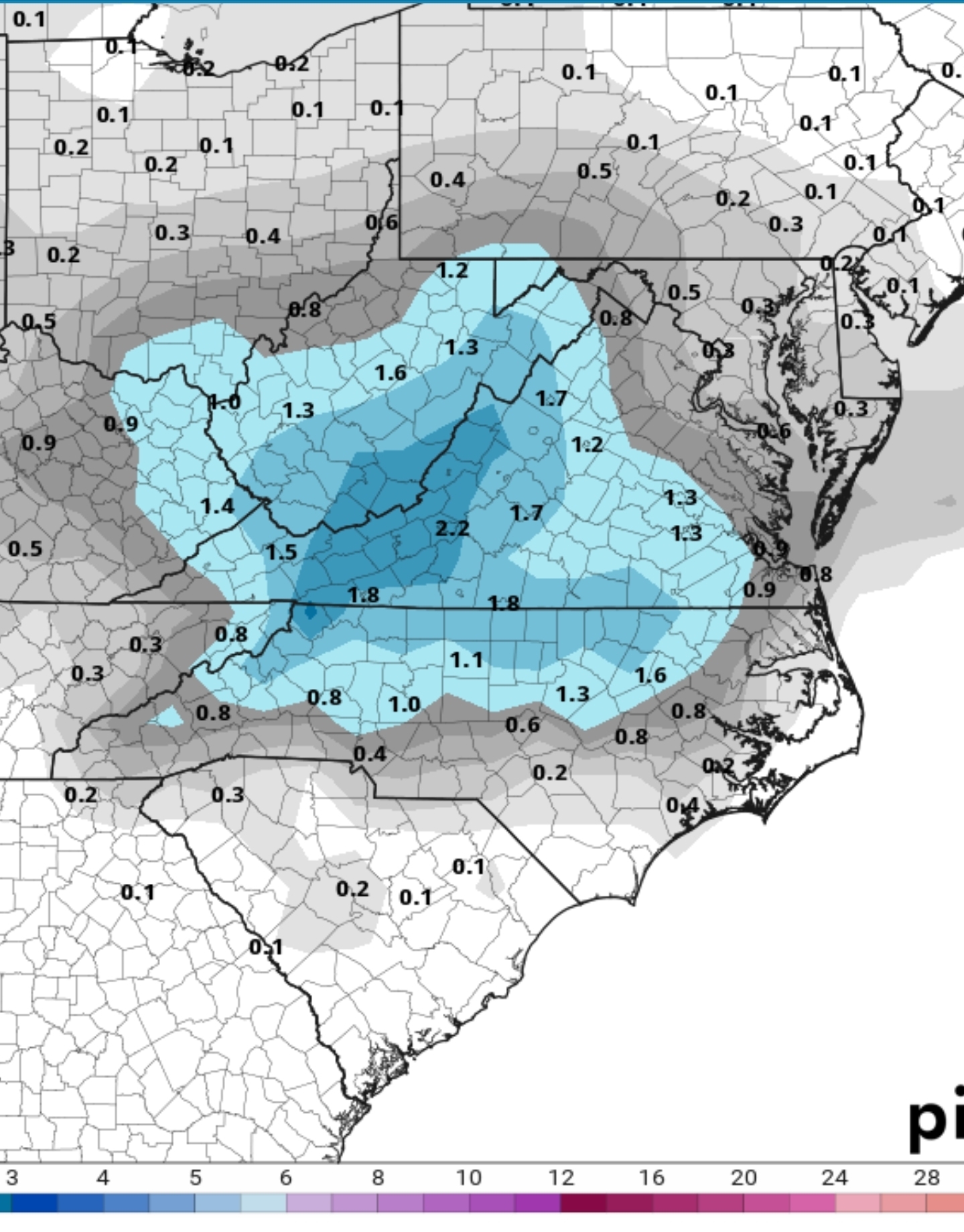
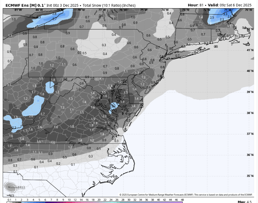
Decent model agreement of a low amplitude shortwave moving across the southern Mid-Atlantic Friday as high pressure retreats offshore. Uncertainties arise in how far north the precipitation will make it. Almost all ensemble and deterministic guidance has enough cold air in place to favor all snow in our FA should moisture make it this far north. There are a few outliers that have rain across the far S of the FA. FWIW, snow and ice has trended up slightly over the past couple of runs. While amounts are forecast to generally be light (an inch or two, perhaps three should a higher end solution verify), the northward shift is notable. Looking at clusters featuring the greatest variance (EOF) regarding amplitude does suggest additional northward expansion is possible. Just something to keep in mind. -
6z GFS very similar to 0z for the Friday system. The Monday system is still there at 6z but not as significant as 0z. Still a good snow up this way for many.
-
0z GEFS just for the Monday system

-
Decent bit more. .
-
Models looking good for Friday... I really like that that Sunday/Monday system by the GFS but im not getting to excited since its the only one showing it like that.
-
Nothing like a hard freeze after getting .74” of rain at 36 degrees. At 26 right now. .
- Today
-
6z Rgem came north and brings 1" up to DCA & BWI. Nothing yet for me (wipe that smile off your face!)
-
Looks like we got a bit more last night i wasn't expecting that
-

Central PA Fall Discussions and Obs
Ruin replied to ChescoWx's topic in Upstate New York/Pennsylvania
that was a jk of a storm sigh -
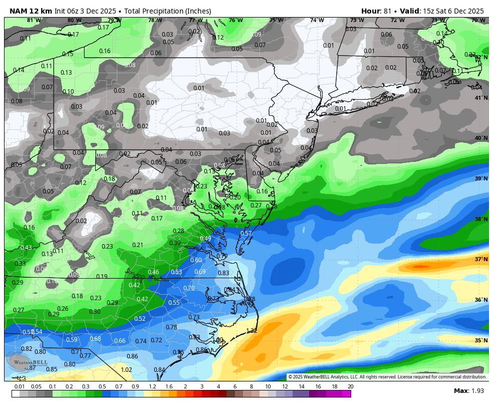
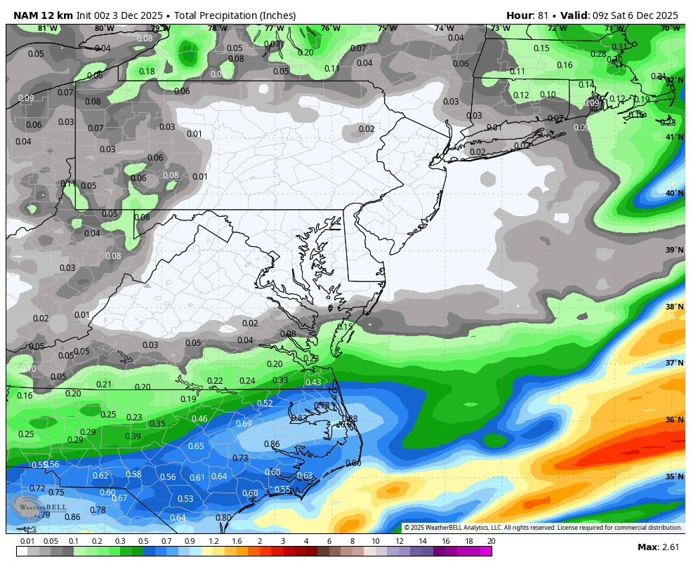
Well maybe I will have to eat a shoe with this storm....at least for southern zones. Nice bump north on WB 6Z 12K NAM compared to 0Z. Trend or blip TBD.


-
Nice solid coating at the end Wintry day here in the tropical interior
-
Ugh lures too....watch out for those treble hooks
-

December 2025 regional war/obs/disco thread
Torch Tiger replied to Torch Tiger's topic in New England
the sooner the better, i'm over cold/snow after like 12/25-1/1.. If it's not a MECS or better blizzard i'm checked out -
How do I get this for BWI?
-

E PA/NJ/DE Winter 2025-26 Obs/Discussion
LVblizzard replied to LVblizzard's topic in Philadelphia Region
And even if the Friday and Tuesday storms miss we have a parade of clippers to look forward to for the next two weeks. Pretty active pattern for this time of year. -
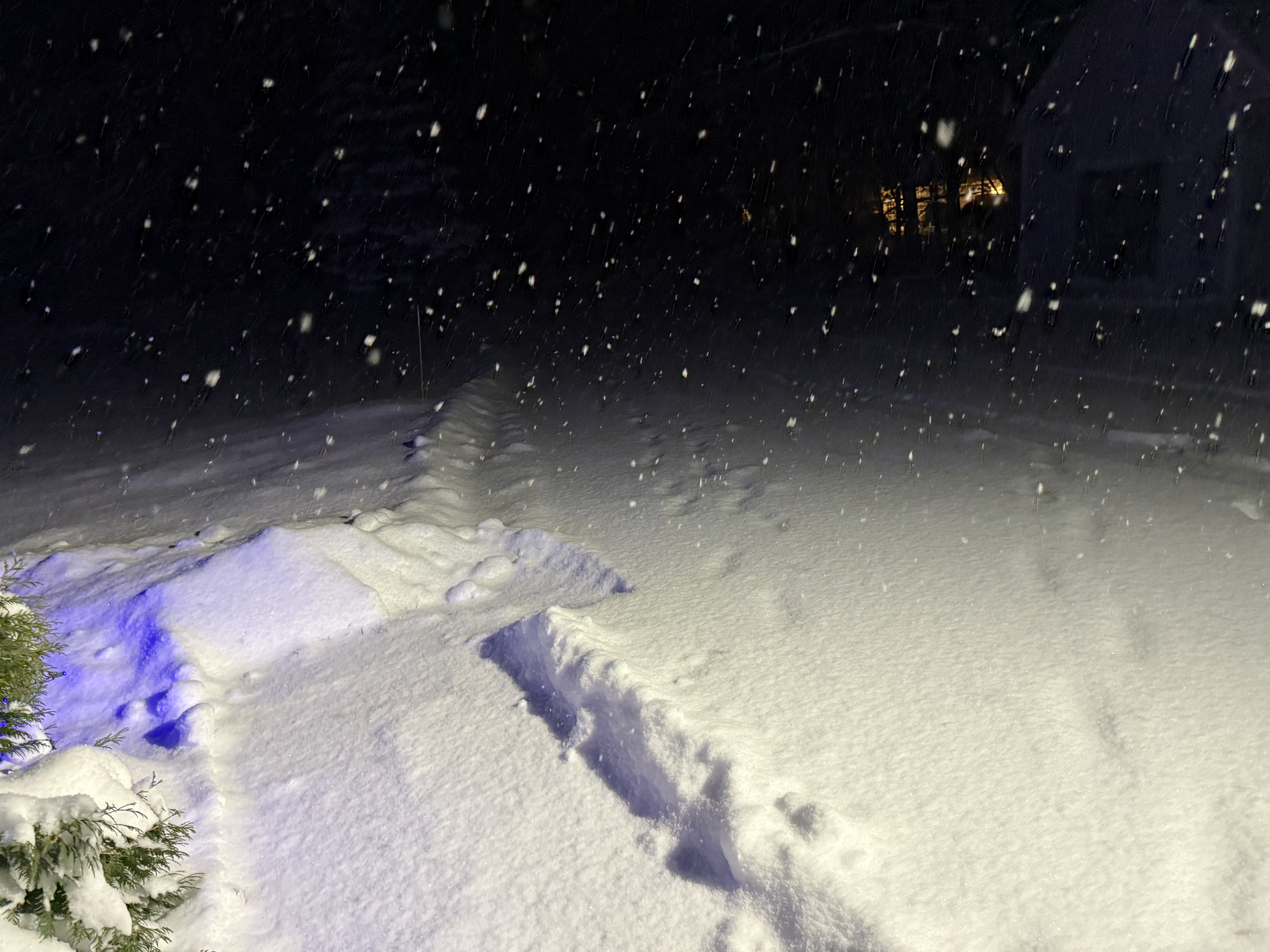
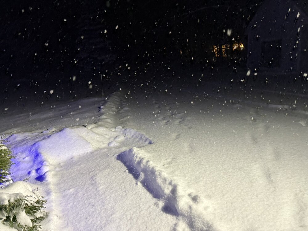
28.6° -SN 9.2” Latest core 1.5”/0.08” Storm total 9.2”/0.71”
-

December 2025 regional war/obs/disco thread
weathafella replied to Torch Tiger's topic in New England
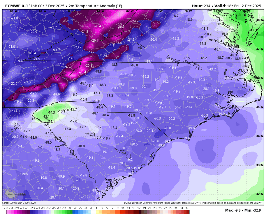
Ensembles (both GEFS and EPS) have a pretty nice pattern by the end of their runs with at most a short period of AOA normal. Time will tell. -
7.5" so far in Gray ME. My wife is jealous.
-

December 2025 Short/Medium Range Forecast Thread
John1122 replied to John1122's topic in Tennessee Valley
Euro is just a little too warm for most of Tennessee heading into the weekend, with very light precip. After, it gets cold, but barely any qpf, looks like warmth and moisture return together mid-month but that may be a head fake too. -
We take
-

E PA/NJ/DE Winter 2025-26 Obs/Discussion
Birds~69 replied to LVblizzard's topic in Philadelphia Region
1:40 am…...cranking winds coming through. Poor trash cans.. -
0z EPS is better than 18z EPS—it's probably the most aggressive it's been for this system.
-
Holy Euro Barney!
-
December 2025 regional war/obs/disco thread
Torch Tiger replied to Torch Tiger's topic in New England
0z gfs has a nice 7-10 day run, but beyond that the -NAO gone and it's much more seasonable, if not AN -
Euro looks nothing like the GFS for Sunday night unfortunately