All Activity
- Past hour
-
 Got 4 degrees here.
 -
Not very many neighbors out enjoying the weather today. Only ones out were clearing their driveways and even then, quickly returned to their warm houses.
-
 I agree with your assessment that the upcoming weekend can still work (snow) before a true thaw takes place and then maybe we reload one more time. At least it does not look like a shut the blind's pattern to me yet.
 -
Even earlier today when it was 17 with wind felt worse than last weekend when it was 0
-
Furnace can't even keep up with the drafts on our second floor. It's freezing in bedrooms.
-
 Dead on goose
-

Friday February 6 FROPA / WINDEX small event
Go Kart Mozart replied to HoarfrostHubb's topic in New England
1" -
7.7
-
Hell, I'd be happy with "Near Normal" at this point!
-
 Man somehow Watertown is a rad pit despite being next to Lake Ontario. Went calm and down to -18
 -
Haven’t left my house today. Fire has been roaring all day.
-
1°/-13° Im over this..
-
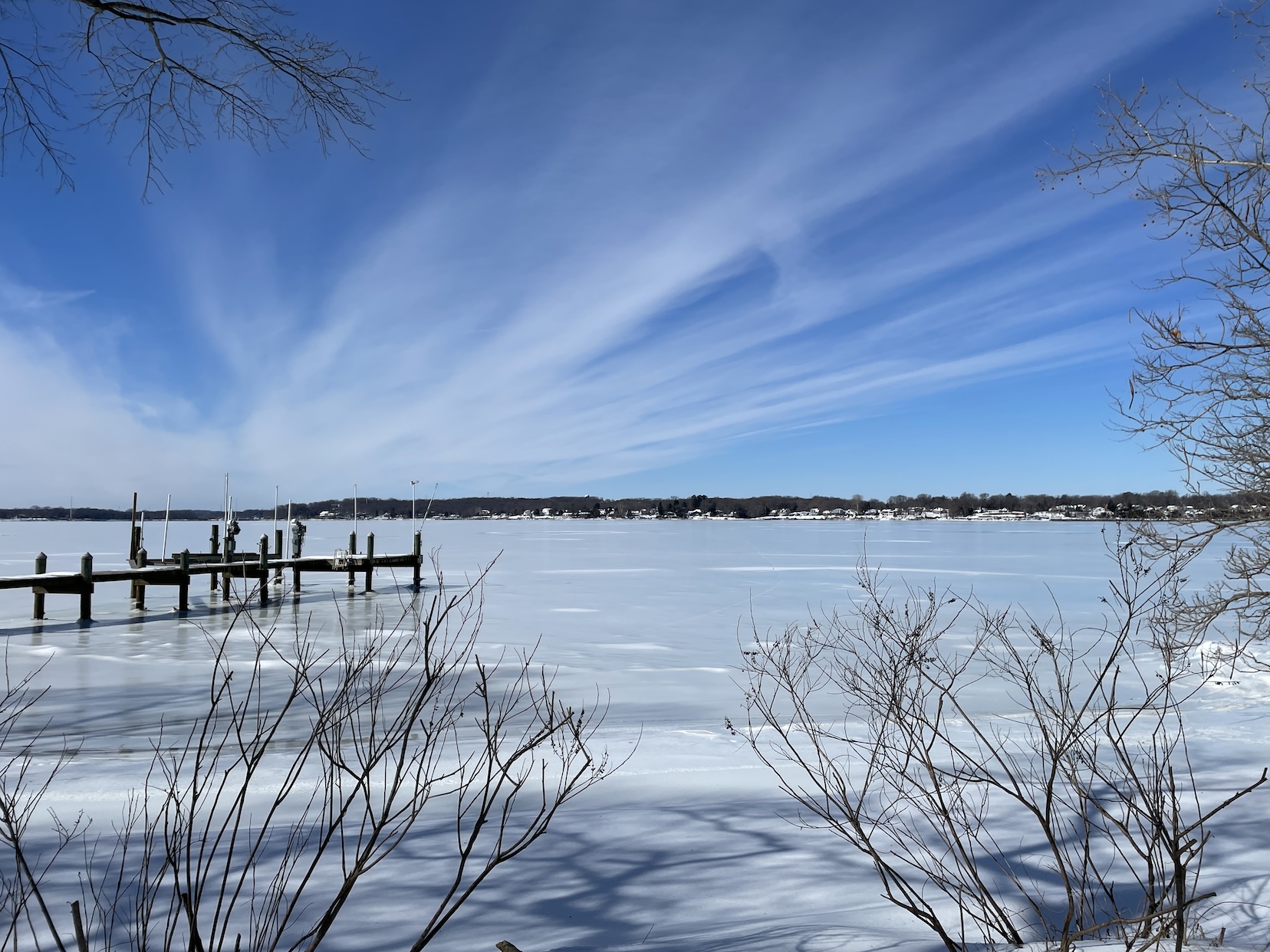
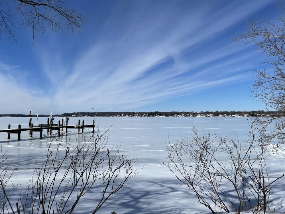
Also Jan 30. Smokin' cirrus on the Bush River.
-
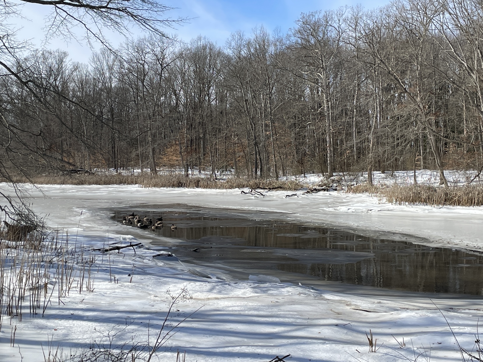
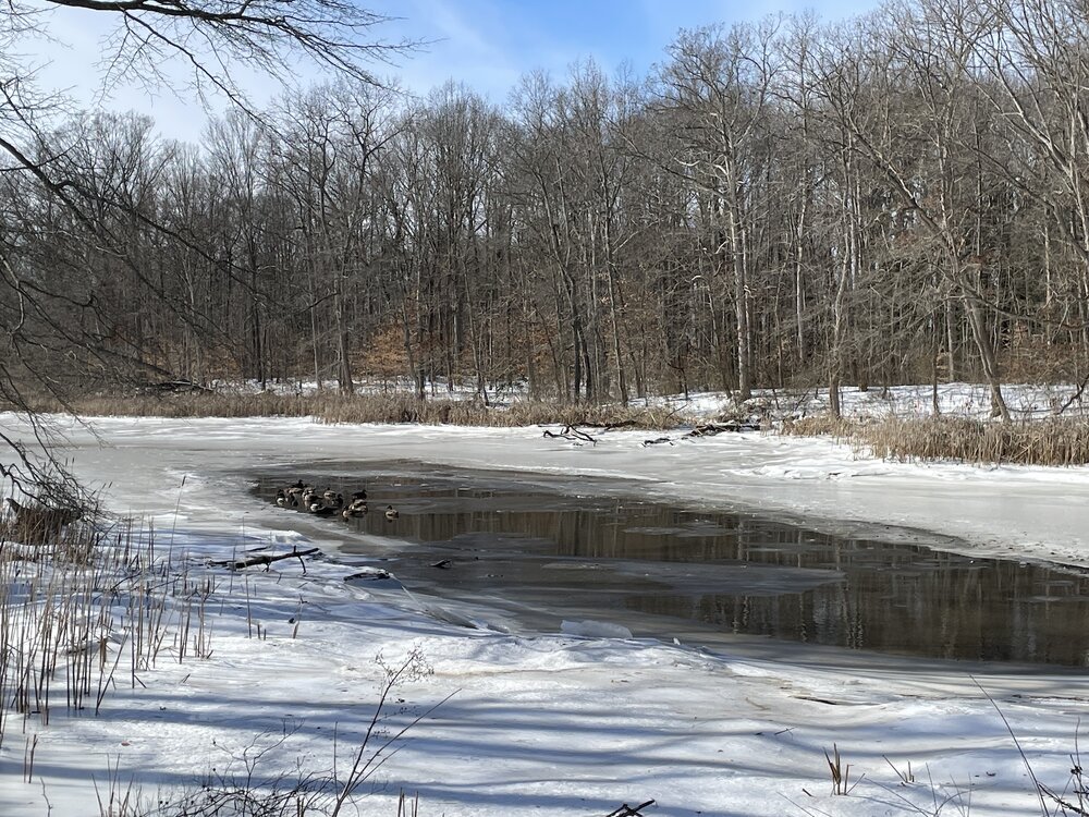
Jan 30. Little bit of melt in this inlet attracted swimmers.
-
I think it’s possible the models are underdoing or not responding rather to the north pacific yet We’ll have to see how this goes
-
Metfan and WinterWhiner aren't going to be pleased with your post!! Fair Warning.
-

February 2026 OBS & Discussion
sussexcountyobs replied to Stormlover74's topic in New York City Metro
Temp -1F right now . Stupid winds blowing. -
 I actually agree with this but without the crazy stupid 1960 comp Dude can’t just make a projection without comparing it to the most extreme example of what he is talking about.
 -
WB's JB just released an updated video. His take is that there will be warmup after the upcoming week, followed by a cool down as we head into the end of the month into March. Reasoning: return of a negative WPO and his belief that the NAO will trend more negative. He cites similarities to 56 and 60.
-
Taking a nice walk. Temp is 6.
-
Winter Storm Threat *Technical* Discussion. No Op Run PBP or Snow maps
psuhoffman replied to CAPE's topic in Mid Atlantic
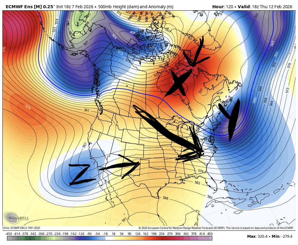
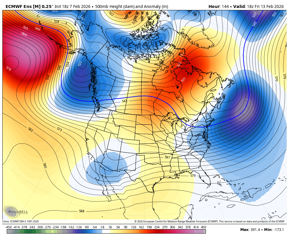
18z AIFS was our win scenario. all ens guidance now shows this at day 5. This general idea seems locked in now The decaying nao block X has retrograded to Hudson Bay. There is a strong 50/50 feature Y from a strong wave that was forced under the retrograding block. The pacific wave Z is entering the southwest. The flow in front of it will prevent it from gaining too much latitude so long as it ejects quickly. Yes the pacific has gone to absolute shit. But because the antecedent pattern was good we have a window of opportunity here. We want a healthy wave to eject and as quickly as possible imo. The 18z AIFS did this. The 18z EPS looked like it was also but doesn’t go out far enough. But I’ll take this… the gfs products are washing more of the wave out and absorbing most of it into the approaching north pacific trough. This means a weaker delayed wave. that’s a loss BTW a “Hudson High” regime actually used to be a cheat code to a snowstorm here absent other features we typically look for PNA, NAO… historically I found numerous Baltimore snowstorms where a high there seemed to be the main feature and it snowed despite flaws elsewhere. But I’ve noted those have gone extinct recently and that some recent examples ended up slightly too warm and “perfect track rainstorms” A recent example was a storm around the Super Bowl in 2023 I think. This will be a good test to see if this can still work! Assuming a wave ejects.

-

Feb 10-11 Mid Week Minor Event - Ride the hot hand?
ORH_wxman replied to HoarfrostHubb's topic in New England
Euro rotates an IVT down too over the Cape…but the main event is pretty paltry. Maybe an inch. -

February 2026 OBS & Discussion
coastalplainsnowman replied to Stormlover74's topic in New York City Metro
Agreed. Low teens with no wind is actually invigorating to me. What's going on out there right now though is as brutal as I can remember. -

February 2026 OBS & Discussion
donsutherland1 replied to Stormlover74's topic in New York City Metro
For the first time since February 4, 2023, Bridgeport, Central Park, Islip, JFK Airport, LaGuardia Airport, Newark, and White Plains have all registered daily low temperatures below 10°. Through 8 pm, the average low for the seven cities is 7.4°. On February 4, 2023, it was 2.9°. -
 I have been radiating this past week, down to -11F one of those mornings. Hoping the wind and any clouds help here this am; currently at 7F