All Activity
- Past hour
-
Slight NNE wind now. Down to 90.
-
We’ve been on a roll recently with having normal rainfall events at regular intervals.
-
87 degrees in Simsbury with clouds now. Lets keep it under 90! Looks like it's snowing out my office window with all the tree detritus in the air
-
Keep your pants on.
-
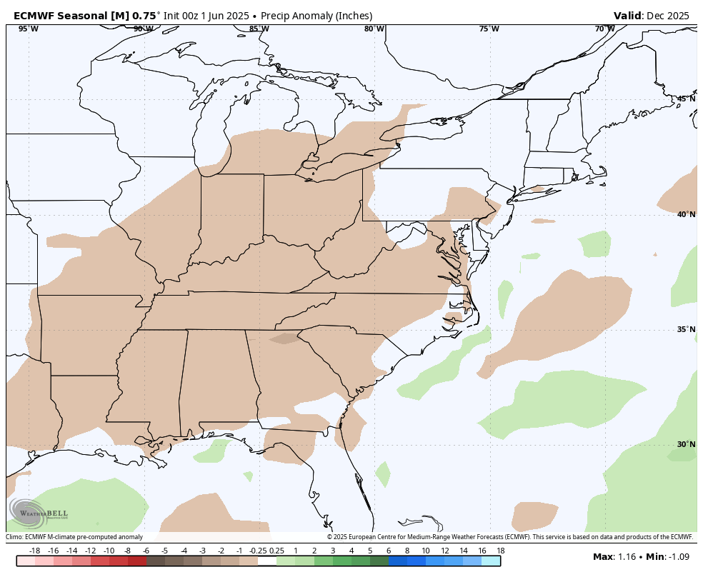
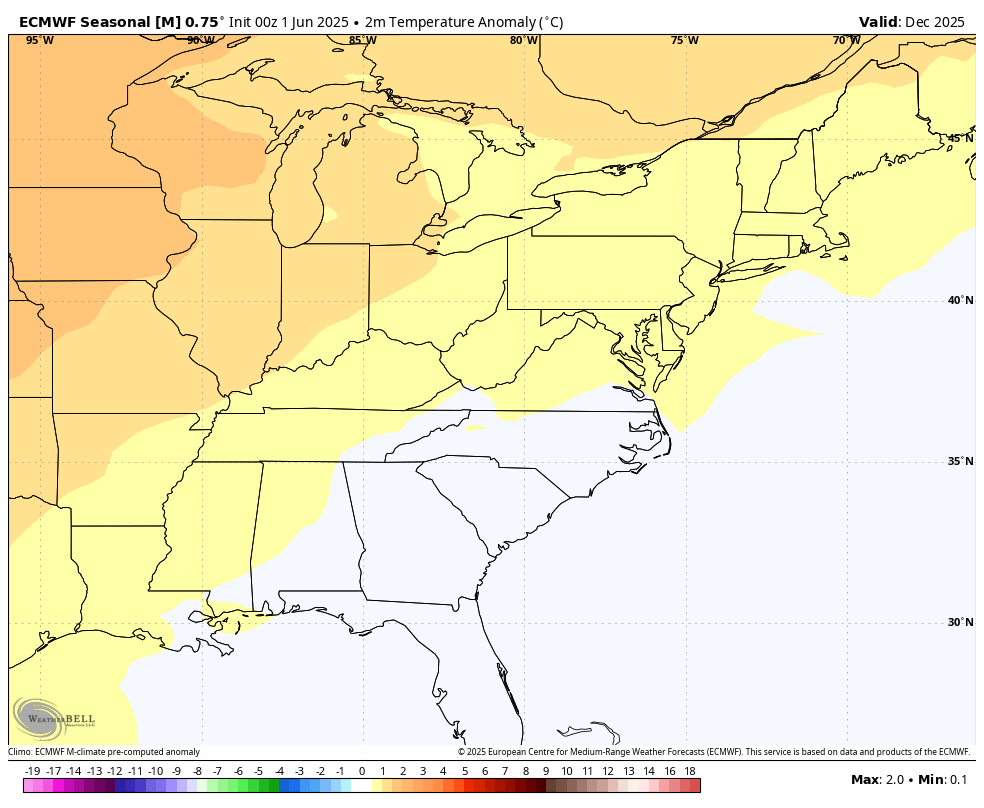
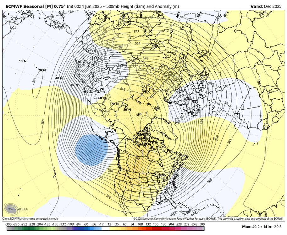
WB 6/1 EPS for December.

-
Great post Don't know why everything has to be called EXTREME WEATHER...they want to make it look like only recent history we have had extreme events and its only been hot because...gasp climate change
-
Oh dear Christ. TimB and TheClimateAsshole just posted similar shit... The tearing of the fabric will soon commence.
-
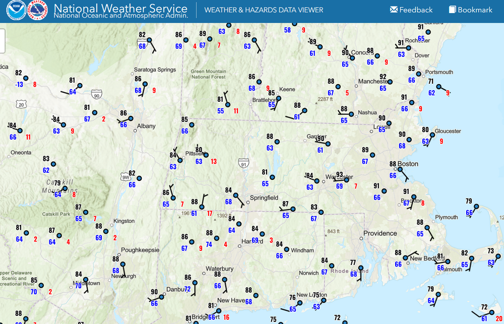
They do have good looking maps though, I like their graphics.
-
overachiever
-
They’re real .. and they’re specdewular
-
@Blizzard of 93 - just 16 days from now we'll observe the longest day in terms of daylight...after that, the slow march towards winter commences!
-
I’m dewing it well too. We evapotranspirate.
-
83/70 here at 12:25pm.
-
Weatherbell lol
-
88/71 for today's Tamaqua nooners. Humid day today ahead of the rain.
-
Kevs mulch pile dews are notorious
-
meh... mostly dps are in the 60s
-
LFG
-
I like trying to make connections and I can't help but feel that the warming of the West Pac and the West Atl is causing high pressures in the western basins to migrate further north causing a feedback mechanism that is resulting in these stuck patterns. I think this will only change when we see a massive melting of the ice caps and an influx of cooler water into these basins, which, ironically enough might reset everything to the old pattern (at a higher level.) Nature does self regulate through feedback mechanisms even though it might do it in a way we don't want it to.
-
91/73. Yeah baby.
-
Why not? It’s not far from Bristol.
-
The exact reason that the warming is manifesting in these new stuck weather patterns that have become common in recent years may not be fully understood yet. But we can still use them as an aid to our long range winter and summer seasonal forecasts. Once a season begins and the same patterns emerge as recent years, then it helps gain confidence in the model forecasts going forward. So if the models show a big over the top warm up like today, then it’s a match for our new recent climo. This becomes useful in comparing it to what the longer range medium and and seasonals are showing.
-
Unexpected .27 of rain this morning.
-
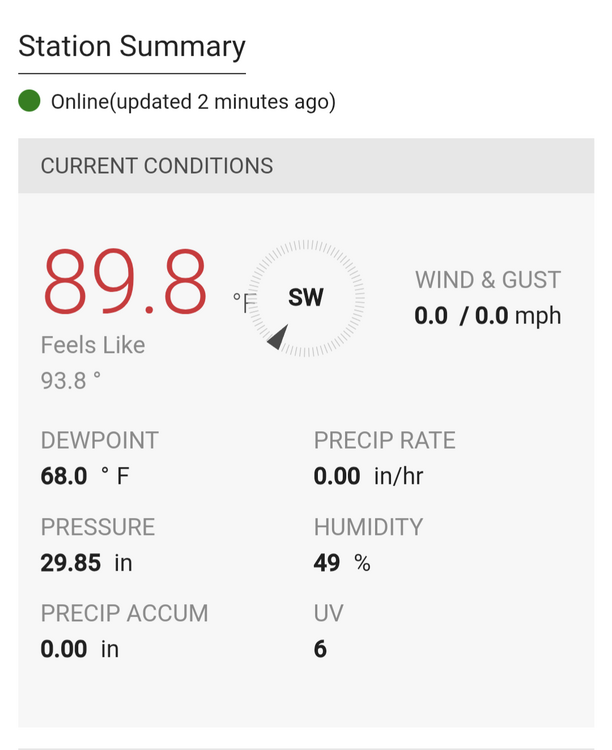
 Again my station is not part of the data set for Chester County PA!
 - Today
-
Thanks Chris, is there a specific reason these over the top patterns are happening? Is it linked to what we are seeing with the western basins in the Oceans warming up more quickly too (it's happening both in the Western Pacific and the Western Atlantic.) I noticed that Western Europe has been getting a lot of extreme heat the last few years just like Western North America has been getting. London reached 104 F (40 C) for the first time in recorded history a few years ago.