All Activity
- Past hour
-

Spooky Season (October Disco Thread)
CoastalWx replied to Prismshine Productions's topic in New England
Looks boring for awhile -

Central PA Fall Discussions and Obs
Mount Joy Snowman replied to ChescoWx's topic in Upstate New York/Pennsylvania
Low of 52 with .46” of rain. -
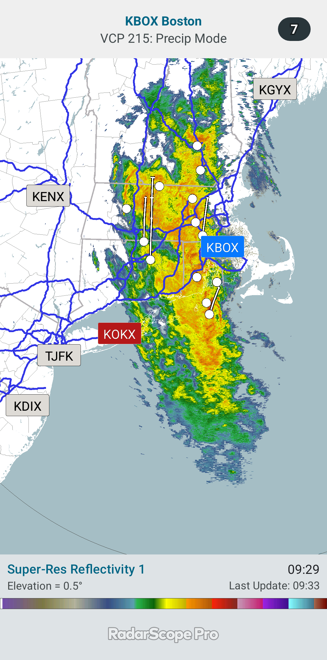
Yea the rain was west, then disappeared when it came to Long Island, except the far east where it came back.
-

-
0.83 this morning. I win!
-

2025-2026 ENSO
40/70 Benchmark replied to 40/70 Benchmark's topic in Weather Forecasting and Discussion
Yea, I'm been trying to get it ...entered 70N/20N an 100E/60W. Must be doing something wrong. -
I selected custom for the map view and entered the coordinates.
-
0.5" in Holyoke, no interesting winds or anything. I'll take the rain tho.
-
Notable left trend on FNV3 (Google DeepMind ensemble) from 12z run yesterday to today's 6z run - both in terms of the the members that show a sharp NE curve into Hispaniola being further west (Haiti vs. DR) and a lot more members turning west into the NW Caribbean
.thumb.gif.c231d3ed69c3691e578abcb4b99b6498.gif)
-
If I put 2 buckets outside, I think both would equal 40" for the year if it was 57 degrees outside or 54.
-
We would get occasional months where some part of the area would get with 10” since 2003. The last month for us was August 2024 and at MPO May 2025. Many spots have been well below 40” over the last 12 months. My area has only had around 32” in the last 12 months which is too dry in this much warmer climate. In the old days we could get away with some drier years since a cooler climate didn’t dry out so quickly during the warm season. Long range precipitation forecasting is very uncertain. So we can’t say based off one year that the wet pattern since 2003 has shifted. But the current dry pattern since September 2024 has been defined by storms underperforming model forecasts like we are seeing today. We will know that this drought is over when and if the storms start beating model expectations. It will probably lead to someone getting near or over 10” on the month and repeated very wet months. Since in the warmer climate we need something closer to 50” due to the much warmer summers drying things out very quickly.
-
Stuck patterns FTW. You really can’t go wrong betting on continuity this decade if you’re a seasonal forecaster.
-

Spooky Season (October Disco Thread)
MJO812 replied to Prismshine Productions's topic in New England
Yep onto November -
If that person prefers covered chins over covered feet it was well worth the cut.
-
Most systems get closed between now and like Nov 10th. Get it fixed when it is getting closed for winter or in the Spring when opening.
-
Overdone EC/EPS late last week for this morning in terms of SE BL inflow and associated rainfall... Block continues into November, even in its weakened state in early Nov. sometime between Oct 28-Nov 3 maybe something pretty strong? No promises and not self evident in the ops. Am back from this past weekend near CMH with bumpy flight return last evening in OH/PA. Indian marriage celebration... pretty cool.
-

Spooky Season (October Disco Thread)
HoarfrostHubb replied to Prismshine Productions's topic in New England
0.63" at a station 1 mile from my house. Not bad for 2 hours -

Occasional Thoughts on Climate Change
Typhoon Tip replied to donsutherland1's topic in Climate Change
Fermi Paradox explanation, incarnate if you ask me. It is a personal hypothesis of mine; in it's simplest preface states, 'the species evolves the ability, and then the ability unwittingly devolves the species'. Which yet even more succinctly equates to, 'evolution emerges the devolution of the species' Whether there is any veracity to that idea or not, we cannot deny the intuitive suspicious, nor the outright observation of the 'emerging Idiocrasy' phenomenon. Maybe human evolution has reached the point whence the Law of Diminishing Returns has kicked it. The law of diminishing returns, often referred to as the law of lessening returns, states that if you keep increasing one factor of production while keeping others constant, the additional output gained from each new unit of that factor will eventually decrease... I mean ... we can see that with a modest interpretation of that we might be observing how more and more provision of resource, both physical or informed, is resulting in less productivity ( perhaps a perversion of "intelligentsia" for this context - coming back from the people being effected by all that provision. Or maybe that's twisting things too much. Either way, I've been finding that via vis-à-vis with humanity, the ideas above don't even get comprehended on the first pass like they did decades ago. I'm old enough to remember a time when a mere water cooler discussions like that among sincere head nodders. Now, you get a more gape jawed stares. Maybe in some physics sense it is also entropy growing within the system - I kind of like that actually. Because we learn via formal academia that entropy does in fact gain in every system that exists in nature. So why would the evolutionary process not have to pay the cosmological tax of disorder. interesting -
Make that 34.3.! also put on a new pool cover for my above ground and the wind took it off last night.28.6 gust! Need more string and tie downs! .
-
With 98L's increased organization in the past 12 hours, the hurricane models finally seem to be getting a better handle on its track and intensification. https://x.com/yconsor/status/1980253973345923256
-
A sprinkler valve broke last night and I'm not handy with those, so rest assured that it will absolutely be the Atacama Desert around here until I'm able to get someone in to repair it.
-
Spooky Season (October Disco Thread)
CoastalWx replied to Prismshine Productions's topic in New England
Nothing really interesting in the long range. Melissa OTS. Boredom remains. -
SST Anomaly
-
Records: Highs: EWR: 80 (2021) NYC: 80 (1969) LGA: 80 (2021) JFK: 81 (1969) Lows: EWR: 31 (1974) NYC: 31 (1974) LGA: 32 (1972) JFK: 33 (1974) Historical: 1770 - An exceedingly great storm struck eastern New England causing extensive coastal damage from Massachusetts to Maine, and the highest tide in 47 years. (David Ludlum) 1770: An exceedingly great storm struck eastern New England causing extensive coastal damage from Massachusetts to Maine, and the highest tide in 47 years. 1835: 6.0 inches of snow fell at Ft. Snelling, MN. (Ref. AccWeather Weather History) 1940: The earliest snow greater than one inch in Washington, DC, fell on October 20, 1940 with 1.4 inches and the second earliest greater than one inch was October 30, 1925 with 2.2 inches. (Ref. Washington Weather Records - KDCA) (Ref. October Snows by Herb Close) 1952: Central Park in New York City had their earliest measurable snowfall with a half inch falling. (Ref. Wilson Weather History) 1983 - Remnants of Pacific Hurricane Tico caused extensive flooding in central and south central Oklahoma. Oklahoma City set daily rainfall records with 1.45 inch on the 19th, and 6.28 inches on the 20th. (17th-21st) (The Weather Channel) 1987 - Cold arctic air invaded the Upper Midwest, and squalls in the Lake Superior snowbelt produced heavy snow in eastern Ashland County and northern Iron County of Wisconsin. Totals ranged up to 18 inches at Mellen. In the western U.S., the record high of 69 degrees at Seattle WA was their twenty-fifth of the year, their highest number of record highs for any given year. Bakersfield CA reported a record 146 days in a row with daily highs 80 degrees or above. (The National Weather Summary) (Storm Data) 1988 - Unseasonably warm weather continued in the western U.S. In California, afternoon highs of 96 degrees at Redding and Red Bluff were records for the date. (The National Weather Summary) 1989 - Forty-nine cities reported record low temperatures for the date as readings dipped into the 20s and 30s across much of the south central and southeastern U.S. Lows of 32 degrees at Lake Charles LA and 42 degrees at Lakeland FL were records for October, and Little Rock AR reported their earliest freeze of record. Snow blanketed the higher elevations of Georgia and the Carolinas. Melbourne FL dipped to 47 degrees shortly before midnight to surpass the record low established that morning. Showers and thunderstorms brought heavy rain to parts of the northeastern U.S. Autumn leaves on the ground clogged drains and ditches causing flooding. Up to 4.10 inches of rain soaked southern Vermont in three days. Flood waters washed 600 feet of railroad track, resulting in a train derailment. (The National Weather Summary)(Storm Data) 1994: 1994 The rampaging San Jacinto River (20 feet+ higher than normal) caused 8 pipelines carrying various petroleum products to rupture near Houston, TX; the river ignited in flame and smoke which shot 100s of feet into the air. More than 500 (mostly minor) burn/inhalation injuries. (Ref. Weather Guide Calendar with Phenomenal Weather Events 2011 Accord Pub. 2010, USA) 1996: New Englandwas in the middle of a four day nor'easter which dumped tremendous rainfall totals, especially over eastern sections. 19.19 inches of rain fell at Camp Ellis, ME. 13.03 inches was recorded at Newburyport, MA. Portland, ME set a new all-time 24 hour rainfall record with 13.32 inches. Other rainfall totals included 17.21 inches at Sanford, ME, 12.23 inches at Portsmouth, NH, 11.21 inches at Bedford, MA, and 7.89 inches at Boston, MA. The storm tapped moisture from Hurricane Lili, far to the southeast over the Atlantic, which contributed to the excessive rainfall. The nor'easter also produced high winds along coastal sections. A wind gust to 81 mph was recorded at Little Compton, RI. One person was killed and total damage was over $50 million dollars.(Ref. Wilson Weather History) (Ref. AccWeather Weather History)
-
0.10 as well. Most of it was just remnant broken bands of showers as the southern edge rotated north. A nothing burger for the longer term drought. What did places like Buffalo and Toronto pick up? Looked like solid rains out there for close to 24 hours.


.gif.9da44c81a628481e8d1a3f702b8537e2.gif)


