All Activity
- Past hour
-
This map above is hilarious .But Maybe Just Maybe
-
Looks nice Rather show this than the deep cold which would cause suppression like last year.
-
Did you mean you would not expect a very cold December, then?
-

November 2025 general discussions and probable topic derailings ...
cleetussnow replied to Typhoon Tip's topic in New England
Like I said. I believe in CC and that men can’t have babies. Somehow both are heavily political -

Mid to long range discussion- 2025
WinstonSalemArlington replied to wncsnow's topic in Southeastern States
-

November 2025 general discussions and probable topic derailings ...
KoalaBeer replied to Typhoon Tip's topic in New England
I’ll come out of hibernation and bite against my better judgement. It’s funny (or not) how CC became such a bipartisan issue. I was watching the documentary The White House Effect on Netflix last night and didn’t realize how seriously the bush administration took global warming, at first accepting the scientific facts but eventually whitewashing it as up to debate. How much we have regressed since then is depressing. It should not be a D vs R issue. Anyways hope all of you are well. Just got a snowmaking gun delivered to work today so I’ll be making and frolicking in the white stuff before the rest of you weenies. -

November 2025 general discussions and probable topic derailings ...
dendrite replied to Typhoon Tip's topic in New England
Well that’s why I don’t even debate temps anymore. It’s hard to know how much could be a natural cycle vs anthropogenic induced. Obviously we know there’s a lot of heat being added in order to raise the ocean temps and arctic ice/permafrost, but it’s more difficult comparing changes in 2m temps globally…heck we have a hard enough time doing it with a single station with siting changes. But for me there’s no getting around the runaway CO2 levels. I’ve said it many times, but just clean that up and let the temps be whatever they may be. Who wants all of those emissions in the atmosphere anyway? I just don’t understand why it has to come down across party lines. It’s so mind numbingly dumb. -
I didn't get an answer directly, but LWX FB page has an image showing the growing season is over in the LWX CWA for everyone but St. Mary's/Calvert in S MD and King George in VA
-

2025-2026 ENSO
40/70 Benchmark replied to 40/70 Benchmark's topic in Weather Forecasting and Discussion
I would not expect a very cold Decemer, - NAO just delivers consistently pedestrian departures. You need the +TNH get really cold values...and this is assuming tha the -NAO isn't overdone, which it probably is. -
 well, pretty soon the snowmobile crowd will be relegated to northern Manitoba, so those posts will be gone. Driving 20 hours to find snow for snowmobiling
 -
Totally my anecdotal observations, but it seems like the weeklies are ok at picking out a single “pattern change” during the forecast period, but then don’t properly show how that new pattern may evolve or change. So I buy a “good” pattern develops after thanksgiving, but I doubt it looks the same for the subsequent 4 weeks.
-
Of course there is very little fundamental accuracy this far out however it would be nice to see a more robust signal for precipitation in our area. A lot will depend on the configuration and presence of blocking if we are to get any snowfall prior to the holidays. And years past going far back with a Nina when it has been cold in December which has happened on quite a few occasions it has normally been dry right when the cold snap ends was when the precipitation set in as you can imagine a typical occurrence cold dry warmer wetter.
-
Not going to lie, I think it’s pretty garbage that we cater to an anti-science crowd and temper tantrums, when it comes to the very obvious human influenced warming of the earth. On a science and weather forum no less. Just calling it like it is.
-
+WPO is actually cooler pattern in the extreme Southeast. It's main effect is a ridge in SE Canada and around the Great Lakes/Midwest/Northeast. I think the digging trough that was +wpo/+pna related, and the fact that it happened 1 day from the coldest of the year on average (Jan 27). Surprisingly, the NAO/AO was not negative for that event.. so in the optimal scenario, it could have gone even further south!
-
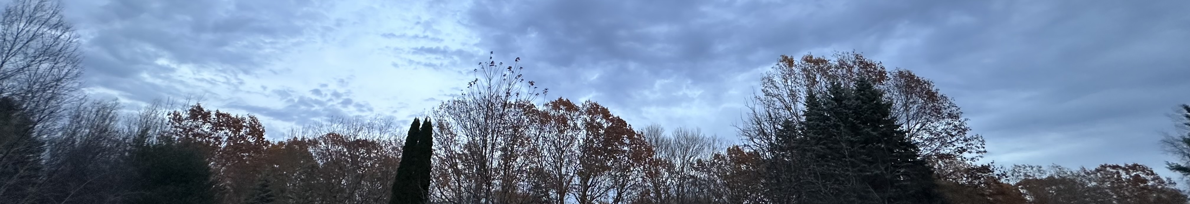
Shitty late evening pano picture, but you can see how many oaks are still loaded here.

-
That tracks well with weeklies usually showing colder air and then correcting warmer as time gets closer.
-
Thought it would be a more severe thunderstorm not tor watch
-
URGENT - IMMEDIATE BROADCAST REQUESTED Tornado Watch Number 635 NWS Storm Prediction Center Norman OK 325 PM CST Fri Nov 7 2025 The NWS Storm Prediction Center has issued a * Tornado Watch for portions of Northern Alabama South-Central Kentucky Middle into Eastern Tennessee * Effective this Friday afternoon and evening from 325 PM until 1000 PM CST. * Primary threats include... A couple tornadoes possible Scattered damaging wind gusts to 70 mph possible Isolated large hail events to 1.5 inches in diameter possible SUMMARY...Scattered thunderstorms are forecast to develop and intensify through the remainder of the afternoon and persist through much of the evening, as they move west to east across the Watch area. A few of the stronger storms will likely become supercellular and pose a risk for isolated large hail and perhaps a couple of tornadoes. Scattered damaging gusts (60-70 mph) are possible with the stronger storms and may focus with the more organized thunderstorm bands as a mix of linear and cellular storms evolve. The tornado watch area is approximately along and 85 statute miles east and west of a line from 60 miles north northwest of Crossville TN to 40 miles east of Muscle Shoals AL. For a complete depiction of the watch see the associated watch outline update (WOUS64 KWNS WOU5).
-

Major Hurricane Melissa - 892mb - 185mph Jamaica landfall
eyewall replied to GaWx's topic in Tropical Headquarters
I thought Josh got into some of it but he has not mentioned anything about it so not sure. -
Mid to long range discussion- 2025
WinstonSalemArlington replied to wncsnow's topic in Southeastern States
-

Central PA Fall Discussions and Obs
Voyager replied to ChescoWx's topic in Upstate New York/Pennsylvania
Wow...the wind is wicked up in Hazleton (Humboldt Industrial Park) today... It literally ripped the truck door out of my hand when I opened it. Meanwhile, here in Tamaqua, just a light to moderate breeze. I've got to wonder. At 1,500 to 1,800 feet does that area sit at just the right elevation to be in some sort of upper level jet? -
Mid to long range discussion- 2025
WinstonSalemArlington replied to wncsnow's topic in Southeastern States
European weekly upper level patterns favor colder than normal 12/5, 12/12, and 12/19 EIA weeks for U.S. -
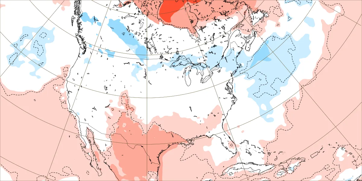
Today’s Euro Weeklies run for Dec 1-7 has backed off significantly from yesterday’s run, which was the coldest run yet. It looks like the run from 2 days ago. Also, the subsequent two weeks are warmer than yesterday. All 3 weeks are now near normal in most of the E US. Dec 1-7: Today Yesterday:

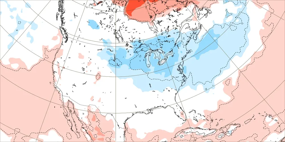
- Today
-
Looks meh,DP's arent even into the 60s along the Al/TN line,no convection other than 1-40N ATM
-
Still have yet to visit Chicago