All Activity
- Past hour
-

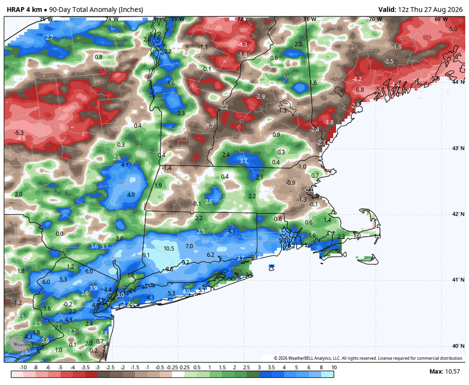
Augdewst 2026: Summer's Last Stand
Sey-Mour Snow replied to Prismshine Productions's topic in New England
-

2026-2027 Record-breaking El Nino
40/70 Benchmark replied to Stormchaserchuck1's topic in Weather Forecasting and Discussion
Yea, I Iike that analog better from a +TNH (High solar/E QBO) perspective....2015 would have been my top polar analog had it been cool ENSO, but wish I had still used it. I'm not going to be as ENSO restrictive with weaker events moving forward, especially as ENSO continues to wash out some. The extra Pacific was much more hostile in general than 2015, which is somewhat related to ENSO, but def. a great polar analog. -
(002).thumb.png.6e3d9d46bca5fe41aab7a74871dd8af8.png)
Central PA Summer 2026 Discussion/Obs Thread
ChescoWx replied to Voyager's topic in Upstate New York/Pennsylvania
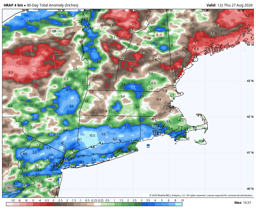
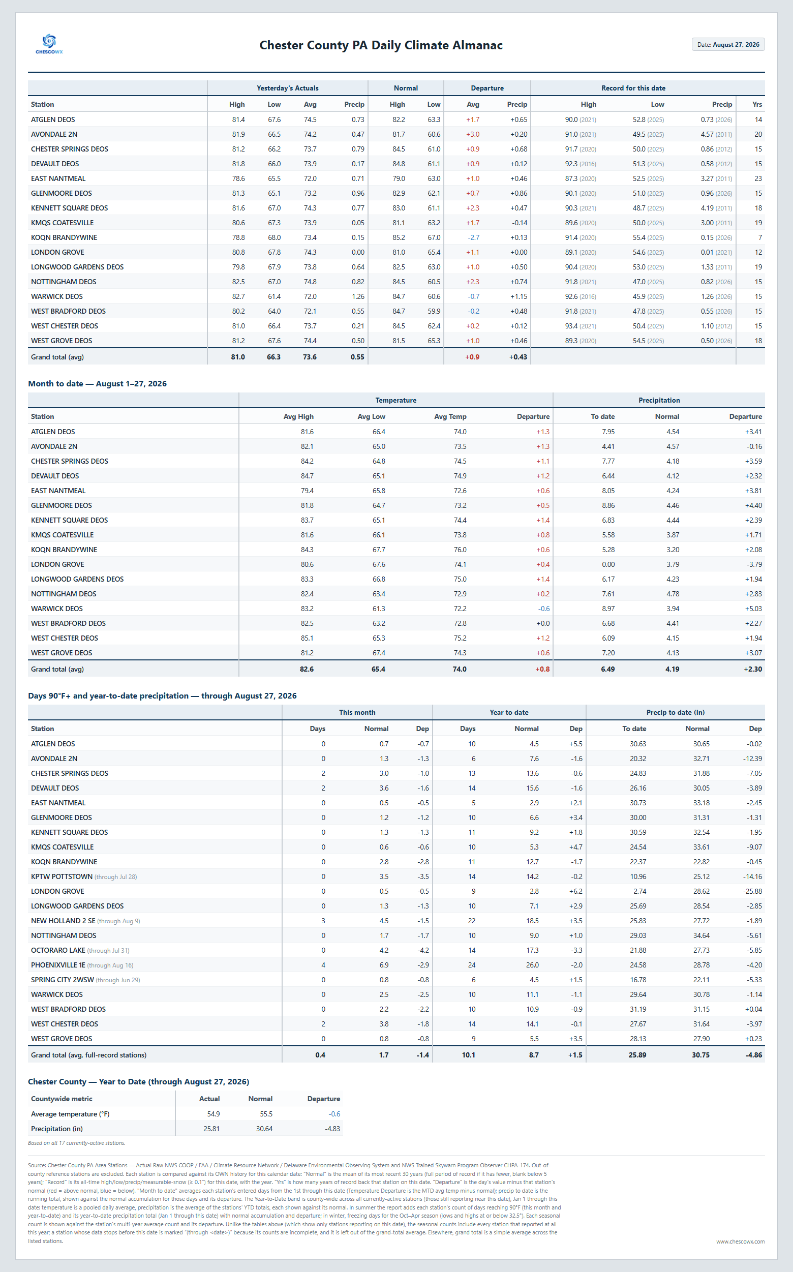
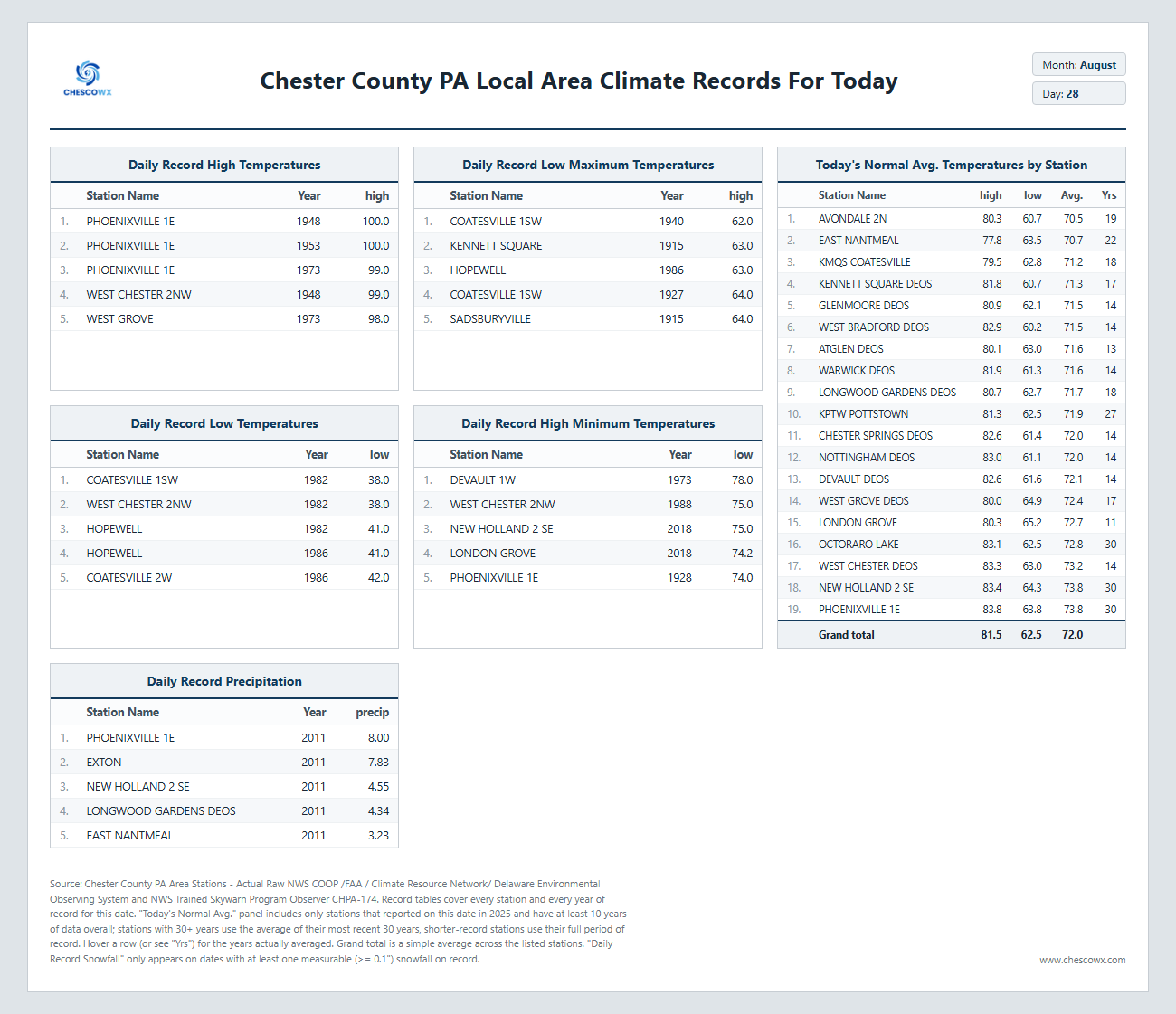
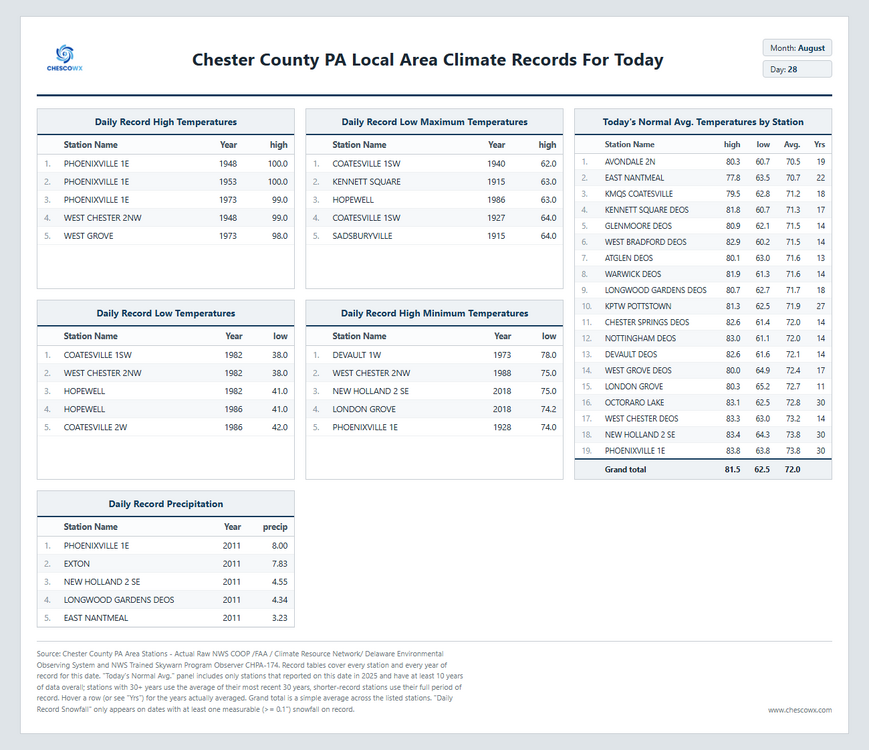
A nice weekend ahead with increasing sun today and continued below normal temperatures through the weekend. We warm to above normal highs in the mid to upper 80's by Monday lasting through Wednesday we then fall back to a bit closer to normal by the end of next week. Next rain chances look to be toward Tuesday.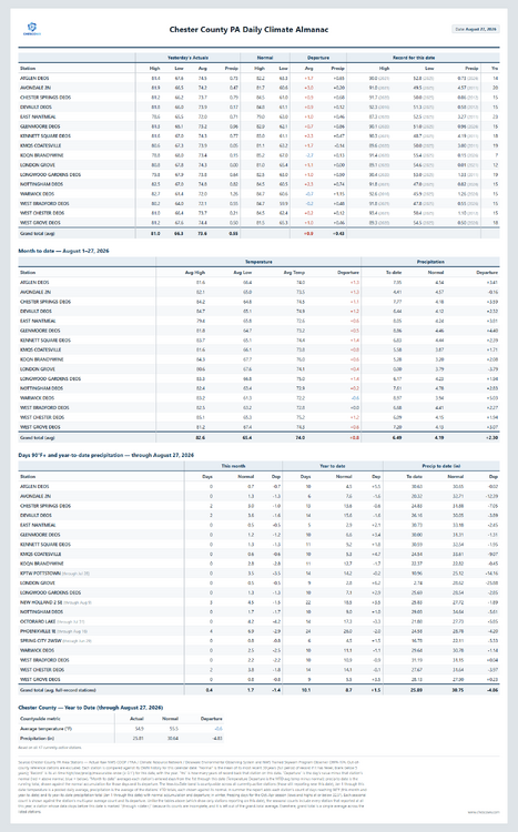
-
E PA/NJ/DE Summer 2026 Obs/Discussion
ChescoWx replied to PhiEaglesfan712's topic in Philadelphia Region
A nice weekend ahead with increasing sun today and continued below normal temperatures through the weekend. We warm to above normal highs in the mid to upper 80's by Monday lasting through Wednesday we then fall back to a bit closer to normal by the end of next week. Next rain chances look to be toward Tuesday.
-

2026-2027 Record-breaking El Nino
PhiEaglesfan712 replied to Stormchaserchuck1's topic in Weather Forecasting and Discussion
At the end of the day, the winter of 2025-26 was a warmer version of 2014-15. The 10+ departures in the West were much more widespread, and the cold in the East wasn't as strong or as long. -
Lol. Defending a political decision by accusing someone of being political.
-
2026-2027 Record-breaking El Nino
40/70 Benchmark replied to Stormchaserchuck1's topic in Weather Forecasting and Discussion
You understand both can be true, right? It's not as cold as the 1970s...got it.....but last season was not as conducive to sustained cold and high latitude blocking as 1995. -

2026-2027 Record-breaking El Nino
LakePaste25 replied to Stormchaserchuck1's topic in Weather Forecasting and Discussion
Yeah other than that stretch in late January, the last 2 winters featured just normal winter cold that we used to get much more frequently. -

2026-2027 Record-breaking El Nino
bluewave replied to Stormchaserchuck1's topic in Weather Forecasting and Discussion
The cold in the East this past winter was weak sauce compared the the hard winters of the 1970s. -
 Take a look at this link: MedGuide USA for complete instructions.
 -
2026-2027 Record-breaking El Nino
40/70 Benchmark replied to Stormchaserchuck1's topic in Weather Forecasting and Discussion
I do think the increasing predisposition towards +NAO and +WPO is in part a byproduct of CC, but it's not the only factor...there are other reasons why 2025 was not as favorable as 1995. That being said, would an identical pattern be as cold? No...agree, there. -
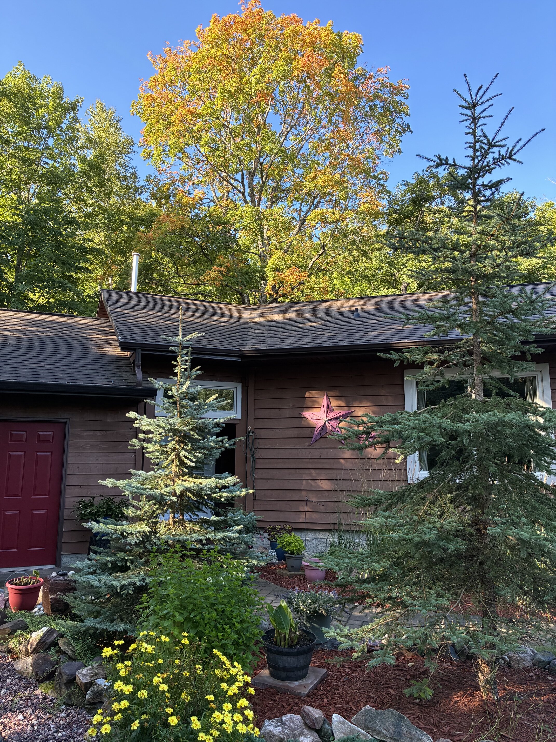
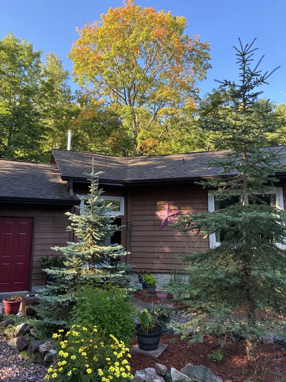
Beautiful morning with a low of 46, even a few spotty showers around dawn. Great stretch of late summer-early fall weather ahead after some much needed weekend rain.
-
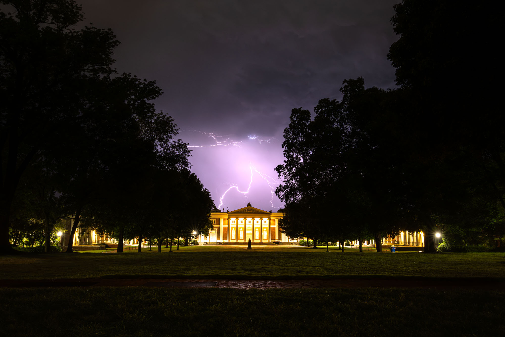
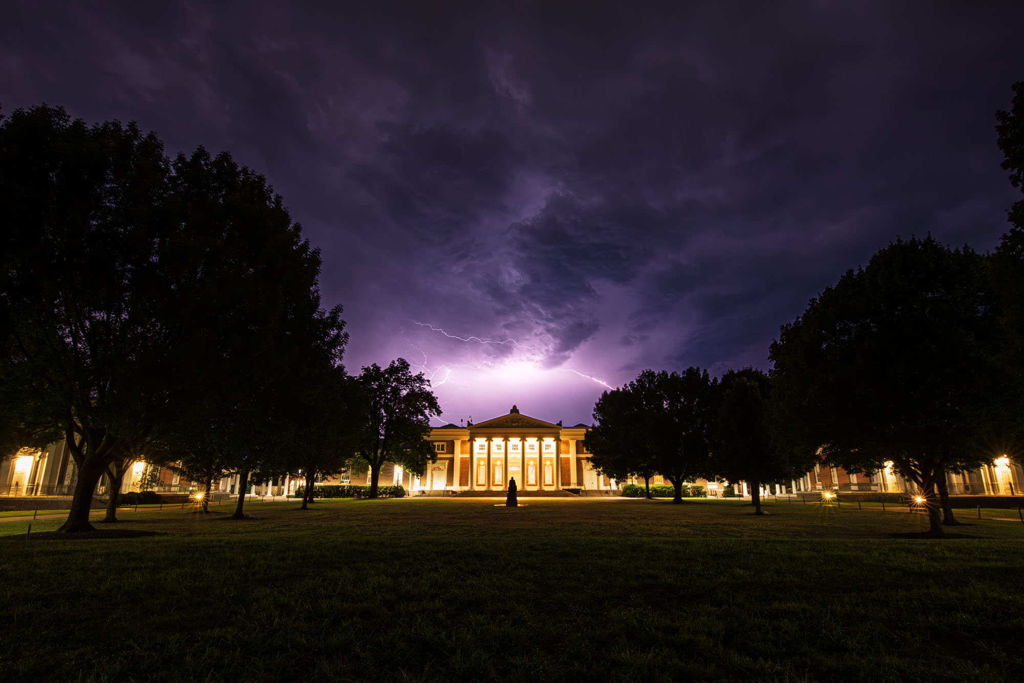
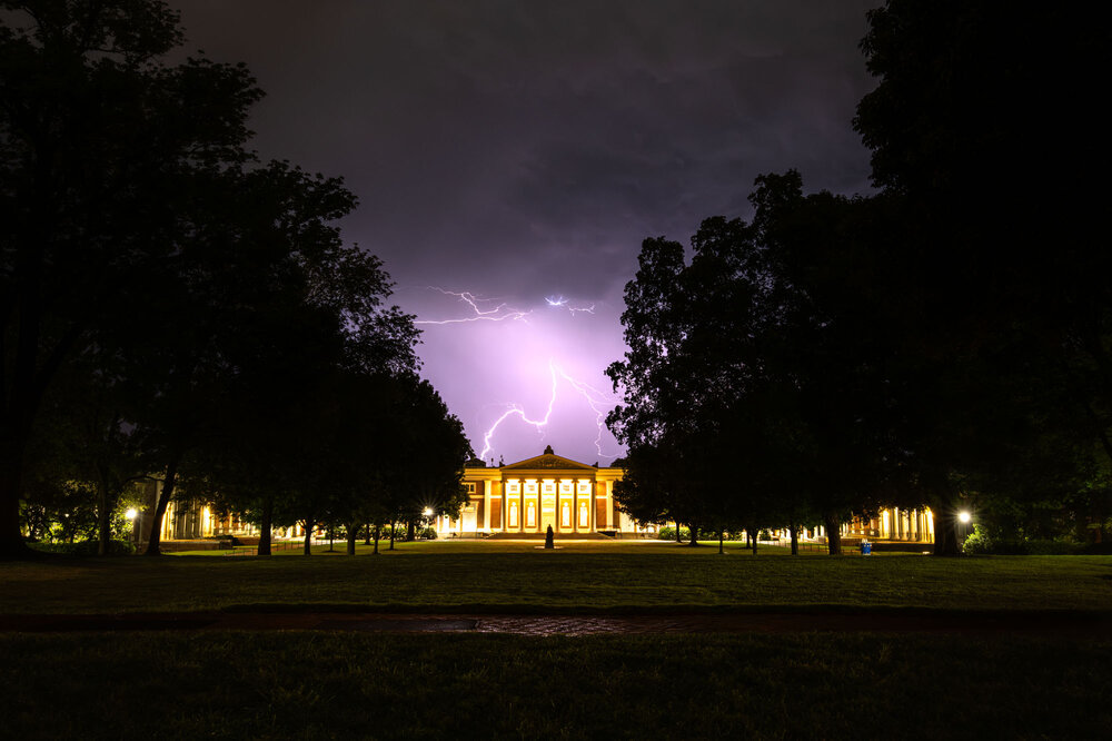
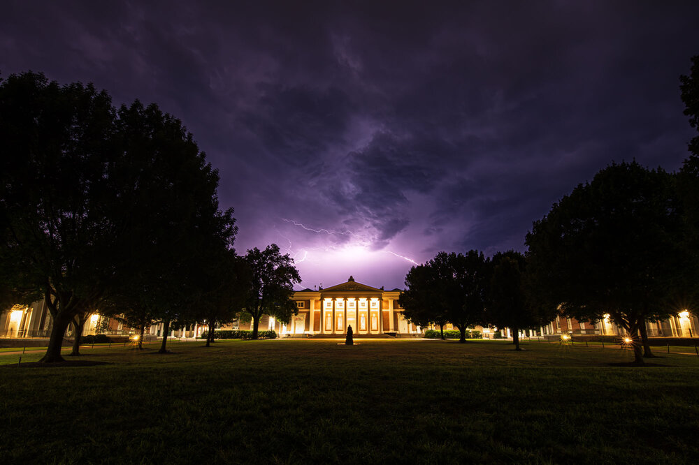
Storms ruined my picnic plans last night, but once they moved out to the southeast they put on one of the most incredible lightning shows I've seen. One of those times were even other, presumably "normal" people stop to look up at the sky. Bolt after bolt ran along the clouds for hours. Had the privilege of walking down to watch it once with a friend and then later on with my camera. Won't be a night to forget.

-
Out at the cabin this weekend, last night had a thunderstorm with lots of lightning and thunder coming in but as soon as it reached the edge of my property it just fizzled out and ended up with nothing.
-
2026-2027 Record-breaking El Nino
40/70 Benchmark replied to Stormchaserchuck1's topic in Weather Forecasting and Discussion
This is the problem with any issue as politicized as CC....no one is ever going to "win", or change their mind because the data is always going to be shoehorned into a specific ideology. We could end up somehow having this winter be colder than last year and I would bet my life they would find a way to link it to CC. -
Within the U.S. this is true since we have widespread access to air conditioning. Most of the movement within the U.S has been from cooler locations to warmer ones. Outside this forum most people applaud the much milder winters since they require less heating demand which has become so expensive these days. They will put up with warmer summers since the extra cooling costs are pennies on the dollar compared to what a really cold winter like we would regularly get in the past did to winter heating bills. But the movement to warmer locations within the U.S comes with risks. Water shortages are becoming an issue out West with some smaller communities losing water rights. Wildfires have become a big issue with the land becoming so dry combined with human and natural ignition sources on the rise. Another risk is that over the coming decades is that the Western droughts begin to creep out into the Plains lowering crop yields. Places like France and The UK with much smaller agricultural output have suffered significant crop losses this summer. Plus increasing exposure to extreme flood events across the U.S from rainfall and tropical systems.
-
2026-2027 Record-breaking El Nino
40/70 Benchmark replied to Stormchaserchuck1's topic in Weather Forecasting and Discussion
So weren't the solar cycle and the state of the northern Atlantic....both of which were much different from 1996. Chuck and I were both pretty accurate with that. -
Mid 30's-40's inland areas with 50's along the shore. Buoy air temps around 60. Looks like sct shwrs/stms thru the weekend. Need every bit.
-

2026-2027 Record-breaking El Nino
soadforecasterx replied to Stormchaserchuck1's topic in Weather Forecasting and Discussion
That was not the case on the east coast for last winter though. We had one of the coldest stretches since the 70s right after a massive winter storm. -

2026-2027 Record-breaking El Nino
EasternLI replied to Stormchaserchuck1's topic in Weather Forecasting and Discussion
Love that gradients were mentioned. Everything weather related needs gradients in order to operate, after all. I'm going to take this opportunity to add a PDO illustration to that same context. Because if you really dig deep into the research on it. You will find that the most important feature of that in a sst sense is the warm or cold tongue. Remember that when the PDO is in phase with enso, that enso effects are amplified. Out of phase, the opposite occurs to a degree. It is the increase or decrease in the gradients through latitude sst that contributes to this. You can see in the image below how a negative PDO(opposite of picture) in conjunction with El Niño offers a relaxed sst gradient by latitude. That makes it all the more interesting to see how this year evolves. -
August 28 1989: Baseball-sized hail pummels Pequot Lakes. For Friday, August 28, 2026 1898 - Torrents of rain accompanied by a furious wind upset the rain gage at Fort Mohave AZ. However, water in a wash tub set out on the mesa, clear of everything, measured eight inches after the 45 minute storm. (The Weather Channel) 1911 - Saint George, GA, was deluged with 18.00 inches of rain in 24 hours to establish a state record. (The Weather Channel) 1959 - Lieutenant Colonel William Rankin bailed out of his plane at a height of 46,000 feet into a violent thunderstorm, and lived to write about the 45 minute journey (which normally would have been a thirteen minute descent). He described it as one of the most bizarre and painful experiences imaginable. (The Weather Channel) (Note: Insane!!) 1971 - Heavy rains from Tropical Storm Doria caused devastating floods in central and northeast New Jersey resulting in 138 million dollars damage. In southeastern Pennsylvania, high winds downed trees and power lines, and in New York City, heavy rains flooded streets and subways. (David Ludlum) 1973 - An F4 tornado touched down near Canaan, New York, and moved to western Massachusetts. Three people were killed in West Stockbridge, Massachusetts when a truck stop was destroyed, and another person died in a ruined house nearby. 1986 - The temperature at Apalachicola, FL, dipped to 62 degrees to shatter their previous August record by four degrees, having tied their August record high of 99 degrees on the 2nd of the month. (The Weather Channel) 1987 - Severe thunderstorms broke the heat in the southeastern U.S. and the Gulf Coast Region, but not before seven cities reported record high temperatures for the date. The severe thunderstorms produced wind gusts to 80 mph downing large trees around Horse Shoe NC, and pelted southeastern Meridian MS with hail two inches in diameter. (The National Weather Summary) (Storm Data) 1988 - Tropical Storm Chris spawned a tornado near Manning, SC, which killed one person, and spawned three tornadoes in North Carolina. Chris produced one to two foot tides, and three to six inch rains, over coastal South Carolina. Severe thunderstorms in New York State and Vermont, developing ahead of a cold front, spawned a tornado which killed one person at Hector NY, produced tennis ball size hail at Brandon VT, and produced wind gusts to 80 mph at Lyndonville VT. (The National Weather Summary) (Storm Data) 1989 - Early morning thunderstorms in Nebraska produced 4.50 inches of rain around McCook, and 4.65 inches near Auburn and Brownville. Showers in Montana pushed the rainfall total for the month at Havre past the previous August record of 3.90 inches. (The National Weather Summary) 1990 - Between 3:15 p.m. and 3:45 p.m. a devastating F5 tornado ripped a 16.4 mile-long path through portions of Kendall and Will counties in northern Illinois. A total of 29 people were killed, and 350 more were injured. An estimated $160 million in damages occurred. The tornado's path width ranged from 200 yards to half a mile. A total of 470 homes were destroyed, and another 1000 homes were damaged. Sixty-five thousand customers lost power. 2005 - Hurricane Katrina attained Category 5 status on the morning of August 28 and reached its peak strength at 1800 UTC that day, with maximum sustained winds of 175 mph and a minimum central pressure of 902 mbars (26.6 inHg). Observances: 28 Fri March on Washington 28 Fri Rainbow Bridge Remembrance Day 28 Fri Bow Tie Day 28 Fri World Sanskrit Day 28 Fri Crackers Over The Keyboard Day 28 Fri National Bow Tie Day 28 Fri National Cherry Turnover Day 28 Fri Power Rangers Day 28 Fri Race Your Mouse Around the Icons Day
-
Good thing you chose meteorology over politics! Lol
-
Didn't matter with all that cloud cover last night.
-
2026-2027 Record-breaking El Nino
bluewave replied to Stormchaserchuck1's topic in Weather Forecasting and Discussion
Last season was the best this new much warmer climate could do as compared to the 95-96. More warmth was a factor in the NAO reversing so quickly in March as corals studies have found bigger NAO and AO swings from one state to another as the climate has warmed. Much less available cold made last winter the 2nd warmest for the CONUS. -

Augdewst 2026: Summer's Last Stand
Brian5671 replied to Prismshine Productions's topic in New England
Happy to miss the rains for the most part on this one. Finally drying out a bit here. 76 now waiting for the front to clear later today and wow didn't realize the political forum was back up...LOL