All Activity
- Past hour
-
6z GEFS No western trough but a Great Lakes trough . You are overthinking this. Everything still looks fine going forward.

-
Rarely has anyone captured the pure excitement of our recent run of weather, so well and descript in written word.
-

2025-2026 ENSO
donsutherland1 replied to 40/70 Benchmark's topic in Weather Forecasting and Discussion
I wanted to illustrate that CPC isn’t panicking. This map at that timeframe is along the lines of what many of us are thinking. It’s very close to my baseline scenario. -

Central PA Fall Discussions and Obs
Jns2183 replied to ChescoWx's topic in Upstate New York/Pennsylvania
Ice Ice baby. Just like Decembers of lore Sent from my SM-G970U1 using Tapatalk -

November 2025 general discussions and probable topic derailings ...
kdxken replied to Typhoon Tip's topic in New England
Crummy day. -
My cousin and her fiancé were there last winter and he proposed to her under the northern lights! They said it was a truly amazing and unique place.
-

November 2025 general discussions and probable topic derailings ...
Modfan2 replied to Typhoon Tip's topic in New England
37F and rain, as November feel as you can get. .10” so far -

Central PA Fall Discussions and Obs
Blizzard of 93 replied to ChescoWx's topic in Upstate New York/Pennsylvania
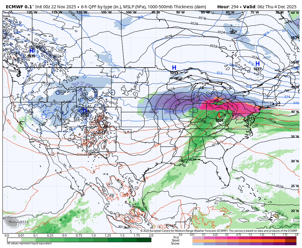
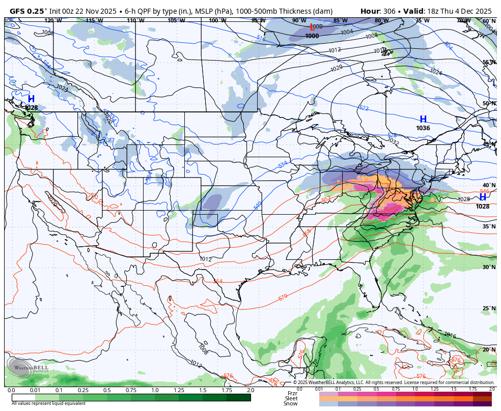
The 0z Euro & GFS now show a chance out on December 4th. Hopefully that’s the beginning of the Winter tracking fun & games.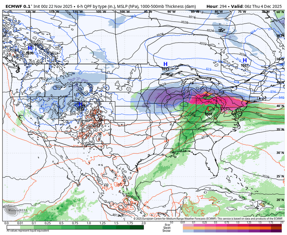

-
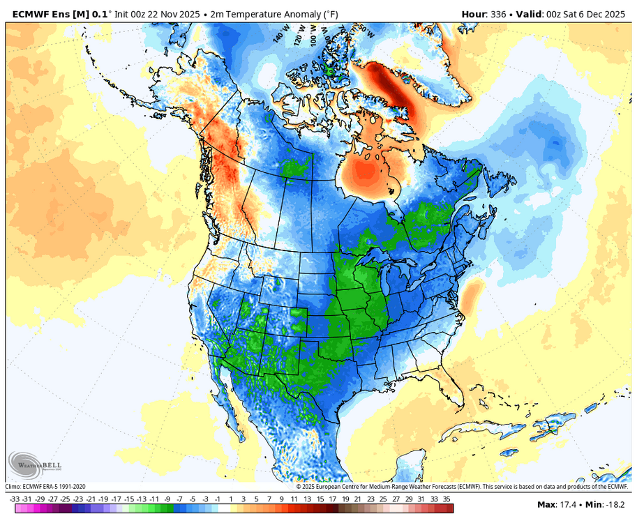
 Not a great look into the first 5-10 days of Dec overnight
 -
Yep already saw that. Insane how they live. They are the true winter weenies
-
If we roll through phase 7, 8 and 1 later in December, we should have a pattern with chances to score Winter weather.
-

December 2025 Short/Medium Range Forecast Thread
Carvers Gap replied to John1122's topic in Tennessee Valley
Overnight, it looks like the GFS started to get rid of the feedback over the SW. The 6z run pretty much eliminates it after the 6th. There will be a cutoff out there, but the GFS(and its ensemble) kick out everything after it. Is this because the model has a progressive bias? Maybe. But it would also be the first to fix whatever is going on(if indeed there is a feedback error which seems to be growing more likely). -
 I grew up in Dover, DE. We had lots of good winters between 1977 and 1996. At least 4 16"+ storms and good stretches of deep cold, iced/skating ponds, etc.
 -
If that trough out west progresses east, that could be a good set up?
-
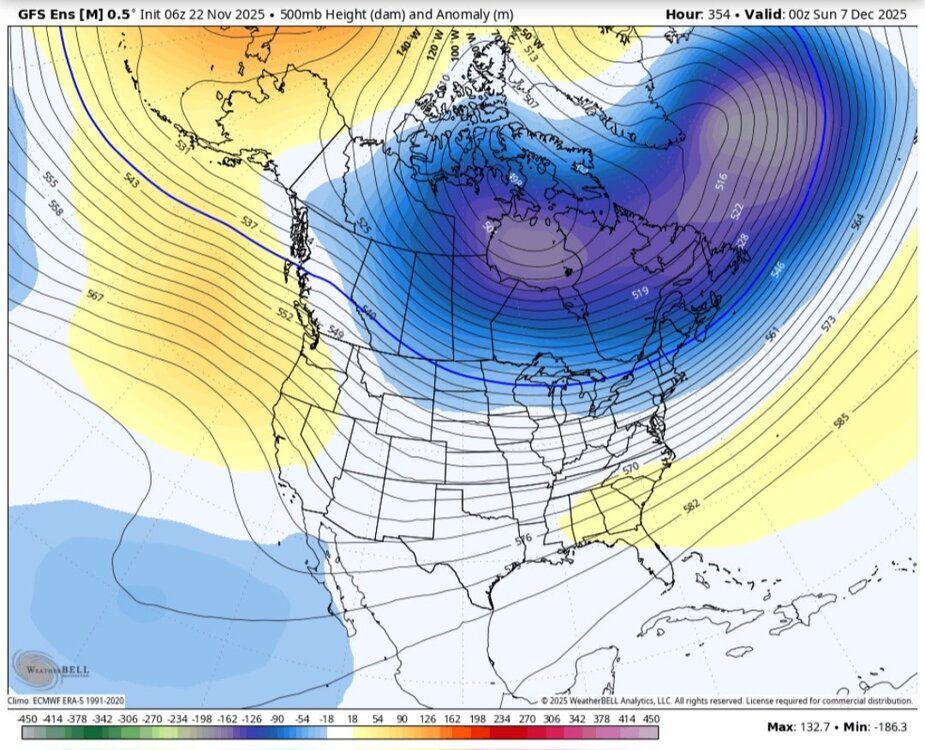
I think that evolving N. Pacific pattern doesn't match the MJO too well. Wonder if the EPS, and models over the last two days, have it less amped.
-

Central PA Fall Discussions and Obs
pawatch replied to ChescoWx's topic in Upstate New York/Pennsylvania
43 degrees and foggy. Picked up .18 of rain overnight. Deer came to visit last night, had about 8 deer in the yard. My oldest son lives on the outskirts of the city. “Hill section” And it nothing for him to see 20 deer a night. He has an electric fence around his garden to keep the deer out. -
^It's what the pattern is evolving into. The EPO is breaking down there, and -PNA is building.. usually that happens over the Pacific at 500mb first then a few days later it effects SE ridge downstream. With super +NAO like that anything unfavorable in the Pacific is going to blast the ridge north going into the 2nd week of December.
-
 wet
wet
-
The videos from Svalbard are pretty wild also.
-
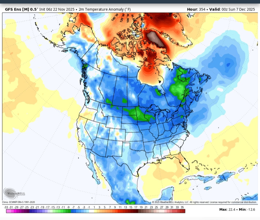
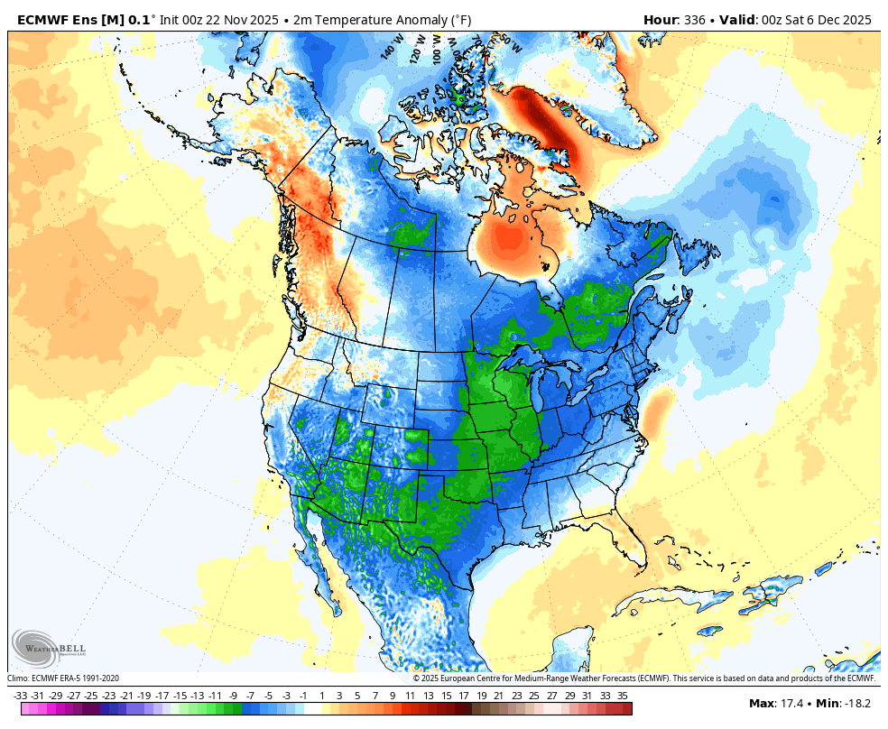
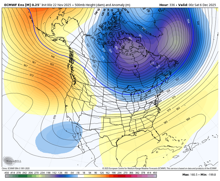
Lol, someone please tell me how this is not good … EPS is still on track for cold to be entrenched by December 5th.
-
I always watch videos of Siberia lol
-

November 2025 general discussions and probable topic derailings ...
ineedsnow replied to Typhoon Tip's topic in New England
In leominster and mod rain.. meh -
GFS FTW this morning. What a miserable run that was in cold rain
-
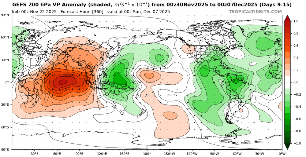
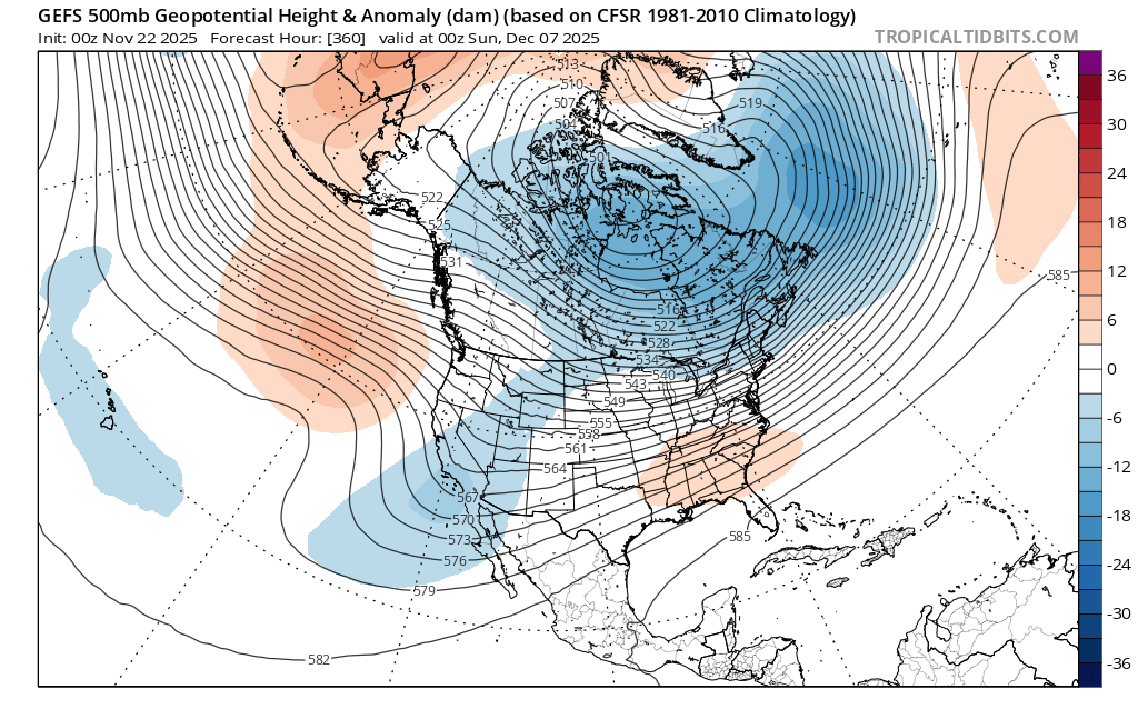
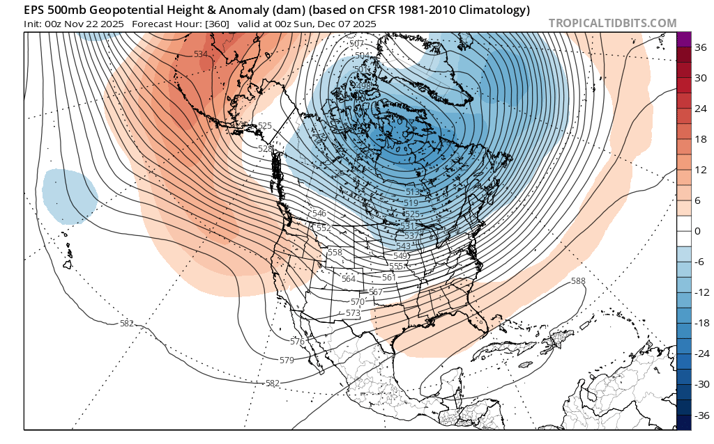
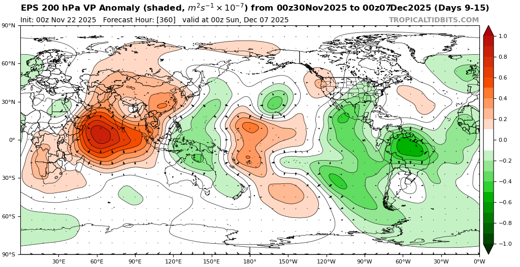
You can already see the model differences between the EPS, GEFS, and GEPS at the end of their respective runs. The GEFS and GEPS hold onto the Western trough and Southeast ridge longer than the EPS. It’s probably due to the GEFS and GEPS showing more Maritime Continent forcing longer than the EPS. One of the EPS biases is dampening the convection too much there week 2 and beyond. This is why I like to use the VP anomaly charts over the RMM charts which can follow the convection to the east. One of the features of recent Decembers is a tendency for the forcing to linger in that region than the models originally anticipate. This lingering convection is why it has been so difficult in recent years to get a clean MJO 8 with no convection in that area like we last had in January 2022. So patience is often required this time of year as the pattern change to colder is usually delayed.