All Activity
- Past hour
-

November 2025 general discussions and probable topic derailings ...
powderfreak replied to Typhoon Tip's topic in New England
Snowy week for the mountains. Pretty much high POPs every day.
-
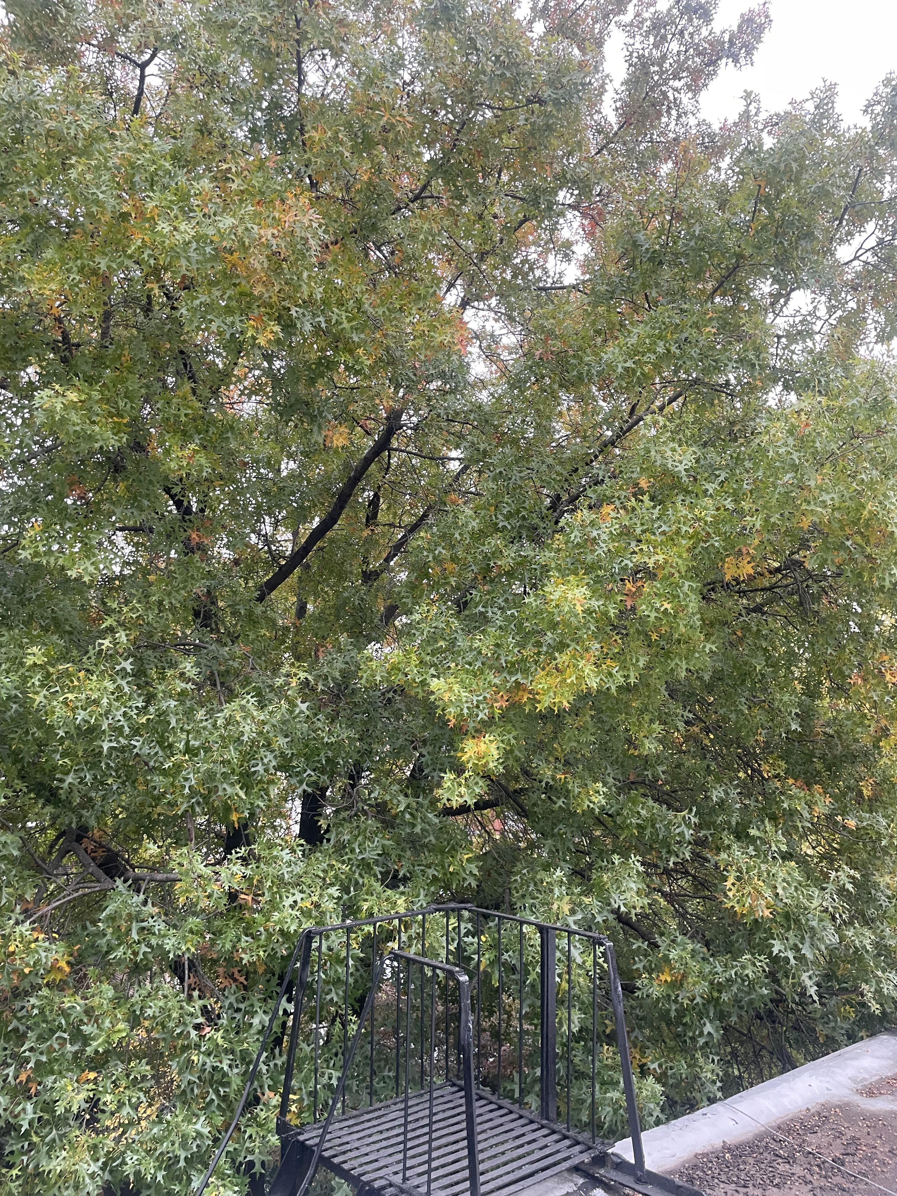
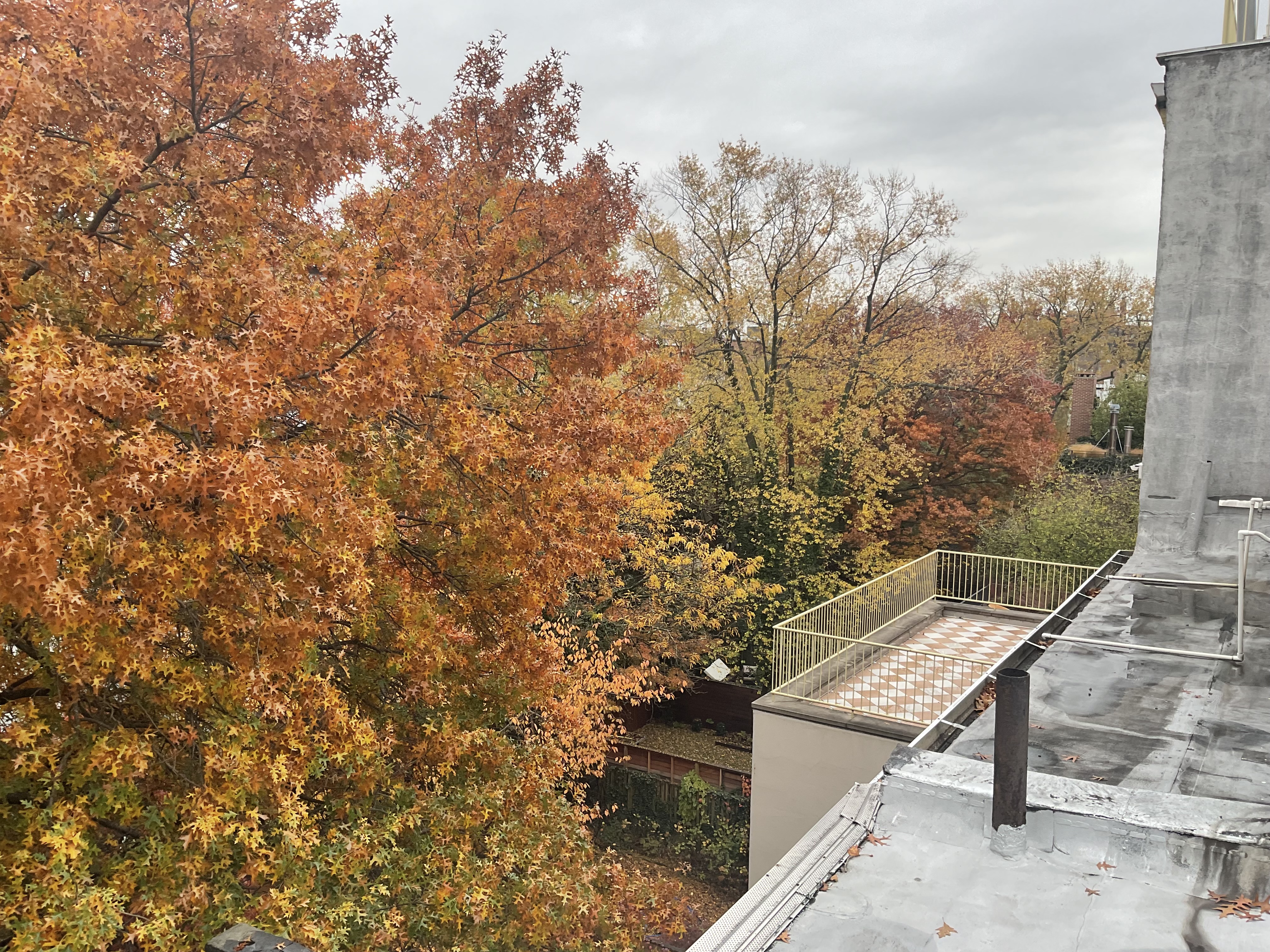
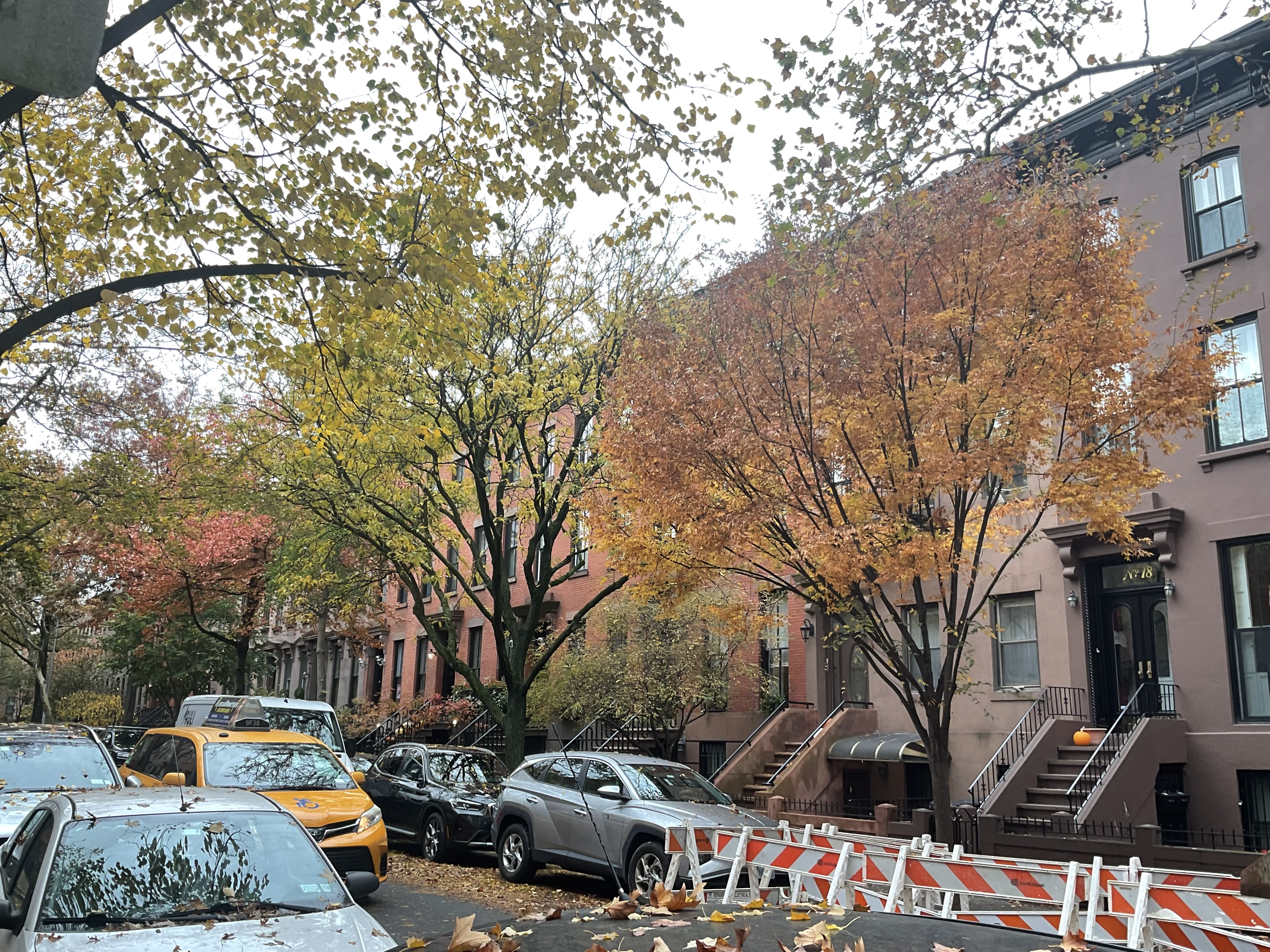
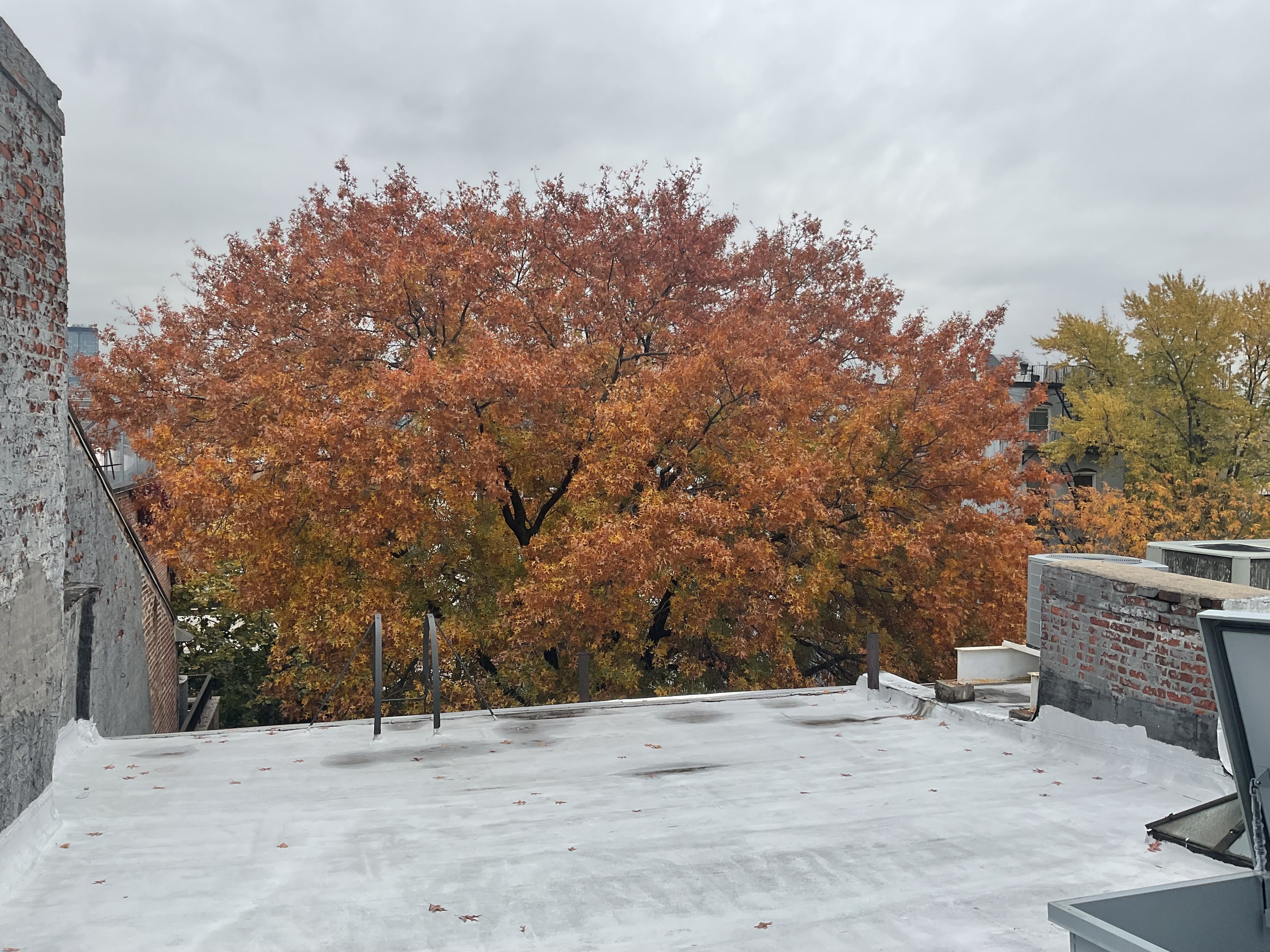
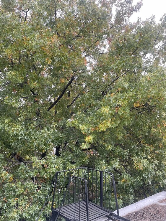
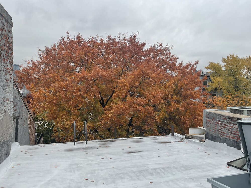
The first photo was taken Oct 29th the second today, 12 days later. The second, third and fourth photos show how a small piece of inner city Brooklyn accelerated to peak. Looking at the street side or from the backyard roof the transformation gives me a sense of peace …… because, I, like the season, am in the Autumn of my years. Stay well everyone. As always ……


-

2025-2026 Fall/Winter Mountain Thread
Maggie Valley Steve replied to Buckethead's topic in Southeastern States
Visible imagery suggests gravity waves are developing just ahead of the potent vort max. I'm starting to see some rising cumulus suggesting the possibility of thundersnow just E of the Knoxville Region. -
Yes, I wasn't expecting much activity until 3pm and beyond. MRX had to move the WWA up by a couple hours.
-
-
Heck yeah! Im working that intersection today.
-
Nice! Yeah it's been snowing here non-stop all day. Starting to lay now.
-

November 2025 general discussions and probable topic derailings ...
CoastalWx replied to Typhoon Tip's topic in New England
I wouldn’t be surprised at a few rumbles of thunder in that. -

11/8-11/10 First Snow and Lake Effect Event
Chicago Storm replied to Geoboy645's topic in Lakes/Ohio Valley
The thing is, there was stationary banding, two in fact. The issue was more that the core of the metro was just split by both bands, just due to unfavorable positioning. The main-full lake plume ended up too far west (Racine-Kenosha-Waukegan) and the southern lake/meso-low band was too far south (Lake Co, IN to Iroquois Co). -
Family reporting some flurries out in Harrisonburg.
-

November 2025 general discussions and probable topic derailings ...
WinterWolf replied to Typhoon Tip's topic in New England
A sign of things to come with modeling in the very short term this upcoming winter? It wouldn’t surprise me. -
And to think, last year at this time we were in the midst of the snowiest November for Denver in over 30 years.
-
It's whiteout, sun, whiteout here. Temp will be 29 when it's sunny, and drop into the 24-25 range when it's snowing.
-

2025-2026 Fall/Winter Mountain Thread
snowbird1230 replied to Buckethead's topic in Southeastern States
Met im at Ingles in Rville! Missed u! -
Winter 2025-2025 Offers Return to Normalcy
WinterWolf replied to 40/70 Benchmark's topic in New England
Now that we think that…it’ll do the exact opposite. And it Wouldn’t be the first time that happened. -
November 2025 general discussions and probable topic derailings ...
powderfreak replied to Typhoon Tip's topic in New England
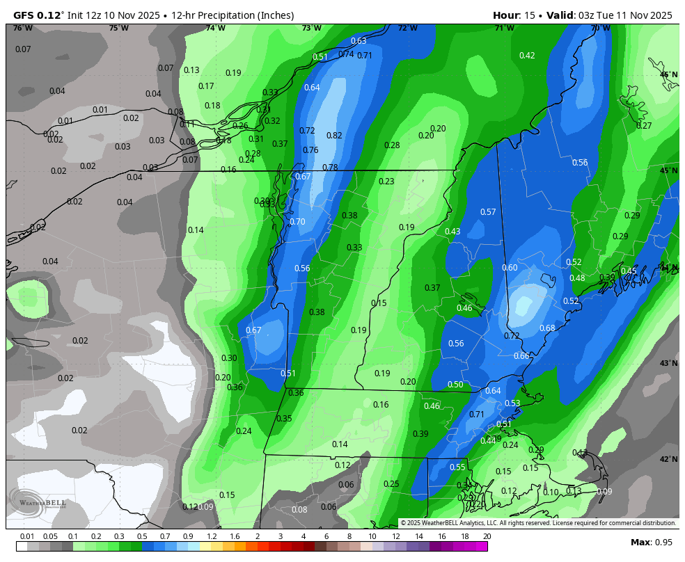
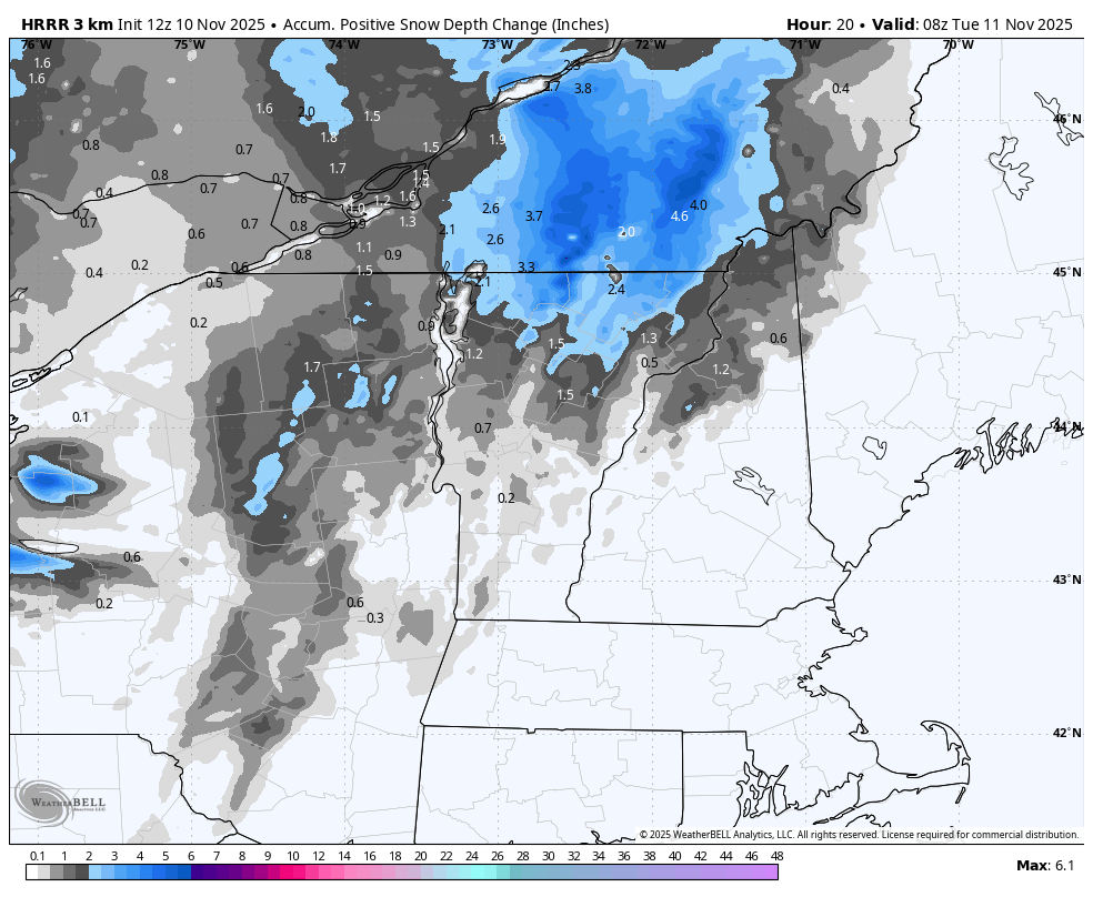
Pretty significant changes in 12 hours for the Champlain Valley to west slopes this evening.

-
2025-2026 Fall/Winter Mountain Thread
CheoahBald1 replied to Buckethead's topic in Southeastern States
Just left Haywood in the I40 gorge rest area, it’s snowing good down there. Glad to see you in my hometown buddy . -

Richmond Metro/Hampton Roads Area Discussion
NorthArlington101 replied to RIC Airport's topic in Mid Atlantic
Curious if the light snowfall on most of the modeled for SE Virginia actually pans out. You all might get on the board first! -
November 2025 general discussions and probable topic derailings ...
powderfreak replied to Typhoon Tip's topic in New England
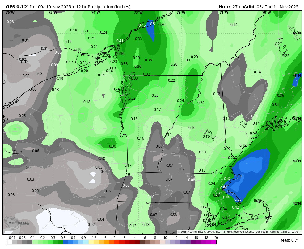
Ahh was that was it was, I thought it was the Tuesday set-up. Tuesday has looked upslope driven. But this evening never truly got me jazzed until the 12z+ models have all changed fairly significantly. I had seen a bunch of runs with more of a diffuse 1-4" event further north. Like 12z HRRR. HRRR has made a big change in the past like 4 hours.
-
The models wavered a bit over the past few days, but have now picked this back up. Fingers crossed that we finally get some snow in the lower elevations next week.
-
Been having some moderate to heavy rains since 1130. Just had double rainbow appear.
-
Hit 36.3 around noon (when sun poked out for about 10 minutes) and been dropping since. Currently 33.8/21.4 with clouds and a few flakes still flying around on NW winds 9 gusting to 22 mph. Feels like winter! Nice hot fire in the stove.
-
Hammering in Robbinsville. Sent from my SM-G998U using Tapatalk
-
November 2025 general discussions and probable topic derailings ...
CoastalWx replied to Typhoon Tip's topic in New England
Yeah I tagged you this morning about this. Looks like a spine west event -
Certainly hasn't seemed that way with the historical snowfall drought in Cleveland and many other Great Lakes locations: