All Activity
- Past hour
-
always the safest bet.
-
Coldest August ever.
-
@Gawx
-
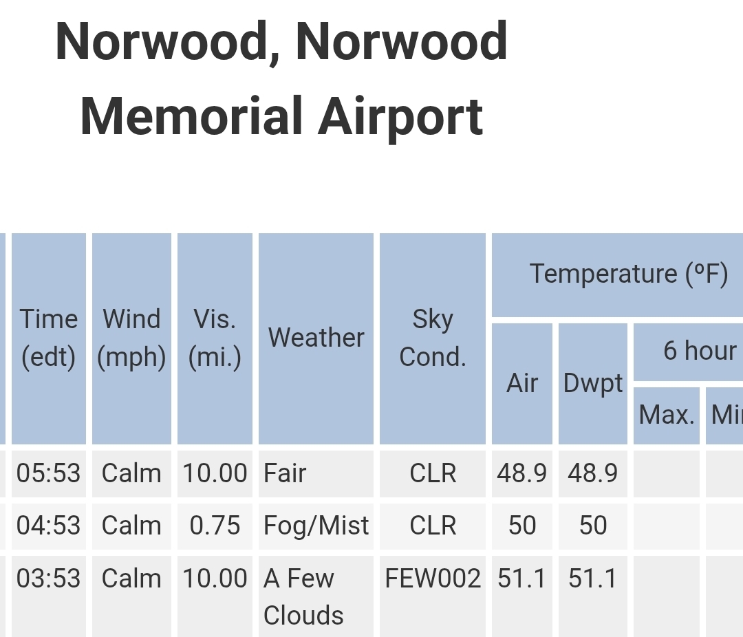
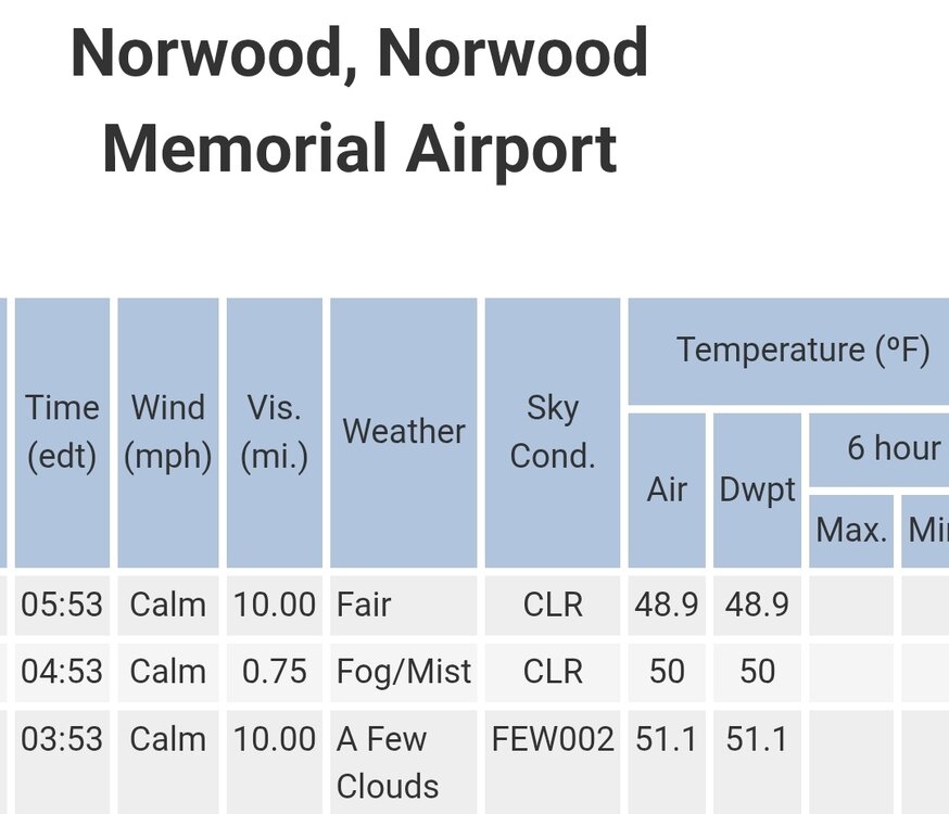
Fine you want to use Norwood.
-
Seeing the hazy look from the smoke driving around yesterday made me think of hazy/hot/humid weather back in the 70s and 80s, but the temp was cool. Weird! Looks like a beautiful stretch coming up -- until we cook next week
-
Loop it it's kind of funny.
-
14 day heat wave and desert Stein out the window on one run.
-

2025-2026 ENSO
so_whats_happening replied to 40/70 Benchmark's topic in Weather Forecasting and Discussion
I still find it very weird that we can use new baselines and the anomalies that are associated with them as facts (especially temps) but yet we use this chart above as fact taking out that baseline increase... https://psl.noaa.gov/map/clim/sst.anom.anim.week.html https://coralreefwatch.noaa.gov/data_current/5km/v3.1_op/animation/gif/ssta_animation_30day_large.gif -
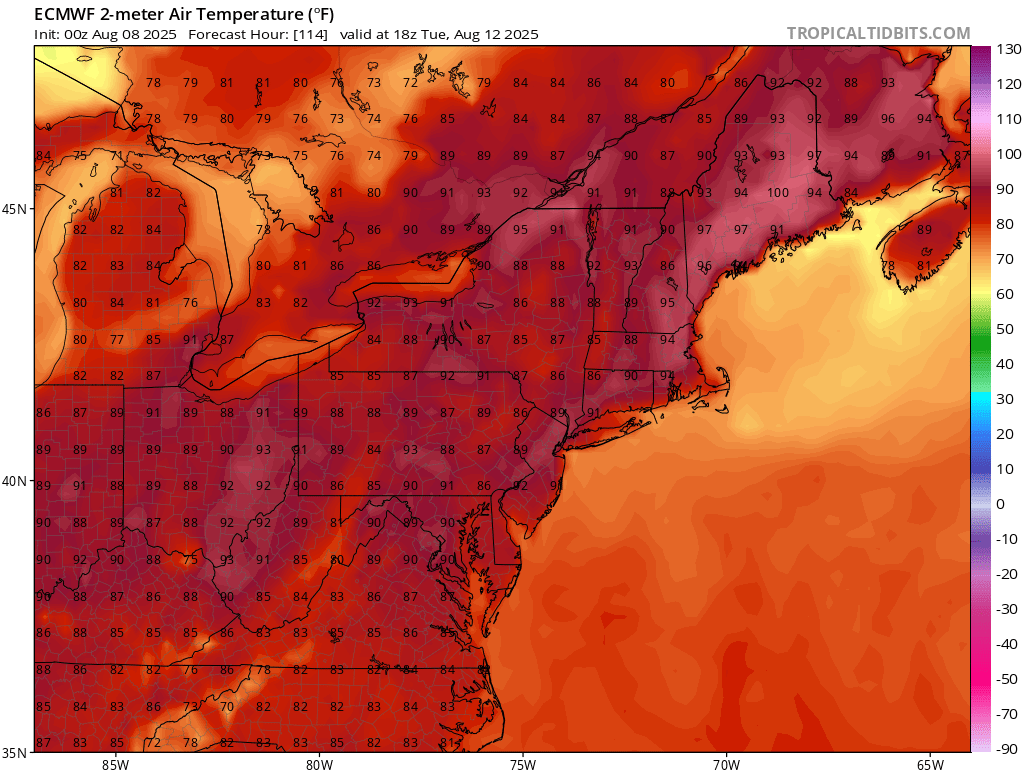
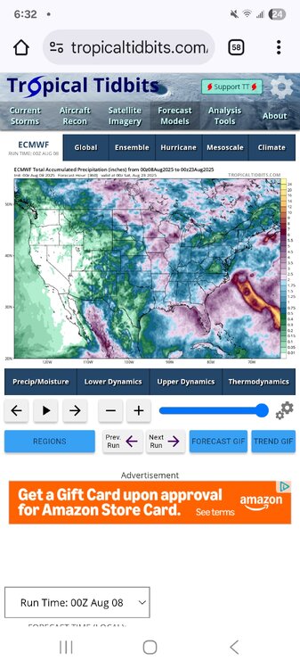
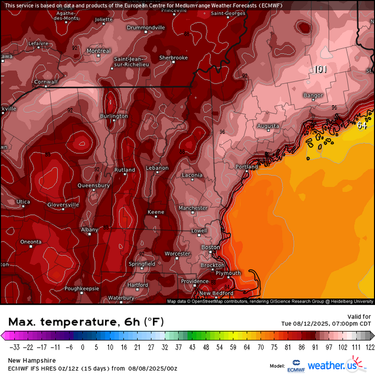
 The 0z Euro backed off the 100° heat and has more onshore flow. But the GFS still has 101° heat on Wednesday. With the late July heatwave, the Euro had a cool bias and missed a few of the 100s that verified. Would be nice if this 0z Euro had a clue and the 100° heat misses to our north in Maine.
-
If anything, the -PMM has increased in strength…more support for a possible La Niña event this fall/winter:
-
Sky net and Euro in sync lol. Nice cold front day 7 on both. That's a change.
-
 The temperature has reached 64 at Central Park. That is the second 3-day streak with lows of 64 or below. The last time that occurred in August was 2008. The last time there were two such streaks during August 1-10 was 1921.
 -
 58° this am...been a pleasant first 3rd of the month, with a -5° temp departure here.
 -
Sell any cane near here.
-
- Today
-
Of course! I wouldn't let you down...
-
I knew I could count on you!
-
Some of us live above and we take!
-
-
we Euro!
-
At this rate in the next few weeks if we don't get one east of the Mississippi this might be the first time in a couple years most of us haven't had a nasty summer derecho
-
You have better lake breeze positioning than me. Afternoon popup convection is shadowed by Lake Michigan almost every time IMBY. Also, this summer the upper trough always seems to dig more to the east of Michigan. Being on the trailing west side of every trough / ridge-flattening event is just not ideal. Edit: Interestingly GRR did have many days with precipitation, and even thunder, but they were mostly extremely measly amounts
-
Yea. Specifically it has been both west and north. The northern plains has been active. They typically get that southeasterly low level flow this time of year that always helps enhance the shear even when 500 mb flow is marginal.
-

WELCOME ABOARD INVEST 96L (10/60)
Prismshine Productions replied to BarryStantonGBP's topic in Tropical Headquarters
As a former South Carolinian... Hugo was 89. Sent from my SM-S166V using Tapatalk