All Activity
- Past hour
-

July 2025 Obs/Disco ... possible historic month for heat
CoastalWx replied to Typhoon Tip's topic in New England
The 4th looks like the coolest day out of the bunch coming up. Probably near 80 and low dews. Otherwise it’s a summery look. Possibly some 90+ weekend after the 4th. After that we trough again and then as I said yesterday, it looks to retro and open up the door to warmer and more humid weather at the end of the 11-15 day. -
Mild low? Lolz It ain't April. Average low for this time of year is 65.
-
When you start posting dewpoint 2m temps for real temps, it’s just very sad to see.
-
I honestly think they believe what they’re posting too. It’s mind boggling and a little disturbing all in one
-
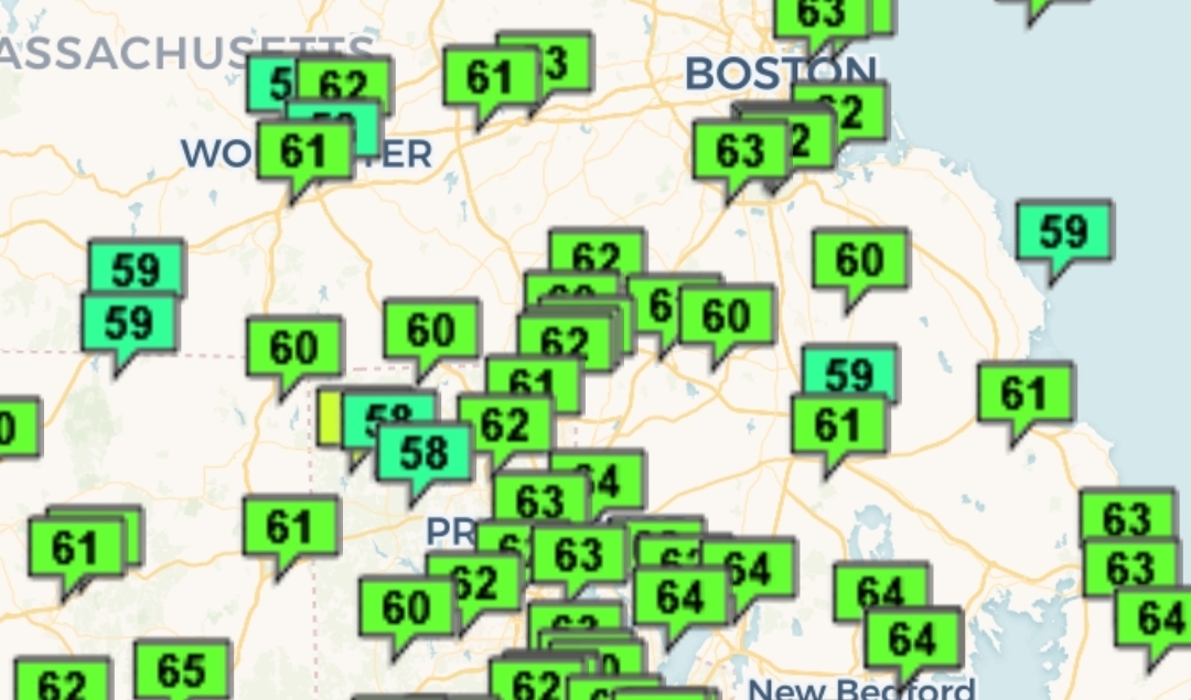
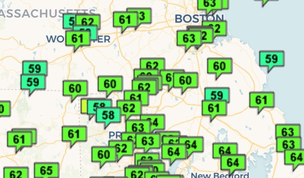
Mild low near 60. Meh morning but should be better aftn.
-
57* and pouring for the past hour. What a beaut of a Saturday.
-
Yeah it’s sad.
-
.13"/60F good down pour, will cut lawn Sunday. Gosh this month flew by to me, just like May WTF
-
Will be near normal today. 2 mild downs in a sea of warmth. ACATT really struggling.
-
Glad I stayed after the top of the 6th. Left at the start of the 7th when up 11-7. Was nice to see them finally be able to get some hits.
-
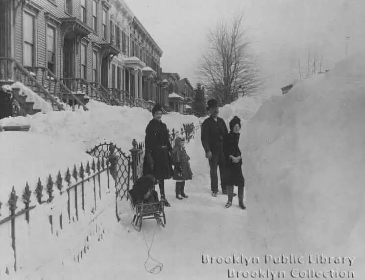
Beautiful collection of photos. There is so much Brooklyn history there going back to the Dutch settlement. The neighborhoods from around Prospect Park back to through your area up to Williamsburg contain some of the most sough-after urban real estate in the United States. I was able to find a great old photo from the Blizzard of 1888. https://www.brownstoner.com/history/blizzard-1888-new-york-brooklyn-snow-storm-history-environmental-subway/ Out in the snow in Cobble Hill, possibly Clinton Street near Amity Street. Photo via Brooklyn Public Library
-
Models go for another strong ridge after the holiday but it's centered SW of us vs directly over and then it retros west. If that holds true then we'll avoid another 100+ stretch.
-
Once we scour out the rain and the 50° temperatures it's shaping up to be a pretty nice day!
-
Having spent 7 years in the 518 area code, @powderfreakpost is bringing back some nostalgia for me… Granted I held onto my north-Jersey 973 while living there.
- Today
-
The Orioles have now given up 20+ runs in a game and scored 20+ runs in a game in a single season. Down 6-0 they win 22-8.
-
I know a bunch of people have solar. Interesting article from WBUR Boston on how much behind the meter solar reduced the grid demand during the heatwave. I produced more than my home and central air used Mon-Weds. I was also exporting a ton back to the grid to my neighbors on those days as well. https://www.wbur.org/news/2025/06/24/behind-the-meter-solar-peak-demand-iso-new-england
-
Today likely makes the third below normal day in a row. Tip of the cap. Some knew...
-
"* Gorgeous conditions on tap for Sunday, plenty of sunshine, and seasonably warm temperatures. Fairly quiet weather for Sunday as the cold front shifts off shore and northwest flow ushers in a drier albeit warmer airmass. Surface high pressure begins to build into the northeast, which will remain in the area through Monday. Have subtle mid-level height increases as well, leading to a dry and mostly sunny afternoon. With the 925mb temperatures on either side of +20C, maximum temperatures will reach the lower and middle 80s. Dew points are manageable in the upper 50s across the interior, while the coastal plain are in the lower and middle 60s. Can we make it through the weekend without any measurable and stop the rainy streak?
-
Like I was saying a few very warm days and some cooler days….
-

Chester County PA - Analytical Battle of Actual vs. Altered Climate Data
chubbs replied to ChescoWx's topic in Climate Change
The Chester County deep-dive has shown that a county station average is a terrible way to evaluate NOAA. The available stations aren't designed to produce county averages by simple averaging and the stations change with time. The average shelf life of a coop station isn't very long. Even stations with long-term records have station moves and equipment changes. The NOAA method is well proven for getting the right answer from a constantly changing station network. If the stations didn't change then simpler methods would also work; but, as we have seen in Chester County the simpler methods breakdown when there are large changes in the station network with time. -
61° / 53° and no rain. I'll take it.
-

July 2025 Obs/Disco ... possible historic month for heat
Snowedin replied to Typhoon Tip's topic in New England
No matter what happens it’s gonna be hot and dewy..somewhere and for some indeterminate amount of time, that we know for sure. Maybe we’ll even see thunderstorms again, the likes of which we’ve never seen before! -

July 2025 Obs/Disco ... possible historic month for heat
Cyclone-68 replied to Typhoon Tip's topic in New England
“Hurricane hottest” would also work -
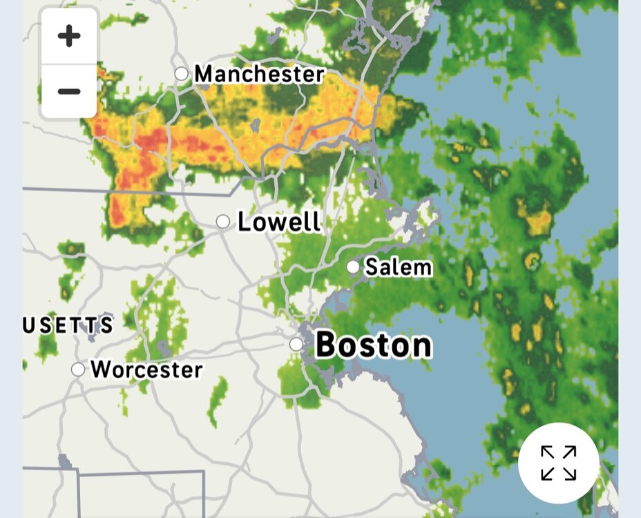
wtf, heavy mist here and nothing showing on radar.
-

2025 Atlantic Hurricane Season
Stormchaserchuck1 replied to BarryStantonGBP's topic in Tropical Headquarters
Invest is up to 40%.. the wave is currently over the Yucatan, but should be going into the Bay of Campeche soon.