All Activity
- Past hour
-
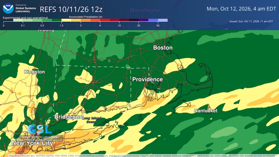
2.78”, becoming more drizzly and showery
-

2026-2027 Record-breaking El Nino
40/70 Benchmark replied to Stormchaserchuck1's topic in Weather Forecasting and Discussion
Ignore this at your own forecast peril if you plan on publishing work touting a non-winter along the east coast. The final two analogs have very similar placement of the central-based connective node this season, which is in the vicinity of 170 degrees longitude in the central Pacific, however, they were appreciably weaker El Niño events that were largely bereft of any eastern competition. The forcing was in the central Pacific simply because they were central-Pacific El Niño events, which is why there was no competing forces stretching the convection, as is the case this year. Thus it is for this reason in addition to the warming climate that the second half of the impending winter is highly unlikely to be as consistently cold as the coming season, despite each being viable polar analogs. It is for these reasons that this season the warmer periods will be of longer duration and of greater magnitude than the colder periods relative the 1957-1958 and 1965-1966 analogs. However, each of these seasons are relatively strong polar analogs and the center of the convective forcing was nearly identical to where the central node is expected to reside during the coming season, at around 170 degrees longitude. -
Places out west like SLC have been getting consistent stretched of +10 for weeks at a time. I pointed it out a couple of summers ago. Normal high was 88F and they were clocking 100F on 14 day forecasts. Its bone dry out there, so if they get stuck in an airmass, there is no moisture in the air to slow down the endless skyrocket each day
-
Not @CoastalWx. He would be "tea-kettle" STEAMED if that happened b/c it wasn't within 5 mi of Weymouth! GFS not by itself here. It's a quite impressive cold trough for mid-Oct, and fits the very strong El Nino pattern well. The only decent CONUS cold shots in such winters occur in the NEUS.
-
Very healthy event here this morning. It’s funny bc we all talked about needing tropical remnants here and finally got it. Also…weekend rule is still a thing.
-
2026-2027 Record-breaking El Nino
40/70 Benchmark replied to Stormchaserchuck1's topic in Weather Forecasting and Discussion
Adam used to edit previous posts to add in another comment lol...I like that better. -
2026-2027 Record-breaking El Nino
40/70 Benchmark replied to Stormchaserchuck1's topic in Weather Forecasting and Discussion
Right....not as far west as 2023, which as into the MC and very hostile. Expect it to the south of Hawaii...this is more favorable. This is what I was just trying to explain to Chuck. -
Also TOG over Fayetteville Severe Weather Statement National Weather Service Raleigh NC 1204 PM EDT Sun Oct 11 2026 NCC051-111615- /O.COR.KRAH.TO.W.0013.000000T0000Z-261011T1615Z/ Cumberland NC- 1204 PM EDT Sun Oct 11 2026 ...A TORNADO WARNING REMAINS IN EFFECT UNTIL 1215 PM EDT FOR NORTHWESTERN CUMBERLAND COUNTY... At 1203 PM EDT, a confirmed tornado was located over Fayetteville, moving northeast at 35 mph. HAZARD...Damaging tornado. SOURCE...Radar confirmed tornado. IMPACT...Flying debris will be dangerous to those caught without shelter. Mobile homes will be damaged or destroyed. Damage to roofs, windows, and vehicles will occur. Tree damage is likely. This tornado will be near... Fayetteville around 1210 PM EDT. Other locations impacted by this tornadic thunderstorm include Bonnie Doone. PRECAUTIONARY/PREPAREDNESS ACTIONS... To repeat, a tornado is on the ground. TAKE COVER NOW! Move to a basement or an interior room on the lowest floor of a sturdy building. Avoid windows. If you are outdoors, in a mobile home, or in a vehicle, move to the closest substantial shelter and protect yourself from flying debris.
-
2026-2027 Record-breaking El Nino
40/70 Benchmark replied to Stormchaserchuck1's topic in Weather Forecasting and Discussion
I'm not talking about STRENGTH...I mean strongest point of convective forcing. -
MAJOR CC drop now
-
Tornado OTG SW of Apex! CC drop and very high velocities
-
Yes, I remember we had just domesticated horses and I got very wet and muddy on a chariot ride.
-
Had some rain overnight and some more is expected this evening. Overall not as much as many tropical systems bring but still a nice soaking rain to get the ground nice and wet in advance of a lot of leaves falling. It's model wars for next weekend. The GFS throws us into the ice box, the Euro says "cold front? never heard of it." The GFS has mid-20s, the Euro mid-40s next weekend. Ironically, the AIGFS is closer to the Euro, and the Euro AI is closer to the GFS with lows in the low to mid 30s.
-
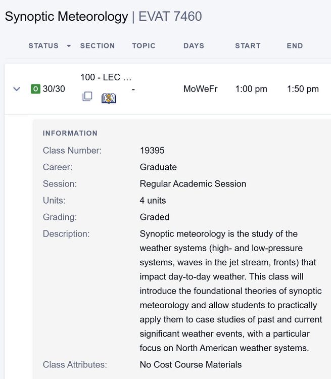
Classes posted for spring semester and I'll finally get to take the course I've been waiting for! Currently with the professor as he teaches Intro to Climatology or the grad level version of my Atmosphere and Weather course I took last fall and he's been great (test tomorrow though). Excited to learn some more stuff that'll help me write better posts on here (hopefully) in time for synoptic season!
-
One historical item concerning sting jets. It likely that HU Edna in Sep 1954 when crossing Cape Cod in a very strong PT/ET transition (110 mph at landfall) had a sting jet. Why? BOS gusted to 101 mph out of the NW -- its highest gust on record! 10 days before HU Carol (115 mph at landfall) produced a gust to 100 mph at BOS out of the SE as the storm passed to the W, which is what you would expect for very high winds. When HUs get to New England, the PT/ET transition is almost always ongoing and the typical cooler/more stable air NW of the center along w/ rapid forward motion that will reduce winds W of the track. I always wondered how such a wind gust occurred in BOS from Edna from that direction. Once the concept of the sting jet became front and center about 20 years ago, that explained it! In the larger TC picture, Isaias in some ways is a watershed event. From strictly a conventional satellite perspective (EIR and Dvorak), that much deep convection not all sheared N and NE of the center near/at landfall, that says it was still more tropical than not, and can be called a HU at landfall. However, the SAR imagery tells a much different story! It's overall elongated wind structure, a string jet present, and the lack of a coherent inner core says it was more PT/ET. Other factors stating it was more PT/ET? That abrupt rise in center pressure in a short time before landfall (something obliviously happen at the core here) and the rather cool surface conditions directly ahead of the storm. This shows it was not just a race for cooler/drier air trying to wrap in from the W and NW. This less than favorable TC atmosphere was N and NE as well, and got ingested into the core before landfall. This is an excellent example how new technology reveals things we could never quite detect, or detected/quantify at all prior. SAR gives a very detailed wind profile of a TC when it is over water. And as we know, the wind structure is paramount as to if it is a TC or not (tight or spread out?, symmetrical of asymmetrical?) And is also makes us rethink what we thought we knew well, and adjust accordingly. This is good b/c the science is always evolving. Imagine when SAR-type imagery is available on gestational satellites? That will revolutionize analysis and modelling for currently data sparse oceans.
-
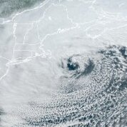
That line of convection that has extended from NC to FL and came through this area as thunderstorms around dawn-sunrise has been just ahead of a cold front pushing E to the S of Isaias’ remnant low (see image below). That’s what was needed to finally bring dewpoints here back down from the 24 hour long oppressive mid to upper 70s to the current low 60s as winds shifted from S to SW to a drier W.
-
There's snow in Montana today, but, I think, rain at Yellowstone National Park
-
2.75 down here Steady rain still ....
-
Up to 1.37” on the Lancaster rain gauge. Driving up to my home in CT in this mess. .
-
Nice! .
-
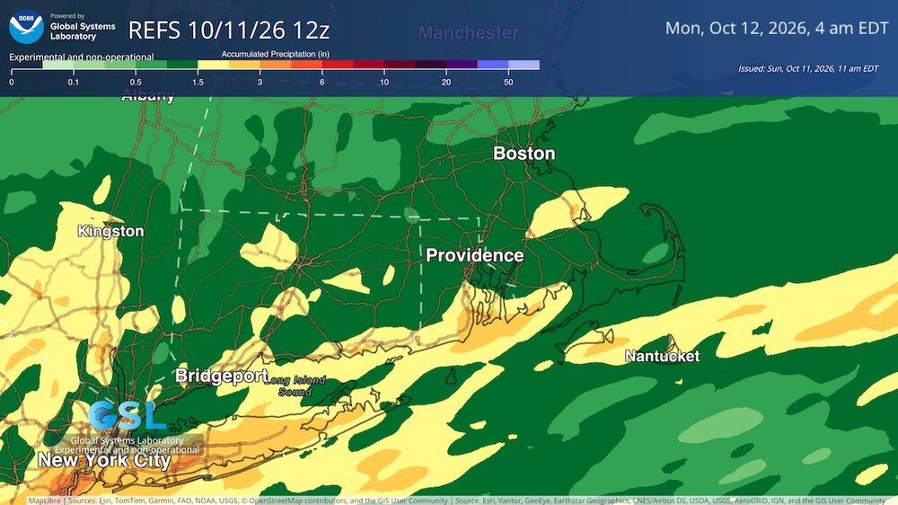
Looks like a pretty good drink from the remnants of Isias...
-
 us pharmacy no prescription and pharmacy websites online pharmacy no prescription needed https://www.google.td/url?q=https://queticarerx.com no rx needed pharmacy or https://shockingbritain.com/user/uofdleegun/ us pharmacy no prescription [url=http://images.google.com.ph/url?q=https://queticarerx.com]overseas online pharmacy[/url] online pharmacy no rx and [url=https://nidobirmingham.com/user/jsuhrtmmnt/]medstore online pharmacy[/url] overseas online pharmacy
 -
Good news here. I slept overnight!
-
us pharmacy no prescription and pharmacy websites online pharmacy no prescription needed https://www.google.td/url?q=https://queticarerx.com no rx needed pharmacy or https://shockingbritain.com/user/uofdleegun/ us pharmacy no prescription [url=http://images.google.com.ph/url?q=https://queticarerx.com]overseas online pharmacy[/url] online pharmacy no rx and [url=https://nidobirmingham.com/user/jsuhrtmmnt/]medstore online pharmacy[/url] overseas online pharmacy
-
2.55'' storm total.