All Activity
- Past hour
-
New STW up for my yard Severe Thunderstorm Warning MDC021-043-WVC003-037-065-191845- /O.NEW.KLWX.SV.W.0147.250619T1744Z-250619T1845Z/ BULLETIN - IMMEDIATE BROADCAST REQUESTED Severe Thunderstorm Warning National Weather Service Baltimore MD/Washington DC 144 PM EDT Thu Jun 19 2025 The National Weather Service in Sterling Virginia has issued a * Severe Thunderstorm Warning for... Washington County in north central Maryland... Northwestern Frederick County in north central Maryland... Northeastern Jefferson County in the Panhandle of West Virginia... Central Morgan County in the Panhandle of West Virginia... Berkeley County in the Panhandle of West Virginia... * Until 245 PM EDT. * At 144 PM EDT, a severe thunderstorm was located 7 miles northeast of Greenwood, moving east at 50 mph. HAZARD...60 mph wind gusts. SOURCE...Radar indicated. IMPACT...Damaging winds will cause some trees and large branches to fall. This could injure those outdoors, as well as damage homes and vehicles. Roadways may become blocked by downed trees. Localized power outages are possible. Unsecured light objects may become projectiles. * Locations impacted include... Hagerstown, Martinsburg, Thurmont, Shepherdstown, Hancock, Municipal Stadium, Greenwood, Robinwood, Fountainhead-Orchard Hills, Boonsboro, Smithsburg, Paramount-Long Meadow, Wilson-Conococheague, Williamsport, Berkeley Springs, Mount Aetna, Mount Lena, San Mar, Long Meadow, and Wolfsville. PRECAUTIONARY/PREPAREDNESS ACTIONS... For your protection move to an interior room on the lowest floor of a building. Large hail, damaging wind, and continuous cloud to ground lightning are occurring with this storm. Move indoors immediately. Lightning is one of nature`s leading killers. Remember, if you can hear thunder, you are close enough to be struck by lightning. Torrential rainfall is occurring with this storm, and may lead to flash flooding. Do not drive your vehicle through flooded roadways.
-
URGENT - IMMEDIATE BROADCAST REQUESTED Severe Thunderstorm Watch Number 442 NWS Storm Prediction Center Norman OK 145 PM EDT Thu Jun 19 2025 The NWS Storm Prediction Center has issued a * Severe Thunderstorm Watch for portions of District Of Columbia Delaware Maryland Northern North Carolina New Jersey Southeast Pennsylvania Central and Eastern Virginia Eastern Panhandle of West Virginia Coastal Waters * Effective this Thursday afternoon and evening from 145 PM until 900 PM EDT. * Primary threats include... Scattered damaging winds likely with isolated significant gusts to 75 mph possible Isolated large hail events to 1.5 inches in diameter possible SUMMARY...A line of thunderstorms will move off the mountains of western Virginia and southern Pennsylvania, spreading eastward across the watch through the afternoon and evening. Damaging wind gusts and hail are possible in the stronger storms. The severe thunderstorm watch area is approximately along and 90 statute miles east and west of a line from 35 miles north northeast of Allentown PA to 20 miles east of Danville VA. For a complete depiction of the watch see the associated watch outline update (WOUS64 KWNS WOU2).
-
I'm guessing 70/30 wind probs based on the watch wording?
-
You should be very pleased with my Michigan round-up then! You are the one who has thrown out comparisons to White Lake, Flint, Saginaw, and Ann Arbor in the past - all of which were warmer than DTW in my summary, some by several degrees.
-
Mentions isolated significant gusts to 75mph
-
Why is it weak?
-
Watch up until 9pm
- 1,093 replies
-
- 1
-

-
- severe
- thunderstorms
- (and 2 more)
-
-
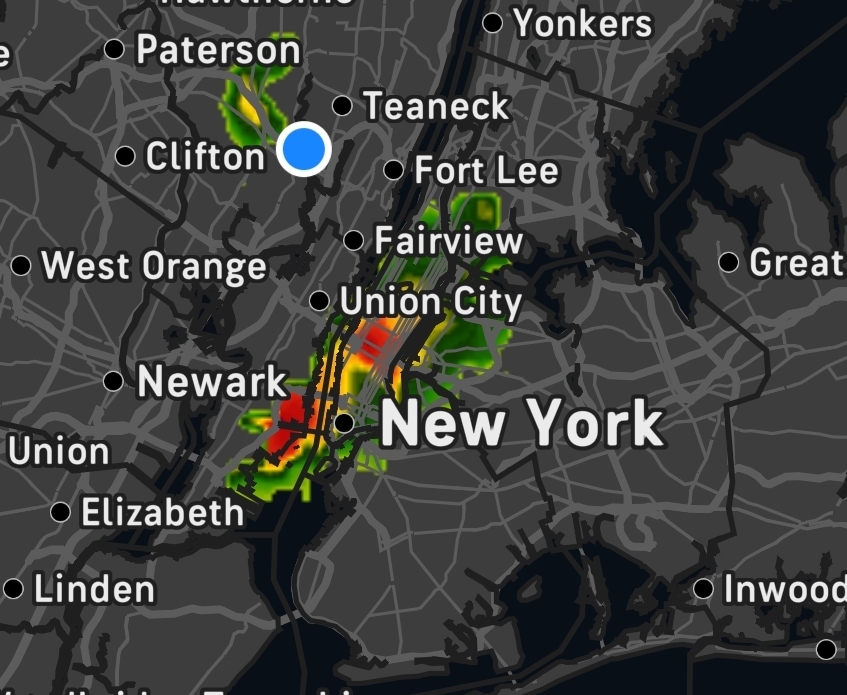
Insane storms to my east, south and north. The one over NYC looks incredible. Lots of thunder and lightning seen/heard from my house.
-
Only thing we have going against us are weak mid level lapse rates. Would lean towards the pulse type storms with a few decent wind reports today.
-
It does, and there is more activity forming well behind it. Might support the idea of storms in the next couple of hours and then again at some point after 5pm.
-
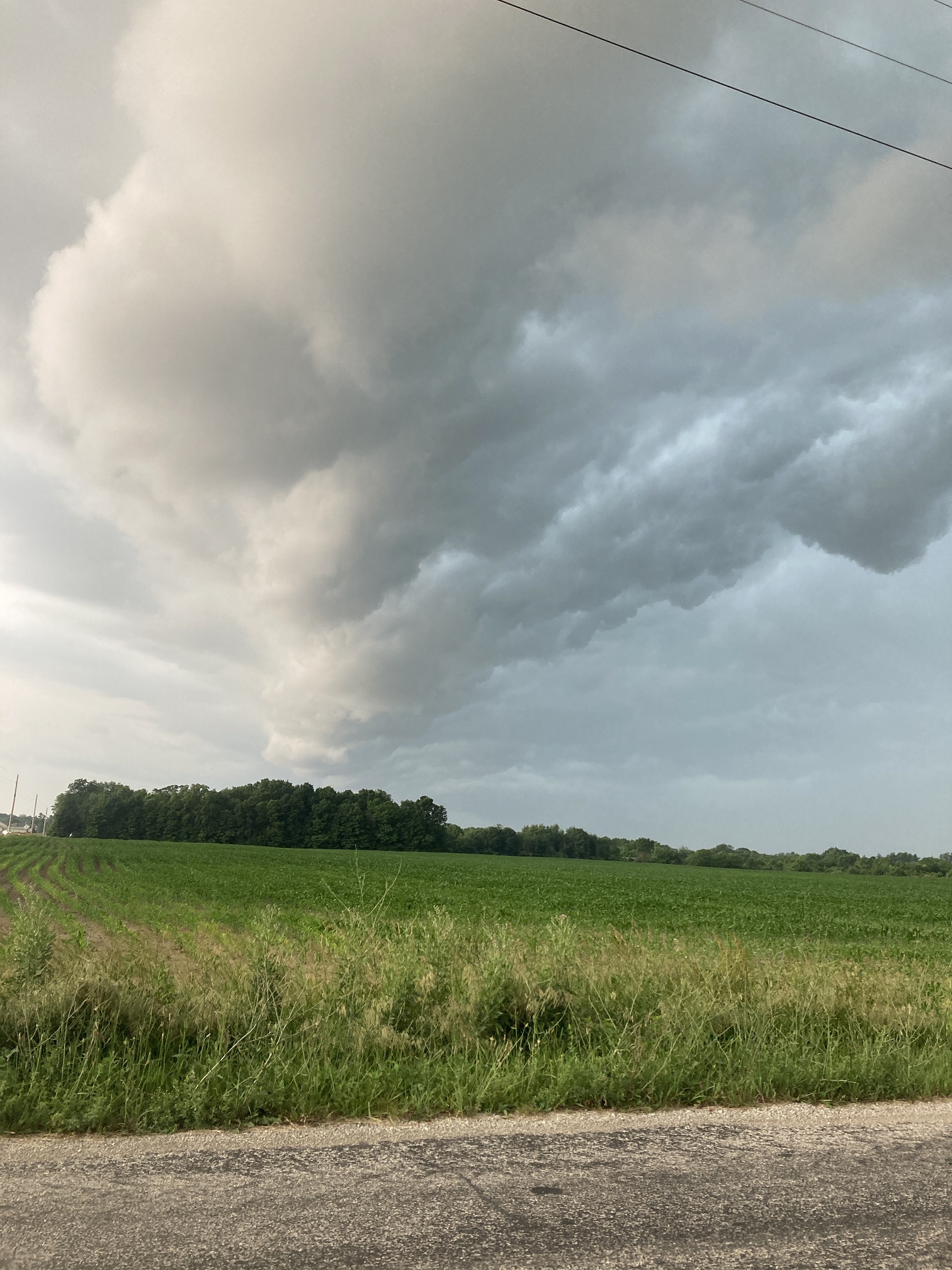
Here's my shelf cloud when it was overhead pic from yesterday

-
Hit 90, now down to 86 dew 77 with partial sun and rain, a few claps of thunder but the worst seemed to fizzle out.
-
88/73. Summah!!!
-
Pretty obvious where storms will and won’t be based on agitated cu.
-
It begins BULLETIN - IMMEDIATE BROADCAST REQUESTED Severe Thunderstorm Warning National Weather Service Baltimore MD/Washington DC 135 PM EDT Thu Jun 19 2025 The National Weather Service in Sterling Virginia has issued a * Severe Thunderstorm Warning for... North central Shenandoah County in northwestern Virginia... Frederick County in northwestern Virginia... The City of Winchester in northwestern Virginia... Northeastern Hardy County in eastern West Virginia... Southwestern Berkeley County in the Panhandle of West Virginia... Southeastern Hampshire County in eastern West Virginia... * Until 215 PM EDT. * At 134 PM EDT, a severe thunderstorm was located near Wardensville, or 16 miles east of Moorefield, moving northeast at 45 mph. HAZARD...60 mph wind gusts. SOURCE...Radar indicated. IMPACT...Damaging winds will cause some trees and large branches to fall. This could injure those outdoors, as well as damage homes and vehicles. Roadways may become blocked by downed trees. Localized power outages are possible. Unsecured light objects may become projectiles. * Locations impacted include... Winchester, Millwood Pike, Wardensville, Star Tannery, Capon Bridge, Yellow Spring, High View, Cedar Grove, Stephenson, Delray, Cross Junction, Baker, Gore, Albin, Capon Springs, Mccauley, Gravel Springs, Greenwood, Gainesboro, and High View Manor. PRECAUTIONARY/PREPAREDNESS ACTIONS... For your protection move to an interior room on the lowest floor of a building. Large hail, damaging wind, and continuous cloud to ground lightning are occurring with this storm. Move indoors immediately. Lightning is one of nature`s leading killers. Remember, if you can hear thunder, you are close enough to be struck by lightning. Torrential rainfall is occurring with this storm, and may lead to flash flooding. Do not drive your vehicle through flooded roadways.
- 1,093 replies
-
- 1
-
-
- severe
- thunderstorms
- (and 2 more)
-
88/75/98 here.
-
Happy summer. Heat index mapping is now available through the statewide mesonet.
-
-
Won’t be long for the next watch for areas to the south of that.
-
It's out. Blue Box coming. Really like the new graphics from SPC.
- 1,093 replies
-
- 1
-
-
- severe
- thunderstorms
- (and 2 more)
-
the HRRR is WAYYYYYYYY off
-
That line looks impressive .
-
thunder in the city..
-
Skaket is one of my favs too. Nice.