All Activity
- Past hour
-

July 2025 Obs/Disco ... possible historic month for heat
Torch Tiger replied to Typhoon Tip's topic in New England
Average t-storm here, not complaining. no gauge but est. .75", gusts 30-35mph -
0.90” for round 1, with round 2 almost here. I joined Cocorahs btw, so you all will be seeing my daily rain totals on there starting tomorrow.
-

July 2025 Obs/Disco ... possible historic month for heat
amarshall replied to Typhoon Tip's topic in New England
South shore stein inevitable. Tumbleweeds and burnt lawns for the 4th. . -

E PA/NJ/DE Summer 2025 Obs/Discussion
LVLion77 replied to Hurricane Agnes's topic in Philadelphia Region
1.22 this evening and a little over 2” total since last evening. Thankfully we dry out over the next 7 days! . -

July 2025 Obs/Disco ... possible historic month for heat
DavisStraight replied to Typhoon Tip's topic in New England
Wonder if these storms hold together to hit Fenway. -

July 2025 Obs/Disco ... possible historic month for heat
Damage In Tolland replied to Typhoon Tip's topic in New England
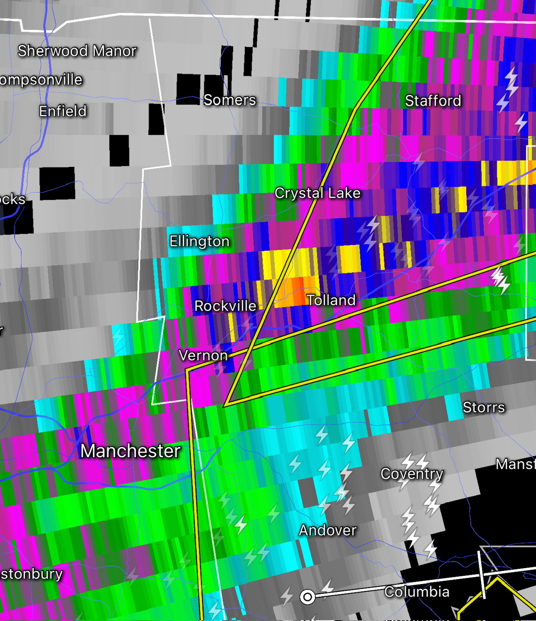
That pixel is literally over my hood here . I feel like I’m standing naked and free on top of Brokeback Stowe -

July 2025 Discussion-OBS - seasonable summer variability
lee59 replied to wdrag's topic in New York City Metro
That line in Westchester dipping south into southwest Ct. and White Plains. -

July 2025 Obs/Disco ... possible historic month for heat
CoastalWx replied to Typhoon Tip's topic in New England
Off to go north. At least it will be a good summer stretch. -
I don't have a great rain gauge so I may be under. Up to 2.20 now. Anyone have suggestions on a model?
-
 sandalwood vibes joined the community
 -
July 2025 Obs/Disco ... possible historic month for heat
CoastalWx replied to Typhoon Tip's topic in New England
Yeah he can stop complaining now -
Up to 1.82"
-
and thats what we just had!
-

July 2025 Discussion-OBS - seasonable summer variability
LibertyBell replied to wdrag's topic in New York City Metro
Yep, it became hot when summer actually starts. -
July 2025 Obs/Disco ... possible historic month for heat
CoastalWx replied to Typhoon Tip's topic in New England
It’s just outflow that caused it. Could see it and that’s why I called it. -
July 2025 Obs/Disco ... possible historic month for heat
Damage In Tolland replied to Typhoon Tip's topic in New England
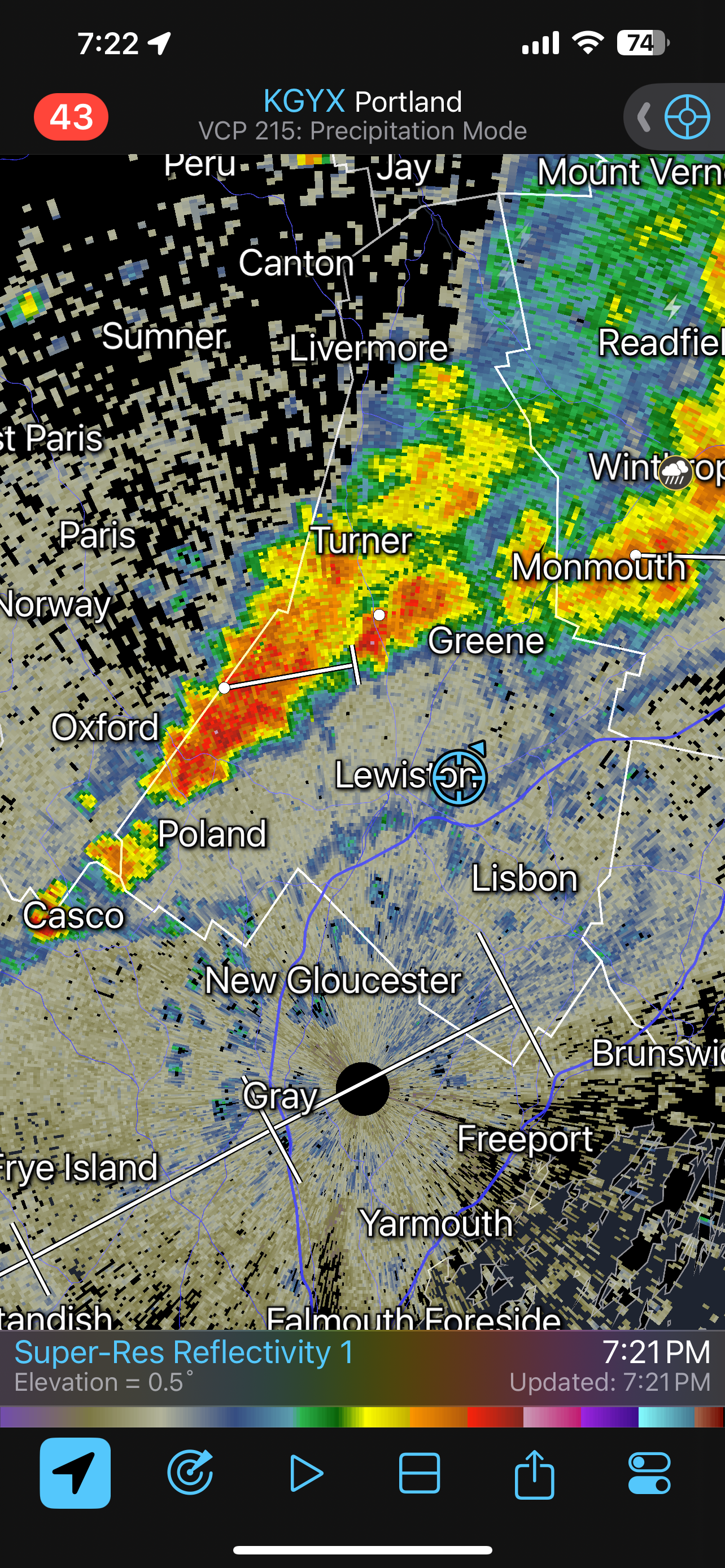
I don’t know if this will load here since they F’d around with what you can upload.. but if it does.. look at how this thing blew up overhead here. I’ve seen this happen a few times around here over the years.. but this one takes the cake . It should be a short video radar lightning animation if it works https://imgur.com/a/xbRXIBX -
 yep nailed it-hoping to get a couple hr of that moderate rain here...
 -

July 2025 Obs/Disco ... possible historic month for heat
powderfreak replied to Typhoon Tip's topic in New England
Decent Tolland jackpot.
-
July 2025 Obs/Disco ... possible historic month for heat
Damage In Tolland replied to Typhoon Tip's topic in New England
2.16 as I drop a Roman helmet on him -
July 2025 Obs/Disco ... possible historic month for heat
CoastalWx replied to Typhoon Tip's topic in New England
Don’t worry I’ll catch it. -
July 2025 Obs/Disco ... possible historic month for heat
powderfreak replied to Typhoon Tip's topic in New England
Webbed hands let one slip through. -
July 2025 Obs/Disco ... possible historic month for heat
CoastalWx replied to Typhoon Tip's topic in New England
Looks like new line forming on outflow again in RI. Maybe gets SE Ma good -

July 2025 Obs/Disco ... possible historic month for heat
dryslot replied to Typhoon Tip's topic in New England
Gust front just came thru ahead of this line about to move thru.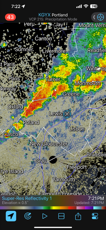
-

July 2025 Obs/Disco ... possible historic month for heat
512high replied to Typhoon Tip's topic in New England
LMAO, reminds me of winter....so close , but yet so far away, missing everything, barley raining, I can piss more then this! -
Whoever said earlier that places yesterday who got storms probably won’t today, specially northern MD, was spot on. All the good stuff missed south today.
-

July 2025 Obs/Disco ... possible historic month for heat
Sn0waddict replied to Typhoon Tip's topic in New England
Can’t wait for this entire thing to dissipate before reaching me. Not even looking for storms I just want some rain so I don’t have to water the plants lol