All Activity
- Past hour
-

January 2026 regional war/obs/disco thread
codfishsnowman replied to Baroclinic Zone's topic in New England
So much for that short last week about East Coast storminess and blocking and snowstorms up and down the eastern seaboard that I saw a few days ago on YouTube -
Gefs looks cold too
-
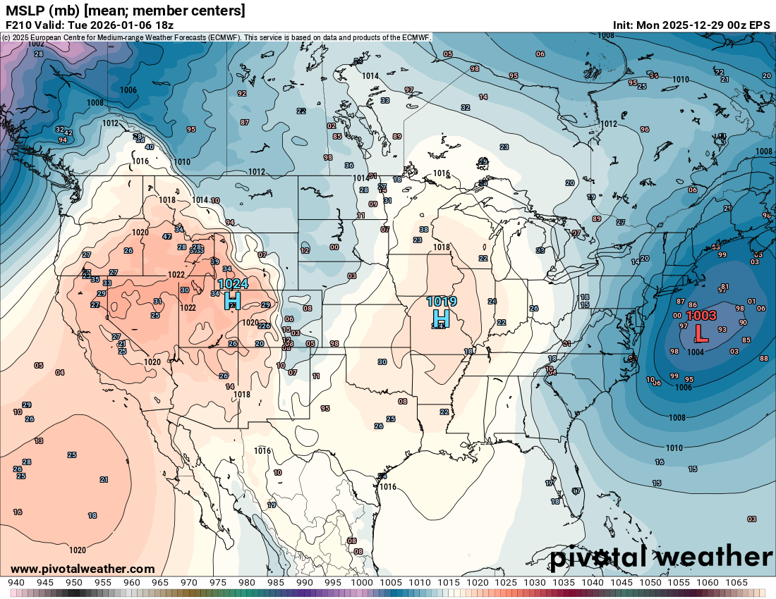
Maybe a blip, but 6z GEFS is a big change in a more positive direction for us. Much deeper -NAO/-AO and it keeps a trough in the east until the very end of the run, when it’s still a very workable gradient pattern.
-
Here bro. Use this map. It dosent have a global warning agenda
-

January 2026 regional war/obs/disco thread
Spanks45 replied to Baroclinic Zone's topic in New England
Currently -1.7⁰, finally made it below zero....I'm ok with a January thaw now with hopefully snow mid to late month. In a few short weeks I will be starting some seeds for the coming garden season. -
The way we got our snowfall this past December was different from the previous cold and snowy Decembers. This was our first December since at least 1950 with two 4-8” snowfall clippers. Past snowy Decembers into early January had big KU systems with widespread snows over 10”. The models backing off the coastal system which was forecast for next week is telling us that the Northern Stream is still dominant. We haven’t had a widespread 25”+ season from EWR-NYC-LGA-JFK-ISP in over 30 years without at least one KU NESIS Cat 1 event or higher. The other thing is that all our recent winters since 21-22 had most of the seasonal snowfall focused into just one winter month. This is why I am concerned that absent a revival of the BM coastal storm track before this winter is over, that December will be our snowiest winter month this year and most spots from EWR to ISP finish with another below average snowfall season. Since it was something like a 50 year+ event to get two 4-8” snowfall clippers in a two week period in December. That really productive clipper pattern for snow has shifted and we still haven’t seen evidence for a big KU pattern developing. Whatever happens, this was our best December in terms of cold and snow in a long time which we are all very grateful for.
-

Central PA Winter 25/26 Discussion and Obs
Voyager replied to MAG5035's topic in Upstate New York/Pennsylvania
You and me both. -

Central PA Winter 25/26 Discussion and Obs
mahantango#1 replied to MAG5035's topic in Upstate New York/Pennsylvania
Remember the last forecast warmup around Christmas, and what transpired? Hope they're right this time. -

January 2026 regional war/obs/disco thread
dendrite replied to Baroclinic Zone's topic in New England
GL
-
That was a great March with back to back events which saved winter here.
-
Trough looks to build in just beyond here / the 11th
-
Daylight: 9:h20:m added about 5 mins since the Winter solstice Sunrise is at its latest 7:20 (the next 6 days) Sunset : 4:41 about 12 mins past the earliest sunset of 4:28 in early Dec Gaining about 60 seconds to more than 2 mins a day by the 31st.
-

January 2026 regional war/obs/disco thread
Damage In Tolland replied to Baroclinic Zone's topic in New England
A fluffy inch will be common in SNE. Won’t be surprising if a few pull 2” -
Records: Highs: EWR: 65 (2000) NYC: 64 (2000) LGA: 63 (2000) JFK: 60 (2000) Lows: EWR: 8 (2014) NYC: -4 (1879) LGA: 10 (2014) JFK: 9 (2014) Historical: 1777 - An overnight freeze enabled George Washington and his troops to flank the British at Trenton, cross their lines at Princeton, and seek security in the hills of northern New Jersey. (David Ludlum) 1824: The oldest known weather information in Oklahoma begins on this today at Fort Gibson in 1824. Now known as Muskogee County. 1877: The minimum temperature for the date is -3°F. in Washington, DC. (Ref. Washington Weather Records - KDCA) 1883: A remarkably brilliant meteor display occurred on the night of January 3rd. The phenomenon was observed at stations in Wisconsin, Michigan, Missouri, Iowa, Illinois, Indiana, and Ohio. This meteor was described as having resembled a large, bright ball of fire. 1886: A severe ice storm struck portions of northeastern Iowa when heavy accumulations of freezing rain brought down trees and branches across the area. An observer near Garnavillo in Clayton County wrote that "the rain...mostly froze as it fell, and coated twigs of trees with ice an inch thick, and many trees were seriously broken. Our telephone wires were broken in many places. Large old trees and large limbs broken. In the woods, many trees bent their tops, so the ground and the roads were impassible until the treetops were cut off." In Fayette County, it was reported that "ice formed on the trees so thick that many limbs, from four to eight inches through, were broken and the tops of the trees, thirty feet high, rested on the ground in many instances blockading the roads." An observer at Waukon noted that "ice formed on the trees to such an extent that in very many cases our shade trees were ruined. All afternoon and night, it was a continual crash." 1911: Brutal record cold prevailed from the Plains to the West Coast. Locations reporting record lows for the date included: International Falls, MN: -35°, St. Cloud, MN: -31°, Grand Forks, ND: -31°, Aberdeen, SD: -30°, Duluth, MN: -30°, Huron, SD: -29°, Rochester, MN: -28°, Norfolk, NE: -27°, Valentine, NE: -24°, Sioux Falls, SD: -23°-Tied, North Platte, NE: -22°, Scottsbluff, NE: -22°, Sioux City, IA: -20°, La Crosse, WI: -20°-Tied °F. (Ref. Wilson - Additional Temperatures Listed On This Link) 1918: The coldest period of the winter of 1917 and 18 occurred from December 29th to January 4th. The temperatures for this date were a high of 15 degrees Fahrenheit and a low of +4 degrees Fahrenheit at KDCA. Extreme cold recorded in Western Maryland -30° at Oakland, -18° Hagerstown and -1°F in Frederick. Also a light snow falls in Frederick.(Bob Ryan's 2000 Almanac) (Ref. Wilson - Additional Temperatures Listed On This Link) 1921: The first radio broadcasts of weather forecasts began as the University of Wisconsin began using the new medium. Within two years, over 140 radio telephone stations would be broadcasting weather reports by radio. (Ref. AccWeather Weather History) 1949: During the late afternoon hours, an estimated F4 tornado destroyed Warren, Arkansas. The tornado killed 55 people and injured more than 250 others. The destruction of the Bradley mill displaced 1,000 employees. 1949: The Great Blizzard of 1949 continued and grew in intensity with heavy snow, strong winds and bitter cold temperatures. On this day Cheyenne, WY recorded their highest daily precipitation total ever in January with 1.32 inches. Many areas recorded all-time daily record snowfalls including 26.7 inches at Chadron, NE with snowfall estimated at 25 to 30 inches burying Cheyenne and much of southeast Wyoming. This combined with temperatures at or below zero all day and wind gusts over 50 mph paralyzed the region. (Ref. Wilson Wx. History) 1961 - A three day long icestorm was in progress over northern Idaho which produced an accumulation of ice eight inches thick, a U.S. record. Heavy fog, which blanketed much of northern Idaho from Grangeville to the Canadian border, deposited the ice on power and phone lines causing widespread power outages. (David Ludlum) (The Weather Channel) 1970: The barometer at Barrow, AK soared to a reading of 31.43 inches of mercury. (Ref. AccWeather Weather History) 1971: The temperature reached a scorching 96° at Cotulla, TX, just two degrees shy of the U.S. record for January. Other locations in Texas that reported record highs for the date included: Corpus Christi: 88°, San Antonio: 86°, Austin (Bergstrom): 84° and Austin (Camp Mabry): 83°. (Ref. AccWeather Weather History) (Ref. Wilson Wx. History) 1977: 14.2 inches of snow falls on Mankato, MN. (Ref. AccWeather Weather History) 1987 - A powerful Pacific coast storm blasted the western U.S. with high winds, heavy rain and heavy snow. Winds gusted to 96 mph at Cape Blanco OR, and snowfall totals reached 20 inches in the Sierra Nevada Range of California. (National Weather Summary) (Storm Data) 1988 - After a day of rest, "Old Man Winter" came back as a triple threat, hitting both coasts with winter storms, and blasting the central U.S. with cold arctic air. Snow and ice in the eastern U.S. caused 4.5 million dollars damage to homes and vehicles in North Carolina, the storm in the western U.S. produced two feet of snow in the Lake Tahoe area of Nevada, and temperatures in North Dakota plunged to 30 degrees below zero, with wind chill readings as cold as 95 degrees below zero. (National Weather Summary) (Storm Data) 1989 - Thirteen cities in the southeastern U.S., and five more in Washington and Oregon, reported new record high temperatures for the date. Highs of 78 degrees at Galveston TX and 82 degrees at Lake Charles LA were records for the month of January. (National Weather Summary) 1990 - A winter storm in the southwestern U.S. spread snow across Colorado and New Mexico. Heavy snow fell in southwestern Colorado, with 13 inches reported at Wolf Creek Pass. Snow spread into the Central Plains Region during the day, with six inches reported at Garden City KS. (National Weather Summary) 1994 - A heavy wet snow blanketed much of the state of Ohio, with 12 to 18 inches reported in counties along the Ohio River. Newport received 21 inches. Thunder and lightning accompanied the snow, with five inches reported in Washington County and Noble County between 7 AM and 8 AM Tuesday. Parts of Washington County were without electricity for eight days following the storm.(National Weather Summary) (Storm Data) 1999: A powerful area of low pressure and deep Arctic high pressure brought almost all winter elements to central and northeast South Dakota as well as west central Minnesota from the afternoon on this date to the morning of the 5th. Late during the evening on this date, the freezing rain changed to sleet and then snow, with substantial snowfall accumulations of 6 to as much as 27 inches by late on the 4th. As the deep Arctic high pressure pushed in through the morning and afternoon of the 4th, northwest winds increased to 25 to 45 mph gusting to 55 mph creating widespread blizzard conditions, drifts up to 20 feet, and wind chills from -40 °F to -70 °F. The heavy accumulation of ice and snow across parts of central and mainly across northeast South Dakota resulted in the ROOF COLLAPSE OF OVER 150, MAINLY RURAL, BUILDINGS. The collapse of so many buildings from snow and ice was believed to be the first in this area. On most other buildings, the snow had to be shoveled or blown off. One man was killed in west central Minnesota as he was trying to shovel snow off the roof of a building. A few homes during the storm were buried by the huge snow drifts near Lake Poinsett. Some people were without power for several days in the extreme cold conditions. At Aberdeen, SD heavy snow blocking a furnace exhaust vent, sent 3 family members to the hospital for carbon monoxide poisoning. Also, the snowmobile club, the drift busters were called upon for the first time in several years to deliver medicine, take patients to the hospital, and carry essential workers to work and home. Interstates 29 and 90 were both closed for a few days along with most state highways. Area airports were closed or flights were canceled or delayed. The heavy snowfall from this storm brought the widespread snowpack up to 2 to 5 feet. For the winter season so far, the area had record snowfall and record cold. Snowfall amounts of 1 to over 2 feet included, 27 inches at Wheaton, SD, 24 inches at Sisseton, SD, 22 inches at Britton, SD, 20 inches at Webster, SD, 18 inches at Faulkton, SD. (Ref. Wilson Wx. History) 2000: Two F3 tornadoes struck northwest Kentucky late in the afternoon of January 3. Owensboro, Kentucky, sustained the most severe damage and the highest number of injuries. Click HERE for more information from the NWS Office in Paducah, Kentucky. 2000: The maximum temperature for the date in Washington, DC is 68 °F. (Ref. Washington Weather Records - KDCA) 2002: You know the weather is bad when The Weather Channel closes their offices for the day. Parts of the Deep South ground to a standstill as a rare 2 day winter storm brought snow to the area, including Atlanta, where only essential personnel reported for work at the network. (Ref. AccWeather Weather History) 2018: The first time in 28 years, light snowfalls in Tallahassee, Florida. The NWS Office in Tallahassee measured 0.1" of snow/sleet at 8:30 am.
-
19 / 7 looking mainly cloudy with snow flurries / showers later this night. Colder through the 5th before warming. Still looks to be a 4 - 5 day warmup before trough and next active period starts around 1/11.
-
January 2026 regional war/obs/disco thread
dendrite replied to Baroclinic Zone's topic in New England
D-1” -
January 2026 regional war/obs/disco thread
dendrite replied to Baroclinic Zone's topic in New England
Yup. We CAD Wed AM. GFS was pretty snowy. We may have to watch for a warm layer around H8 when it starts getting in meso range. -

Central PA Winter 25/26 Discussion and Obs
canderson replied to MAG5035's topic in Upstate New York/Pennsylvania
CTP had 57 as the forecast high next Friday. Major warmup coming quick. -
Clear skies. Hit a low of 9.0
-
January 2026 regional war/obs/disco thread
Damage In Tolland replied to Baroclinic Zone's topic in New England
Grab 1-2” tonight, enjoy a snowy morning tomorrow and then see where the week takes us. -
It’s been the lack of big east coast storms causing the drier pattern. There is only so much precipitation we can get with such a dominant northern stream. Unfortunately, the models backed off the potential coastal storm track they were showing about a week ago. New run Old run


-
Mentioned this in response to @Bluewave post in the NYC forum, but we haven’t seen a dry pattern of this magnitude since 2001-2002. It began in late summer, 2024
-
What a snowy week it was. Storm total of around 14” imby… very high ratio snow.
-
We haven’t seen a dry pattern of this magnitude since 2001-2002
-
Thank you @GaWx for taking the time and the care to provide that data. Of course I had an agenda was hoping I could lessen the guilt about being glad it was warmer overall and that would not have any effect on potential snow (at least in N GA) but that doesn't seem to be the case. It was worth a try. Interesting though that near normal doesn't really lessen the chances, so thats good and I think I can hang my hat on that.