All Activity
- Past hour
-

Hurricane Erin: 140 MPH - 935 mb - NW @ 12
olafminesaw replied to BarryStantonGBP's topic in Tropical Headquarters
A halficane! That is the worst looking cat 4 I've ever seen structurally (realistically has probably dropped back down to cat 3). Should put the lid on intensity, probably for the rest of Erin's truck across the Atlantic

-
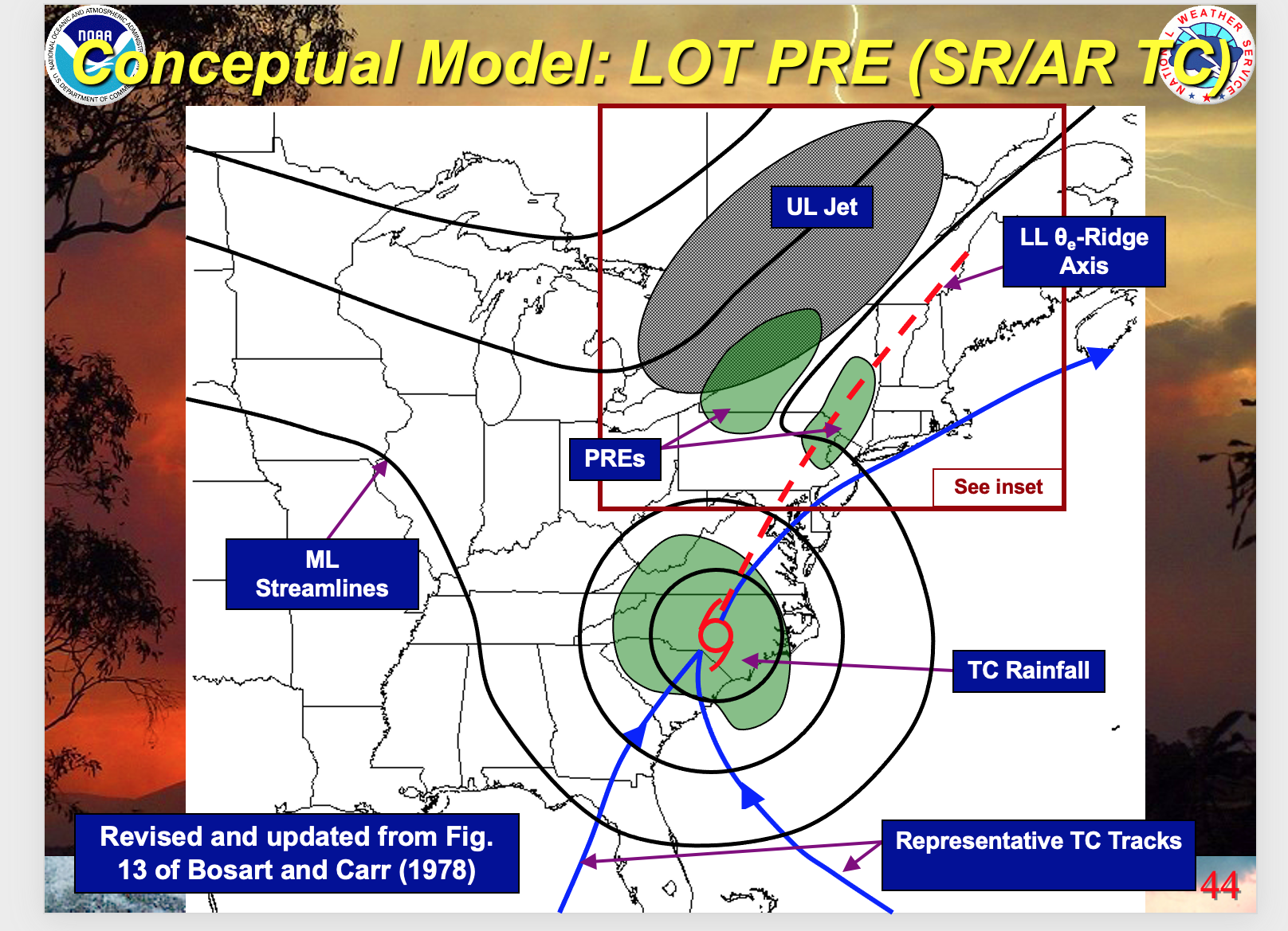
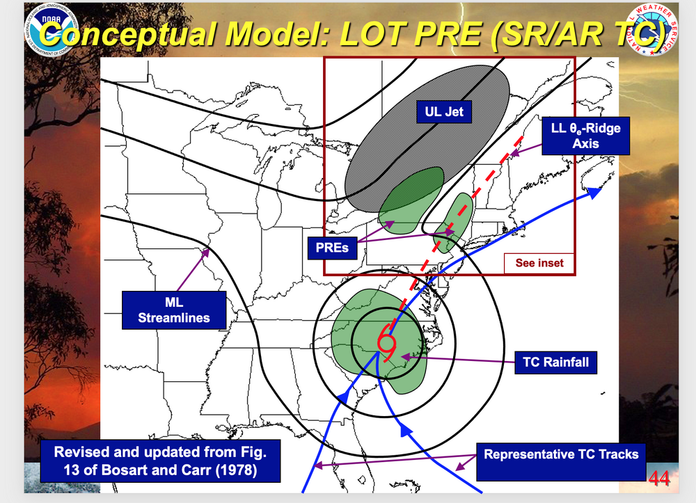
 May issue a thread tomorrow morning for general 1/2-2" drought relieving rain event 10Z Wed-10z Thu, isolated 5". Too early, especially since 18z WPC less than 0.1" this week NYC subforum as too the 13z BOM. Meanwhile 12z EPS/EPS AI increasing since 00z cycles. 12z NAM had the idea of iso 3+. Again way too early for me but either physics is out to lunch or something else is wrong with my thinking. PRE conceptual sampler added. Just shift the modeling a bit too the east. Everything now within the 42-84 time hr frame.
-
-
That is what scares the shit out of me. Sucks, man.
-

2025 Short Range Severe Weather Discussion
pen_artist replied to Chicago Storm's topic in Lakes/Ohio Valley
Will see what happens, got activity blowing up west now near I-39 -
lIt's August. Save this for January.
-

Hurricane Erin: 140 MPH - 935 mb - NW @ 12
BarryStantonGBP replied to BarryStantonGBP's topic in Tropical Headquarters
-
Will be 80s Saturday
-
It's been a couple years since we have had our late August first cool wave. Definitely will feel nice (smoke not withstanding) after this humid summer.
-

Hurricane Erin: 140 MPH - 935 mb - NW @ 12
wthrmn654 replied to BarryStantonGBP's topic in Tropical Headquarters
All models are now north west of 35°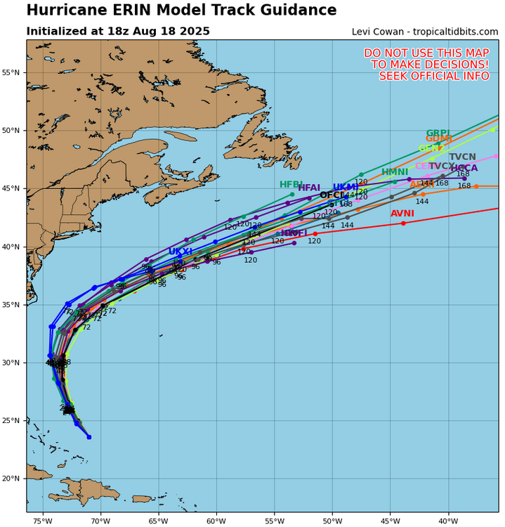
-

Hurricane Erin: 140 MPH - 935 mb - NW @ 12
NJwx85 replied to BarryStantonGBP's topic in Tropical Headquarters
The 12z Euro is West again. Hurricane force winds come very close to the outer banks and Virginia Beach area. -
nice time of year for it
-

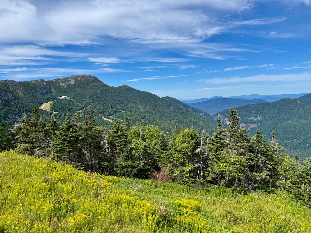
Central PA Summer 2025
TheClimateChanger replied to Voyager's topic in Upstate New York/Pennsylvania
Wow! Looks like @MeteoMark broke summer's back once and for all: -
Wow! This is incredible... I haven't seen anything like this in a LONG time:
-
Can confirm. Just horrible out here. Summit dipped into the 30s for the first time of the season this morning.
-
 Stuck in the muck still mai
 -
It's absolutely fantastic outside what is wrong with you.
-
I have stayed Lyme free for 35 years after 3 bouts one almost killed me. 90 day IV port with antibiotic drip every week. I stay completely out of the woods. Dogs Seresto and spray the yard plus chickens.
-
Euro doesn't hit 80 here until day 14
-

NEW DISTURBANCE: Central Tropical Atlantic (10/60)
cptcatz replied to BarryStantonGBP's topic in Tropical Headquarters
The convection blob still remains on the southwest side of this huge wave. I don't trust any model until this consolidates and as long as that convection blob remains to the southwest, I'd still lean towards a more south/west track...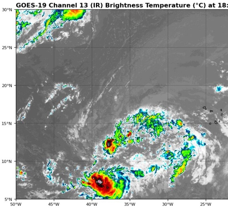
-
The 12z Euro nudges west again. It's getting to the point where Tropical Storm Watches are going to be required for the Outer Banks.
-
 Could be some pretty significant erosion later this week. 12-15 foot waves possible especially due to Erin expanding in size. Any weakening unless it’s rapid won’t affect the wave heights much-the fetch is a bigger player and it nudging west doesn’t help either.
 -
The washing machine took me out 2 weeks ago when the last NE'ly flow event happened. I'm still finding sand in places you'd never think sand could ever reach.
-
Nothing like that thankfully.
-
Down in Emerald Isle for the week. Yesterday was gorgeous. Today, surf has picked up, chased some folks off the beach as tide has come in. Some weekend warrior boogie boarders have learned some valuable lessons.