All Activity
- Past hour
-
Torch Tiger seems confused.
-
Today near 90 and next weekend too imo as long as it doesn’t rain. What a stretch we’ve been in. Definitely cools down this week.
-
Hottest August ever lolz. Where do people come up with this stuff?
-
A bit of fog here in Templeton this morning.
-
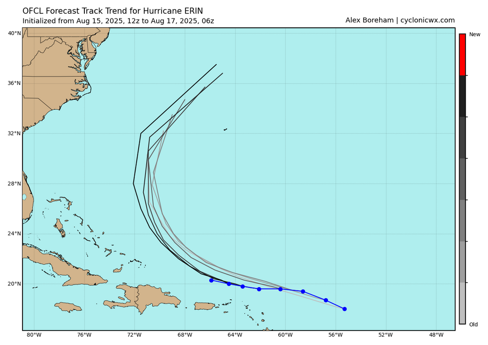
NHC noting the possibility of some impacts 4. Interests along the North Carolina and Mid-Atlantic coasts, and Bermuda should monitor the progress of Erin as there is a risk of strong winds associated with the outer rainbands during the middle part of the week.
-
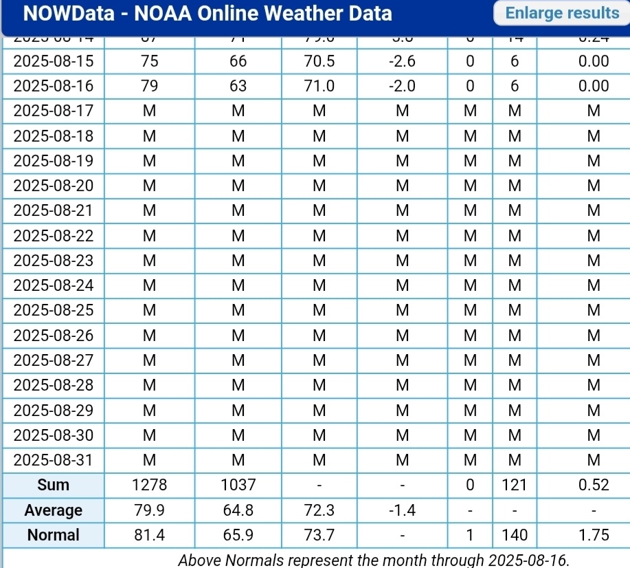
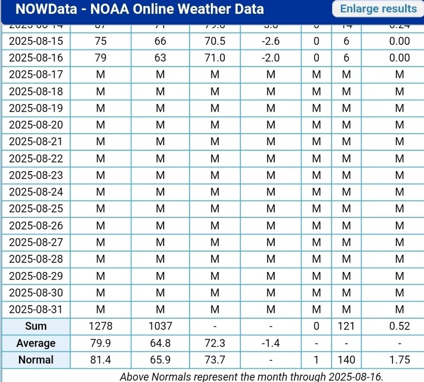
Met summer here is stuck at 3.93". Average thru August 16 is just over 11".
-

Hurricane Erin: 125 MPH - 940mb - WNW @ 14
RevWarReenactor replied to BarryStantonGBP's topic in Tropical Headquarters
Anymore shifts and outer banks could be looking at some fringe effects. -
We were on the verge of drought imby when I left, glad to see the multi year just in time rains trend continue
-

Hurricane Erin: 125 MPH - 940mb - WNW @ 14
bugalou replied to BarryStantonGBP's topic in Tropical Headquarters
twitter - Today
-
 Hot tamale today
 -
We can look at the SST data for the WPAC over the last 10 years and see that this has been a top down rather than bottom up warming process. The subsurface charts show warming starting at the surface around 10 years ago and gradually working down. It also matches the increase in high pressure and drop in clouds. This is consistent with the warming we have seen in other oceans like the Atlantic following light winds, more sunshine, higher pressure, and fewer clouds.
-
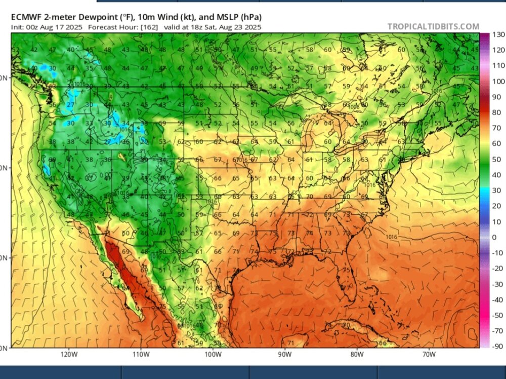
Not anymore unfortunately for the heat and dew crowd. 80 + maybe?
-
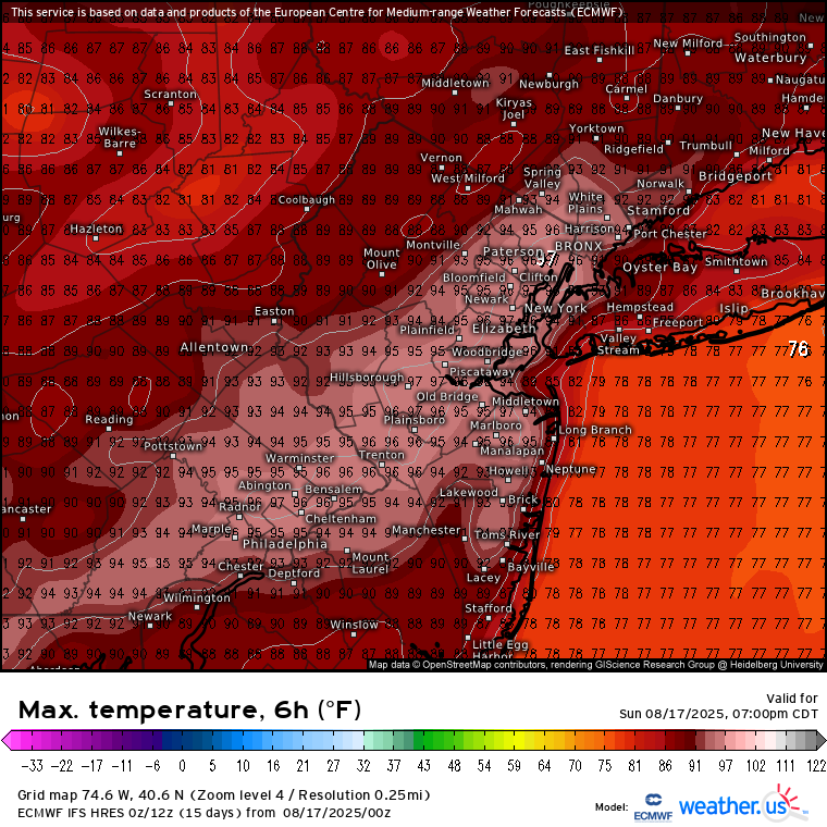
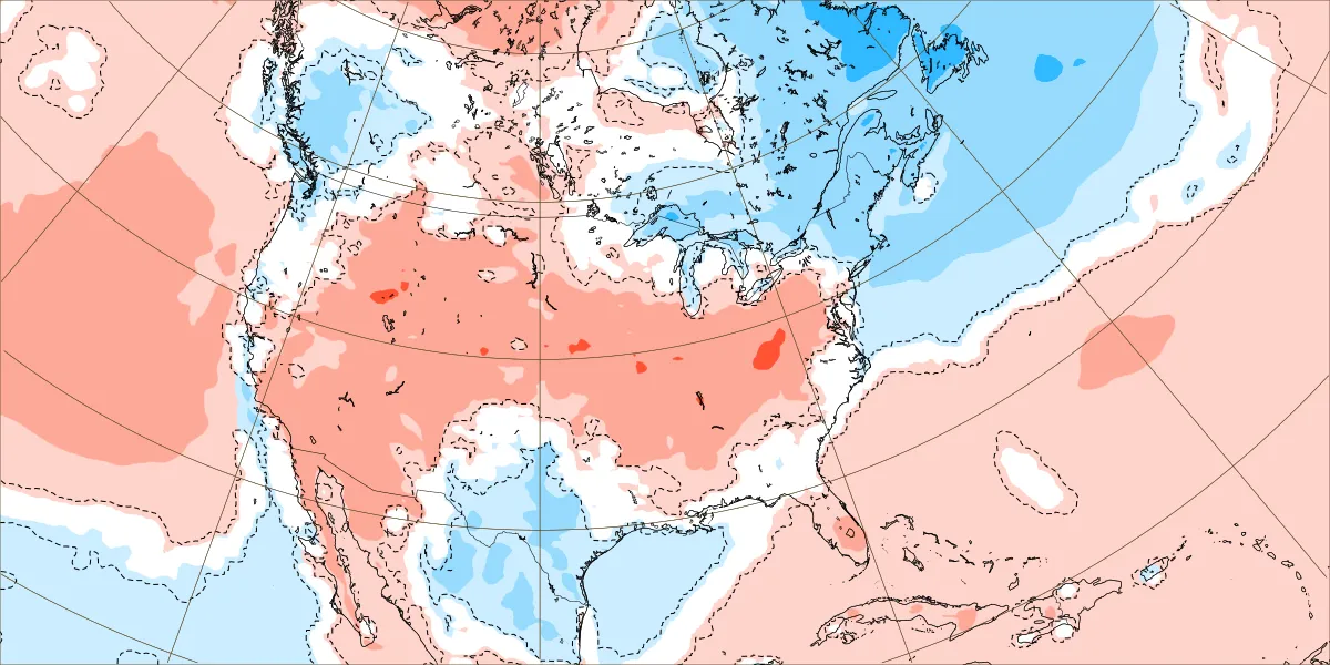
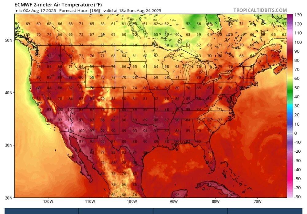
 Looks like we get a break for a while on the mid 90s after today. This week should be very close to seasonable for the temperarures. But unfortunately it still looks drier than normal. August 18-25 forecast

-
I think the last rain of significance at Pit2 was on July 13th when a tiny little cell stalled right over my head and gave a 90-120 minutes of absolute deluge. Horrible after since. August: 0.0. Lawn is brown and crispy.
-
Finally some rain for the Pioneer Valley!
-
Can you narrow it down further to -NAO/-ENSO (La Niña/cold-neutral) winters? The whole theory was based on years with high ACE and recurving hurricanes during -ENSO’s supposedly causing -NAO blocking during winter
-

Hurricane Erin: 125 MPH - 940mb - WNW @ 14
olafminesaw replied to BarryStantonGBP's topic in Tropical Headquarters
It really looked like the inner eyewall was trying to weaken last night, but now it's seemingly strengthening and the outer eyewall growing larger/weaker. Very strange -

Hurricane Erin: 125 MPH - 940mb - WNW @ 14
wthrmn654 replied to BarryStantonGBP's topic in Tropical Headquarters
6z nhc track is again to far east as models again shift west. -
Hurricane Erin: 125 MPH - 940mb - WNW @ 14
wthrmn654 replied to BarryStantonGBP's topic in Tropical Headquarters
Where did you get that gem?!I love that -
Hurricane Erin: 125 MPH - 940mb - WNW @ 14
wthrmn654 replied to BarryStantonGBP's topic in Tropical Headquarters
-
Pretty wicked non-severe cracks and strobing.
-
Hurricane Erin: 125 MPH - 940mb - WNW @ 14
bugalou replied to BarryStantonGBP's topic in Tropical Headquarters
-

Hurricane Erin: 125 MPH - 940mb - WNW @ 14
LakeNormanStormin replied to BarryStantonGBP's topic in Tropical Headquarters
OBX keep an eye on this one. These wobbles might put them in play if she turns too wide -
That’s what she said